
Southern Israel
The Negev
More than half of Israel is desert, and almost none of it is sand: erosion craters, canyons with water in them, Nabataean ruins and the darkest sky in the country.
Land area
about 12,000 km²
roughly 60% of Israel within the 1949–67 boundaries, per Britannica
Makhtesh Ramon
40 km long
2–10 km wide and about 500 m deep, per USGS
Rain in the makhtesh
about 25 mm a year
hyper-arid; cloud cover is rare, per USGS
Bedouin residents
304,513
September 2023, Population and Immigration Authority
Be'er Sheva sub-district
850,600 people
at 31 December 2023, Central Bureau of Statistics
Things to do
11 sites, each with its own page
in The Negev
Restaurants
13 picks
in The Negev
Hotels
7 picks
in The Negev
Getting there
7 routes
in The Negev
When to go
Month by month
in The Negev
הַנֶּגֶב · Southern Israel, from the Beersheba basin to the Gulf of Aqaba
The Negev is the part of Israel that most visitors fly over. It is a rough triangle with its point at Eilat, covering about 12,000 square kilometres (roughly 60 per cent of the country's land area within the 1949–67 boundaries, on Britannica's reckoning) and it holds a small fraction of the population. Almost none of it looks like the desert of postcards. There are no dune seas here to speak of. Instead there are chalk and limestone plateaux, gravel plains, black basalt dykes, dry riverbeds that run only after a storm, and the erosion craters that geologists call by their Hebrew name because no other language has a word for them.
It is also a working landscape, and always has been. Nabataean caravans crossed it carrying frankincense from Arabia to the port of Gaza; Byzantine farmers built something like a hundred thousand terraces to catch runoff and grew wine grapes on 80 to 150 millimetres of annual rain. Today the same ground carries Bedouin towns and unrecognised villages, kibbutz vineyards, a 121-megawatt solar thermal plant with molten-salt storage, and the Nubian ibex herds that make Israel the country holding the largest numbers of the species anywhere.
For a traveller, the Negev is a two-to-four-day proposition rather than a day trip: Makhtesh Ramon and the town on its rim, the canyon at Ein Avdat, the Nabataean ruins strung along the old incense road, and, if you time it right, a night with no moon and no streetlights.

The scale
Half a country, and hardly anyone in it
Britannica puts the Negev at about 4,650 square miles (12,000 square kilometres), shaped like a triangle with the apex at the south, bounded by the Sinai Peninsula to the west and the Jordan Valley to the east. Its northern edge is a matter of convention rather than geography; an arbitrary line at about 30°25′ N is commonly used. Israel's Central Bureau of Statistics counted 850,600 people in the Be'er Sheva sub-district at the end of 2023 (the administrative unit that most nearly matches the Negev) in a Southern District of 1.45 million.
Rainfall is the organising fact. Around Beersheba it runs from 200 to 305 millimetres in a good year; on the central plateau it is 76 to 102 millimetres; at Eilat, at the southern tip, it is negligible. At Makhtesh Ramon the US Geological Survey, which uses the crater floor as a satellite calibration site precisely because conditions there are so stable, records average annual precipitation of about 25 millimetres and notes that cloud cover is rare throughout the year.
The practical consequence for a visitor is distance. Sightlines run for tens of kilometres, petrol stations are far apart, and phone signal is not continuous. Route 40 south of Beersheba is the spine of the region, past Sde Boker and Avdat before it drops into the makhtesh; almost everything worth stopping for is on it.
- About 12,000 km², roughly 60% of Israel's land area (Britannica)
- 850,600 residents in the Be'er Sheva sub-district at end-2023 (CBS)
- 76–102 mm of rain a year on the central plateau (Britannica)
- About 25 mm a year on the floor of Makhtesh Ramon (USGS)
Geology
Makhtesh Ramon, and the word only Hebrew has
A makhtesh is not a crater in the usual sense. Nothing struck the ground and no volcano erupted. NASA's Earth Observatory sets out the sequence: more than 200 million years ago this ground lay beneath the Tethys Sea. As the sea receded it exposed a hill of hard rock over a soft limestone core. Wind and water flattened the top, rivers found their way inside, and the interior eroded far faster than the walls, leaving a steep-sided valley with a flat floor and a single drainage outlet. The Israel Nature and Parks Authority counts three such craters in the Negev and calls the Ramon the largest; NASA calls it the world's largest erosion crater.
The figures depend a little on where you draw the rim. The USGS, which maintains a calibration site on the floor, gives approximately 40 kilometres in length, 2 to 10 kilometres in width and about 500 metres in depth, at an altitude of 557 metres above sea level; NASA's description is 40 kilometres long, 2 to 19 kilometres wide and 500 metres deep. Either way the eye cannot take it in from one viewpoint.
What makes the floor unusual is not the size but the variety. The USGS notes a wide range of mineralogical compositions with distinct spectral signatures (which is why satellites are pointed at it) and on the ground that means ammonite fossils, a hill of volcanic prisms, and coloured sands. The crater is a protected reserve: leave the rock where you find it.
Water
Ein Avdat: a canyon with water at the bottom of it
Nahal Zin is the long dry riverbed that drains the Negev highlands eastward towards the Arava, and where it cuts through the chalk below Sde Boker the walls close in to a white-sided gorge with permanent springs in it. Ein Avdat is the pool-and-waterfall section of that gorge, protected as a national park by the Israel Nature and Parks Authority. Water in the desert concentrates everything: poplars grow where nothing else does, ibex come down to drink, and raptors use the cliffs.
The walk is short and steep rather than long. The usual route runs upstream from the lower gate through the pools to a ladder-and-staircase climb out at the upper car park, so it works best with two vehicles or a lift arranged in advance. Because the exit is one-way, the park authority closes the gates well before dark and turns walkers back at a fixed hour; check its own page for the day you plan to go rather than trusting a time quoted elsewhere.
The gorge is also why the Nabataean town of Avdat sits where it does, a few kilometres up the ridge, and why Ben-Gurion chose this stretch of the Zin to retire to. It is the one place in the central Negev where the landscape stops being an abstraction of distance and becomes something you can stand inside.

Nabataeans
The Incense Route and the desert cities
The Nabataeans were, in Britannica's description, a people of ancient Arabia whose settlements lay in the borderlands between Syria and Arabia, first documented in 312 BCE when Demetrius Poliorcetes attacked them. Their wealth came from a monopoly on the caravan trade running from the Arabian interior to the coast, and their capital was Petra. The road from Petra to the Mediterranean crossed the Negev highlands, and the towns and forts along it are what survives.
The Times of Israel reported in 2018 that UNESCO declared the Incense Route a World Heritage Site in 2005, describing a path that stretched from Yemen to the ports at Gaza and beyond, in use possibly before the 3rd century BCE and continuing into the 2nd century CE, with Avdat considered the most important city along the way. In February 2018 a group retracing roughly 100 kilometres from Petra to Avdat mapped a 7.5-kilometre section that had eluded scholars for decades.
Recent archaeology has changed how the route is read. A study of rubbish middens at three Negev caravanserais (Orhan-Mor, Sha'ar-Ramon and Neqarot Fort) reported in 2022 that the road ran in both directions, with traders carrying organic goods from fertile land back into the desert. Professor Guy Bar-Oz, who led the work, put it plainly: 'We were trained to think that the road functioned mainly in a one-way direction.' The route was at its height, the study found, roughly between 300 BCE and 300 CE; Rome annexed the kingdom under Trajan in 105–106 CE.
- Nabataeans first documented in 312 BCE (Britannica)
- Route ran from Yemen to the Gaza ports (Times of Israel)
- At its height roughly 300 BCE–300 CE
- Annexed by Rome under Trajan, 105–106 CE
- Inscribed by UNESCO in 2005
Who lives here
The Bedouin Negev, counted and uncounted
The largest single community in the Negev is Bedouin, and how many people that means depends on which arm of the state you ask. The Statistical Yearbook of Bedouin Society in the Negev, compiled by Nagabiya, the research hub of the Negev Coexistence Forum, and published in December 2024, sets the two figures side by side: the Central Bureau of Statistics counted 312,300 Bedouin residents in the Be'er Sheva district at the end of 2022, making up 37.6 per cent of the district's population, while the Population and Immigration Authority reported 304,513 in September 2023.
The breakdown matters more than the total. On the Population Authority's September 2023 figures, 192,224 people (63 per cent) live in seven urban localities; 25,922 (9 per cent) live in 11 recognised villages under the Al-Qasum and Neve Midbar regional councils; and 86,367 (28 per cent) live in villages the state does not recognise. The authority's registers list 25 'tribes' rather than places; the yearbook counts 35 unrecognised villages on the ground. Residents of those villages have no address on their identity cards, which is why, as the yearbook's editors argue, they fall out of employment and income surveys.
Rahat is the only one of the seven urban localities with city status, and the largest of them: 76,539 residents in the September 2023 Population Authority reporting, about 40 per cent of everyone living in those seven towns. The population is strikingly young: children aged 0 to 18 make up 51.17 per cent of the total, against 31.13 per cent in Israeli society as a whole. Visitors will meet Bedouin hospitality tents and desert camps across the region; they sit within a community whose argument with the state over land, planning and recognition remains unresolved.
- 304,513 Bedouin residents of the Negev (Population Authority, September 2023)
- 63% in seven urban localities; 9% in 11 recognised villages
- 86,367 people, 28%, in 35 villages the state does not recognise
- Rahat, the only Bedouin city: 76,539 residents
- 51.17% of the population is under 18

Sde Boker
The prime minister who moved to a kibbutz, and what grew after him
Kibbutz Sde Boker was founded in May 1952 by 13 members, most of them former intelligence officers from Southern Command, on a stretch of the Negev highlands with no obvious reason to farm it. In December 1953 David and Paula Ben-Gurion were accepted as members and moved in: a prime minister relocating to a hut in the desert, and the most literal statement he ever made of his belief that the Negev had to be settled. Britannica records that he left the Knesset and political life in 1970 and returned to the kibbutz to write, and that he died on 1 December 1973.
The hut is preserved as it stood at his death and has been open to the public since 1974, in accordance with a will that asked for exactly that. The kibbutz itself now numbers around 150 people (members, children, candidates for membership and residents) and makes its living from an adhesive-tape factory, poultry, agriculture, a solar field and tourism.
The agricultural argument he started is older than he was. Archaeologists working at Avdat between 2017 and 2019 recovered carbonised grape seeds from Byzantine layers; the Israel Nature and Parks Authority and Professor Guy Bar-Oz of the University of Haifa have since replanted the varieties on rebuilt terraces. At its mid-sixth-century peak the Negev highlands carried something like 100,000 terraces, watered by nothing but engineered runoff on 80 to 150 millimetres of rain a year, and by the late fifth century 'Gaza wine' was reaching Europe. The modern echo arrived in June 2026, when the Negev was recognised as a wine appellation running from Kiryat Gat to Eilat, with some 60 winemakers in it.

Energy
Ashalim, and the argument over what the empty ground is for
Drive Route 40 north of Sde Boker and a point of light appears on the horizon that is too bright and too high to be anything natural. It is the receiver at the top of the Ashalim solar tower. The Times of Israel reported in January 2017, as the plant was being built, that the tower would rise 250 metres (then the world's tallest) ringed by about 50,000 computer-steered mirrors, or heliostats, each tracking the sun and throwing it back at the boiler. The complex was projected then to generate some 310 megawatts, roughly 1.6 per cent of Israel's energy needs, or about 130,000 households.
The adjacent plot uses a different technology and is the more quietly impressive of the two. Shikun & Binui Energy, which built and operates it, describes a 121-megawatt parabolic-trough plant across roughly 3,900 dunams with a 545 megawatt-hour molten-salt store, enough for up to four and a half extra hours of generation after sunset, about 11 hours of output a day across the year, and around 60,000 households. It entered commercial operation in 2019.
Ashalim was the opening move, not the end of it. In July 2025 The Times of Israel reported a government plan to designate about 110,000 dunams near Oron and Zin, close to the Ramon Crater, for solar generation, starting with 20,000 dunams and 2,000 megawatts, and aiming eventually at 10 gigawatts of the 16 needed for the national target of 30 per cent renewable electricity by 2030. The Society for the Protection of Nature in Israel, the Environmental Protection Ministry and the parks authority all objected; the last called it a project with environmental impacts on a scale not seen before in Israel. It is the argument Ben-Gurion started, with the terms reversed.
- Solar tower reported at 250 m with about 50,000 heliostats (2017)
- Parabolic-trough plot: 121 MW, 545 MWh of molten-salt storage
- About 3,900 dunams; commercial operation from 2019
- 110,000 dunams proposed near Oron and Zin in 2025
- National target: 30% renewable electricity by 2030

The rim
Mitzpe Ramon, the ibex and the darkest sky in Israel
Mitzpe Ramon sits on the northern rim of the makhtesh, a small town (5,178 residents at the end of 2021, on the Central Bureau of Statistics estimate) that began as a road workers' camp and has become the base for everything that happens in the crater. Nubian ibex wander its edges as a matter of routine, and they are why the town's drivers go slowly after dark.
The ibex are not a curiosity but a conservation story. The Nubian ibex was assessed by the IUCN as Vulnerable in 2020, with a rough estimate of fewer than 2,500 mature individuals worldwide; Israel holds the largest numbers and has run annual one-day counts with supplementary aerial surveys since 1981. Research published through The Wildlife Society (48 marked animals in the northern Judean Desert, 2016–2019) showed how hard those counts are to get right: the official method assumes a daily visit to water, while collared females drank every 1.4 days and males every 1.5, and research estimates diverged from agency counts by up to threefold. The 2017 drought hit those herds badly.
The other thing the town protects is the dark. In September 2017 the International Dark-Sky Association designated the Ramon Crater an International Dark Sky Park, the first in the Middle East, awarded after three years of scrutiny and on the strictest sky-quality tier. The western crater is kept as an undisturbed core; eastern campgrounds are lit to minimise spill. Come on a moonless night, let your eyes adjust, and the Milky Way is not a metaphor.
On the ground
What to see at The Negev
The things worth building a visit around, in the order most people reach them.
The rim promenade at Mitzpe Ramon
A level walk along the crater edge, with the makhtesh dropping away below it. Best in the hour before sunset, when the far wall turns red and the light rakes across the floor.
Ein Avdat gorge
White chalk walls, permanent spring pools and a ladder climb out at the top end. Short, steep and one-way: plan the transport before you start walking.
Avdat
The Nabataean and Byzantine town on the ridge above the Zin, considered the most important city on the Incense Route in its day. Its Byzantine layers gave up the carbonised grape seeds now being replanted on rebuilt terraces.
Ben-Gurion's hut at Sde Boker
The prime minister's desert house, kept as it stood when he died in 1973 and open to the public since 1974. Small, plain, and more eloquent about the Negev project than any museum.
The Ashalim solar complex
A receiver tower ringed by about 50,000 mirrors, beside a 121-megawatt trough plant with molten-salt storage. Visible from Route 40 for many kilometres; do not stare at the receiver.
A moonless night in the crater
The Ramon Crater has been an International Dark Sky Park since 2017, the first in the Middle East. Check the lunar calendar before you book: a full moon washes out everything the designation exists to protect.
Go deeper
Every site in The Negev, in full
11 places here have a page of their own: what survives, what it costs, when it opens and how long to give it.
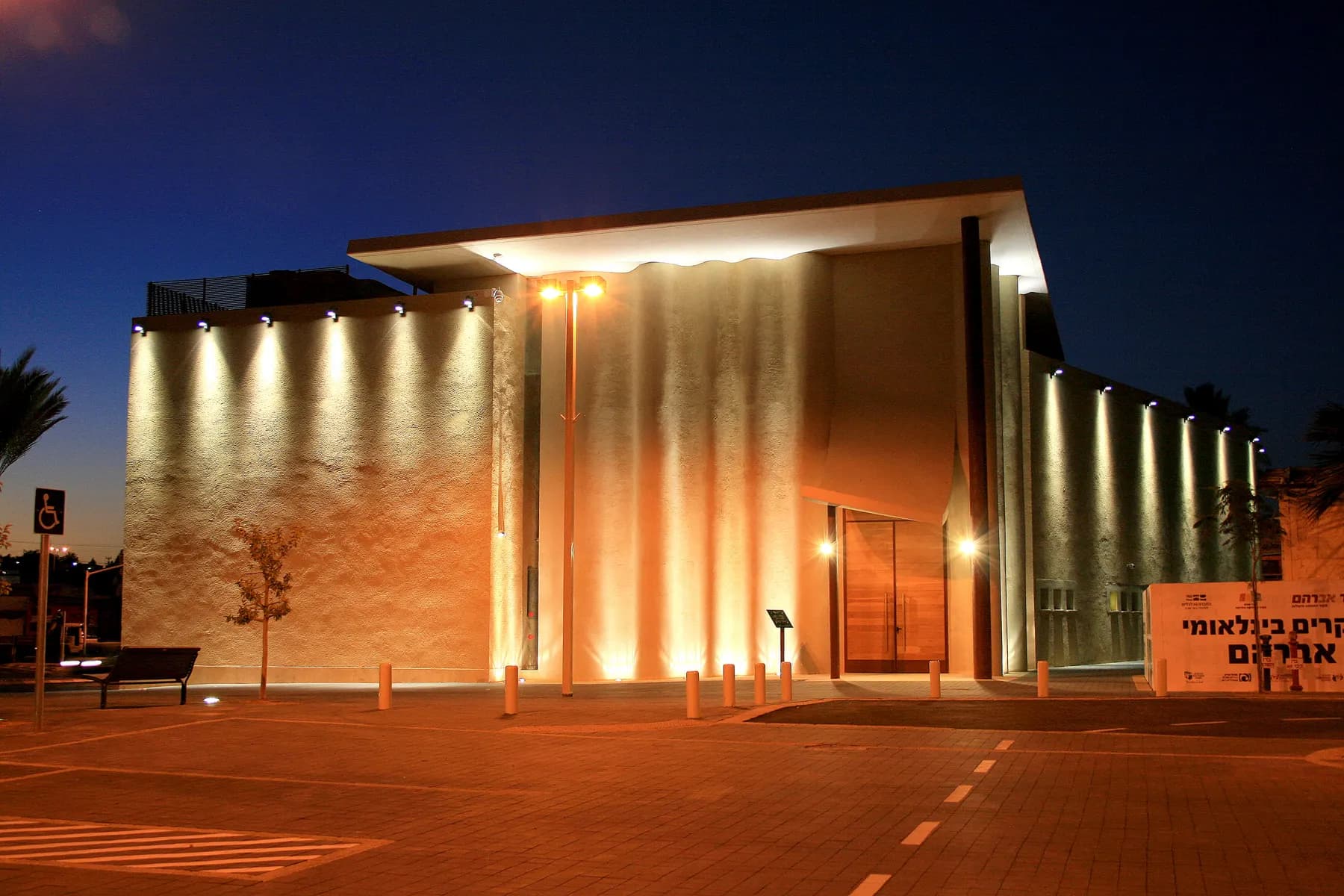
Abrahams Well / CC BY-SA 3.0 · Wikimedia Commons
Museum
Abraham's Well International Visitor Centre
The shaft is 13.5 metres deep, and the inscribed stone Claude Conder found fifteen courses down inside it is dated 505 AH, which is the twelfth century CE.
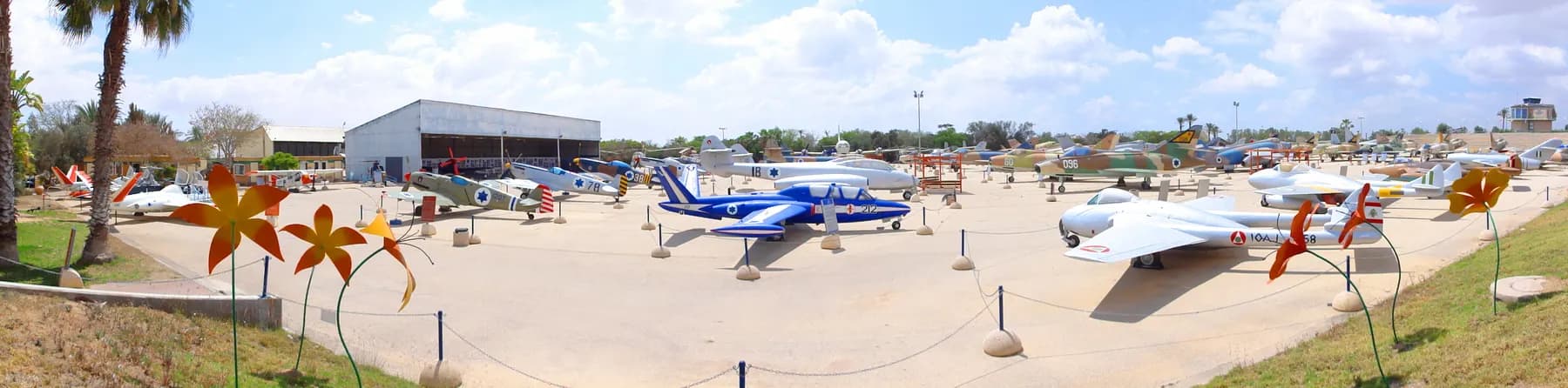
DYKT Mohigan / CC BY 2.0 · Wikimedia Commons
Museum
Israeli Air Force Museum, Hatzerim
The air force parks its retired and captured aircraft on an open concrete apron beside its own flight school west of Beersheba, from a Czech-built Messerschmitt copy of 1948 to the F-16 that struck the Osirak reactor in 1981.
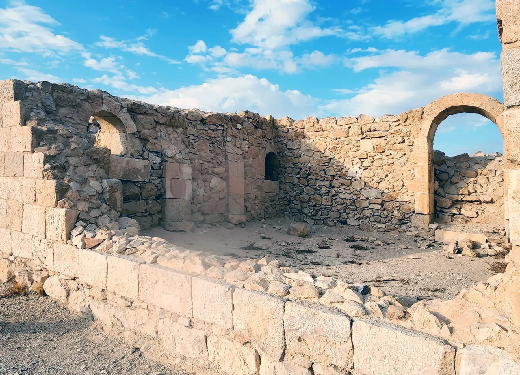
ישראל פרקר / CC BY 2.5 · Wikimedia Commons
Archaeological site
Avdat National Park
Avdat was station number 62 on the Incense Route, and the caravan road that brought frankincense from Arabia towards the port of Gaza can still be picked out climbing to it from the southeast.
Museum
Ben-Gurion's Desert Home and Tomb
David and Paula Ben-Gurion moved into a Swedish prefabricated hut at Kibbutz Sde Boker on 14 December 1953, and his will asked that it be left exactly as he died in it twenty years later.
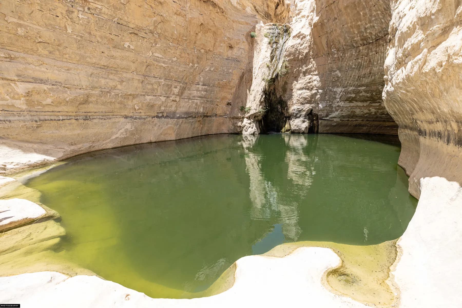
רחל וייסלר / CC BY 2.5 · Wikimedia Commons
Nature reserve
Ein Avdat National Park
Three springs keep water running all year at the bottom of a white chalk canyon that was cleared, laid out and opened to the public in 1961 as a seventy-fifth birthday present for David Ben-Gurion.
Orhat / CC BY-SA 4.0 · Wikimedia Commons
Nature reserve
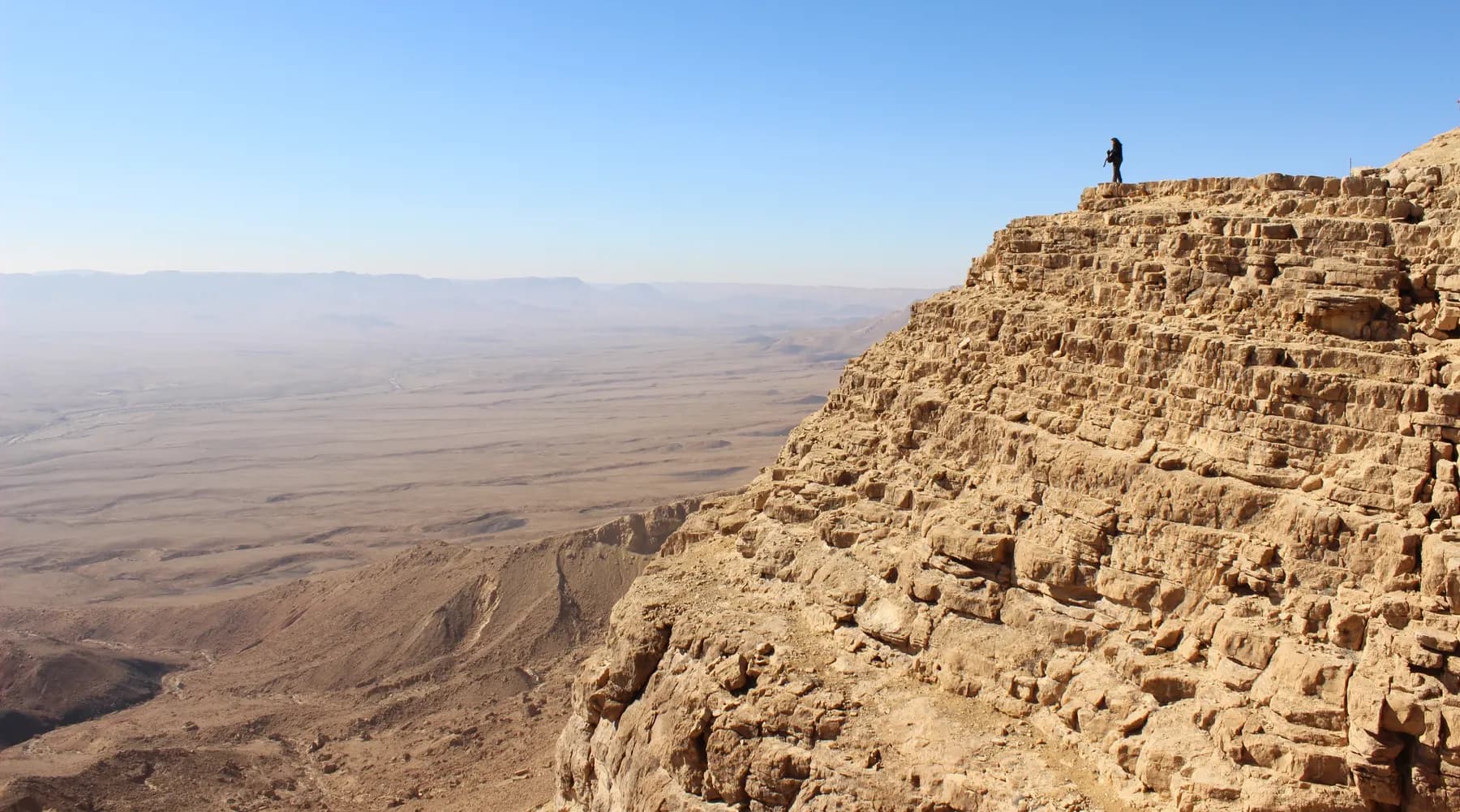
Makhtesh Ramon (Ramon Crater)
The floor of the makhtesh was quarried for clay and quartz before it was protected, and the parks authority's scenic road across the eastern half runs over ground it had to rehabilitate.
Deror avi / CC BY-SA 3.0 · Wikimedia Commons
Archaeological site
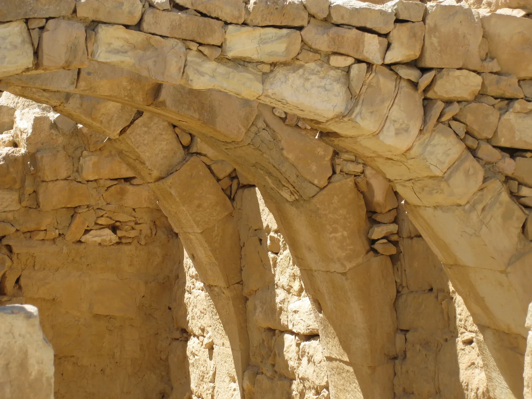
Mamshit National Park
Mamshit is the most compact of the four Negev desert cities in the UNESCO Incense Route inscription: about four hectares of Nabataean, Roman and Byzantine town inside a national park of 142.
ישראל פרקר / CC BY 2.5 · Wikimedia Commons
Archaeological site
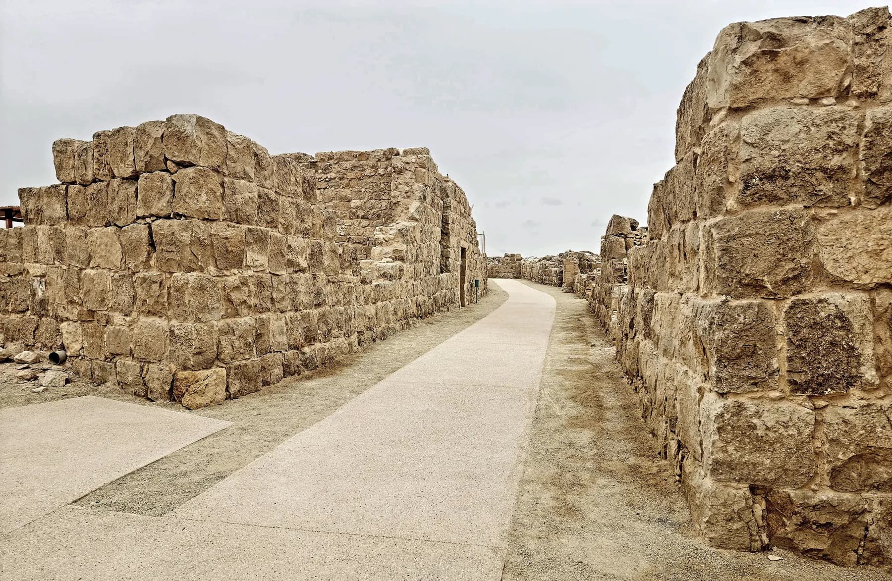
Shivta National Park
Nobody sacked Shivta: a University of Haifa survey recorded 21 doorways deliberately blocked with stone in 16 of its houses, which is why the streets and churches are still standing.
Activity
Stargazing in the Ramon Crater
The Israel Nature and Parks Authority won the International Dark Sky Park title for the Ramon Crater in September 2017 after three years of assessment, and the research observatory five kilometres west of the town logs about 170 nights a year with no cloud at all.
זאב שטיין / CC BY 2.5 · Wikimedia Commons
Archaeological site
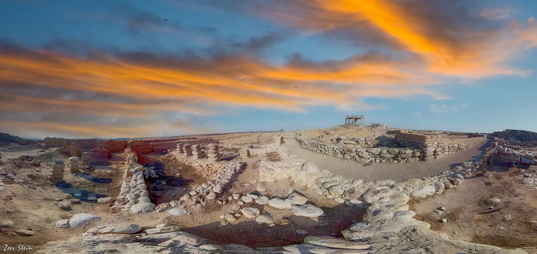
Tel Be'er Sheva National Park
The stones of a four-horned altar were found here buried inside a storehouse wall, and the well beside the town gate goes down 69 metres to the water table.
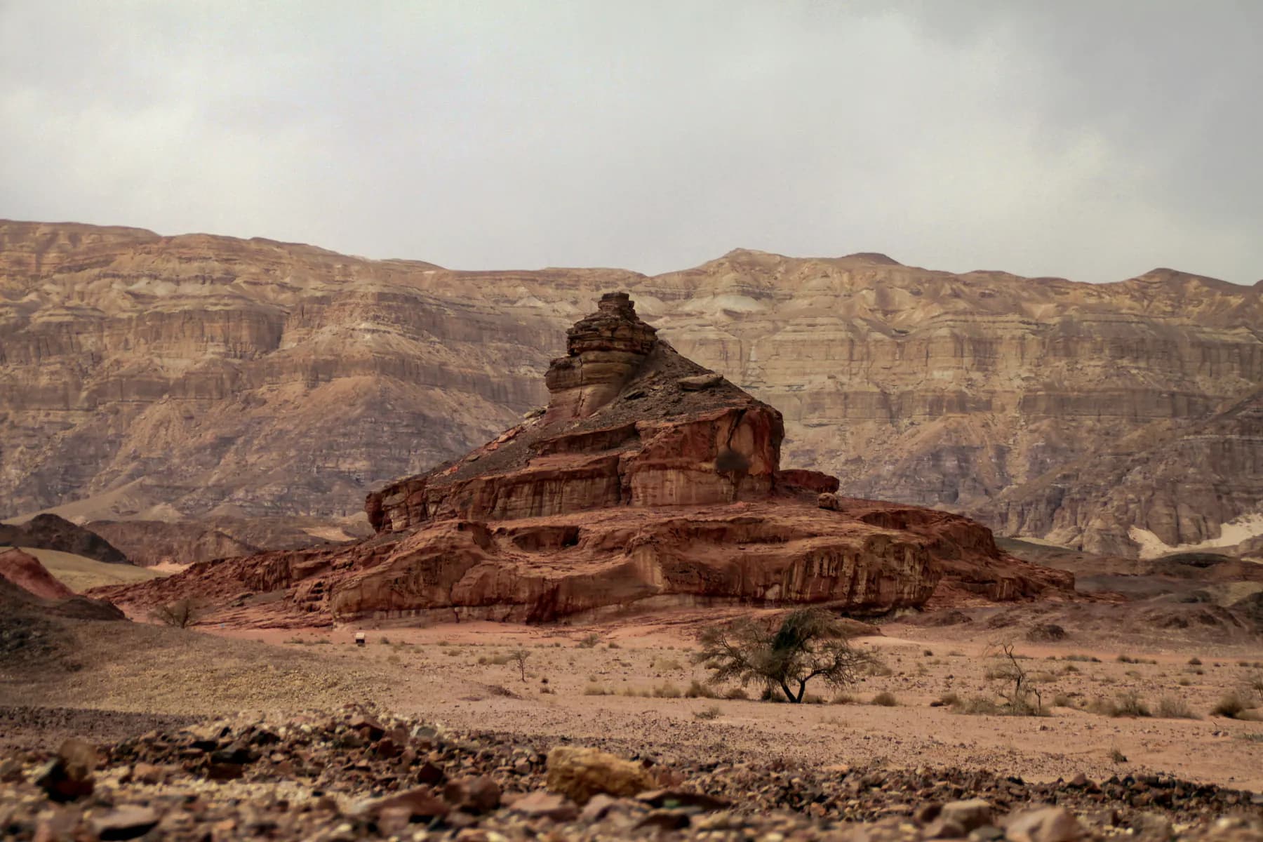
טלי אראל / CC BY-SA 4.0 · Wikimedia Commons
Archaeological site
Timna Park
Beno Rothenberg's Arabah Expedition dug an Egyptian temple to the goddess Hathor out of the sand at the foot of Solomon's Pillars in 1969, and the mines around it have been redated twice since.
The long view
The Negev, in order
More than 200 million years ago
The ground that becomes the Negev lies beneath the Tethys Sea; as the sea retreats it exposes the hard-shelled hill whose soft interior will erode into Makhtesh Ramon.
312 BCE
First documented mention of the Nabataeans, when Demetrius Poliorcetes attacks them.
From the 3rd century BCE
Nabataean caravans work the Incense Route from Arabia to the Mediterranean; Avdat becomes the most important town on the Negev stretch.
c. 300 BCE – 300 CE
The route is at its height. Middens at the Orhan-Mor, Sha'ar-Ramon and Neqarot caravanserais show goods moving in both directions, not just outward.
105–106 CE
Trajan annexes the Nabataean kingdom; Bostra replaces Petra as the provincial capital of Roman Arabia.
Late 5th century CE
'Gaza wine', grown on Negev runoff terraces, is being shipped to Europe.
Mid-6th century CE
The Negev highlands carry some 100,000 cultivated terraces, the peak of the ancient desert wine industry.
May 1952
Kibbutz Sde Boker is founded by 13 members, most of them former Southern Command intelligence officers.
December 1953
David and Paula Ben-Gurion are accepted as members of Sde Boker and move into the hut.
1970–1973
Ben-Gurion leaves the Knesset and returns to Sde Boker to write; he dies on 1 December 1973, and the hut opens to the public in 1974 under the terms of his will.
2005
UNESCO inscribes the Incense Route (Desert Cities in the Negev) as a World Heritage Site.
2017–2019
The Ramon Crater is named the Middle East's first International Dark Sky Park (September 2017); the Ashalim solar plots enter service, the trough plant reaching commercial operation in 2019.
Getting there
- Beersheba is the gateway and the transport hub: Israel Railways serves the city from Tel Aviv and the coastal line (from Jerusalem, expect at least one change) and intercity buses fan out from there into the desert.
- There is no railway to Mitzpe Ramon. From Beersheba it is a drive of a little over an hour south on Route 40, past Sde Boker, Ein Avdat and Avdat, all of them on or just off the same road.
- Coming from Eilat, it is Route 90 up the Arava to the foot of Route 40, or Route 12 along the Egyptian border; the approach to the makhtesh from the south crosses the crater floor itself, which is the most dramatic way to arrive.
- A hire car is close to essential if you want more than one site in a day. Fill the tank in Beersheba or Mitzpe Ramon; stations between them are sparse.
Access
Access varies sharply by site. Crater-rim viewpoints and the promenade at Mitzpe Ramon are largely level and manageable for wheelchairs and pushchairs, and the visitor centre and much of Ben-Gurion's Desert Home are built for public visiting. Ein Avdat is not: the through-route involves a steep gorge and fixed ladders, though the lower section from the southern gate to the first pools is far gentler and can be walked out and back. Avdat sits on a ridge with uneven ancient paving. The park authority marks accessible routes site by site; ask at the gate.
When to go
October to April. Spring (roughly February to April) is the sweet spot: daytime temperatures are comfortable, the wadis may still be green from winter rain, and the light is long. Summer in the central Negev is punishing and midday walking is genuinely dangerous. Winter nights on the crater rim are cold, and flash floods can close canyon routes for a day or two after rain, so check conditions before setting out. For stargazing, pick the week around the new moon.
Hours and cost
The Israel Nature and Parks Authority runs Ein Avdat, Avdat, Shivta, Mamshit and the Ramon Crater reserves, and its sites close well before dark, earlier still at Ein Avdat, where the exit is a one-way climb and staff turn walkers back at a set hour. Ben-Gurion's Desert Home at Sde Boker lists Sunday to Thursday 08:30–16:00, Friday 08:30–14:00 and Saturday 10:00–16:00 on the Ben-Gurion Heritage Institute's own site, checked in 2026, and asks visitors to arrive up to an hour before closing. Hours shift on Fridays, Shabbat and Jewish holidays across the board; confirm with each operator on the day.
Most of the archaeological and canyon sites are ticketed national parks or reserves under the Israel Nature and Parks Authority, which sells single-site tickets and multi-site passes; if you are visiting three or more parks in a fortnight the pass is usually the cheaper option. Viewpoints along the crater rim, the town promenade at Mitzpe Ramon and driving Route 40 through the makhtesh cost nothing. Prices change annually; check the park authority's own page before you travel rather than relying on a figure quoted elsewhere.
Opening times and prices change. Both are given as published by the operator and should be checked against its own page before you travel.

Practical
What people wish they had known about The Negev
- Carry more water than you think you need: three litres per person or more for any walk, and more again in warm months. There is no drinking water on most trails.
- Start early. By late morning in spring and autumn the light is flat and the heat is real; the best hours in the Negev are the first two and the last two of the day.
- Check the lunar calendar before booking a crater stay. The dark-sky designation is worth nothing under a full moon.
- Do not walk in a canyon or wadi when rain is forecast anywhere upstream. Flash floods in the Negev arrive from storms you cannot see.
- Drive slowly at dusk and after dark near Mitzpe Ramon. Ibex use the roads and verges, and they do not move for headlights.
- Leave the rocks and fossils where they are. The makhtesh floor is a protected reserve, and its mineral variety is the reason satellites are calibrated against it.
- Fuel, cash and a spare phone charger before you leave Beersheba or Mitzpe Ramon; signal is patchy across the highlands.
The figures
The Negev by the numbers
Each figure carries the year it belongs to and links the source it came from.
| Measure | Figure | As of | Source |
|---|---|---|---|
| Negev land area | about 12,000 km² (4,650 sq mi) | 2026 | britannica.com |
| Share of Israel's land area | about 60% of the territory within the 1949–67 boundaries | 2026 | britannica.com |
| Makhtesh Ramon dimensions | about 40 km long, 2–10 km wide, about 500 m deep | 2025 | calval.cr.usgs.gov |
| Average annual rainfall on the crater floor | about 25 mm | 2025 | calval.cr.usgs.gov |
| Bedouin residents of the Negev | 304,513, of whom 86,367 (28%) live in 35 unrecognised villages | 2023 | nagabiya.org |
| Be'er Sheva sub-district population | 850,600 | 2023 | cbs.gov.il |
| Ashalim parabolic-trough plant | 121 MW with 545 MWh of molten-salt storage, on about 3,900 dunams | 2019 | shikunenergy.com |
| Ashalim solar tower, as reported during construction | 250 m planned height, about 50,000 heliostats | 2017 | timesofisrael.com |
Where this is
The Negev in the length of the country
Israel runs about 420 km from its northern tip to Eilat. Here is where this one sits on that line.
Nearby
Where to go next

The Jordan Rift Valley
The Dead Sea
The lowest ground on Earth, water nearly ten times saltier than the ocean, and a shoreline retreating by more than a metre a year.

Judaean Desert
Masada
A desert plateau some 450 metres above the Dead Sea, carrying Herod's palace, the most complete Roman siege works to survive anywhere, and an unfinished argument about what happened here.

Mediterranean coast
Caesarea
Herod poured a harbour into open water here, using volcanic ash shipped from the Bay of Naples. Most of it now lies more than five metres down.
Sources and further reading
Every link below was opened and checked when this page was written. Official statements are marked as such: they are the subject's own account, not an independent one.
- OfficialNASA Earth Observatoryscience.nasa.govIsrael's Heart-Shaped Crater
How a makhtesh forms: Tethys Sea retreat, soft limestone core, differential erosion; Makhtesh Ramon at 40 km long, 2–19 km wide, 500 m deep, and described as the world's largest erosion crater.
- OfficialInternational Dark-Sky Association / Israel Nature and Parks Authoritydarksky.orgDesignation of the Ramon Crater, Israel as an International Dark Sky Park
September 2017 designation, Israel the first recognised country in the Middle East, after three years of scrutiny at the strictest sky-quality level; western crater as undisturbed core, eastern campgrounds lit to minimise spill; the Ramon described as the largest of the three erosion craters in the Negev.
- OfficialShikun & Binui Energy (operator)shikunenergy.comAshalim project
121 MW parabolic-trough plant with a 545 MWh molten-salt store across about 3,900 dunams; up to 4.5 additional hours of generation and an average of 11 hours a day; commercial operation in 2019; around 60,000 households supplied.
- OfficialBen-Gurion Heritage Institute, Sde Bokerben-gurion.co.ilBen-Gurion's Desert Home
Paula and David Ben-Gurion accepted as kibbutz members and relocated in December 1953; the hut left as it was in 1973 under his will and open to visitors since 1974; opening hours as listed by the operator and checked in 2026: Sun–Thu 08:30–16:00, Fri and holidays 08:30–14:00, Sat 10:00–16:00, arriving up to an hour before closing. No admission price is published on the page.
- OfficialBen-Gurion Heritage Institute, Sde Bokerben-gurion.co.ilKibbutz Sde-Boker
Founded May 1952 by 13 people who had served together in Southern Command intelligence; about 150 people today counting members, children, candidates and residents, with the Davik adhesive-tape factory, poultry, agriculture, a solar field and tourism.
- ReportingThe Times of Israeltimesofisrael.com86-year-old guide helps discover section of Incense Route lost for millennia
UNESCO declared the Incense Route a World Heritage Site in 2005; the route ran from Yemen to the Gaza ports and beyond, possibly before the 3rd century BCE and into the 2nd century CE; Avdat as the most important city along the way; a 7.5 km lost section mapped on an 18–23 February 2018 walk of some 100 km from Petra.
- ReportingThe Times of Israeltimesofisrael.comAncient trash a treasure in mapping first steps to globalization on Incense Route
Middens at Orhan-Mor, Sha'ar-Ramon and Neqarot Fort; route at its height roughly 300 BCE–300 CE; evidence of two-directional trade, quoting Prof. Guy Bar-Oz. Published 12 May 2022.
- ReportingThe Times of Israeltimesofisrael.comLong-lost Byzantine-era vines are again cultivated on ancient Negev terraces
Negev highlands rainfall of 80–150 mm a year; some 100,000 terraces at the mid-sixth-century peak; Gaza wine transported into Europe by the late fifth century CE; carbonised grape seeds from the 2017–2019 excavations at Avdat; Israel Nature and Parks Authority and Prof. Guy Bar-Oz of the University of Haifa.
- ReportingThe Times of Israeltimesofisrael.comCelebrating new appellation, Negev winemakers uncork plans to take their bottles global
Negev recognised as a wine appellation running from Kiryat Gat to Eilat, with some 60 winemakers, after a four-year process. Published 20 June 2026.
- ReportingThe Times of Israeltimesofisrael.comIsrael harnessing sunshine with world's tallest solar tower
Reported during construction: the Ashalim tower planned at 250 m, then the world's tallest, with 50,000 heliostats; the complex projected at some 310 MW, about 1.6% of national energy needs or 130,000 households. Published 5 January 2017; later accounts of the finished tower give a lower height, so the figure is cited here as reported at the time.
- ReportingThe Times of Israeltimesofisrael.comPlan for vast solar field riles critics seeking to preserve Negev's open vistas
110,000 dunams proposed at Oron and Zin near the Ramon Crater; first phase of 20,000 dunams and 2,000 MW; target of 10 GW of the 16 GW needed for 30% renewable electricity by 2030; objections from the Society for the Protection of Nature in Israel, the Environmental Protection Ministry and the Israel Nature and Parks Authority. Published 21 July 2025.
- DataU.S. Geological Survey, EROS CalVal Center of Excellencecalval.cr.usgs.govMakhtesh Ramon calibration site
Approximately 40 km long, 2–10 km wide, about 500 m deep at 557 m altitude; hyper-arid with about 25 mm average annual precipitation and rare cloud cover; wide mineralogical variety across the 400–2500 nm range.
- DataNagabiya, Negev Coexistence Forum for Civil Equalitynagabiya.orgStatistical Yearbook of Bedouin Society in the Negev, 2012–2023
CBS count of 312,300 in the Be'er Sheva district at end-2022 (37.6% of the district); Population Authority count of 304,513 in September 2023, split 192,224 urban / 25,922 recognised villages / 86,367 unrecognised; 25 registered 'tribes' against 35 unrecognised villages on the ground; Rahat 76,539, about 40% of the urban-locality population; 51.17% under 18 against 31.13% nationally.
- DataIsrael Central Bureau of Statisticscbs.gov.ilPopulation of Israelis, by district, sub-district and religion (Table 2.15)
Be'er Sheva sub-district population of 850,600 and Southern District of 1,452,800 at 31 December 2023.
- DataCityPopulation.de, citing Israel Central Bureau of Statisticscitypopulation.deMizpe Ramon (Local Council Area)
Population estimate of 5,178 at 31 December 2021, sourced to the Central Bureau of Statistics.
- ReferenceEncyclopaedia Britannicabritannica.comNegev
Area of about 4,650 sq mi (12,000 km²), roughly 60% of Israeli territory under the 1949–67 boundaries; the arbitrary 30°25′ N northern boundary; rainfall of 200–305 mm near Beersheba, 76–102 mm on the central plateau and negligible at Eilat.
- ReferenceEncyclopaedia Britannicabritannica.comNabataean
First documented in 312 BCE when Demetrius Poliorcetes attacked them; monopoly on the caravan trade from the Arabian interior to the coast; Petra as capital; Roman annexation under Trajan in 105–106 CE with Bostra as provincial capital.
- ReferenceSan Diego Zoo Wildlife Alliance Libraryielc.libguides.comNubian Ibex Fact Sheet: Population & Conservation Status
IUCN Vulnerable (2020 assessment); rough estimate of fewer than 2,500 mature individuals; Israel home to the largest numbers, with annual one-day surveys and supplemental aerial counts since 1981.
- ReferenceThe Wildlife Societywildlife.orgWSB: Counting Nubian Ibex in the Judean Desert
Mark-resight study in the northern Judean Desert, not the Negev: 48 marked ibex, 38 of them GPS-collared, 2016–2019; females drank every 1.4 days and males every 1.5, so research estimates diverged from government agency counts by up to threefold; population fell sharply after the 2017 drought.
- ReferenceEncyclopaedia Britannicabritannica.comDavid Ben-Gurion
Retirement from the Knesset and all political activity in 1970 and memoir-writing at Sde Boker; death on 1 December 1973; his framing of the settlement of the desert lands as a national challenge.
The Negev: common questions
How big is the Negev, really?+
About 12,000 square kilometres, or roughly 60 per cent of Israel's land area within the 1949–67 boundaries, according to Britannica. It runs as a triangle from an indistinct northern line near Beersheba down to Eilat, bounded by Sinai to the west and the Jordan Valley and Arava to the east.
Is Makhtesh Ramon a meteor crater or a volcano?+
Neither. NASA's Earth Observatory explains it as an erosion feature: a hill of hard rock over a soft limestone core was exposed as the Tethys Sea retreated, rivers cut into the interior, and the inside eroded far faster than the walls. The Hebrew word makhtesh is used in English precisely because no other language has a term for the landform.
How long do you need in the Negev?+
Two days covers Mitzpe Ramon, the crater, Ein Avdat and Sde Boker at a reasonable pace. Three or four lets you add Avdat, Shivta or Mamshit, a night walk, and time to sit still, which, in a landscape built on distance, is most of the point.
Can you see the Milky Way from the Ramon Crater?+
On a clear, moonless night, yes. The International Dark-Sky Association designated the Ramon Crater an International Dark Sky Park in September 2017, the first in the Middle East, after three years of assessment and on the strictest sky-quality tier. The western crater is kept as an undisturbed core and eastern campgrounds are lit to minimise spill.
Will you see ibex?+
Very likely, especially around Mitzpe Ramon at dawn and dusk and near the springs at Ein Avdat. The Nubian ibex is listed by the IUCN as Vulnerable (a rough global estimate of fewer than 2,500 mature individuals) and Israel holds the largest numbers, with annual counts run since 1981. Do not feed them; the habituated animals at the town edge are a management problem, not a photo opportunity.
Who lives in the Negev?+
The Central Bureau of Statistics counted 850,600 people in the Be'er Sheva sub-district at the end of 2023. The largest single community is Bedouin: 304,513 people on the Population Authority's September 2023 figures, 63 per cent of them in seven urban localities, 9 per cent in 11 recognised villages, and 28 per cent (86,367 people) in 35 villages the state does not recognise.
What is the Incense Route, and can you walk it?+
It was the caravan road carrying frankincense and myrrh from southern Arabia to the Mediterranean, at its height roughly between 300 BCE and 300 CE, and UNESCO inscribed the Negev section as a World Heritage Site in 2005. Sections are walkable: a group retracing about 100 kilometres from Petra to Avdat in 2018 mapped a 7.5-kilometre stretch that scholars had lost. But the desert crossings need a guide, water planning and permits.
Is the Negev too hot to visit?+
In summer, largely yes, at least for walking. The central plateau is hyper-arid (about 25 millimetres of rain a year on the crater floor, with cloud cover rare) and midday heat is a genuine hazard. October to April is the sensible window, with February to April the best of it. Winter nights on the rim are cold, so pack layers.
What is at Sde Boker?+
A kibbutz founded in May 1952 by 13 members, and the hut David and Paula Ben-Gurion moved into in December 1953. He returned there after leaving the Knesset in 1970 and died in 1973; the house has been open to the public since 1974 under the terms of his will, preserved as it stood. The kibbutz today numbers around 150 people.
Can you visit the Ashalim solar plant?+
The plants are working industrial sites, not attractions, and are not open for casual walk-up visits. You will see the tower and its field of roughly 50,000 mirrors clearly from Route 40 and from viewpoints for many kilometres around, which is as close as most visitors get, and close enough.
Hotels & Stays
See all hotels & stays →Ecce Homo Pilgrim House
Jerusalem
A guesthouse on the Via Dolorosa, over Roman pavement
Jerusalem Hotel
Jerusalem
A stone-vaulted hotel in East Jerusalem, by the Old City
Jungle Jaffa Hostel
Tel Aviv
A social hostel in old Jaffa, ten minutes' walk from the beach
Matmon Barava
Ein Yahav
Desert cabins and a visitor centre in Ein Yahav, deep in the Arava