
The Jordan Rift Valley
The Dead Sea
The lowest ground on Earth, water nearly ten times saltier than the ocean, and a shoreline retreating by more than a metre a year.
Surface elevation
about 435 m below sea level
the lowest land surface on Earth, per NASA's 2019 measurement
Salinity
above 30 per cent
nearly ten times the salt concentration of the oceans (NASA)
Rate of fall
about 1.15 m a year
northern basin, in Israel's State Comptroller report of 2025
Surface lost
41.8 per cent
shrinkage between 1971 and 2022, per a 2026 remote-sensing study
Sinkholes
more than 6,000
on the Israeli shore by 2021, against roughly 100 in 1990
Things to do
10 sites, each with its own page
in The Dead Sea
Restaurants
14 picks
in The Dead Sea
Hotels
10 picks
in The Dead Sea
Getting there
7 routes
in The Dead Sea
When to go
Month by month
in The Dead Sea
יָם הַמֶּלַח · The Jordan Rift Valley, between the Judaean Desert and the mountains of Moab
The Dead Sea is not a sea, nothing swims in it, and its shoreline is the lowest exposed land on the planet. The water sits at roughly 435 metres below the level of the Mediterranean, a figure NASA used in 2019 and one that has been falling ever since. The lake fills the deepest part of the Jordan Rift Valley, hemmed by the chalk cliffs of the Judaean Desert and the red escarpment of Moab, and it is a terminal basin: water arrives, and the only way out is up, as vapour.
That single fact produced everything else. Evaporation under a desert sun has concentrated the brine until it holds more than 30 per cent dissolved salts, close to ten times the ocean, and dense enough that a body cannot sink in it. It also built an industry: solar evaporation ponds at the southern end supply potash, bromine and magnesium to two national economies, and the resorts most visitors mean when they say "the Dead Sea" stand on the shore of one of those ponds.
The lake is also visibly going. Its surface shrank by 41.8 per cent between 1971 and 2022, according to a 2026 study in the journal Water, and Israel's State Comptroller reported in 2025 that the northern basin is still dropping about 1.15 metres a year. A visitor therefore finds two places: a wild, half-abandoned northern shore pitted with sinkholes, and a managed southern strip where the floating is easy and the water is engineered.

Geography
The floor of the world, and why you cannot sink in it
Nowhere on Earth can you stand on dry ground lower than the Dead Sea shore. The United States Geological Survey describes the lake's surface as the lowest natural land or water surface on the planet; NASA's Earth Observatory put it at around 435 metres below sea level in 2019. Britannica records the highest level ever measured, 389 metres below sea level, in 1896, which gives some sense of how far the water has come down.
The salinity is the reason people come. NASA gives the salt concentration as above 30 per cent, nearly ten times that of the open ocean. The brine is not dominated by common salt: magnesium and calcium chlorides make up a large share, which is why the water feels slick between the fingers, tastes bitter rather than merely salty, and stings so ferociously in a shaving nick.
Floating is not a trick of technique. A brine that dense weighs far more per litre than a human body, so a bather displaces less than their own volume before the upward force balances their weight. Rolling face down is the one thing you must not do: the buoyancy that holds you up makes it awkward to get your legs back under you.
The lake is really two basins: a deep northern one that once held about three quarters of the surface area, and a shallow southern one, divided by the Lisan peninsula. The strait between them is now dry, the USGS notes, and the southern basin survives only as an artificial pond kept full by pumping.
- Lowest land surface on Earth: about 435 m below sea level (NASA, 2019)
- Salt concentration above 30 per cent, nearly ten times the ocean (NASA)
- Highest recorded level: 389 m below sea level, in 1896 (Britannica)
- Rainfall of roughly 50 mm a year (USGS)
- 49.9°C recorded near Sodom on 17 July 2019 (Times of Israel)
The decline
A metre a year, and where the water went
The collapse is unusually easy to date. The USGS tracks the acceleration decade by decade: about 17 centimetres a year between 1930 and 1973, 79 centimetres through the 1980s, a full metre from 1994 to 2001, and roughly 1.2 metres a year from 2018. Israel's State Comptroller, in a 2025 report covered by Ynet, gave the current fall in the northern basin as about 1.15 metres a year.
The cause is upstream. The Jordan River once delivered around 1.3 billion cubic metres of fresh water to the lake each year, the USGS records; today it contributes roughly 100 million, the rest impounded for irrigation and drinking water in Israel, Jordan and Syria.
The area figures are starker than the depth figures. A 2026 remote-sensing study in the journal Water found the lake shrank by 41.8 per cent between 1971 and 2022, from roughly 934 square kilometres in 1973, and modelled a level near 471 metres below sea level by 2050 if present trends hold. The southern basin had already dried out by 1976. It will not disappear altogether: as the brine concentrates it evaporates more slowly, so the lake tends toward a new, lower equilibrium rather than a dry pan. That is cold comfort for the shoreline, which is where the damage lands.

Collapse
Six thousand holes, and the road that had to move
As the lake retreats it leaves buried layers of salt behind, laid down when the water stood higher. Fresh groundwater, and runoff from flash floods off the Judaean cliffs, dissolves those layers. A cavity opens underground; the roof holds for a while; then the surface drops without warning. The resulting sinkholes can be more than ten metres deep.
They began appearing in the late 1980s. By 1990 there were just over a hundred; by 2021 the Times of Israel reported more than 6,000 on the Israeli shore, with new ones opening daily. Ariel Meroz of the Geological Survey of Israel told the paper that Jordan has roughly a tenth as many, the eastern geology being different.
The consequences are permanent. The public beach at Ein Gedi closed for good in 2015, Mineral Beach has closed too, and the fast section of Route 90 south of Ein Gedi was replaced by a winding bypass the same year. The Ein Gedi spa, once at the water's edge, now sits about three kilometres from it. Israel's State Comptroller noted in 2025 that there was still no mechanism to insure property against sinkhole damage.
For visitors the rule is non-negotiable: on the northern shore, stay on marked roads, marked paths and supervised beaches. Fenced ground is fenced for a reason, and the ground that looks solid is exactly the ground that gives way.
- First sinkholes: late 1980s; about 100 by 1990
- More than 6,000 on the Israeli shore by 2021
- Ein Gedi public beach closed permanently in 2015
- Route 90's fast section south of Ein Gedi bypassed in 2015
- Jordan's shore has roughly a tenth as many (Geological Survey of Israel)
Industry
The ponds that make the potash
The green and white rectangles at the southern end of the lake, unmistakable from the air, are solar evaporation ponds. Brine is pumped from the deep northern basin, spread thin in the south and left to the sun; potassium and sodium salts crystallise out and are harvested for fertiliser and industrial chemicals.
The Israeli operator, ICL, publishes its own accounting. In 2022 it pumped about 473 million cubic metres out of the northern basin and returned roughly 310 million, a net withdrawal of some 160 million a year, about 23 per cent of the basin's annual depletion, by the company's reckoning. Without it, ICL says, the lake would still be falling, but at roughly 0.85 metres a year rather than about 1.1. On the eastern shore the Arab Potash Company runs the equivalent operation, working Dead Sea salts and mud through its Numeira subsidiary.
The industry has also created a problem that costs more to fix than the ponds cost to build. Salt precipitating out of Pond 5, the pond the hotels look at, raises its floor by about 20 centimetres a year, forcing the water up with it and threatening the foundations of buildings along the western shore. The remedy agreed with the Israeli government is to dredge roughly 20 million tonnes of salt from the pond each year and pipe it back north. ICL's board approved about $280 million in 2017, covering 80 per cent of the cost against the government's 20; the first dredger began work in November 2020 and shifts about 8 million tonnes a year, with two or three needed to reach the full 20 million. The pond you float in at Ein Bokek is, in other words, an industrial asset with a maintenance budget.
The shores
Israeli shore, Jordanian shore, and the ground in between
The lake touches three jurisdictions. The eastern shore is Jordan. The western shore from around Ein Gedi past Masada to Sodom is Israel. The northern part of the western shore, taking in Qumran and the beaches around Kalia, lies in the West Bank, which Israel captured in 1967 and which most of the international community regards as occupied territory; the sinkholes, as the Times of Israel notes, are spread across all three. The status of the Israeli-run beaches on that northern stretch under international law is disputed, with most states and Israel taking opposite views.
On the Israeli side almost everything a visitor wants sits at the southern end. Ein Bokek is the hotel strip: about fifteen hotels along a short frontage, drawing something like 800,000 visitors a year before the pandemic, with a tourism ministry scheme announced in 2022 to add four to five thousand rooms toward Neve Zohar. The region's tourism authority states that the main beaches at Ein Bokek and Hamei Zohar are run by the regional council, with chairs, umbrellas and shade free to the public, plus showers, lockers, lifeguards and wheelchair access.
North of there the coast is thinner. Masada stands on its rock above the western shore, Qumran sits back on its marl terrace and Ein Gedi's canyons cut through the cliffs, but the shoreline itself is largely closed, unsupervised or unreachable. The Jordanian shore reads differently: a run of resort hotels, the Dead Sea Panorama complex above them and, further north, Wadi Mujib, which the Jordan Tourism Board calls the lowest nature reserve in the world, dropping from mountains 900 metres above sea level to a gorge floor 410 metres below it. Its popular Siq Trail is a summer-only wading route.

The oasis
Ein Gedi: fresh water, ibex and a burnt scroll
Ein Gedi is the exception to everything else on this coast: perennial fresh water in a place with about 50 millimetres of rain a year. Britannica calls it a spring in an otherwise entirely arid country, which is why people have lived here so long: excavations turned up a Chalcolithic sanctuary from the fourth millennium BCE and occupation from the seventh century BCE through Byzantine times.
The reserve is split into three parts, sold by the Israel Nature and Parks Authority as separate visits: the Wadi David trail, the harder Wadi Arugot trail and the En Gedi Antiquities site, with a ticket to any one good for same-day entry to the others. The authority listed adult entry at ₪31 and a child at ₪16 for the reserve in 2026. Nubian ibex and rock hyraxes are common along the lower paths, and a short accessible trail runs to an observation point over the pool below the waterfall.
The antiquities site holds the mosaic floor of a synagogue from the sixth century CE, reached on well-paved paths with parking at the gate. It also produced one of the more remarkable finds in modern biblical archaeology: a charred lump excavated from the synagogue's Torah ark in 1970 lay unread for more than forty years until it was scanned in 2014, and imaging software developed by Brent Seales at the University of Kentucky recovered the opening verses of Leviticus from inside it without unrolling it.
The reserve is weather-dependent in a way that catches people out. Severe floods in May damaged it, and at the time of writing the parks authority still had Wadi David open only along its accessible path and the Ein Gedi Spring and Dudim's Cave closed until further notice. Telephone before setting off.
- Chalcolithic sanctuary, fourth millennium BCE (Britannica)
- Synagogue mosaic floor, sixth century CE (Israel Nature and Parks Authority)
- Charred Leviticus scroll excavated 1970, scanned 2014 and read digitally
- Kibbutz Ein Gedi founded 1953 (Britannica)
- Reserve entry ₪31 adult, ₪16 child, posted 2026
Your body
What the water does to you, for better and worse
The therapeutic claims are, unusually for a spa destination, backed by clinical literature. A review of twenty-five years of continuous ultraviolet measurement at the Dead Sea, published in 2022, reports clearance of psoriasis rated excellent to complete in more than 85 per cent of patients after four weeks on the shore. The reason is the altitude: the measuring station at Neve Zohar sits about 690 metres below Beer Sheva, and the burn-causing UVB that reaches it is attenuated by roughly 7 per cent in December and close to 12 per cent in August, while the longer UVA wavelengths are barely reduced at all. Patients can therefore take long exposures with less risk of burning.
The dangers are equally documented and less publicised. A 1989 study in Annals of Emergency Medicine of 48 adults poisoned by Dead Sea water found extreme hypercalcaemia and hypermagnesaemia, arrhythmias in 29 per cent of patients and an adult mortality rate of 19 per cent; a 2012 case report in Pediatric Emergency Care describes severe electrolyte disturbance from a single accidental ingestion. Swallowing or inhaling this water is a medical emergency, not an unpleasant taste.
In practice: float on your back, never put your head under, do not shave beforehand, rinse in fresh water afterwards, and keep the brine out of your eyes. Twenty minutes at a time is plenty, and bathe only where a lifeguard is on duty.
- Float on your back; never turn face down
- Do not shave for a day or two before bathing
- Rinse in fresh water immediately afterwards
- Swallowed or inhaled brine needs medical attention
- Bathe only where a lifeguard is on duty
What next
Three plans, no decision
The best-known rescue scheme is dead. The Red Sea–Dead Sea Water Conveyance, agreed in 2013 by Israel, Jordan and the Palestinian Authority, would have desalinated seawater in Jordan and sent the leftover brine north into the lake. Jordan abandoned it in June 2021 after years of delay over financing, environmental objections and Israeli political paralysis, turning instead to a national desalination project at Aqaba.
Israel's Environmental Protection Ministry has since floated an alternative: draw seawater at Haifa Bay, pipe it across the Jezreel Valley to a desalination plant near the Sheikh Hussein bridge, and run 400 million cubic metres of brine a year south alongside 268 million cubic metres of drinking water. The ministry's timetable, reported in 2024, ran to a decade of planning, construction from 2036 and operation around 2045, at 10 to 14.5 billion shekels; and against annual evaporation losses of some 700 million cubic metres, it would slow the fall rather than reverse it.
Nothing has been decided. Israel's State Comptroller found in 2025 that eleven of twelve initiatives intended to shore up the northern basin remained incomplete, and that no fundamental government decision had been taken. The one large intervention under way is ICL's salt harvesting in Pond 5, which protects hotel foundations in the south and does nothing for the north.
The likely outcome is not a dry lake but a smaller, saltier and less accessible one, with a shoreline that keeps moving away from everything built to face it. That is the honest reason to come now: not that the Dead Sea will vanish, but that the version you can walk down to will not last.
On the ground
What to see at The Dead Sea
The things worth building a visit around, in the order most people reach them.
Floating at Ein Bokek
The main public beaches at Ein Bokek and Hamei Zohar are run by the regional council with free chairs, umbrellas and shaded sand, plus showers, lockers, drinking water and lifeguards. It is the easiest and safest place on the Israeli side to get in the water.
Wadi David, Ein Gedi
Fresh water falling through a desert canyon, with Nubian ibex and rock hyraxes along the lower path. A half-kilometre accessible trail runs to an observation point over the pool beneath the waterfall.
The En Gedi synagogue mosaic
A sixth-century CE synagogue floor, reached on well-paved paths with parking at the gate, on the site where a charred Torah scroll was excavated in 1970, scanned in 2014 and then read without being unrolled. Adult entry ₪16, as posted by the parks authority in 2026.
Qumran
The settlement above the caves where Bedouin found the first seven Dead Sea Scrolls in 1947. Eleven caves eventually yielded written material; Cave 4 alone produced about three quarters of it. Adult entry ₪31, per the parks authority in 2026.
Masada at sunrise
The clifftop fortress above the western shore, and the standard early start for anyone staying at the Dead Sea. Fragments of seven biblical scrolls, among them Genesis, Deuteronomy and Ezekiel, were recovered in the 1963–65 excavation.
Wadi Mujib, Jordan
The lowest nature reserve in the world, per the Jordan Tourism Board, dropping from mountains 900 metres above sea level to a gorge floor 410 metres below it. The Siq Trail is a summer-only wade upstream between sandstone walls.
Go deeper
Every site in The Dead Sea, in full
10 places here have a page of their own: what survives, what it costs, when it opens and how long to give it.
ליזי שאנן / CC BY 2.5 · Wikimedia Commons
Beach
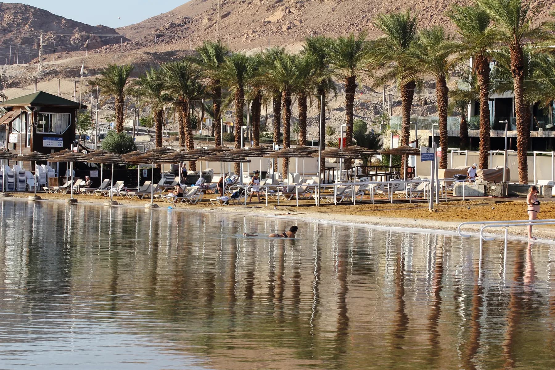
Ein Bokek Beach
The free, lifeguarded public beach in front of the southern hotel strip, where the water is not the open Dead Sea but Pond 5, an evaporation pond of the mineral works, and the beach itself was raised two metres and rebuilt between 2012 and 2016.
ישראל פרקר Israel Preker / CC BY 2.5 · Wikimedia Commons
Nature reserve
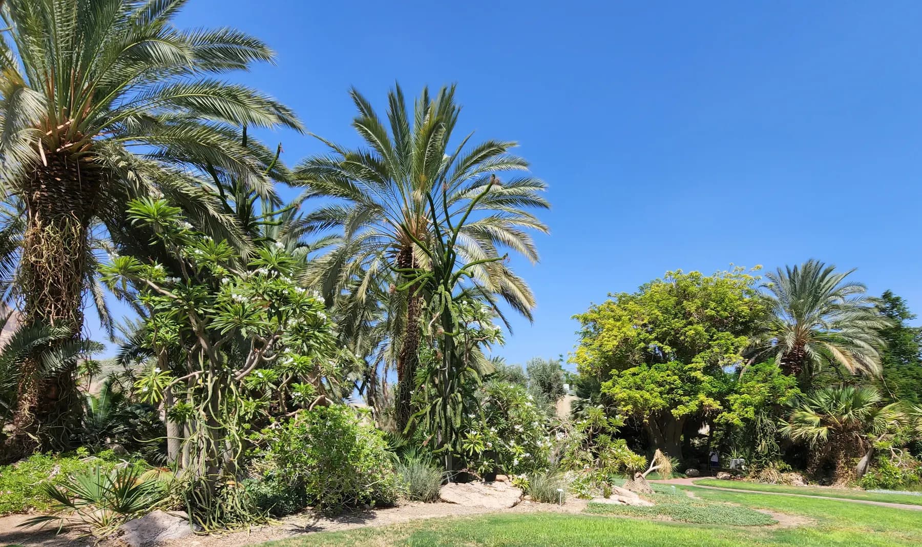
Ein Gedi Botanical Garden
About 80 date palms went into a bare plateau south of Nahal Arugot in April 1959, and the collection that grew out of them was catalogued in the 1980s at more than 900 species, with a kibbutz of some 700 people living inside it.
In-bar / CC BY-SA 4.0 · Wikimedia Commons
Nature reserve
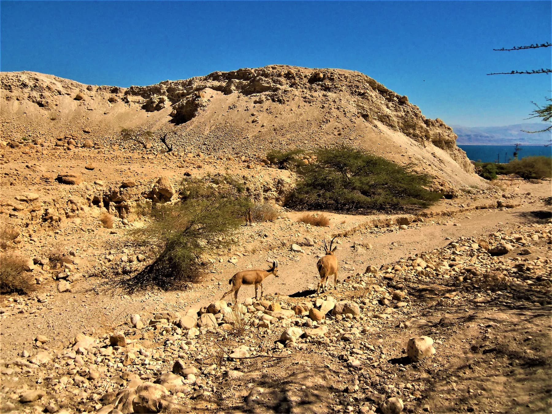
Ein Gedi Nature Reserve
Four springs push about three million cubic metres of fresh water a year through two desert canyons here, and the parks authority has been rebuilding the trails between them since a flood tore through the reserve in May 2025.
ישראל פרקר Israel Preker / CC BY 2.5 · Wikimedia Commons
Archaeological site
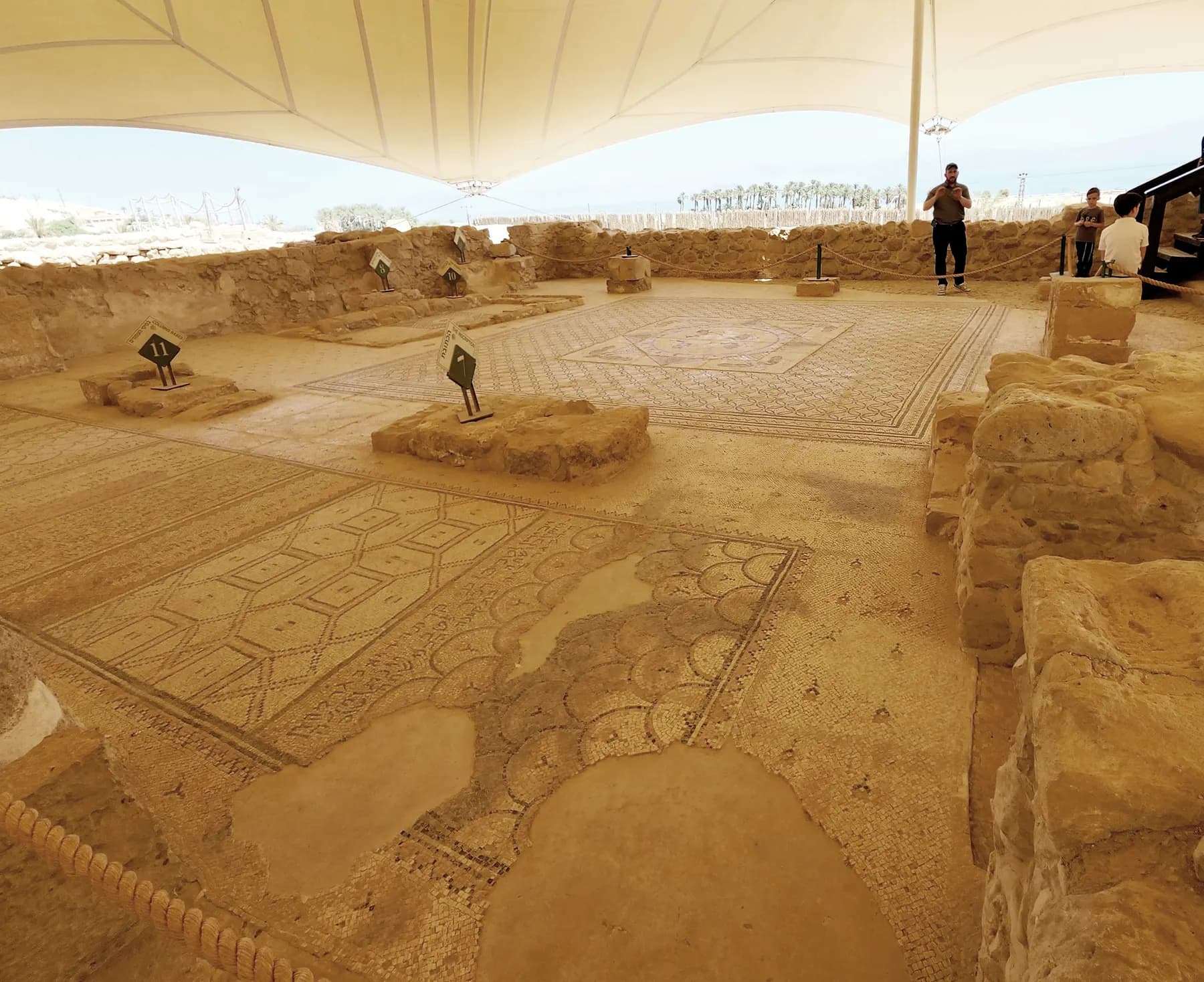
Ein Gedi Ancient Synagogue
The mosaic floor of this village synagogue carries a Judeo-Aramaic curse on anyone who reveals the secret of the town, and the parks authority's own brochure suggests the secret was how to grow and process balsam.
DinaKuzia / CC BY-SA 4.0 · Wikimedia Commons
Nature reserve
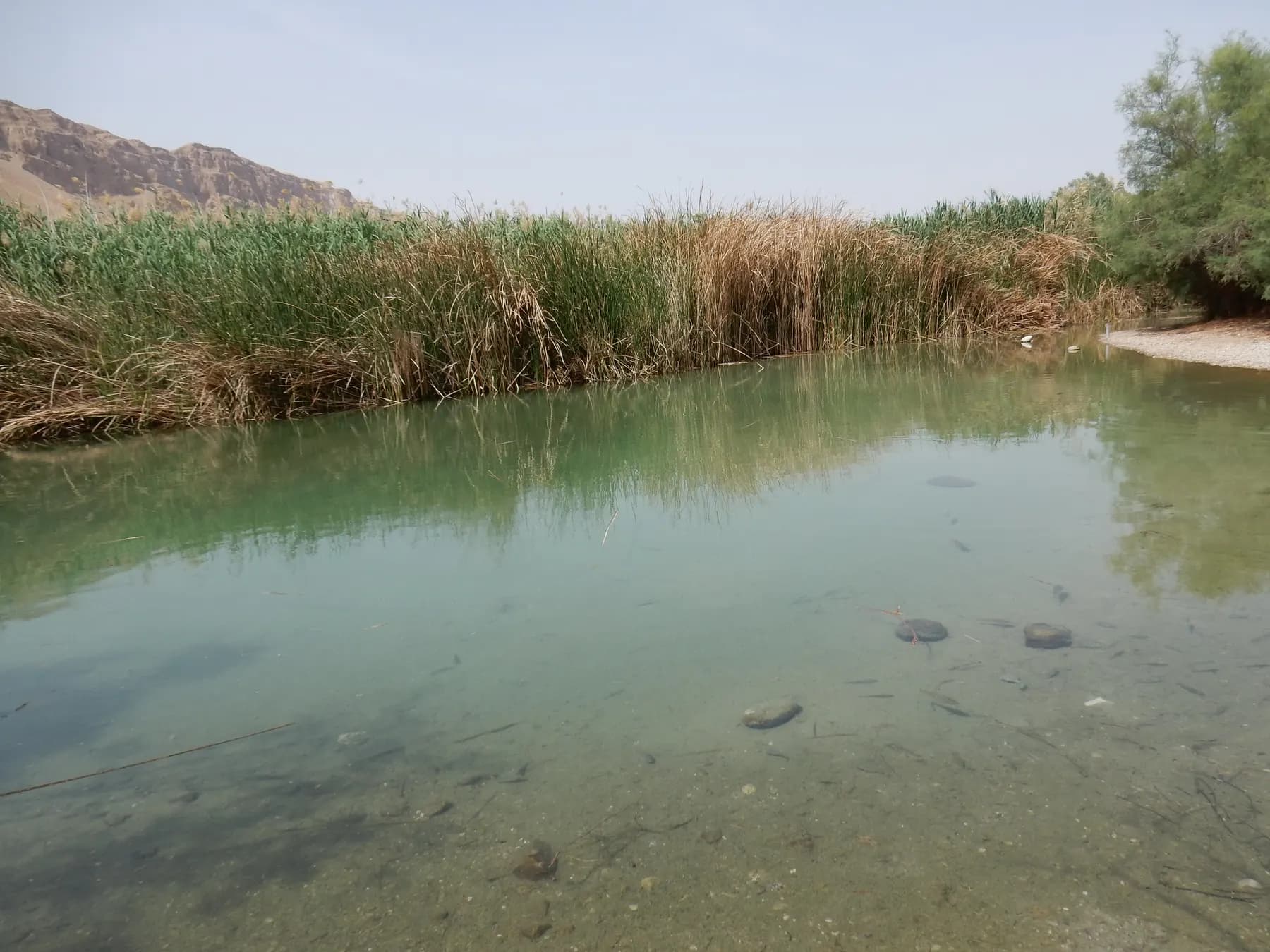
Einot Tzukim (Ein Feshkha) Nature Reserve
Brackish springs surface at the foot of the escarpment here and run into pools you can get into, and the Israel Nature and Parks Authority puts the point where they emerge at 390 metres below sea level.
Bahnfrend / CC BY-SA 4.0 · Wikimedia Commons
Beach
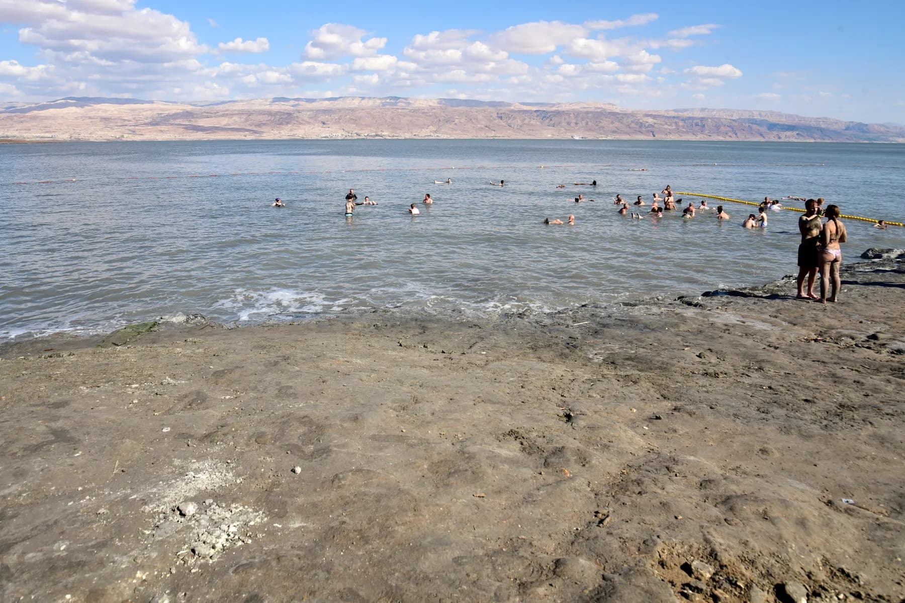
Kalia Beach
The northernmost managed beach on the Dead Sea, run by Kibbutz Kalia on the site of the potash works the Arab Legion destroyed in May 1948, with a paid gate and two quite different tickets.
Hoshvilim / CC BY-SA 4.0 · Wikimedia Commons
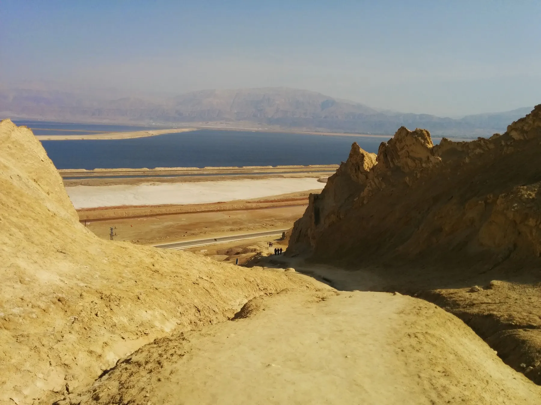
Landmark
Mount Sodom and Lot's Wife
A wall of rock salt that radar measurements show is still rising by up to 8.3 millimetres a year, with the longest salt cave in the world running through the inside of it.
israel zeller ישראל זלר / CC BY 2.5 · Wikimedia Commons
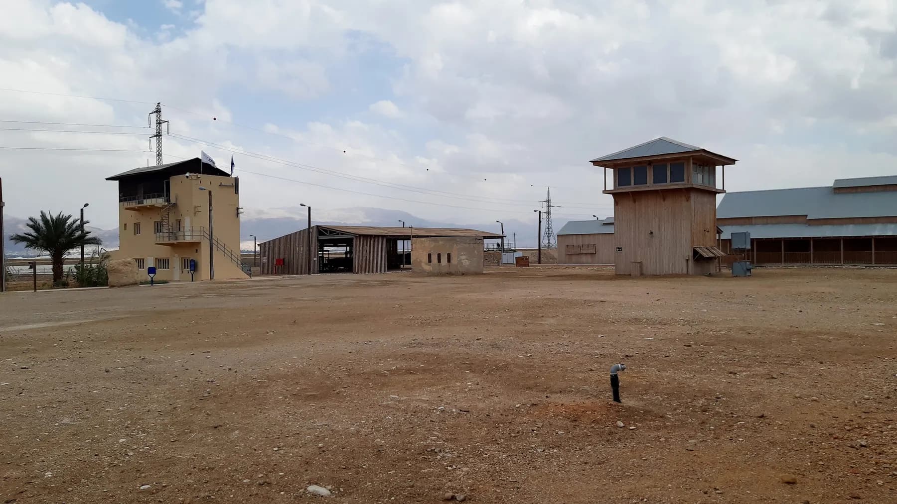
Museum
Moshe Novomeisky Visitor Center
The restored workers' camp of Palestine Potash at Sdom, lived in from 1934 until the early 1950s, open only on a guided tour of about ninety minutes.
שלמה רודד / CC BY 2.5 · Wikimedia Commons
Religious site
Qasr al-Yahud Baptismal Site
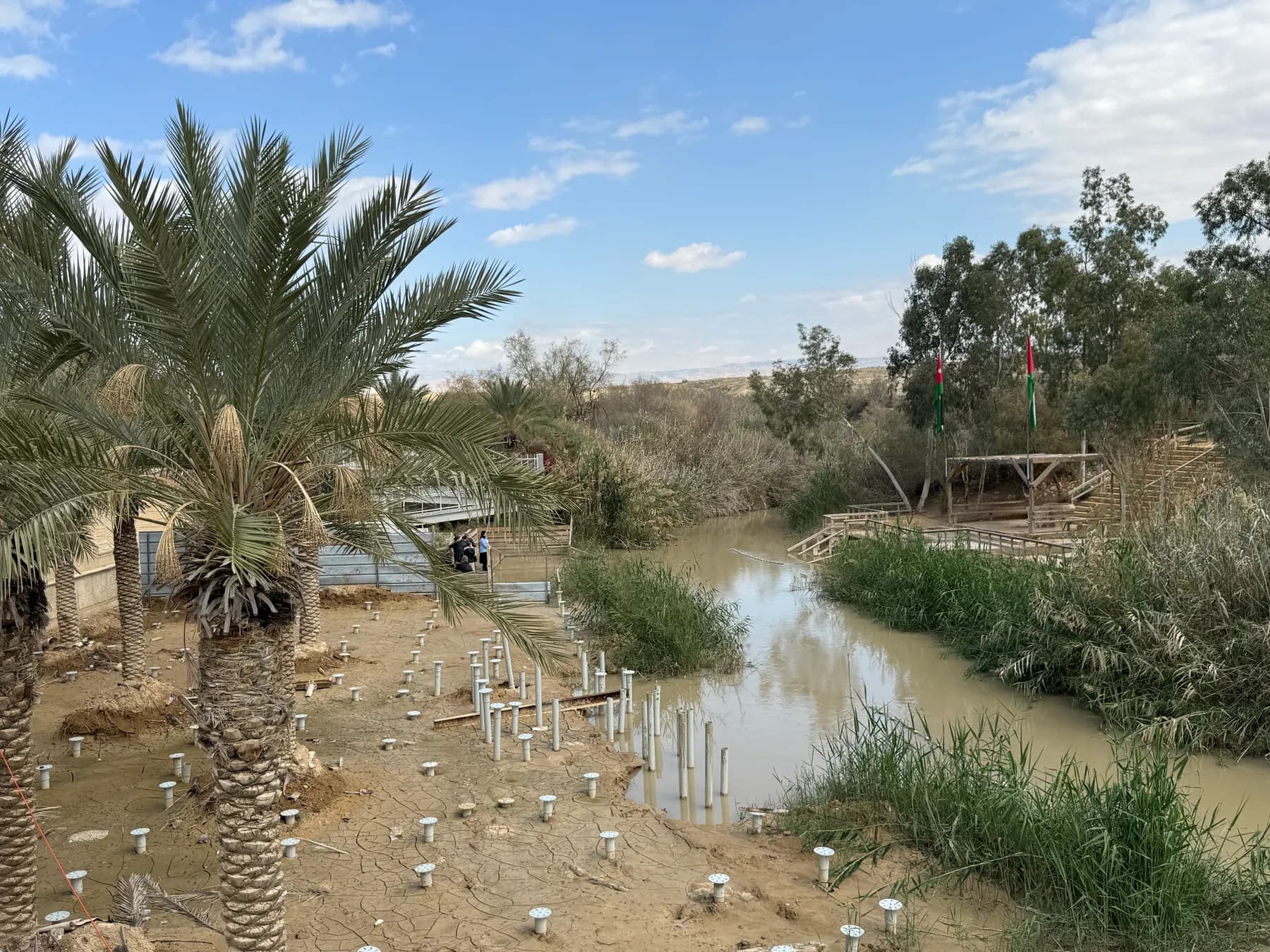
The traditional site of Jesus's baptism stands inside a closed military zone: more than 6,500 landmines were lifted from the monasteries around it between 2018 and 2020, and the riverbank itself reopened in February 2026 after NIS 25 million of building work.
MotherForker / CC BY-SA 3.0 · Wikimedia Commons
Archaeological site
Qumran National Park
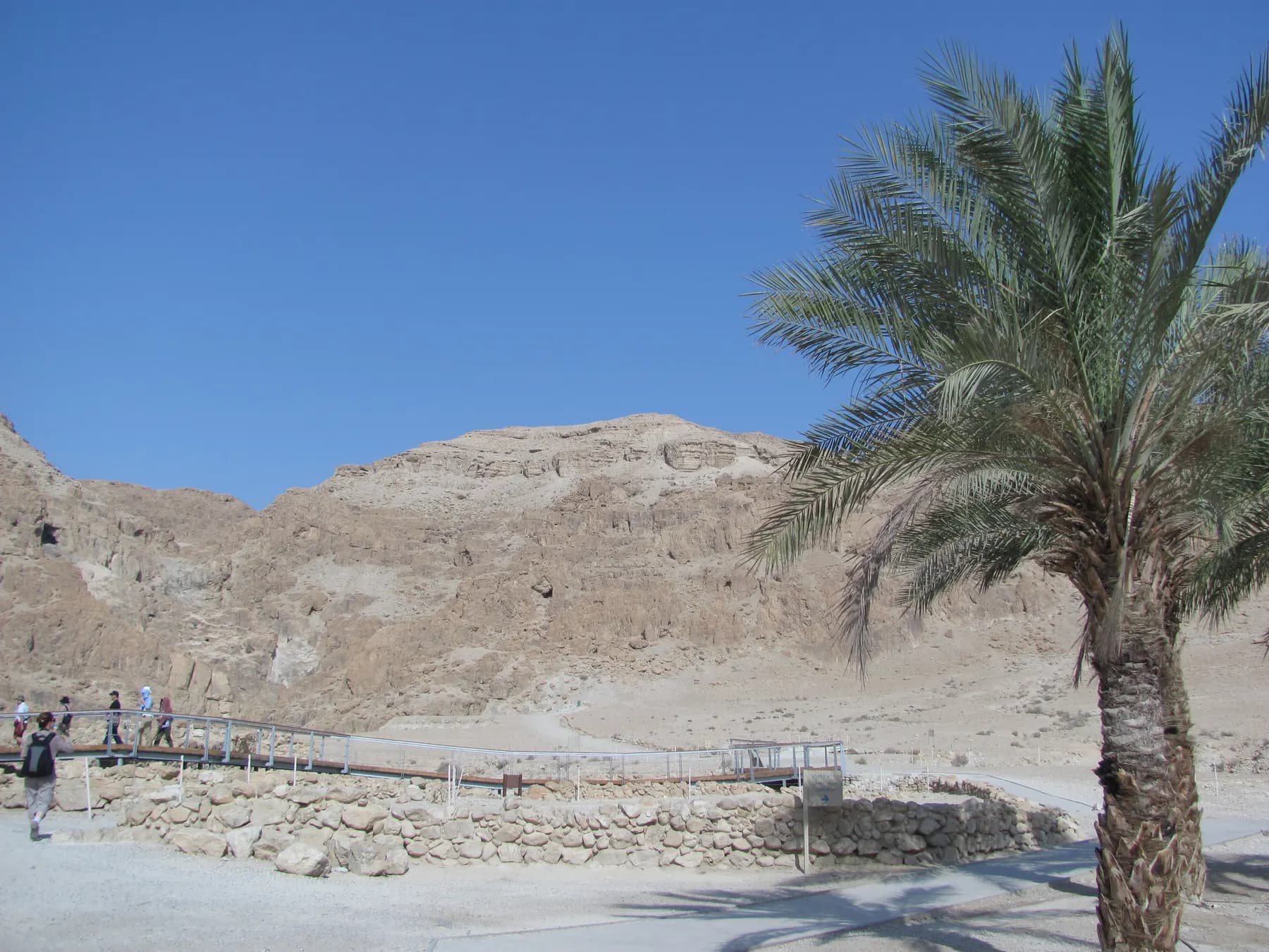
Eleven caves here gave up the Dead Sea Scrolls between 1947 and 1956, five of them found by Bedouin and six by archaeologists, and what the settlement beside them actually was is still argued over.
The long view
The Dead Sea, in order
4th millennium BCE
A Chalcolithic sanctuary is built above the springs at En Gedi, the earliest substantial structure known at the oasis.
6th century CE
The synagogue at En Gedi burns down with a Torah scroll inside its ark; the settlement, the excavator Yosef Porath recorded, was destroyed completely by fire.
1896
The highest level ever recorded is measured at 389 metres below sea level.
1906
Moshe Novomeysky analyses Dead Sea water in his laboratory in Russia. After settling in Palestine in 1920 and years of negotiation with the Mandatory government, he secures a 75-year franchise for the Palestine Potash Company to extract minerals from the lake.
1947
A young Bedouin shepherd finds the first seven scrolls in what is later called Cave 1, near Khirbet Qumran; eleven caves with written remains are identified by 1956.
1976
The southern basin dries out; what fills it thereafter is brine pumped from the north into evaporation ponds.
Late 1980s
The first sinkholes open along the western shore. By 1990 there are just over a hundred.
2015
The public beach at Ein Gedi closes permanently and the fast section of Route 90 south of it is replaced by an inland bypass, both because of sinkholes.
17 July 2019
49.9°C is recorded on the southern shore near the site of biblical Sodom, a record for that location.
November 2020
The first salt-harvesting dredger begins work in Pond 5, removing about 8 million tonnes a year to keep the hotel shoreline stable.
June 2021
Jordan abandons the Red Sea–Dead Sea Water Conveyance agreed with Israel and the Palestinian Authority in 2013.
2025
Israel's State Comptroller reports the northern basin still falling by about 1.15 metres a year, with eleven of twelve remedial initiatives incomplete.
Getting there
- Road 90 runs the length of the Israeli shore, from the northern beaches past Qumran, Ein Gedi and Masada to Ein Bokek and Sodom. It is the spine of any Dead Sea itinerary and the address the parks authority gives for Ein Gedi is simply Road 90, about a kilometre north of the kibbutz.
- From Jerusalem the road drops to the shore in a little over an hour; from Tel Aviv, allow rather more. Buses run from Jerusalem's central station to the Dead Sea hotels and to Ein Gedi, but services are infrequent and stop early on Fridays; check the operator's timetable rather than assuming.
- The Jordanian shore is reached from Amman in a comparable drive. Crossing between the two countries is possible at the Allenby/King Hussein bridge north of the lake and at the Arava/Wadi Araba crossing near Eilat; border procedures, fees and opening days change, so confirm with the relevant border authority before planning around it.
- Note that the stretch of the shore north of Ein Gedi, including Qumran and the Kalia beaches, lies in the West Bank. Some travel insurance policies and rental car agreements treat that differently from the rest of the route.
Access
Better than the terrain suggests. At Ein Gedi the parks authority provides accessible parking, an accessible visitor service station and toilets, and a wheelchair-accessible trail of about half a kilometre in Nahal David with resting points, an audio station and an observation point over the waterfall pool; it recommends that visitors with mobility impairments come with a companion. At the synagogue there is parking at the gate and a shaded accessible path, with movement through the archaeological site on well-paved paths. Ein Bokek's council-run beaches are wheelchair accessible and have accessible facilities. Service animals are not permitted inside En Gedi Nature Reserve.
When to go
November to March. Winter days on the shore are warm and clear, in the range where walking the canyons at Ein Gedi is a pleasure rather than an ordeal, and the water is still comfortable. Summer is genuinely dangerous: 49.9°C was recorded near Sodom on 17 July 2019, and the combination of that heat with intense salt exposure and roughly 50 millimetres of annual rainfall makes midday hiking a bad idea from May to September. If you must come in summer, be in the water or in shade by nine in the morning.
Hours and cost
The Israel Nature and Parks Authority opens En Gedi Nature Reserve and Qumran National Park from 08:00, closing at 17:00 in summer and 16:00 in winter, with earlier closings on Fridays and holiday eves; the gate shuts an hour before closing time and visitors must be out by closing. Last entry to Wadi Arugot at Ein Gedi is 14:00, and the reserve requires separate reservations for the Wadi David and Wadi Arugot trails. The reserve has been subject to flood damage and partial closures: at the time of writing Wadi David was open only along its accessible path and the Ein Gedi Spring and Dudim's Cave were closed until further notice, so telephone the authority's information centre on *3639 before travelling. The regional council's tourism site lists lifeguards on duty at the Ein Bokek and Hamei Zohar public beaches.
Prices posted by the Israel Nature and Parks Authority in 2026: En Gedi Nature Reserve ₪31 adult, ₪16 child; En Gedi Antiquities ₪16 adult, ₪7 child; Qumran National Park ₪31 adult, ₪16 child. A ticket to any one of Ein Gedi's three areas covers the others on the same day. The main public beaches at Ein Bokek and Hamei Zohar are free, including chairs, umbrellas and shade, because the regional council maintains them. Hotel beaches are open to non-guests but charge for loungers. Check the operators' own pages before you travel; these figures drift.
Opening times and prices change. Both are given as published by the operator and should be checked against its own page before you travel.

Practical
What people wish they had known about The Dead Sea
- Wear something on your feet in the water. The bed is crusted with sharp salt crystals, and the shallows at some beaches are worse than the deeper parts.
- Do not shave, wax or scratch for a day or two before you bathe. The brine finds every break in the skin.
- Bring a bottle of fresh water for your eyes as well as for drinking, and locate the rinse showers before you get in.
- Twenty minutes in the water is enough. Longer stays leave most people feeling wrung out, and the mineral load on the skin is not gentle.
- On the northern shore, do not leave marked paths, roads or supervised beaches: sinkholes open without warning and fences are there for that reason.
- Leave jewellery in the room. Silver tarnishes almost instantly in this water and some metals are attacked outright.
- If you are combining the Dead Sea with Masada, start before dawn and be off the rock by mid-morning in any month with heat in it.
The figures
The Dead Sea by the numbers
Each figure carries the year it belongs to and links the source it came from.
| Measure | Figure | As of | Source |
|---|---|---|---|
| Surface elevation | about 435 m below sea level | 2019 | science.nasa.gov |
| Rate of fall, northern basin | about 1.15 m a year | 2025 | ynetnews.com |
| Surface area lost, 1971–2022 | 41.8 per cent | 2026 | mdpi.com |
| Sinkholes on the Israeli shore | more than 6,000 | 2021 | timesofisrael.com |
| Jordan River inflow today | about 100 million m³ a year, from 1.3 billion | 2020s | eros.usgs.gov |
| ICL net withdrawal from the northern basin | about 160 million m³ a year, roughly 23 per cent of its depletion | 2022 | icl-group-sustainability.com |
| Salt dredged from Pond 5 to protect the hotels | about 20 million tonnes a year required | 2020 | icl-group-sustainability.com |
| En Gedi Nature Reserve, adult entry | ₪31 | 2026 | en.parks.org.il |
Where this is
The Dead Sea in the length of the country
Israel runs about 420 km from its northern tip to Eilat. Here is where this one sits on that line.
Nearby
Where to go next

Judaean Desert
Masada
A desert plateau some 450 metres above the Dead Sea, carrying Herod's palace, the most complete Roman siege works to survive anywhere, and an unfinished argument about what happened here.

Southern Israel
The Negev
More than half of Israel is desert, and almost none of it is sand: erosion craters, canyons with water in them, Nabataean ruins and the darkest sky in the country.

Northern Israel
The Galilee
Israel's green quarter: oak hills and basalt vineyards, a mystics' town high in the north, a Crusader capital buried under an Ottoman port, and half a billion birds passing overhead each year.
Sources and further reading
Every link below was opened and checked when this page was written. Official statements are marked as such: they are the subject's own account, not an independent one.
- OfficialICL Group (sustainability report)icl-group-sustainability.comDead Sea Water Level
The operator's own accounting: 473 million cubic metres pumped in 2022, about 160 million net withdrawn, roughly 23 per cent of the northern basin's depletion, and about 50 upstream dams.
- OfficialICL Group (sustainability report)icl-group-sustainability.comSalt Harvesting
Pond 5's floor rising about 20 cm a year, the 20 million tonnes of salt that must be removed annually, the $280 million approved in 2017 on an 80/20 split with the government, and the dredger commissioned in November 2020 at about 8 million tonnes a year.
- OfficialIsrael Nature and Parks Authorityen.parks.org.ilEn Gedi Nature Reserve
Opening hours, last entry to Wadi Arugot, separate reservations for the two trails, entrance fees of ₪31 adult and ₪16 child as posted in 2026, the accessible half-kilometre trail in Nahal David, and the ban on service animals.
- OfficialIsrael Nature and Parks Authorityen.parks.org.ilEn Gedi Antiquities National Park
The sixth-century CE synagogue and its mosaic floor, full accessibility, and entrance fees of ₪16 adult and ₪7 child as posted in 2026.
- OfficialIsrael Nature and Parks Authorityen.parks.org.ilQumran National Park
Opening hours and entrance fees of ₪31 adult and ₪16 child as posted in 2026.
- OfficialIsrael Antiquities Authority, Leon Levy Dead Sea Scrolls Digital Librarydeadseascrolls.org.ilThe Dead Sea Scrolls: Discovery Sites
The 1947 Bedouin discovery of Cave 1, the 1951–56 survey, eleven caves with written remains, Cave 4's share of the material, and the scroll fragments from Masada.
- OfficialJordan Tourism Boardinternational.visitjordan.comWadi Mujib
The Mujib Biosphere Reserve as the lowest nature reserve in the world, its 1,300 m elevation range from −410 m, over 300 plant species and the summer-only Siq Trail.
- OfficialDead Sea Land (Tamar Regional Council tourism)deadsea.co.ilThe Hotel Beaches
Ein Bokek and Hamei Zohar beaches maintained by the council with free chairs, umbrellas and shade, lifeguards, showers, lockers and wheelchair access.
- OfficialPetra, the Jordan News Agencypetra.gov.joArab Potash Company discusses expanding global reach of Dead Sea products
The Arab Potash Company's Dead Sea salt and mud products, produced through its Numeira Mixed Salts and Mud Company subsidiary on the Jordanian shore.
- ReportingThe Times of Israeltimesofisrael.comAs the Dead Sea dries, its collapsing shores force a return to nature
More than 6,000 sinkholes against roughly 100 in 1990, the closure of Ein Gedi beach and the Route 90 bypass in 2015, and the Geological Survey of Israel on Jordan's lower sinkhole count.
- ReportingThe Times of Israel (AFP)timesofisrael.comSinkholes on receding Dead Sea shore are 'nature's revenge'
The dissolution mechanism, sinkhole depths beyond 10 m, the loss of a third of the surface since 1960, and the Ein Gedi spa now some 3 km from the water.
- ReportingThe Times of Israeltimesofisrael.comAfter years of delays, Jordan said to nix Red Sea–Dead Sea canal with Israel, PA
The 2013 agreement, Jordan's cancellation in June 2021, and the Aqaba desalination alternative.
- ReportingThe Times of Israeltimesofisrael.comEnvironment Ministry unveils old-new plan to slow demise of Dead Sea
The Mediterranean-to-Dead-Sea desalination proposal: 268 million cubic metres of drinking water, 400 million of brine, 700 million lost to evaporation, NIS 10–14.5 billion and operation around 2045.
- ReportingThe Times of Israeltimesofisrael.comWith manmade islands and jetties, new hotel plan set to transform Dead Sea tourism
Fifteen hotels at Ein Bokek, about 800,000 visitors a year before the pandemic, and the plan to add 4,000–5,000 rooms toward Neve Zohar.
- ReportingThe Times of Israeltimesofisrael.comIsrael bakes as temperature climbs to near-record 49.9°C
The 49.9°C reading on the southern Dead Sea shore near the site of biblical Sodom on 17 July 2019.
- ReportingYnetnewsynetnews.comDead Sea level keeps falling, but Israel still has no rescue plan
Israel's State Comptroller in 2025: the northern basin falling about 1.15 m a year, eleven of twelve initiatives incomplete, and no sinkhole insurance mechanism as of August 2025.
- ReportingBiblical Archaeology Societybiblicalarchaeology.orgBook of Leviticus Verses Recovered from Burnt Hebrew Bible Scroll
The charred En Gedi scroll excavated in 1970, scanned in 2014 and read by Brent Seales's team, and Yosef Porath on the sixth-century destruction of the settlement.
- ReportingJewish Telegraphic Agency archivejta.orgNovomeysky Dies in Paris
Moshe Novomeysky's 1906 analysis of Dead Sea water in his laboratory in Russia, his settling in Palestine in 1920, and the 75-year franchise behind the Palestine Potash Company. The obituary does not date the franchise, so the page does not either.
- DataU.S. Geological Survey (EROS)eros.usgs.govEarthshots: Rates of Decline
Decade-by-decade rates of decline from 1930, the fall in Jordan River inflow from 1.3 billion to about 100 million cubic metres a year, and annual rainfall of about 50 mm.
- DataU.S. Geological Survey (EROS)eros.usgs.govEarthshots: Dead Sea, Israel, Jordan, West Bank
The lake as the lowest natural land or water surface on Earth, the two basins with the strait between them now dry, and the causes of decline.
- DataNASA Earth Observatoryscience.nasa.govGetting Saltier
Elevation of about 435 m below sea level, salt concentration above 30 per cent, decline of 1.2 m a year against 0.7 m in the 1970s–80s, the salt layer thickening about 10 cm a year, and the southern evaporation ponds.
- ReferenceEncyclopaedia Britannicabritannica.comDead Sea
Dimensions, the northern and southern basins, the Lisan peninsula, the evaporation pools and the 1896 high-water record of 389 m below sea level.
- ReferenceEncyclopaedia Britannicabritannica.comEn-Gedi
The oasis and its spring, the Chalcolithic sanctuary of the 4th millennium BCE, occupation from the 7th century BCE, and the kibbutz founded in 1953.
- ReferenceWater (MDPI), peer-reviewedmdpi.comMulti-Decadal Assessment of the Surface Area and Water Levels of the Dead Sea Using Remote Sensing Data
Surface shrinkage of 41.8 per cent between 1971 and 2022, desiccation of the southern basin by 1976, and a modelled level near −471 m by 2050.
- ReferenceInternational Journal of Environmental Research and Public Health (2022), via PubMed Centralpmc.ncbi.nlm.nih.govUltraviolet Measurements and Photoclimatotherapy for Psoriasis at the Dead Sea: 25 Years of Experience
Clearance rates above 85 per cent after four weeks; UVB attenuation at Neve Zohar of 6.56 per cent in December to 11.68 per cent in August against Beer Sheva, 690 m higher, with UVA attenuated markedly less.
- ReferenceAnnals of Emergency Medicine (1989), via PubMedpubmed.ncbi.nlm.nih.govDead Sea water poisoning
Forty-eight adults and four children; hypercalcaemia and hypermagnesaemia, arrhythmias in 29 per cent, and an adult mortality rate of 19 per cent.
- ReferencePediatric Emergency Care (2012), via PubMedpubmed.ncbi.nlm.nih.govDead sea water intoxication
Severe electrolyte disturbance after accidental ingestion, resolved with forced diuresis over two days.
The Dead Sea: common questions
Why do you float in the Dead Sea?+
Because the water is heavier than you are. NASA gives the salt concentration as above 30 per cent, nearly ten times that of the oceans, and a brine that concentrated weighs far more per litre than a human body. You displace less than your own volume before the upward force matches your weight, so you sit on the surface rather than in it. Lie on your back with your arms out; do not attempt to swim.
Is it safe to swim in?+
It is safe to float, at a supervised beach, on your back, for a short time. It is not safe to swim in the ordinary sense. Turning face down is the main hazard, because the buoyancy makes it hard to right yourself, and the water is genuinely toxic to swallow or inhale: a 1989 study in Annals of Emergency Medicine of 48 adults poisoned by Dead Sea water recorded an adult mortality rate of 19 per cent. Use beaches with lifeguards.
Is the Dead Sea really disappearing?+
It is shrinking fast but it will not vanish. A 2026 study in the journal Water found the surface shrank 41.8 per cent between 1971 and 2022 and modelled a level near 471 metres below sea level by 2050. As the brine concentrates, evaporation slows, so the lake tends toward a smaller, saltier equilibrium rather than a dry basin. The shoreline you can currently walk to, however, is not permanent.
Which side is better, Israel or Jordan?+
They offer different things. The Israeli side has the free, council-run public beaches at Ein Bokek and Hamei Zohar, about fifteen hotels in one strip, and Ein Gedi, Qumran and Masada within an hour's drive. The Jordanian side has resort hotels with private beaches, the Dead Sea Panorama complex, Wadi Mujib (which the Jordan Tourism Board calls the lowest nature reserve in the world) and the baptism site at Al-Maghtas. If you want a free public beach and archaeology, go west; if you want a quieter resort and canyon hiking, go east.
Are the sinkholes a risk to visitors?+
On the northern shore, yes, if you leave the marked ground. More than 6,000 have opened on the Israeli side since the late 1980s, some more than ten metres deep, and they appear without warning. That is why the Ein Gedi public beach closed in 2015 and why a fast section of Route 90 was replaced by an inland bypass the same year. Supervised beaches, marked trails and open roads are managed; fenced or unmarked ground is not.
Can you visit the Dead Sea in summer?+
You can, but plan around the heat. A reading of 49.9°C was recorded near Sodom on 17 July 2019, and the shore gets roughly 50 millimetres of rain a year, so there is no relief in the weather. Be in the water or in shade before nine in the morning, do not attempt the Ein Gedi canyon trails in the middle of the day, and drink far more than feels necessary. November to March is much better.
Does the water actually help skin conditions?+
There is real clinical evidence for psoriasis. A 2022 review of twenty-five years of ultraviolet measurement at the Dead Sea reports that the standard protocol achieves excellent to complete clearance in more than 85 per cent of patients after four weeks. The mechanism is thought to combine the unusual ultraviolet spectrum at this altitude (the burn-causing short UVB wavelengths are attenuated more than the therapeutic ones) with the mineral content of the water and the effect of a long, unhurried stay.
Why are there factories on the shore?+
The brine is a mineral resource. Solar evaporation ponds at the southern end crystallise out potash, bromine, magnesium and salt for fertiliser and industry on both sides of the lake: ICL on the Israeli shore, the Arab Potash Company on the Jordanian one. ICL states that it draws a net 160 million cubic metres a year from the northern basin, about 23 per cent of that basin's annual depletion; the rest is the diversion of the Jordan River and natural evaporation.
Are the hotels really on the Dead Sea?+
Not on the natural lake. The Ein Bokek hotels stand on the shore of Pond 5, an evaporation pond in the southern basin, which dried out as a natural water body by 1976 and is now kept full by pumping. Salt precipitating on its floor raises the level by about 20 centimetres a year, so roughly 20 million tonnes of salt must be dredged out annually to keep the water off the hotel foundations.
Do I need to book Ein Gedi in advance?+
Yes for the trails. The Israel Nature and Parks Authority requires separate reservations for the Wadi David and Wadi Arugot routes, though the En Gedi Antiquities site needs none. A ticket to any one of the three areas covers the other two on the same day. Because flood damage has closed parts of the reserve at times, telephone the authority's information centre on *3639 before you drive down.
Hotels & Stays
See all hotels & stays →Ecce Homo Pilgrim House
Jerusalem
A guesthouse on the Via Dolorosa, over Roman pavement
Jerusalem Hotel
Jerusalem
A stone-vaulted hotel in East Jerusalem, by the Old City
Jungle Jaffa Hostel
Tel Aviv
A social hostel in old Jaffa, ten minutes' walk from the beach
Matmon Barava
Ein Yahav
Desert cabins and a visitor centre in Ein Yahav, deep in the Arava