Archaeological site · The Negev
Mamshit National Park
Mamshit is the most compact of the four Negev desert cities in the UNESCO Incense Route inscription: about four hectares of Nabataean, Roman and Byzantine town inside a national park of 142.
Deror avi / CC BY-SA 3.0 · Wikimedia Commons
The ancient city
about 4 hectares
inside a national park of 142 hectares, per the parks authority brochure
Adult ticket
₪24
child ₪10, as published by the Israel Nature and Parks Authority in 2026
City wall
about 900 m
built at the end of the 3rd century CE and widened after the earthquake of 363
The coin hoard
10,320 recorded coins
found on 18 August 1966; published counts run as high as 10,800
In short
- How long to give it
- about 90 minutes for the antiquities, and around two and a half hours with the marked path down to the dams in Wadi Mamshit
- Summer, Sunday to Thursday and Saturday
- 08:00 to 17:00
- Adult
- ₪24
ממשית
Mamshit National Park holds the ruins of a small Nabataean, Roman and Byzantine town on a low hill about 6 kilometres east of Dimona, on Route 25 towards the Dead Sea. The Israel Nature and Parks Authority puts the ancient city at four hectares inside a national park of 142, which makes it the most compact of the four desert cities in the UNESCO Incense Route inscription, and the only one with a wall right round it.
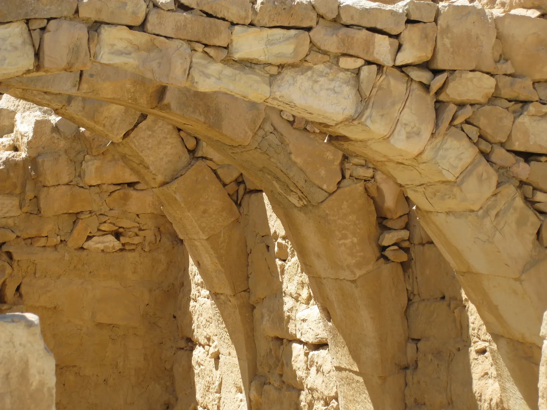
Its compactness is the reason to come. Mamshit is a dense block of houses that can be walked in an hour and a half: a two-storey mansion of about a thousand square metres, a larger one of about two thousand with a stable for sixteen horses in it, a tower with its stone-slab ceiling still carried on arches, a public reservoir, a bathhouse and two Byzantine churches. Avraham Negev, who dug here, found that what looked like heaps of rubble were upper storeys collapsed onto the rooms below, which is why so much of the ground floor was still standing.
It is also a site where the line between excavated and rebuilt has to be kept in view. The parks authority lists its first point of interest as the remains of the Nabataean city, partly restored; the market street is a reconstruction, and the building on the summit with the best view is a British Mandate police station of 1936.
The road
A junction town, and no two sources agree on when it started
Mamshit is not on the main highland road that ran from Petra to Gaza. The parks authority's brochure places it at a junction instead: the roads linking the Arava (by way of the Scorpions Ascent and Tamara) and the Dead Sea (by way of the Tamar fort and the Tamar and Peres ascents) with the coastal plain and the Hebron mountains met near here. That is a different kind of place from a caravan stage, and it shows in what was built.
The founding date is genuinely unsettled. The parks authority's brochure says a permanent settlement was first established in the middle Nabataean period, in the mid-first century CE, apparently at the top of the hill near where the police building now stands. The Encyclopaedia Judaica entry says about 50 CE. English Wikipedia dates the foundation a century earlier, to the first century BCE, as a trade post between Petra and Gaza.
What is not in doubt is when the town was built up. Most of its buildings, and they are mainly grand private houses rather than public architecture, went up in the second century CE, after Rome annexed the Nabataean kingdom in 106 CE. So the mansions a visitor walks through were raised by Nabataean builders under Roman rule, after the kingdom that made them rich had stopped existing.
The name travelled better than the town. Greek sources call it Mampsis, Arabic Kurnub. Eusebius put it between Hebron and Elath, one day's march from Thamara, and it appears in the episcopal lists of Palaestina Tertia, which is to say it had a bishop.
- At the junction of the Arava, Dead Sea, Petra and coastal plain roads, not on the main Petra to Gaza route
- Permanent settlement from the mid-1st century CE on the parks authority's account
- Most surviving buildings are 2nd century CE, after the Roman annexation of 106 CE
- Known as Mampsis in Greek and Kurnub in Arabic
- Shown on the 6th-century Madaba map as Maps
The wall
The only walled one, and the wall is not Nabataean
Mamshit is described almost everywhere, BiblePlaces among them, as the only walled city of the Nabataeans, and that is the fact most visitors arrive holding. The parks authority's own dating complicates it. Its brochure puts the gate and the roughly 900-metre wall in the late Roman period, at the end of the third century CE, and says the wall was widened in the Byzantine period after the earthquake of 363. The circuit is real and it is the only one of its kind in the Negev towns; it is also two centuries younger than the houses inside it.
The gate is worth standing in. It was a passage between two towers with its ceiling carried on three arches, and it is how the town identified itself to the outside world: on the Madaba map, the sixth-century mosaic floor found in a church in Jordan, Mamshit is drawn as a gate with its towers. The parks authority records that the gate was burned and destroyed in the seventh century CE.
The wall also tells you what it left out. Two large complexes outside it, in use from the first to the fourth centuries CE, are read by the parks authority as inns for the commercial caravans: whatever the wall defended, the trade itself slept beyond it.
- Wall about 900 m long, built at the end of the 3rd century CE
- Widened in the Byzantine period after the earthquake of 363 CE
- Gate of two towers and a three-arched passage, burned in the 7th century CE
- The gate and its towers are the city's symbol on the Madaba map
- Two caravan inns stand outside the wall, in use from the 1st to the 4th centuries CE
The houses
Two thousand square metres, sixteen horses and a room with Eros in it
The largest building here is nicknamed the Nabatu house, and the parks authority gives it about 2,000 square metres of interior courtyards, staircases and rooms. Its capitals still carry small reliefs of a human head, a jug and a bull. In one room the excavators found wall frescoes showing Eros and Psyche, figures out of Greek mythology, painted in a desert town on the edge of the empire. In another they found the coin hoard.
The second great house, called the wealthy house, covers about 1,000 square metres on two storeys, with rooms round a rectangular courtyard: a guard room, a reception hall, a chancery, servants' rooms and a residential wing. A round installation topped with a half dome held the household water jar, the northern rooms have Nabataean capitals at their doorways and wall niches that worked as cupboards, and the stairwell is closed.
The most quietly surprising room at Mamshit is a stable. A typical Nabataean dwelling built against the eastern wall of the Western Church has a courtyard with a cistern and a passage through to a stable that could hold sixteen horses. The parks authority states plainly that raising horses for riding was an important part of the city's economy. English Wikipedia goes further and ties the town's later prosperity to breeding the Arabian horse once the incense trade fell away; the parks authority does not make that claim.
One habit explains the shape of nearly everything here. Nabataean building in the Negev did not use timber, because there was none, so ceilings were carried on stone slabs resting on arches. The tower, originally three storeys high, preserves a ground-floor room with exactly that arrangement, and its stairwell leads to a second storey looking over the ruins and the wadi.
- The Nabatu house: about 2,000 m², with capitals carved as a human head, a jug and a bull
- Fresco fragments of Eros and Psyche on one of its walls
- The wealthy house: about 1,000 m² over two storeys, with a guard room, reception hall and chancery
- A stable for 16 horses in the dwelling beside the Western Church
- Stone ceiling slabs on arches throughout, because there was no timber
The hoard
Ten thousand silver coins in a bronze jar under a staircase
The Coin Hoards of the Roman Empire database at the Ashmolean records the find date as 18 August 1966 and the finder as Avraham Negev of the Hebrew University. Its total is 10,320 coins: silver denarii and tetradrachms running from Vespasian to Elagabalus, recovered from a bronze jar. Negev's own account is quoted there: 'While making my regular tour of the site, a worker came up running and presented me with a handful of coins shouting that thousands of them had been discovered in a house which we had started to excavate some time earlier.'
The find spot is as good as the find. The jar had been placed in a strong-box hidden beneath the staircase tower of a Nabataean house, under the fourth tier of steps, facing the inner court of the residential wing. The weight of stone above it had deformed the lid and split the jar along its soldered seam, so more than half the coins had already spread across two or three square metres of debris by the time anyone reached them.
The count is not settled, and a visitor may be told different numbers on the same afternoon. The parks authority says approximately 10,800 silver coins, dating them 75 to 200 CE in the brochure and to the first to third centuries CE on its web page. The Encyclopaedia Judaica says 10,400 Roman tetradrachms; English Wikipedia says 10,500; the Ashmolean database gives 10,320 and notes that 10,343 coins are held by the Israel Antiquities Authority. Its closing reign is Elagabalus, which puts the burial between 218 and 222 CE, roughly a century after the kingdom was annexed. Whoever hid the money never came back for it.
- Found on 18 August 1966 by Avraham Negev, in a bronze jar
- Hidden in a strong-box beneath the fourth tier of a house staircase
- Coins run from Vespasian to Elagabalus, closing between 218 and 222 CE
- Published totals: 10,320 (Ashmolean), 10,400 (Encyclopaedia Judaica), 10,500 (Wikipedia), about 10,800 (parks authority)
Churches
Two basilicas, a font for babies, and the shock of 363
The Western Church is named for the man who paid for it. Entered through a colonnaded atrium with a covered cistern under it, it is a basilica of a nave and two aisles, with an apse at the end and rooms for ritual use on either side. The nave floor is mosaic, with geometric patterns, birds, two peacocks and dedications in Greek. The central one reads, in the parks authority's translation: 'God, save your servant Nilus, lover of Jesus, who founded this building. Preserve him and his household.' That inscription is why it is called the Church of St Nilus.
The Eastern Church, part of a monastery, is the more unusual of the two. A flight of steps leads up to an atrium built over a large cistern, and three doors open from it into the church. The mosaic in the nave carries two crosses, which dates it before 427 CE, after which crosses were no longer permitted on church floors. Human bones were found inside, and the rooms flanking the apse held the remains of receptacles for the bones of martyrs, which is where the name Church of the Saints and Martyrs comes from. A large cruciform basin for baptising adults stands beside a small square font for infants.
Both churches went up, on the parks authority's reading, at the beginning of the fifth century CE, and were in use until either the Persian invasion of 614 or the Arab conquest of 636. After that, its brochure says, Mamshit ceased to exist.
The earthquake is legible on the walk. The staircase of the house beside the Western Church still shows the damage of the shock that helped destroy the town, apparently in 363 CE. Korzhenkov and Mazor's archaeoseismic survey, published in 2003, read some 250 damage cases across twelve deformation patterns as the record of two separate events, one around 363 and one in the seventh century, with the shocks arriving from the north. Tali Erickson-Gini later documented a kitchen whose contents were sealed on the floor by the collapse.
How the town ended is still argued. Negev held that Mampsis ceased to matter after the middle of the fifth century; Jodi Magness has documented occupation through the sixth and seventh centuries, with Arabic graffiti on the churches attesting an Early Islamic presence. The signs on site follow Negev.
- Western Church, named from a Greek dedication by one Nilus, with birds and two peacocks in its mosaic
- Eastern Church: two crosses in the nave mosaic date it before 427 CE
- A cruciform basin for adults and a small square font for infants
- Both churches built at the beginning of the 5th century CE
- Earthquake damage of about 363 CE visible on a house staircase
- Korzhenkov and Mazor, 2003: 250 damage cases, two events, shocks from the north
Reconstruction
The market street is a reconstruction, and so is a good deal else
The parks authority is straightforward about this: the first item on its own list of points of interest is 'the remains of the Nabatean city, partly restored'. The clearest case is the market, described on its page as a reconstructed Nabataean street with rows of rooms down both sides that served as shops. Some scholars, the same page notes, read that street as an army camp instead. At Sukkot and Passover the parks authority fills it with an actual market, which is the one moment when the reconstruction does what it was rebuilt to suggest.
Other elements are labelled too. The residential house attached to the Western Church, the one with the stable and the earthquake-damaged staircase, is partly restored. The lower of the Nabataean dams in the wadi was renovated under the Mandate for the camel-mounted police; a second dam downstream is a Mandate structure outright.
The building with the best view is the newest thing on the hill. In 1936 the Mandate authorities put a police station on the highest point of the city, on top of an ancient Nabataean structure, for the camel-back desert patrols that monitored Bedouin movement and, in the parks authority's own wording, prevented Jews from travelling the area with an eye to settling it. Its roof is now the lookout over the ruins, and the building is used for events.
Even the excavation history comes in incompatible versions. The parks authority brochure has S. Appelbaum making trial soundings for the Hebrew University in 1956 and A. Negev excavating in 1956 and 1957, renewing the work in 1989, with T. Erickson-Gini continuing for the Israel Antiquities Authority in 1993 and 1994. The Encyclopaedia Judaica dates Negev's excavations from 1966; BiblePlaces gives 1965 to 1973; the Ashmolean's hoard record gives 1965 to 1967. The site was declared a national park in 1966 and inscribed by UNESCO in 2005 at the committee meeting in Durban.
- The market street is a reconstruction; some scholars read it as an army camp
- The residential house by the Western Church is partly restored
- The lower dam in the wadi was renovated under the British Mandate
- The police station on the summit dates from 1936 and is now the viewpoint
- Declared a national park in 1966; inscribed by UNESCO in 2005
What to look for
Things not to walk past at Mamshit National Park
The details that repay knowing about before you are standing in front of them.
The Eros and Psyche fresco
Fragments of wall painting in a room of the Nabatu house, showing two figures from Greek mythology. It is the least expected thing in the town, and it sits a few metres from where the coin hoard was hidden.
The stable for sixteen horses
Reached through the courtyard of the dwelling built against the Western Church. The parks authority says raising horses for riding was an important part of the city's economy, and this is the physical evidence for it.
The gate, and the Madaba map
Two towers and a passage whose ceiling rested on three arches, built in the late Roman period. The same gate is how Mamshit is drawn on the sixth-century mosaic map at Madaba in Jordan.
The two fonts in the Eastern Church
A large cruciform basin for baptising adults stands beside a small square font for infants. The nave mosaic beside them carries two crosses, which places it before the prohibition of 427 CE.
The reservoir potsherd
The public reservoir measures 18 by 10 by 3 metres and caught runoff from the houses and streets. A potsherd found in it reads, in translation, 'For Flavius Gormos, son of Zacharia, I have completed one of the obligatory works for the pool, 25th of the month of Dios', which suggests residents maintained it by rota.
The roof of the police station
Built in 1936 for the Mandate's camel-mounted desert patrols, on top of an earlier Nabataean building at the highest point of the city. The roof gives the only view that takes in the whole plan of ancient Mamshit and the wadi below it.
The long view
Mamshit National Park, in order
Mid-1st century CE
A permanent settlement is established, apparently at the top of the hill. The Encyclopaedia Judaica dates it to about 50 CE; English Wikipedia puts the foundation a century earlier, in the 1st century BCE.
106 CE
Rome annexes the Nabataean kingdom. Most of Mamshit's surviving buildings, chiefly large private houses, go up in the century that follows.
218 to 222 CE
The latest coins in the hoard were struck under Elagabalus, which is when the bronze jar was hidden under the staircase and not recovered.
End of the 3rd century CE
The city is surrounded by a wall about 900 metres long, with a gate between two towers.
363 CE
An earthquake damages the town. Its effects are still visible on a house staircase beside the Western Church, and Erickson-Gini recorded a kitchen sealed on its floor by the collapse.
Beginning of the 5th century CE
The Western Church and the Eastern Church are built. The wall is widened in the Byzantine period after the earthquake.
Before 427 CE
The nave mosaic of the Eastern Church is laid with two crosses in it, which becomes datable evidence once crosses on church floors are prohibited in that year.
614 or 636 CE
The churches remain in use until the Persian invasion or the Arab conquest. The gate is burned and destroyed in the 7th century, and the parks authority's account has the town ceasing to exist. Magness has documented occupation continuing into the 6th and 7th centuries with Arabic graffiti on the churches.
1807 to 1871
The site is visited by the explorers U. J. Seetzen, E. Robinson and E. H. Palmer.
1901
A. Musil carries out the first thorough survey and mapping of the ruins.
1914
Leonard Woolley and T. E. Lawrence resurvey and map the area for the Palestine Exploration Fund.
1936
The British Mandate builds a police station on the summit, over an earlier Nabataean structure, for its camel-back desert patrols.
1937
G. E. Kirk and P. L. O. Guy make a detailed survey for the Palestine Exploration Fund.
1956 to 1957
S. Appelbaum makes trial soundings and A. Negev runs large-scale excavations, on the parks authority's account. Other published accounts date Negev's work from 1965 or 1966.
18 August 1966
The silver hoard is found in a bronze jar in a strong-box beneath a house staircase.
1966
Mamshit is declared a national park.
1993 to 1994
Tali Erickson-Gini excavates for the Israel Antiquities Authority, finding a structure of the 2nd century CE under the floor of the police station and buildings of the town's first century.
2005
UNESCO inscribes the Incense Route and the desert cities of the Negev at its Durban committee meeting, with Mamshit, Avdat, Haluza and Shivta.
Practical
Visiting Mamshit National Park
Where
Beside Route 25, the Dimona to Dead Sea road, about 6 km east of Dimona. The park page and the park brochure differ slightly: the brochure says approximately seven kilometres
What ticket you need
Mamshit is one of the four desert cities inside the UNESCO inscription of the Incense Route, with Avdat, Haluza and Shivta, and that listing is not a ticket: each national park charges separately and there is no combined admission. The Nabataean Khan campground is inside the national park but is booked and priced separately, with its own telephone number, its own entry window from 15:00, and a published overnight charge of ₪64 for an adult in an own tent.
Opening hours
- Summer, Sunday to Thursday and Saturday
- 08:00 to 17:00source
- Summer, Friday and holiday eves
- 08:00 to 16:00source
- Winter, Sunday to Thursday and Saturday
- 08:00 to 16:00source
- Winter, Friday and holiday eves
- 08:00 to 15:00source
- Rosh Hashanah eve and Passover eve
- 08:00 to 13:00source
- Yom Kippur eve
- 08:00 to 13:00source
- Entry closes
- one hour before the posted closing time, which is earlier than the half hour used at some other parkssource
Admission
- Adult
- ₪24source
- Child
- ₪10source
- Student
- ₪20source
- Israeli senior citizen
- ₪12source
- Adult in a group of more than 30
- ₪20source
- Child in a group of more than 30
- ₪9source
- Reservist, on the Hebrew price list
- ₪18source
- Soldier in compulsory, national or civilian service, on the Hebrew price list
- no charge, on production of a valid cardsource
- Pupil, on the Hebrew price list
- ₪8source
Access
Partly accessible, and better than most Negev ruins. On the parks authority's Hebrew page the entrance area is accessible throughout: parking, the entrance hall, the visitor service shop, a picnic area next to it, toilets, a lookout over the landscape, signage, and concrete paths running along the cliff as far as the entrance to the antiquities themselves. Inside the antiquities there are handrails beside the steps, paths of well-compacted surface, shade shelters, benches, and illustrated interpretation boards. With the manager's approval, on days that are not busy, visitors may drive up to the top of the ancient mound, and the upper car park gives access to a viewpoint over both the landscape and the ruins. The site is nevertheless a hill of excavated stone buildings with steps, thresholds and uneven paving, and the second storey of the tower is reached by a staircase. The stairwell of the wealthy house is closed to visitors altogether. Telephone 08-6556478 before a long drive.
On site
- Visitor service centre and shop
- Toilets
- Picnic area beside the entrance
- Lookout from the roof of the 1936 police building
- Shade shelters and benches among the ruins
- Illustrated interpretation boards
- Marked path down to Wadi Mamshit and the dams
- Nabataean Khan overnight campground
- Parking, with an upper car park by permission
- Events venue in the former police station
Booking
The parks authority asks visitors to register through its visit-coordination system and states that anyone who has booked and finds the site full will be asked to show the confirmation at the gate. The park telephone is 08-6556478 and the authority's information line is *3639. Dogs are admitted to the national park on a lead and muzzled, on the Hebrew page, but the Nabataean Khan campground next door forbids them entirely, so a dog rules out staying the night here. The parks authority has in the past published extended hours over the intermediate days of Passover, so check the park page for the exact week.
Hours and prices are given as the operator publishes them and change without much notice, particularly around Shabbat and the festivals. Check the operator's own page before you travel for this.
Official page at en.parks.org.il →What people wish they had known
- Check the clock before the gate. Entry to Mamshit closes a full hour before the posted closing time, not the half hour used at several other national parks, so arriving at 16:15 in summer means being turned away.
- Do not plan it as a stop on the Route 40 desert-cities day. Mamshit sits on Route 25 east of Dimona, roughly an hour from Avdat and Shivta by road, and it belongs with a Dead Sea or Beersheba day rather than with them.
- Ask at the ticket office about driving up. The Hebrew page says the manager may allow vehicles to the top of the mound on days that are not busy, and the upper car park is where the viewpoint over the whole plan is.
- Read the market street as a reconstruction. The rows of shop rooms are rebuilt rather than standing fabric, and the parks authority notes that some scholars think the street was an army camp in the first place.
- Climb the tower rather than the wealthy house. The tower's stairwell leads to a second storey and the view; the stairwell in the wealthy house is closed to visitors.
- Camping is a separate transaction. The Nabataean Khan has its own price list, its own telephone number and an entry window that opens at 15:00, and it does not admit dogs even though the national park does.
The figures
Mamshit National Park by the numbers
Each figure carries the year it belongs to and links the source it came from.
| Measure | Figure | As of | Source |
|---|---|---|---|
| Adult admission | ₪24 | 2026 | en.parks.org.il |
| Area of the ancient city | about 4 hectares, inside a national park of 142 hectares | 2026 | static-en.parks.org.il |
| Length of the city wall | about 900 m | 2026 | static-en.parks.org.il |
| The Nabatu house | about 2,000 m² | 2026 | en.parks.org.il |
| The wealthy house | about 1,000 m² over two storeys | 2026 | en.parks.org.il |
| The public reservoir | 18 by 10 by 3 m | 2026 | en.parks.org.il |
| Coins in the hoard | 10,320 recorded, with published counts to about 10,800 | 2026 | chre.ashmus.ox.ac.uk |
| Overnight in your own tent at the Nabataean Khan | ₪64 adult, ₪47 child | 2026 | en.parks.org.il |
While you are here
The rest of The Negev
Everything else in this destination with a page of its own.
ישראל פרקר / CC BY 2.5 · Wikimedia Commons
Archaeological site
Avdat National Park
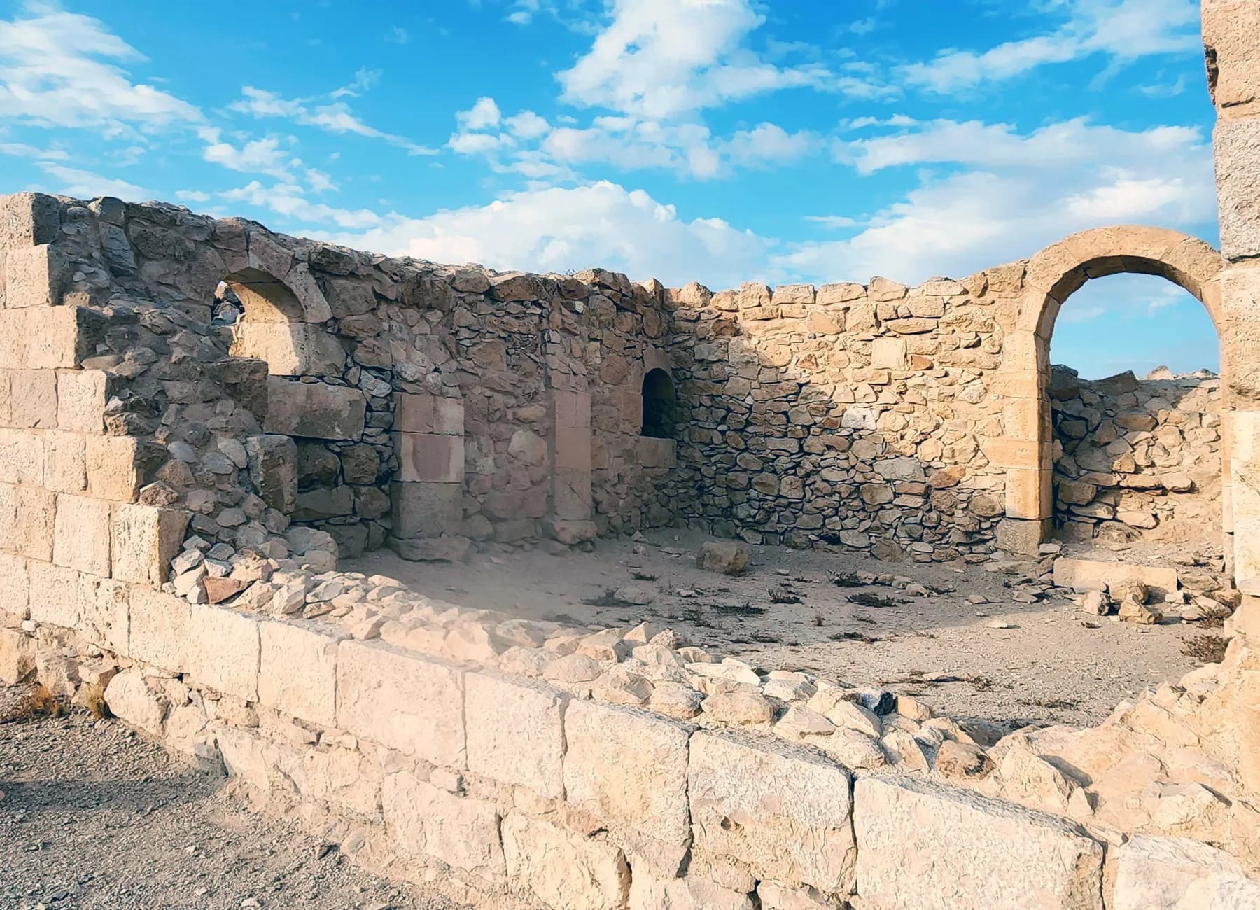
Avdat was station number 62 on the Incense Route, and the caravan road that brought frankincense from Arabia towards the port of Gaza can still be picked out climbing to it from the southeast.
ישראל פרקר / CC BY 2.5 · Wikimedia Commons
Archaeological site
Shivta National Park
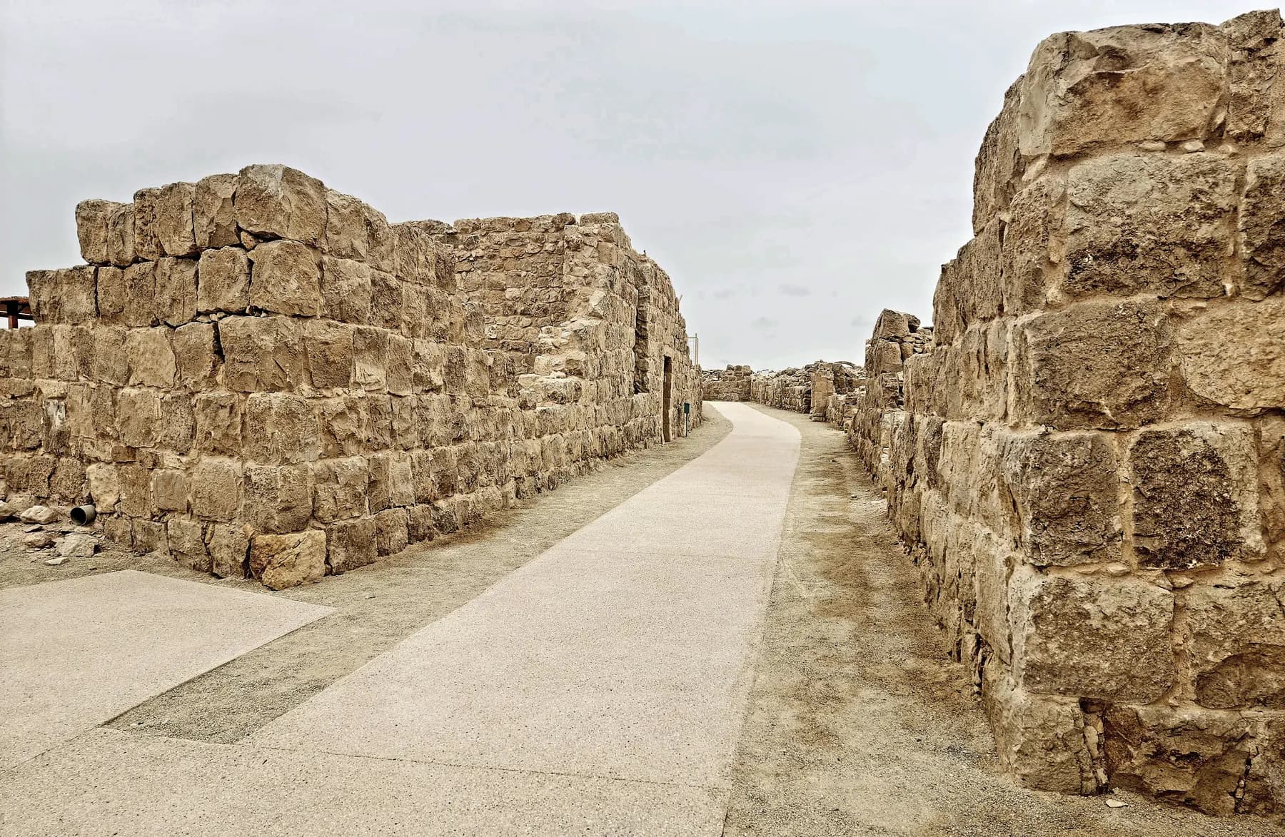
Nobody sacked Shivta: a University of Haifa survey recorded 21 doorways deliberately blocked with stone in 16 of its houses, which is why the streets and churches are still standing.
זאב שטיין / CC BY 2.5 · Wikimedia Commons
Archaeological site
Tel Be'er Sheva National Park
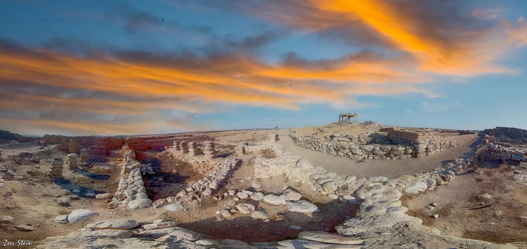
The stones of a four-horned altar were found here buried inside a storehouse wall, and the well beside the town gate goes down 69 metres to the water table.
Sources and further reading
Every link below was opened and checked when this page was written. Official statements are marked as such: they are the subject's own account, not an independent one.
- OfficialIsrael Nature and Parks Authorityen.parks.org.ilMamshit National Park
Opening hours, the one-hour cut-off for entry, the published entrance fees, the points of interest including the two churches, the Nabatu house, the market and the reservoir inscription, and the directions from Dimona
- OfficialIsrael Nature and Parks Authorityparks.org.ilגן לאומי ממשית
The fuller price list with reservist, pupil and soldier rates, the detailed accessibility account including vehicle access to the top of the mound by permission, the dog policy and the Passover extended hours
- OfficialIsrael Nature and Parks Authoritystatic-en.parks.org.ilWelcome to Mamshit National Park (PDF)
The 142-hectare park and four-hectare city, the road junction, the mid-first-century founding, the 900-metre wall, the numbered tour of the site, the history of research and the UNESCO inscription at Durban
- OfficialIsrael Nature and Parks Authorityen.parks.org.ilMamshit National Park Nabataean Khan
The campground's facilities, entry and departure times, the ban on dogs and generators, and the published overnight rates for tents, tukuls and staff rooms
- DataCoin Hoards of the Roman Empire, Ashmolean Museum, University of Oxfordchre.ashmus.ox.ac.ukMAMPSIS, hoard 7616
The discovery date of 18 August 1966, the total of 10,320 coins, the range from Vespasian to Elagabalus, Negev's own account of the find, the bronze jar and the strong-box under the staircase, and the excavation dates of 1965 to 1967
- ReferenceEarthquake Catalog of the Dead Seadeadseaquake.infoMamshit / Mampsis: archaeoseismic evidence
Korzhenkov and Mazor's 2003 analysis of 250 damage cases and two seismic events, Erickson-Gini's sealed kitchen deposit of 363 CE, and the disagreement between Negev and Magness over how long the town lasted
- ReferenceEncyclopaedia Judaica, via Encyclopedia.comencyclopedia.comMampsis
Eusebius, Ptolemy and the Madaba map on the town's position, the episcopal lists of Palaestina Tertia, settlement in about 50 CE, the hoard given as 10,400 tetradrachms and Negev's excavations dated from 1966
- ReferenceWikipediaen.wikipedia.orgMampsis
The alternative founding date in the 1st century BCE, the city area of 10 acres, the horse-breeding account of the town's later economy and the hoard given as 10,500 coins
- ReferenceBiblePlaces.combibleplaces.comMampsis, Mamshit
The description of Mamshit as the only walled Nabataean city, the size of the largest buildings, Negev's excavations dated 1965 to 1973, and the observation that collapsed upper storeys preserved the ground floors
- ReferenceThe Levantine Ceramics Projectlevantineceramics.orgMampsis / Mamshit
The site record and coordinates, the first-century CE ceramic material, and the bibliography of Negev's 1967 article and his 1988 architectural report on the Late Roman and Byzantine periods
Mamshit National Park: common questions
How long do you need at Mamshit?+
About 90 minutes covers the antiquities at a comfortable pace: the gate, the wealthy house, the tower, both churches, the stable, the market street, the reservoir and the bathhouse are all within a compact block. Add roughly an hour if you take the marked path from the entrance gate down to Wadi Mamshit and the dams. It is the quickest of the Negev desert cities to see properly, which is the main practical argument for it.
How much does it cost?+
The Israel Nature and Parks Authority publishes ₪24 for an adult and ₪10 for a child, with ₪20 for a student, ₪12 for an Israeli senior citizen, and ₪20 and ₪9 for adults and children in groups of more than thirty. The Hebrew price list adds ₪18 for a reservist, ₪8 for a pupil, and free entry for a soldier in compulsory, national or civilian service on production of a valid card.
What is original here and what has been rebuilt?+
The parks authority's own first line about the site is that these are the remains of the Nabataean city, partly restored. The market street is explicitly a reconstruction, the residential house attached to the Western Church is described as partly restored, and the lower dam in the wadi was renovated during the British Mandate. The house walls, the arches carrying stone ceiling slabs, the mosaic floors, the baptismal basins and the gate are excavated remains rather than rebuilding, and they survive as well as they do because the upper storeys collapsed onto the ground floors and sealed them.
Is Mamshit really the only walled Nabataean city?+
It is the only one of the Negev towns with a full circuit of wall, and that is why the description is everywhere, but the wall itself is not Nabataean work. The parks authority dates the roughly 900-metre wall and its gate to the late Roman period, at the end of the third century CE, about two centuries after the houses inside it were built, and says it was widened again in the Byzantine period after the earthquake of 363. The wall is real; the label is loose.
How many coins were in the hoard, and where is it now?+
Published counts differ and there is no single right answer. The Coin Hoards of the Roman Empire database at the Ashmolean gives a total of 10,320 and describes a range of 10,320 to 10,500 silver denarii and tetradrachms; the Encyclopaedia Judaica says 10,400 tetradrachms; English Wikipedia says 10,500; the parks authority says approximately 10,800. The database records 10,343 coins in the keeping of the Israel Antiquities Authority. They were found on 18 August 1966 in a bronze jar in a strong-box under a house staircase, and the coins are not on display in the park.
Is it wheelchair accessible?+
Partly, and rather better than most Negev archaeological sites. The parks authority's Hebrew page describes an accessible entrance area with parking, service shop, picnic area, toilets, a landscape viewpoint and concrete paths running along the cliff as far as the entrance to the antiquities. Inside the ruins there are handrails beside steps, compacted paths, shade shelters and benches, and with the manager's approval on quiet days visitors may drive to the upper car park and its viewpoint. The excavated buildings themselves have steps, thresholds and uneven paving, so telephone 08-6556478 before a long journey.
Is there shade, and how bad is it in summer?+
There are shade shelters and benches among the ruins and shade at the entrance area, and very little in between. This is an exposed hill in the northern Negev with no water on it, and the last admission is a full hour before closing, so the workable plan in July and August is to arrive at 08:00. The site closes at 17:00 in summer, which means no late-afternoon option unless the parks authority has published extended hours for a festival week.
Can you combine Mamshit with Avdat and Shivta?+
Not comfortably in one day. Avdat and Shivta sit on and off Route 40 in the Negev highlands, while Mamshit is on Route 25 east of Dimona, about an hour away by road, and each of the three is a separately ticketed national park. Mamshit pairs much more naturally with Beersheba or with a drive on to the Dead Sea, and the three of them together are a two-day proposition rather than a one-day circuit.
Can you stay overnight at Mamshit?+
Yes. The parks authority runs the Nabataean Khan campground inside the national park, with lighting, power points, a field kitchen with gas rings and refrigerators, showers, toilets and fire pits with firewood. Its published rates include ₪64 for an adult in an own tent, ₪96 for an adult in a family camping tent with a mattress, and ₪350 on weekdays for an upgraded tukul. Entry to the campground is from 15:00, tents must be packed away by 11:00 on the day of departure, and dogs are not admitted.
Is it worth the detour if you have already seen Avdat?+
Yes, for one specific reason: Mamshit is the domestic version. Avdat gives you a temple precinct, a citadel and churches on an acropolis, which is the public face of a Nabataean town. Mamshit gives you the houses those people lived in, standing to the height of their ground-floor ceilings, with a stable, a chancery, wall painting, a private cistern and the place where somebody hid ten thousand silver coins. If the question is what a Nabataean family's rooms looked like, this is the site that answers it.