
Northern Israel
The Galilee
Israel's green quarter: oak hills and basalt vineyards, a mystics' town high in the north, a Crusader capital buried under an Ottoman port, and half a billion birds passing overhead each year.
Highest summit
1,208 m
Mount Meron, the high point of Israel inside its pre-1967 boundaries
People in the Northern District
about 1.51 million
Central Bureau of Statistics estimate for 31 December 2021
Birds on the flyway
more than 500 million a year
passing through the Hula Valley between Africa and Eurasia, on KKL-JNF's figure
Akko's World Heritage listing
2001
a Crusader town preserved beneath an Ottoman one
The Jesus Trail
65 km
Nazareth to Capernaum, usually walked in three to five days
Things to do
11 sites, each with its own page
in The Galilee
Restaurants
13 picks
in The Galilee
Hotels
9 picks
in The Galilee
Getting there
7 routes
in The Galilee
When to go
Month by month
in The Galilee
הַגָּלִיל · Northern Israel, between the Mediterranean and the Jordan rift
The Galilee is the part of Israel that surprises people who arrived expecting desert. It is the country's green quarter: limestone and basalt hills carrying oak and terebinth, olive terraces, and a rainfall gradient steep enough that vineyards at the northern end of the Golan take roughly twice the water of vineyards an hour south. Josephus set its frontiers at Akko and Mount Carmel on the west, Samaria and Bet She'an on the south, Transjordan on the east, and a line running through ancient Baca in the north.
Geographers and locals both split it in two. Upper Galilee, centred on Safed, is the higher country of narrow gorges and defiles, rising to Mount Meron at 1,208 metres, the highest point in Israel within its pre-1967 boundaries. Lower Galilee, centred on Nazareth, is gentler, a landscape of ridges and broad valleys punctuated by Mount Tabor standing alone at 588 metres above the Jezreel plain. On the east the whole range ends in an escarpment falling into the Great Rift Valley, with the Golan rising again beyond.
About 1.51 million people live in Israel's Northern District, on the Central Bureau of Statistics estimate for the end of 2021: Jewish, Muslim, Christian, Druze and Circassian, in towns within sight of one another keeping different weekends. What a visitor finds is unusually concentrated: a basilica over a grotto in Nazareth, kabbalists' synagogues in Safed, Crusader halls under an Ottoman port at Akko, and cranes in tens of thousands on a re-flooded lake bed.

The land
Two Galilees, and the drop into the rift
The division into Upper and Lower Galilee is not a tourist-board invention; it is what the ground does. Britannica describes Upper Galilee, around Safed, as higher country of narrow gorges and defiles, and Lower Galilee, around Nazareth, as lower hills with gentler terrain. The dividing line is roughly the Beit HaKerem valley, and you feel it in the gears of a hire car.
Mount Meron, called Jebel Jarmaq in Arabic, tops out at 1,208 metres and is the highest point in Israel within its pre-1967 boundaries. Mount Tabor, further south, is only 588 metres, but because it rises alone from the plain of Esdraelon it dominates a much wider view; from its summit you can see north across the whole of Upper Galilee. Between them the range runs east until it ends abruptly in an escarpment above the Great Rift Valley.
Height is why the region reads as green: moist air off the Mediterranean is forced up over the hills and drops its rain there. The pattern shows in the vineyard records of the Golan Heights Winery, which reports roughly 800 mm of annual precipitation at its highest plots, El Rom at about 1,050 metres and Odem at about 1,100, against roughly 400 mm at Geshur at 400 metres in the south. Within an hour's drive you cross from wet upland pasture to something much closer to the dry country most visitors picture.
- Upper Galilee: higher, wetter, gorges and defiles; Safed is its town
- Lower Galilee: broad valleys and isolated hills; Nazareth is its city
- Mount Meron, 1,208 m, the pre-1967 high point of Israel
- Mount Tabor, 588 m, standing alone above the Jezreel plain
- Rainfall from roughly 800 mm on the northern heights to about 400 mm in the south
Upper Galilee
Safed, where Judaism acquired its mysticism
Safed (Zefat in Hebrew, Tzfat in most transliterations) sits high in Upper Galilee under Mount Canaan, which reaches 960 metres. It is counted among the four holy cities of Judaism alongside Jerusalem, Hebron and Tiberias, and is first documented at the time of the Jewish revolt against Rome in 66–70 CE.
Its lasting importance is later and stranger. In the sixteenth century Safed became the principal centre of the Kabbala, the mystical system of Judaism, and the doctrines worked out in its study houses spread through the Jewish world. Isaac ben Solomon Luria and Joseph Karo both taught here; Karo's legal code and Luria's cosmology went out from a small hill town. In 1577 a Hebrew printing press was set up in Safed, the first anywhere in Asia to use movable type.
The town has been knocked down and rebuilt repeatedly, through the wars of the eighteenth and nineteenth centuries and the earthquake of 1837. The Haganah took it on 12 May 1948 and, in Britannica's account, the Arab population fled; the mountain air and cheap ruined houses then drew painters, and the artists' quarter dates from that period. About 37,500 people lived there on the 2021 estimate: a working provincial town with a mystical old quarter folded into it: stepped lanes, blue-painted doors, small domed synagogues.
Nearby Mount Meron holds the tomb traditionally ascribed to Simeon bar Yohai, and each Lag BaOmer it draws a mass overnight pilgrimage. On 30 April 2021 a crush there killed 45 men and boys; a state commission of inquiry reporting in March 2024 blamed the prime minister, without sanctioning him, and named the then public security minister and the police commissioner as responsible.
Lower Galilee
Nazareth: a working Arab city with a basilica at its centre
Nazareth is the largest Arab city in Israel, with about 77,900 residents on the Central Bureau of Statistics estimate for the end of 2021. It is a regional market town first and a pilgrimage destination second, and the two functions are stacked on the same hillside: garages, spice shops and a covered market run right up to the walls of the Basilica of the Annunciation.
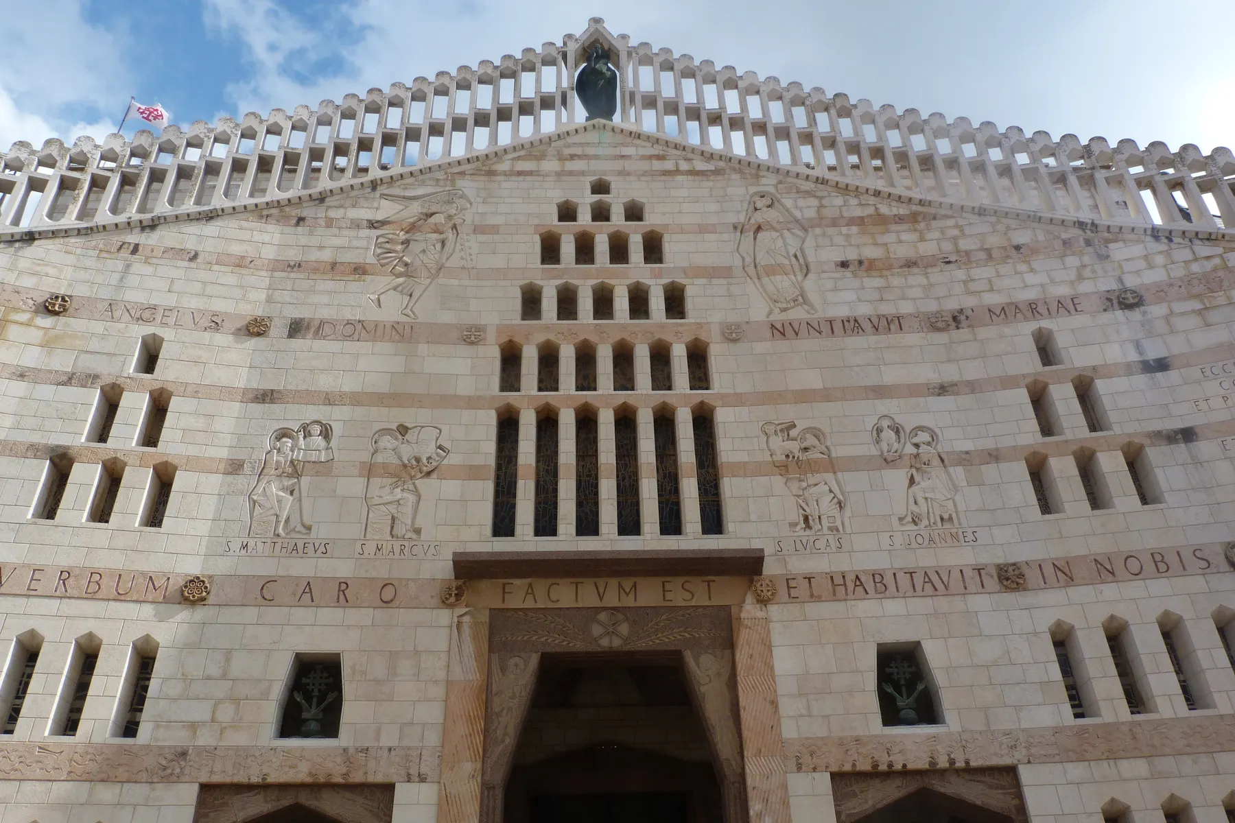
The basilica is the fixed point. The Custody of the Holy Land built it between 1959 and 1969 to a design by the Italian architect Giovanni Muzio, who, by the Custody's account, grew so taken with the project that he waived his fee. It stands 55 metres high on a footprint of 65 by 27 metres; the Custody calls it the biggest monument of its kind in the Middle East, Britannica the largest Christian house of worship in the region. Below it lies the Grotto of the Annunciation, the cave venerated as the place where Gabriel appeared to Mary. Excavation beneath the church found a Byzantine church, dated by its excavator between the fifth century and the seventh or eighth, and a twelfth-century Crusader basilica destroyed when the town fell in April 1263. Franciscans have held the grotto since 1620.
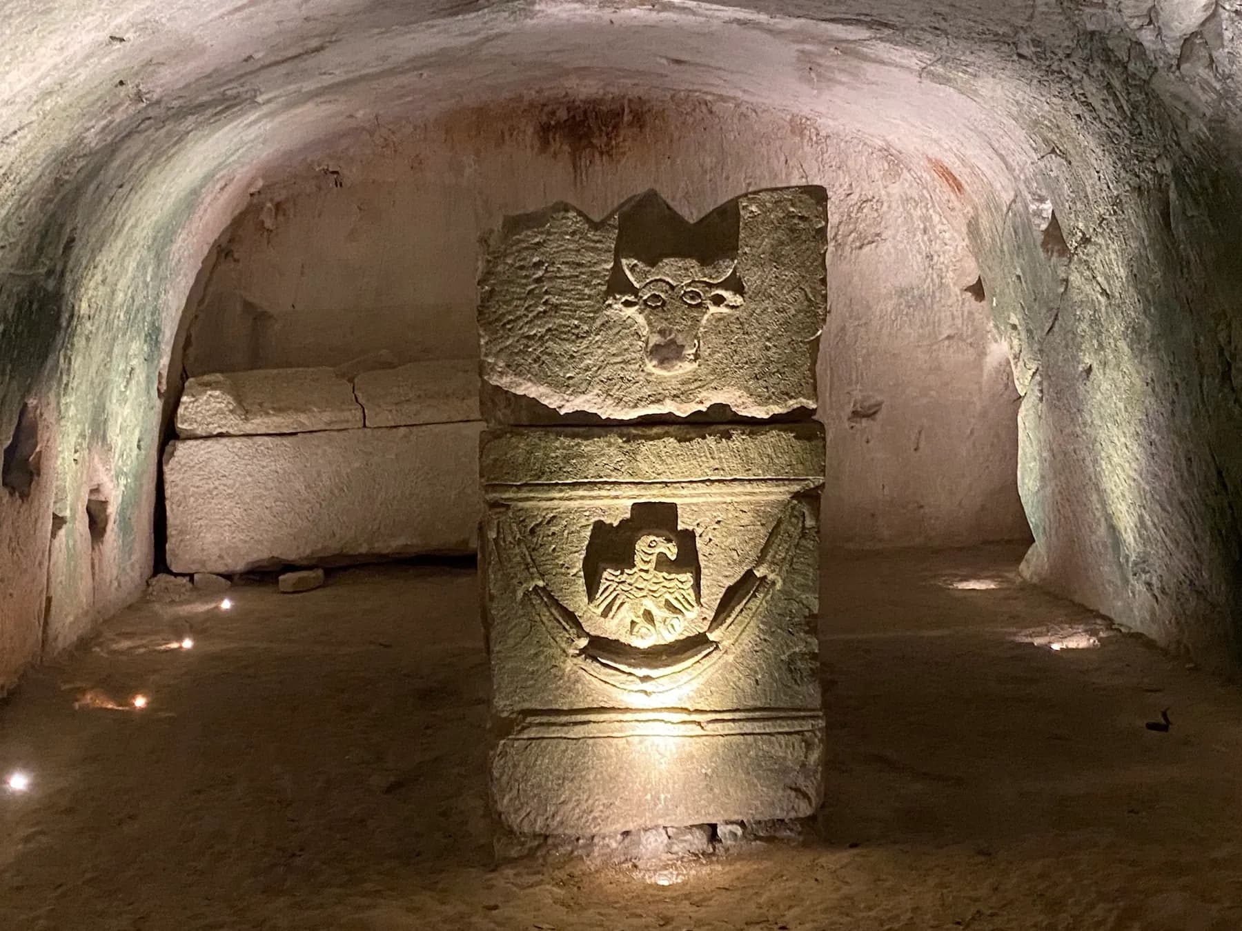
The country around the city is thick with Roman-period remains. At Bet She'arim, on the edge of the Jezreel Valley, more than twenty rock-cut catacombs hold sarcophagi inscribed in Hebrew, Aramaic and Greek. Judah ha-Nasi, who presided over the Sanhedrin here and died around 220 CE, was buried at the site, and prominent Jews who died abroad were then brought there for burial.
- The Basilica of the Annunciation and, beneath it, the Grotto
- St Mary's Well, the one spot tied with confidence to New Testament times
- Gabriel's Church, the Synagogue-Church and the Church of Joseph
- The covered market on the slope below the basilica
- Bet She'arim's catacombs, half an hour west towards the Jezreel Valley

The coast
Akko: a Crusader capital under an Ottoman town
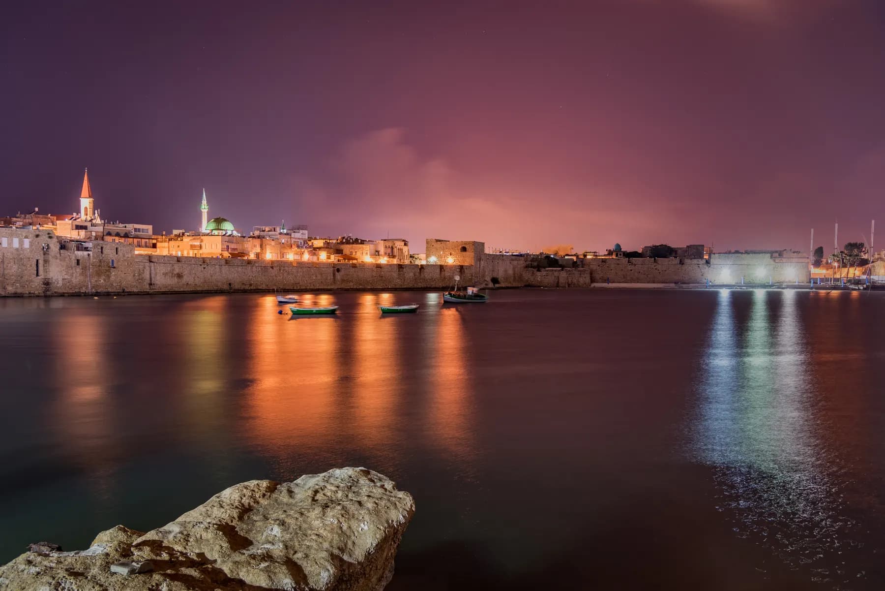
Akko (Acre) appears in Egyptian texts as early as the nineteenth century BCE. Its defining chapter is medieval: it was the Crusaders' last capital, and it fell to the Mamluk sultan al-Ashraf Khalil in 1291, ending Crusader rule in the Levant. What makes the town remarkable is that the Crusader city was not demolished but buried. Ottoman rule ran from 1516 to 1918, and the walled town largely rebuilt in the eighteenth century sealed a whole medieval quarter underneath it. UNESCO put the Old City on the World Heritage list in 2001.
Above ground the town is Ottoman and largely the work of one man. Ahmad Pasha al-Jazzar, governor from 1775 to 1804, rebuilt the walls so effectively that Acre withstood Napoleon's siege in 1799, and his Great Mosque still dominates the skyline. Below ground you walk the Hospitaller compound (the Knights' Halls) and the Templars Tunnel, cut under the streets to the port.
Sites in the Old City are run by the Old Akko Development Company, which in 2026 sells a combined ticket at 55 shekels and a joint Akko and Rosh Hanikra ticket at 90 shekels. Check the operator's site before travelling: as of 2026 it notes that the lift at the Templars Tunnel is out of service. North of the town, at the northernmost point of Israel's coastline on the Lebanese border, the waves have worn grottoes into the white chalk cliffs of Rosh Hanikra, the natural bookend to a day in Akko, which is why the two are sold on one ticket.
- The Knights' Halls, the Hospitaller compound of the Crusader city
- The Templars Tunnel, running under the Ottoman streets to the harbour
- The Great Mosque of al-Jazzar, built by the governor who beat Napoleon
- The Turkish bath house and the Ramchal Synagogue
- Rosh Hanikra's sea grottoes, at the northern end of the coast
Migration
The Hula Valley: drained, regretted, partly undone
The Hula Valley runs about 25 kilometres north to south and 6 across, roughly 177 square kilometres of flat rift floor between the Naftali ridge and the Golan. Before 1951 its southern end was a shallow lake of about 14 square kilometres with some 31 square kilometres of swamp around it. Draining it was the new state's first great engineering project: work ran from 1951 to 1958 and cut more than 40 kilometres of canals.
It did not go as planned. Exposed peat ignited and burned underground, fertiliser-laden water washed downstream into the Sea of Galilee, and by the early 1990s sinking groundwater had made parts of the reclaimed land unfarmable. Rather than drain the valley a second time, KKL-JNF rehabilitated a section as Hula Lake Park, and the wetland came back. A remnant of papyrus swamp in the south-west had already been set aside during the original works, in 1963, and was inaugurated as the Hula Nature Reserve in 1964, the country's first, on the standard account.
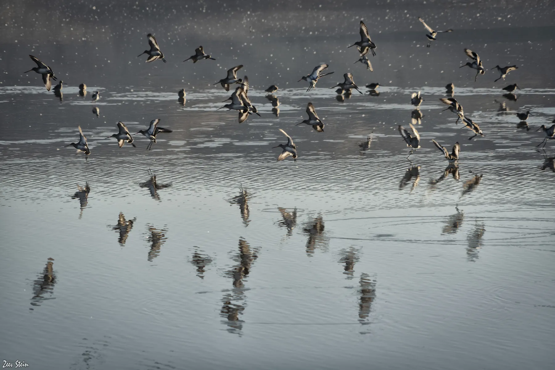
The birds returned in numbers difficult to picture. KKL-JNF puts the annual passage at more than 500 million birds, with no fewer than 390 species recorded and about 35,000 cranes arriving in autumn, some 15,000 of which stay the winter rather than continuing to Africa; BBC Wildlife ranked the site ninth of twenty outstanding birdwatching places in the world in 2009. In the winter of 2017 the Times of Israel reported a far larger stay-over, some 40,000 cranes, fed by the state with up to eight tons of corn a day to keep them off the surrounding fields, which is also why they are concentrated where visitors can see them.
- No private cars inside the park: walk, hire a bicycle or a golf cart, or take the camouflaged wagon
- Entry to the park itself is free of charge, on KKL-JNF's own page
- KKL-JNF's notice for the October 2023 clock change gives a 17:30 close with last entry at 16:00
- Crane season runs roughly November to February; go at dawn
- No fewer than 390 bird species recorded in the valley
- The separate Hula Nature Reserve preserves the older wetland remnant

Wine and oil
Basalt, altitude and a very long oil harvest
Israeli wine is grouped into five regions, and the Galilee (taken to include the Golan and both Upper and Lower Galilee) is the one conventionally regarded as best suited to viticulture, for its elevation, cool breezes, sharp day-to-night temperature swings and well-drained soils, and the country's highest vineyards sit on the Golan.
The winery that made the case for the region is the Golan Heights Winery, founded in 1983 by eight kibbutzim and moshavim and the first in the Golan. Its vineyard notes read like a geology lesson: eleven vineyards on volcanic basalt and tuff, from Geshur at about 400 metres and 400 mm of rain a year in the warm south to El Rom at about 1,050 metres and Odem at about 1,100, where roughly 800 mm falls and snow is a normal winter event. It is no longer alone; boutique wineries are scattered across the Golan and the Galilee hills.
Olives are the older crop by a wide margin. At Ein Zippori in the Lower Galilee, in a salvage excavation between 2011 and 2013, researchers from the Israel Antiquities Authority and the Hebrew University found olive-oil residue in pottery dated to roughly 5,800 BCE, the earliest evidence for the use of olive oil found in the country, and possibly in the wider Levant.
The modern industry is smaller than the landscape suggests. On 2024 figures Israel consumes around 30,000 tonnes of olive oil a year and grows only about half of it, and it takes five kilograms of olives to make one kilogram of oil. Global prices more than doubled after 2022, and in the 2023–24 harvest more than 40 per cent of local olives never reached the presses, groves in the north and near Gaza being inaccessible during the war. Autumn is pressing season, and small mills sell that year's oil straight from the tank.
- Galilee, Golan, Upper and Lower Galilee are one wine region in Israeli practice
- Basalt and volcanic tuff soils, with vineyards up to about 1,100 metres at Odem
- The Golan Heights Winery, founded 1983, opened the region to serious wine
- Five kilograms of olives make one kilogram of oil
- Autumn is the pressing season across the Galilee's small mills
On foot
Two trails: 65 kilometres and about 1,100
The Galilee is the one region of Israel where long-distance walking is genuinely pleasant rather than an endurance exercise, and two waymarked routes cross it. The Jesus Trail runs 65 kilometres from Nazareth to Capernaum, linking sites associated with the life of Jesus with a good deal of ordinary countryside in between: Zippori National Park, Cana, Ilaniya, Kibbutz Lavi, the Horns of Hattin, Nebi Shu'eib, Arbel National Park, Magdala, the Jesus Boat at Kibbutz Ginosar, Tabgha and the Mount of Beatitudes. The route's own operator sells it as a three-day or a five-day walk.
The Israel National Trail is the other order of magnitude. It runs about 1,100 kilometres from Kibbutz Dan, near the Lebanese border, to Eilat on the Gulf of Aqaba, and the exact length changes as the Israel Trails Committee adjusts the routing. National Geographic has listed it among the twenty best epic hiking trails in the world. A thru-hike is a matter of weeks rather than days; the trail's own site cites a two-month, 1,000-kilometre walk as one example.
For a day's walk without logistics, Mount Tabor is the obvious choice: 588 metres, wooded, with Crusader ruins, a Franciscan church and hospice and a Greek Orthodox church on the summit, and a panoramic view north over Upper Galilee. The Arbel cliff above the Sea of Galilee is the other classic, and the more demanding. February to April is the season, when the hills are green and the streams are running; full sun on an exposed ridge in August is a much less rewarding experience.
- Jesus Trail: 65 km, Nazareth to Capernaum, three to five days
- Israel National Trail: about 1,100 km, Kibbutz Dan to Eilat
- Mount Tabor: a half-day climb to churches and a Crusader ruin
- Arbel: the cliff path down to the Sea of Galilee
- Best walked February to April, when the hills are green
Beyond
The Golan: the wall on the eastern horizon
From almost anywhere in eastern Galilee you are looking at the Golan: a basalt plateau of roughly 1,150 square kilometres, about 71 kilometres north to south and 43 east to west, bounded by the Jordan and the Sea of Galilee on the west, Mount Hermon on the north and the Yarmouk on the south. The Israeli-controlled portion rises to 2,224 metres at its extreme north-eastern point on the slopes of Hermon, and the ski site on the mountain's lower flanks is the only one in the country.
The status of the territory is simple to state and contested in substance. Israel captured the Golan from Syria on 9 and 10 June 1967, in the closing days of the Six-Day War, and in December 1981 unilaterally annexed the part it held. Britannica's summary is that the international consensus still views the Golan as part of Syria; the United States, in March 2019, became the only country to recognise the annexation. Five villages of mostly Druze residents remained after 1967; most took permanent residency rather than the Israeli citizenship they were offered, though the Times of Israel reported a surge in applications by 2026. Nearly thirty Jewish settlements had been established by the late 1970s.
The Golan subdistrict counted 53,700 people at the end of 2021; reporting in 2026 puts the Druze population at around 29,000. In mid-April 2026 the government approved a five-year plan of about a billion shekels, roughly 330 million dollars, to bring 3,000 new families to the area by 2030, with a further 150 million shekels for clearing minefields.
- Emptier, higher and colder than the Galilee below it
- Cattle country, old fortifications and some of Israel's best vineyards
- Katzrin is the main town, with about 7,600 residents in 2021
- Golan communities were not evacuated after 7 October 2023
- Israel's only ski site sits on the lower slopes of Mount Hermon
On the ground
What to see at The Galilee
The things worth building a visit around, in the order most people reach them.
Safed's old quarter
Stepped lanes and small domed synagogues in the town where Isaac Luria and Joseph Karo taught in the sixteenth century, and where a press printed Hebrew with movable type in 1577, the first in Asia to do so.
The Basilica of the Annunciation
Fifty-five metres high on a footprint of 65 by 27 metres, built by the Custody of the Holy Land between 1959 and 1969 over the Grotto of the Annunciation, with a Byzantine church and a Crusader basilica excavated beneath it.
Akko underground
The Hospitaller Knights' Halls and the Templars Tunnel, the buried Crusader capital that the Ottoman town sealed over. A combined ticket from the Old Akko Development Company was 55 shekels in 2026.
Hula Lake Park at first light
About 35,000 cranes arrive in the autumn passage and roughly 15,000 stay the winter, on KKL-JNF's figures, on a valley floor drained in the 1950s and partly re-flooded. No private cars: walk, cycle or take the camouflaged wagon.
A Golan vineyard at a thousand metres
Volcanic basalt and tuff, roughly 800 mm of rain and snow events at the top plots. The Golan Heights Winery, founded in 1983 by eight kibbutzim and moshavim, works eleven vineyards from Geshur at about 400 metres to Odem at about 1,100.
The last day of the Jesus Trail
From the Mount of Beatitudes down through Tabgha to Capernaum on the lake shore: the closing stretch of a 65-kilometre walk that starts in Nazareth.
Go deeper
Every site in The Galilee, in full
11 places here have a page of their own: what survives, what it costs, when it opens and how long to give it.
זאב שטיין / CC BY 2.5 · Wikimedia Commons
Nature reserve
Agamon Hula
A one square kilometre lake that KKL-JNF put back forty years after draining the valley, ringed by an 8.5 kilometre flat circuit and stocked every winter with 2 to 3 tonnes of maize a day to keep the cranes off the farmers' fields.
ארז אשכנזי / CC BY-SA 4.0 · Wikimedia Commons
Neighbourhood
Akko Old City
The Ottoman port town inside the walls stands roughly eight metres above the Crusader city it was built on, and one ticket of ₪55 opens six of the sites inside, including the Hospitaller Fortress and the Templars Tunnel.
כובש המלפפונים / CC BY-SA 4.0 · Wikimedia Commons
Religious site
Basilica of the Annunciation
The Custody of the Holy Land dropped Antonio Barluzzi's design for this church and built Giovanni Muzio's instead: two churches stacked over one rock-cut cave, with the excavated village of Nazareth left open in the floor between them.
שלמה רודד / CC BY 2.5 · Wikimedia Commons
Archaeological site
Beit She'arim Necropolis
About thirty catacombs cut into the soft chalk of Sheikh Abreik hill, holding more than three hundred funerary inscriptions in Greek, Hebrew, Aramaic and Palmyrene, around the tomb attributed to Rabbi Judah ha-Nasi.
Archaeological site
Montfort Castle
The Teutonic Order bought this spur above Nahal Kziv from the de Milly family in 1220 and moved its archive and treasury here in 1229, out of reach of the Templars and Hospitallers in Acre.
עמוס גל / CC BY-SA 4.0 · Wikimedia Commons
Religious site
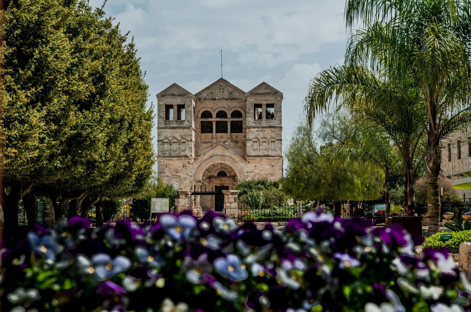
Mount Tabor
Antonio Barluzzi's first church in the Holy Land stands on this dome of a hill above the Jezreel Valley, built between 1921 and 1924 over a Byzantine apse and the ruins of a Benedictine abbey that Baibars levelled in 1263.
Museum
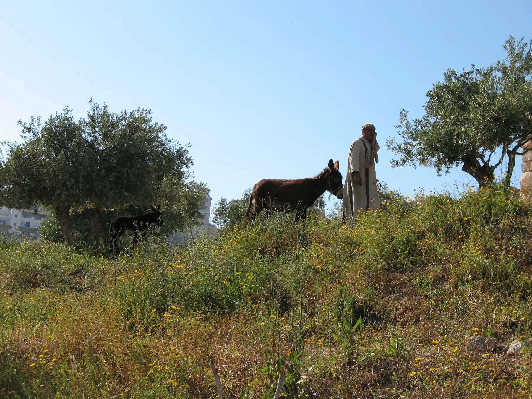
Nazareth Village
The hillside was quarried and farmed in the Late Hellenistic and Early Roman periods, and the wine press cut into its bedrock sits about 500 metres from the centre of the village Nazareth grew out of.
Natalinasser / CC BY-SA 4.0 · Wikimedia Commons
Nature reserve
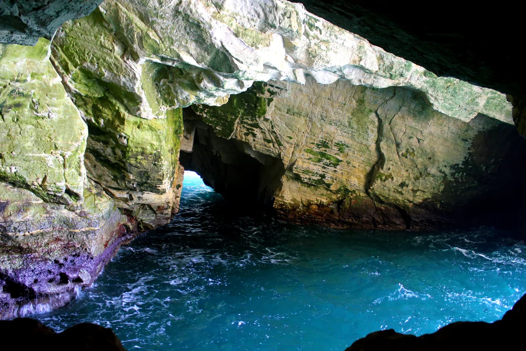
Rosh Hanikra Grottoes
The sea cut these caves out of soft chalk at the top of Israel's coast, and until a 400 metre tunnel was driven through the ridge in 1968 the only way into them was to swim.
זולטן קלוגר - לעמ / Public domain · Wikimedia Commons
Neighbourhood
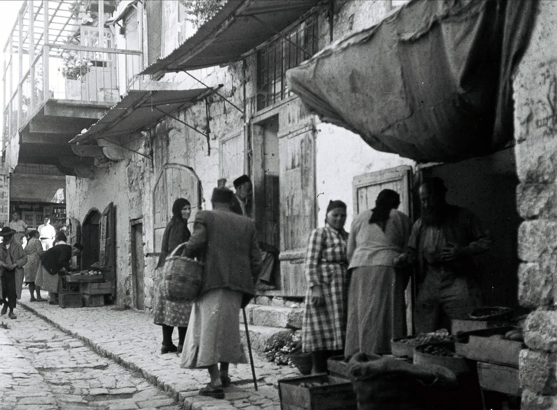
Safed Old City and Artists' Quarter
The synagogue quarter and the artists' quarter sit on one slope, divided by a broad flight of stairs the British Mandate authorities cut through the town to keep two populations apart.
שלמה רודד / CC BY 2.5 · Wikimedia Commons
Nature reserve
Tel Dan Nature Reserve
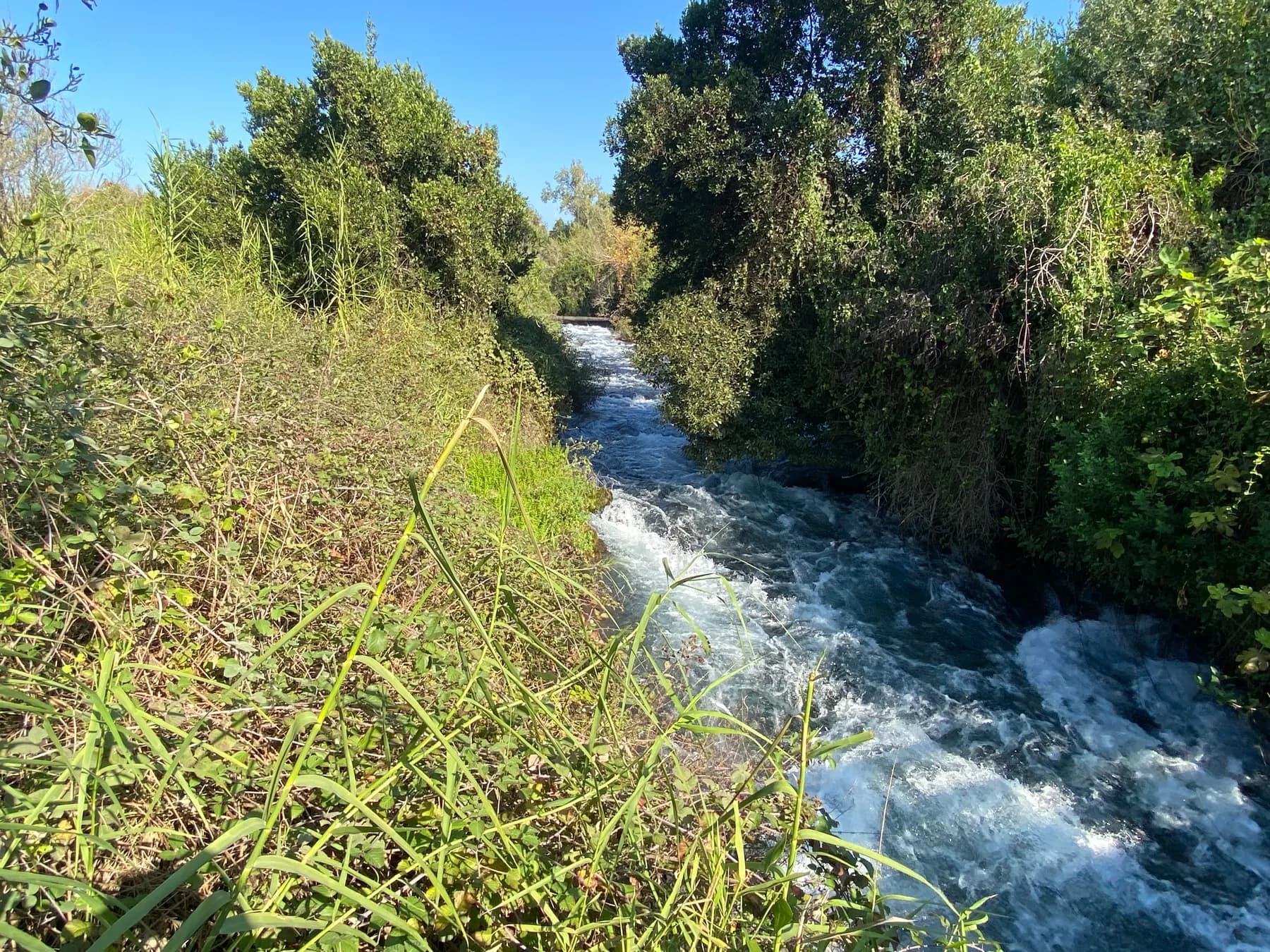
The largest of the Jordan River's three headwaters rises inside this 48 hectare reserve, and the trail that follows it ends at a mudbrick city gate of about 1750 BCE that still stands seven metres high.
Yair Haklai / CC BY-SA 4.0 · Wikimedia Commons
Archaeological site
Zippori National Park
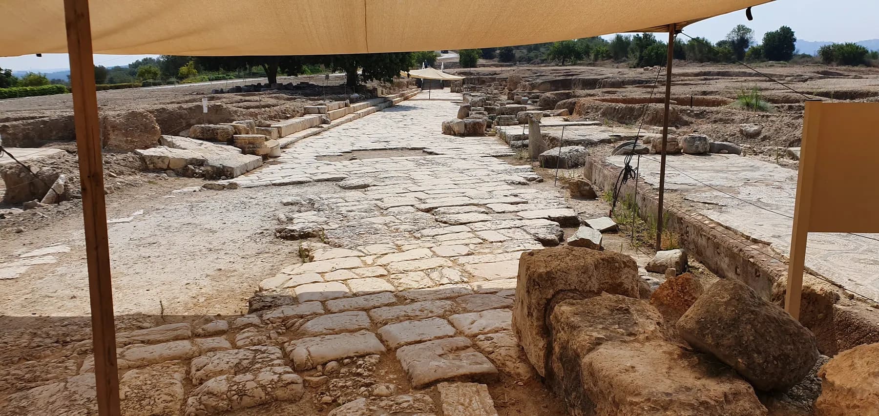
The Roman capital of the Galilee, where the dining room of a third-century mansion holds the face known as the Mona Lisa of the Galilee and a rock-cut reservoir 260 metres long runs under the hill to the east.
The long view
The Galilee, in order
c. 5,800 BCE
Olive oil is being produced at Ein Zippori in the Lower Galilee; residue in pottery from the site is the earliest evidence for its use found in the country.
19th century BCE
Akko appears in Egyptian texts, the earliest written record of the port. Mount Tabor is first mentioned in Egyptian inscriptions of Ramses II, in the thirteenth century BCE.
66–220 CE
Safed is first mentioned during the Jewish revolt against Rome; after the destruction of the Second Temple the centre of Jewish scholarship in Palestine moves to the Galilee. Judah ha-Nasi, who presided over the Sanhedrin at Bet She'arim, dies around 220 CE and is buried there, and prominent Jews who die abroad are brought to the site for burial.
1099–1291
Tancred takes the Galilee in the First Crusade and makes Nazareth his capital. Acre becomes the Crusaders' last capital and falls to the Mamluks in 1291, ending Crusader rule in the Levant.
1577
A Hebrew printing press is established at Safed, the first anywhere in Asia to use movable type.
1799
Acre withstands Napoleon's siege behind walls rebuilt by the Ottoman governor Ahmad Pasha al-Jazzar. An earthquake wrecks Safed in 1837.
1951–1958
The Hula swamps and lake are drained, the state's first national engineering project, with more than 40 km of canals cut. A remnant of papyrus swamp set aside in 1963 is inaugurated as the Hula Nature Reserve in 1964, on the standard account, the country's first.
9–10 June 1967
Israel captures the Golan Heights from Syria in the closing days of the Six-Day War; Israel unilaterally annexes the part it holds in December 1981, a step the international consensus does not accept.
1969
The Basilica of the Annunciation is consecrated in Nazareth on 23 March, to Giovanni Muzio's design. Fourteen years later eight kibbutzim and moshavim found the Golan Heights Winery, the first in the Golan.
2001
UNESCO inscribes the Old City of Acre on the World Heritage list.
30 April 2021
Forty-five men and boys are killed in a crush at the Lag BaOmer pilgrimage on Mount Meron; a state commission reports in March 2024.
2023–2026
Communities along the Lebanese border are evacuated after 7 October 2023; residents of Kiryat Shmona are permitted to return in March 2025, and about 60 per cent are back by 2026.
Getting there
- By road: this is a driving region. The Galilee's interest is spread across hill towns, wineries, trailheads and parks that public transport reaches slowly and infrequently, and a hire car turns a week of logistics into a week of walking.
- By train: Israel Railways' coastal line runs north from Tel Aviv and Haifa to Akko and Nahariya, which puts Akko and Rosh Hanikra within easy reach without a car. Trains do not run on Shabbat; check current timetables before planning a Friday or Saturday leg.
- By bus: intercity buses link Tel Aviv and Haifa to Nazareth, Safed, Karmiel, Tiberias and Kiryat Shmona, and a Rav-Kav card works across operators. Services thin out sharply from Friday afternoon to Saturday night.
- From the airport: Ben Gurion is the arrival point for almost everyone; Haifa makes a sensible first or last night at the coastal end of the region.
- On foot: the Israel National Trail enters the country's northern end at Kibbutz Dan, and the Jesus Trail crosses the Lower Galilee from Nazareth to Capernaum.
Access
Mixed, and worth researching site by site. Hula Lake Park is flat, car-free and served by wagon and cycle hire, which makes it among the easier major sites. Akko's underground halls and tunnels involve steps and low headroom, and the operator noted in 2026 that the lift at the Templars Tunnel was out of service. Safed's old quarter is built on stepped lanes and is hard going on wheels or with a pushchair. At the Basilica of the Annunciation the venerated grotto sits in the lower church, below the upper one and reached by steps.
When to go
Late winter and spring, roughly February to May, is the region at its best: hills green, streams running, wildflowers out and walking temperatures comfortable. Autumn, September to November, is the second choice, and coincides with the olive pressing and the start of the crane passage. Crane season at the Hula runs from about November into February. Summer is hot and, on the coast at Akko, humid, though the Upper Galilee and the Golan stay noticeably cooler than the rift floor below. Winter is wet, and snow falls on the high ground: the Golan Heights Winery records snow events at its vineyards at 1,050 to 1,100 metres.
Hours and cost
Nothing here runs on a single timetable. National parks and nature reserves are run by the Israel Nature and Parks Authority, with last entry well before closing; sites in Old Akko are run by the Old Akko Development Company; Hula Lake Park is run by KKL-JNF, whose page, in the notice attached to the October 2023 clock change, gives a 17:30 close with last entry at 16:00, though hours move with the season. In Jewish towns such as Safed, Tiberias and Katzrin, expect much to shut from Friday afternoon until Saturday night; in Nazareth and the Arab towns the rhythm is different again, and Sunday is a church day. Check each operator's own page in the week you travel.
Entry is charged separately almost everywhere. In 2026 the Old Akko Development Company sells a combined Old Akko ticket at 55 shekels and a joint Akko and Rosh Hanikra ticket at 90 shekels. Hula Lake Park is the cheap exception: KKL-JNF's own page says entry is free of charge and you may walk around for nothing, with bicycles, golf carts and the camouflaged wagon charged extra. Israel Nature and Parks Authority sites charge per site and sell multi-site passes; prices are published on the authority's own pages and are worth checking before you commit to an itinerary. Winery tastings usually need booking in season.
Opening times and prices change. Both are given as published by the operator and should be checked against its own page before you travel.

Practical
What people wish they had known about The Galilee
- Base yourself twice rather than once: one night around Safed or the Hula for the north, one around Nazareth or the lake for the south, and you halve the driving.
- At the Hula, go at dawn. The cranes fly out to feed early and the light and the noise are the whole point; midday is a walk beside an empty lake.
- Book a Golan or Galilee winery visit ahead. Tasting rooms keep genuine weekend hours but small producers work by appointment.
- Carry more water than seems necessary on the trails. Shade is patchy on the ridges and the springs marked on maps are not all reliable in late summer.
- Check the security situation for the border strip before travelling. Communities along the Lebanese border were evacuated after 7 October 2023 and residents of Kiryat Shmona were permitted to return only in March 2025, with about 60 per cent back by 2026; the Golan settlements were not evacuated.
- Dress for churches and synagogues (shoulders and knees covered) and expect photography restrictions inside shrines.
The figures
The Galilee by the numbers
Each figure carries the year it belongs to and links the source it came from.
| Measure | Figure | As of | Source |
|---|---|---|---|
| Mount Meron | 1,208 m | 2026 | britannica.com |
| Northern District population | 1,513,600 | 2021 | citypopulation.de |
| Nazareth population | 77,925 | 2021 | citypopulation.de |
| Birds passing through the Hula Valley each year | more than 500 million | 2026 | kkl-jnf.org |
| Cranes in the Hula: autumn arrivals, and those staying the winter | about 35,000, of which about 15,000 | 2026 | kkl-jnf.org |
| Corn fed to wintering cranes | up to 8 tonnes a day | 2017 | timesofisrael.com |
| Combined Old Akko ticket | 55 shekels | 2026 | akko.org.il |
| Israeli olive oil consumption | about 30,000 tonnes a year, roughly half of it grown locally | 2024 | timesofisrael.com |
Where this is
The Galilee in the length of the country
Israel runs about 420 km from its northern tip to Eilat. Here is where this one sits on that line.
Nearby
Where to go next

Lower Galilee and the Jordan Rift…
The Sea of Galilee
A harp-shaped lake more than 200 metres below sea level, ringed by basalt hills, gospel ruins and a water gauge the whole country reads.

Mount Carmel and Haifa Bay
Haifa
Israel's third city climbs a mountain: a World Heritage garden staircase on Mount Carmel, a working port at its foot, and a mixed Jewish and Arab downtown in between.

Mediterranean coast
Caesarea
Herod poured a harbour into open water here, using volcanic ash shipped from the Bay of Naples. Most of it now lies more than five metres down.
Sources and further reading
Every link below was opened and checked when this page was written. Official statements are marked as such: they are the subject's own account, not an independent one.
- OfficialKKL-JNF (Jewish National Fund), site operatorkkl-jnf.orgHula Lake Park
The 1951 drainage as the first national engineering project undertaken by the state; more than 500 million birds a year; no fewer than 390 species; about 35,000 cranes arriving in autumn with about 15,000 staying the winter; the BBC Wildlife ranking of ninth out of twenty sites worldwide in 2009; free entry, no private cars, bicycle and golf-cart hire and the camouflaged wagon; and the hours attached to the October 2023 clock change: entry to 16:00, site closes 17:30
- OfficialCustody of the Holy Land (Custodia Terrae Sanctae)custodia.orgNazareth: the Sanctuary of the Annunciation
Site works from 1959 and consecration on 23 March 1969; Giovanni Muzio as architect and his waiving of his fee; height of 55 m on a 65 by 27 m footprint and the claim to be the biggest monument of its kind in the Middle East; the grotto; Bagatti's dating of the Byzantine church between the fifth and the seventh or eighth century; the Crusader basilica destroyed in April 1263; and the grotto obtained by the Franciscans in 1620
- OfficialOld Akko Development Company, site operatorakko.org.ilOld Akko: visiting the sites
The Knights' Halls, Templars Tunnel, Turkish bath house, Ramchal Synagogue, Okashi and ethnographic museums; the 55-shekel combined ticket and 90-shekel Akko plus Rosh Hanikra ticket as listed in 2026; and the notice that the Templars Tunnel lift is out of service
- OfficialRosh Hanikra, site operatorrosh-hanikra.comRosh Hanikra grottoes
Sea grottoes formed over many years as the waves wore away the white chalk cliffs, at the northernmost point of Israel's coastline, on the border with Lebanon
- OfficialJesus Trail (route operator)jesustrail.comThe Jesus Trail
The 65-kilometre route from Nazareth to Capernaum, the three-day and five-day packages, and the sites it passes: Zippori, Cana, Ilaniya, Kibbutz Lavi, the Horns of Hattin, Nebi Shu'eib, Arbel, Magdala, Ginosar, Tabgha and the Mount of Beatitudes
- OfficialJesus Trail (route operator)jesustrail.comAbout the Jesus Trail
Confirms the main route's 65-kilometre length and its description as a walk connecting sites from the life of Jesus in the Galilee
- OfficialIsrael National Trail (Shvil Israel)israeltrail.netIsrael National Trail
Approximately 1,100 km from Kibbutz Dan to Eilat, with the exact length changing as the Israel Trails Committee adjusts the routing; the National Geographic listing among the twenty best epic hiking trails; and a two-month, 1,000-kilometre hike given as one example
- OfficialGolan Heights Winerygolanwines.co.ilAbout the winery
Founded in 1983 by eight kibbutzim and moshavim as the first winery established in the Golan Heights, and the Yarden, Gamla, Golan and Har Hermon labels
- OfficialGolan Heights Winerygolanwines.co.ilThe vineyards
Eleven vineyards on soils of basaltic origin and volcanic tuff: Geshur at about 400 m with roughly 400 mm of rain a year, Ein Zivan at 960-980 m with about 900 mm, El Rom at about 1,050 m and Odem at about 1,100 m with about 800 mm, and snow events at the highest plots
- ReportingThe Times of Israel (19 November 2017)timesofisrael.comTens of thousands of migrating cranes weather winter in Israel's north
Some 40,000 grey cranes staying the winter of 2017 at Agamon Hula, the state feeding them up to eight tons of corn a day to protect farmers, and the 1950s drainage followed by re-flooding four decades later
- ReportingThe Times of Israel (12 March 2024)timesofisrael.comImpact of olive oil shortage on Israel could have been averted, industry chief says
Annual consumption of about 30,000 tons with roughly half grown locally, five kilograms of olives to a kilogram of oil, global prices more than doubling since 2022, and more than 40 per cent of local olives not reaching the presses with groves in the north and near Gaza inaccessible
- ReportingThe Times of Israel (17 December 2014), reporting Israel Antiquities Authority and Hebrew University researchtimesofisrael.comOlive oil traces dating back 8,000 years found in Israel
Olive-oil residue in pottery from Ein Zippori in the Lower Galilee dated to about 5,800 BCE, from a 2011-2013 salvage excavation by Ianir Milevski and Nimrod Getzov of the IAA with Dvory Namdar of the Hebrew University; described as the earliest evidence for the use of olive oil in the country and possibly the wider Levant
- ReportingThe Times of Israel (30 April 2026)timesofisrael.com'The city is dead': Israel's north struggles to recover as war leaves uneven economic scars
Kiryat Shmona's 24,000 residents evacuated after 7 October 2023 and permitted to return in March 2025, with only about 60 per cent back and about half of local businesses reopened; and the note that Golan towns were not evacuated
- ReportingThe Times of Israel (9 May 2026)timesofisrael.comThe quiet frontier? With minefields cleared, Golan Heights readies for construction boom
Roughly 29,000 Druze residents, most of whom took permanent residency rather than citizenship after 1981 though applications have since surged; about 8,000 residents in Katzrin; the five-year plan of about NIS 1 billion ($330 million) approved in mid-April 2026 to bring 3,000 families by 2030; NIS 150 million for mine clearance; and 700 dunams cleared near Katzrin on 27 April 2026
- ReportingThe Times of Israel (topic page)timesofisrael.comMount Meron disaster
The crush of 30 April 2021 in which 45 men and boys died at the Lag BaOmer pilgrimage, and the state commission of inquiry of March 2024, which blamed the prime minister without sanctioning him and named the then public security minister, Amir Ohana, and the police commissioner, Kobi Shabtai, as responsible
- DataCityPopulation.de, citing the Central Bureau of Statistics, State of Israelcitypopulation.deNorthern District of Israel: cities and subdistricts
Populations on the estimate for 31 December 2021: Northern District 1,513,600; Nazareth 77,925; Akko 49,614; Tiberias 46,698; Karmiel 46,311; Nof HaGalil 42,657; Zefat 37,472; Katzrin 7,606; Golan subdistrict 53,700
- ReferenceEncyclopaedia Britannicabritannica.comGalilee
Josephus's frontiers of the Galilee, including the northern line running through ancient Baca; the division into Upper Galilee around Safed and Lower Galilee around Nazareth; the move of Jewish scholarship to the Galilee after 70 CE; and the 1950s drainage of Lake Hula
- ReferenceEncyclopaedia Britannicabritannica.comSafed (Zefat)
Mount Canaan at 960 m, the four holy cities, first mention in 66-70 CE, the sixteenth-century kabbalistic centre with Isaac Luria and Joseph Karo, the 1577 printing press as the first in Asia to use movable type, the 1837 earthquake, the capture of the town by the Haganah on 12 May 1948 and the flight of its Arab population, and the artists who settled afterwards
- ReferenceEncyclopaedia Britannicabritannica.comNazareth
Largest Arab city in Israel, the Church of the Annunciation as the largest Christian house of worship in the Middle East, St Mary's Well as the only site securely datable to New Testament times, and Tancred's capture of the Galilee in 1099 with his capital at Nazareth
- ReferenceEncyclopaedia Britannicabritannica.comAcre (Akko)
First mention in a nineteenth-century BCE Egyptian text, the Crusaders' last capital falling to the Mamluk sultan al-Ashraf Khalil in 1291, Ottoman rule from 1516 to 1918, al-Jazzar's governorship 1775-1804 and the 1799 siege, and the 2001 World Heritage designation
- ReferenceEncyclopaedia Britannicabritannica.comGolan Heights
Area of 1,150 sq km, 71 km north to south and 43 km east to west, rising to 2,224 m at its extreme north-east on the Mount Hermon slopes; the capture on 9-10 June 1967; the unilateral annexation of December 1981 and the continuing international consensus that the Golan is part of Syria; US recognition in March 2019; the five Druze villages; and nearly 30 Jewish settlements established by the late 1970s
- ReferenceEncyclopaedia Britannicabritannica.comMount Meron
Elevation of 1,208 m (3,963 ft), described as Israel's highest point within its pre-1967 boundaries, and the range terminating in an escarpment overlooking the Great Rift Valley
- ReferenceEncyclopaedia Britannicabritannica.comMount Tabor
Elevation of 588 m (1,929 ft), its dominance of the level landscape around it, the first mention in Egyptian inscriptions of Ramses II in the thirteenth century BCE, the panoramic view of Upper Galilee, and the Franciscan church and hospice, Greek Orthodox church and Crusader ruins on the summit
- ReferenceEncyclopaedia Britannicabritannica.comHula Valley
Valley about 25 km long, 6 km wide and 177 sq km in area; former lake of about 14 sq km with 31 sq km of swamp; drainage begun in 1951 and complete by 1958 with more than 40 km of canals; and farmland rendered unusable by sinking groundwater by the early 1990s
- ReferenceEncyclopaedia Britannicabritannica.comBet She'arim
More than twenty catacombs discovered, with Hebrew, Aramaic and Greek inscriptions; Judah ha-Nasi (c. 135-220 CE) presiding over the Sanhedrin there and his remains transferred to the site for burial; and prominent Jews who died abroad brought there for burial
- ReferenceWikipediaen.wikipedia.orgHula Valley
Used only for the papyrus swampland set aside in 1963 as the country's first nature reserve and inaugurated as the Hula Nature Reserve in 1964, and for the peat that ignited underground and the fertiliser-laden water flowing into the Sea of Galilee after the drainage
- ReferenceWikipediaen.wikipedia.orgIsraeli wine
Used only for the five recognised Israeli wine regions and the description of the Galilee, including the Golan, as the area most suited to viticulture for its elevation, breezes, diurnal range and drainage; the elevation figures in the text come from the Golan Heights Winery instead
- ReferenceWikipediaen.wikipedia.orgMount Hermon ski resort
Used only for the existence of Israel's single ski site, on the south-eastern slopes of Mount Hermon; the elevations in the text are taken from Britannica instead
The Galilee: common questions
Where exactly is the Galilee?+
It is the hill country of northern Israel between the Mediterranean and the Jordan rift. Josephus gave its frontiers as Akko and Mount Carmel on the west, Samaria and Bet She'an on the south, Transjordan on the east, and a line running through ancient Baca in the north. Administratively it makes up most of Israel's Northern District, which held about 1.51 million people at the end of 2021.
What is the difference between the Galilee and the Golan?+
The Galilee is the limestone hill country west of the Jordan rift. The Golan is the basalt plateau on the east side, about 1,150 square kilometres, captured by Israel from Syria in June 1967 and unilaterally annexed in December 1981, a step the international consensus does not accept, though the United States recognised it in March 2019. They are usually visited together and are treated as one region by winemakers.
How many days do you need?+
Four to five days covers the region without rushing: a day for Akko and the coast, a day for Nazareth and the Lower Galilee, a day around Safed and Meron, a day in the Hula and the Golan, and a day walking. A week lets you add a stretch of the Jesus Trail.
When do the cranes arrive at the Hula?+
The autumn passage brings around 35,000 cranes through the valley, and KKL-JNF says about 15,000 of them stay for the winter rather than continuing to Africa; in the winter of 2017 the Times of Israel reported some 40,000 staying. Roughly November to February is the season; go at dawn, and check the park's own page, as hours shift with the migration.
Do I need a car?+
For Akko and Rosh Hanikra, no: the coastal railway reaches Akko and Nahariya. For everything else, effectively yes. The hill towns, wineries, trailheads and parks are spread thinly and bus services drop away from Friday afternoon until Saturday night.
Is Safed worth a night?+
Yes, if you want the old quarter without day-trippers. It is a small town of about 37,500 people with a sixteenth-century mystical quarter folded into it, and it empties in the evening. It also closes hard for Shabbat, so a Thursday or Sunday night works better than a Friday.
Can you walk the Jesus Trail without a guide?+
It is a waymarked 65-kilometre route from Nazareth to Capernaum, sold by its own operator as a three-day or five-day walk, and it is commonly walked independently with a guidebook or a booked baggage-transfer package. Water and shade are the two things to plan for outside the spring months.
Does it snow in the Galilee?+
On the high ground it does. The Golan Heights Winery records snow events at its highest vineyards, at 1,050 to 1,100 metres, and Israel's only ski site sits on the lower slopes of Mount Hermon, whose Israeli-controlled summit reaches 2,224 metres. In the valleys and on the coast, snow is rare.
Is the north safe to visit now?+
Conditions vary by how close you are to the Lebanese border. Communities on the border strip were evacuated after 7 October 2023 and Kiryat Shmona's residents were permitted to return in March 2025, with about 60 per cent back and around half of local businesses reopened by 2026; the Golan was not evacuated and has recovered faster. Check current government travel guidance and local advice before booking.
What is the largest city in the Galilee?+
Nazareth, with about 77,900 residents at the end of 2021, is the largest Arab city in Israel and the largest city in the Galilee proper. Akko had about 49,600, Tiberias about 46,700, Karmiel about 46,300 and Nof HaGalil about 42,700 on the same estimate.
Hotels & Stays
See all hotels & stays →Ecce Homo Pilgrim House
Jerusalem
A guesthouse on the Via Dolorosa, over Roman pavement
Jerusalem Hotel
Jerusalem
A stone-vaulted hotel in East Jerusalem, by the Old City
Jungle Jaffa Hostel
Tel Aviv
A social hostel in old Jaffa, ten minutes' walk from the beach
Matmon Barava
Ein Yahav
Desert cabins and a visitor centre in Ein Yahav, deep in the Arava