
Mediterranean coast
Caesarea
Herod poured a harbour into open water here, using volcanic ash shipped from the Bay of Naples. Most of it now lies more than five metres down.
Harbour enclosed
about 100,000 m²
Sebastos at its height, in the late first century BCE
Breakwaters
about 500 m and 275 m
southern and northern moles
Volcanic ash shipped in
over 24,000 m³
pozzolana from Puteoli, in the Bay of Naples
Theatre
about 4,000 seats
Herodian, and still a working concert venue
Crusader town
about 120 dunams
the walled area Louis IX fortified in 1251
Things to do
11 sites, each with its own page
in Caesarea
Restaurants
13 picks
in Caesarea
Hotels
4 picks
in Caesarea
Getting there
7 routes
in Caesarea
When to go
Month by month
in Caesarea
קֵיסָרְיָה · Mediterranean coast, midway between Tel Aviv and Haifa
Caesarea is the most legible Roman city on the Israeli coast, and it exists because one king decided the shore needed a port it did not have. Between about 22 and 10/9 BCE, Herod the Great rebuilt the decayed anchorage of Straton's Tower in white stone and gave it a harbour, Sebastos, laid into open water on a coast with no natural shelter. Josephus, who describes the place at length, says the haven Herod built was larger than the Piraeus at Athens, and that the whole city took twelve years.
What a visitor finds now is a national park strung along the shore: a Roman theatre with the sea behind the stage, the stump of a palace on a promontory with a pool cut into the rock, a long racing arena, Herod's harbour vaults turned into a visitor centre, and the walls and dry moat that Louis IX of France threw round a much smaller Crusader town in 1251. North of the park, the arcades of the aqueduct run along the sand. Offshore, the breakwaters that made everything else possible lie more than five metres under water, and can be dived.
The site also holds one block of limestone that matters out of all proportion to its size. Reused as a step in the theatre stairs, it carries a Latin dedication naming Pontius Pilate, prefect of Judaea.

Foundation
From Straton's Tower to a city named for Augustus
The place began as a modest anchorage called Straton's Tower, a Phoenician foundation of about the fourth century BCE, named for a ruler of Sidon. Alexander Jannaeus took it for the Hasmonean kingdom in 90 BCE, Rome declared it an autonomous city in 63 BCE, and in 30 BCE Augustus handed the site to Herod.
Herod rebuilt it wholesale. Josephus says he raised the city in white stone, laid the streets at regular intervals down to the harbour, and set a temple on an elevation facing the harbour mouth, with statues of Rome and the emperor inside it. He also built sewers arranged so that the incoming tide flushed them out to sea. The theatre and the arena went up alongside. The whole programme, Josephus writes, took twelve years.
The naming did the political work. The city was Caesarea, for Caesar; the harbour Sebastos, the Greek for Augustus. It paid off. When Judaea became a Roman province in 6 CE it was Caesarea, not Jerusalem, that became its civil and military capital and the seat of its governors: Pontius Pilate among them, and later Antonius Felix, who according to Acts held Paul here for two years. Vespasian, proclaimed emperor at Caesarea, raised it to the rank of a colonia.

Engineering
A harbour poured into the open sea
Josephus sets out the problem plainly: the whole shore between Dora and Joppa had no good haven, so that anyone sailing from Phoenicia to Egypt had to ride out the south winds in open water. Herod's answer was not to find a bay but to manufacture one, using a material Rome had recently mastered: hydraulic concrete, a mortar of lime and pozzolana that sets under water.
The scale of the import operation is the part that still startles. The Roman Maritime Concrete Study, which cored the submerged blocks at Caesarea in 2005, reckons the job needed roughly 35,000 cubic metres of concrete, including more than 24,000 cubic metres of pozzolana quarried at Puteoli in the Bay of Naples and carried some 1,200 miles east as bulk cargo: between 100 and 150 large shiploads of ash alone.
Getting the concrete into place under water took three different systems, all found in this one harbour. One is the method Vitruvius describes: planks driven into the seabed and braced to make a box, then filled. Another used a large double-walled hollow box, about 11 by 15 by 4 metres, built on shore and towed out; the cavity between the two walls was filled with mortar until the form sank, and only then was the interior concreted. The third used planked barges joined with mortise-and-tenon carpentry, part-filled in the shallows and towed into place.
The result was two moles (the southern about 500 metres long, the northern about 275) enclosing roughly 100,000 square metres of sheltered water, though the diving club that runs the underwater park puts the protected anchorage nearer 200 dunams. Josephus describes a mole 200 feet wide, half of it a wave-breaking apron called the Procumatia, the rest carrying a wall with towers, the finest named Drusion after Drusus, whom Josephus calls Caesar's son-in-law. The entrance was put on the north, he says, because the north wind was gentlest there.
- About 35,000 m³ of concrete in total, per ROMACONS
- Over 24,000 m³ of pozzolana imported from Puteoli
- About 12,000 m³ of local kurkar quarried as aggregate
- About 12,000 m³ of slaked lime
- Three separate formwork systems, all used in one harbour
Decline
Why the greatest harbour of its day is five metres down
The concrete that made Sebastos possible was also its weakness. When ROMACONS tested the Caesarea cores, all five came out substantially weaker than the Italian cores the project had sampled, two of them at less than half the compressive strength of its benchmark block from Santa Liberata. Lumps of lime never properly worked into the mortar show up in all five, more often than at the Italian sites, and the team's impression was that the mortar did not bond to the local kurkar rubble as well as it does to Italian tuff.
Geology did the rest. The harbour was built beside a fault running close offshore, and seismic movement tilted the moles and let them settle into the seabed; seabed deposits record a tsunami striking at some point in the first or second century CE. Researchers still differ over how much weight to give each cause.
The outcome is clear enough. By the sixth century the harbour was unusable, and the jetties now lie more than five metres down. The city carried on (capital of Palaestina Prima from 390, and a centre of Christian scholarship where Origen wrote and the school of Caesarea kept a library reported to hold more than 30,000 manuscripts) but the engineering marvel that justified it had gone under.
Spectacle
The theatre, the seaside arena and the circus
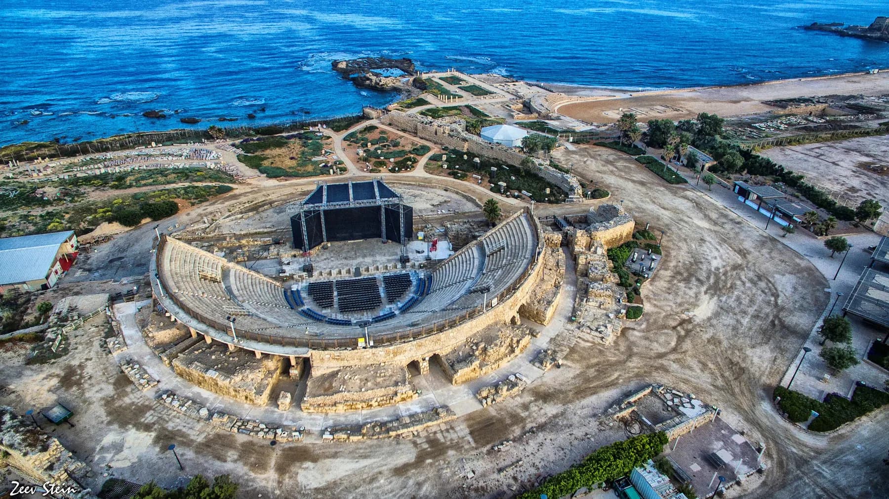
The theatre is the first thing most visitors meet. It is Herodian in origin, semicircular, and holds about 4,000 seats in its present form; the Caesarea Development Corporation calls it one of the largest and finest found in the country. At the end of the Byzantine period the orchestra, the flat performing floor, was turned into a pool for water displays. It is a working music venue again, and playing it is treated by Israeli performers as a career marker.
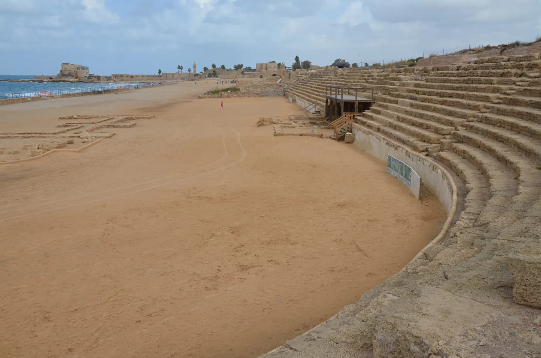
South of the harbour, Josephus records that Herod built an amphitheatre 'capable of holding a vast number of men, and conveniently situated for a prospect to the sea'. The long, narrow arena beside the promontory palace is that building: a course for races and games rather than a Roman amphitheatre in the later sense, and the sea forms one whole side of it. Herod instituted games every fifth year in Augustus's honour and, Josephus says in the Jewish War, first offered the largest prizes at them in the 192nd Olympiad.
The far larger circus lies east of the built-up city. The Caesarea Development Corporation dates it to Hadrian's day, on the model of the Circus Maximus, covering some 31,500 square metres and in use into the sixth century. Its kurkar seating was robbed out long ago, but the vaults that carried the tiers survive, along with the spina: the central barrier, fitted with pools and crowned by an obelisk of Aswan granite.
Between them the three make the point. A city with a theatre, a seaside racing arena and a circus was not a provincial afterthought; it was a Roman capital.

Epigraphy
The block that put Pontius Pilate in the record
In June 1961 an Italian expedition working on the theatre under Antonio Frova turned over a limestone block, 82 by 65 centimetres, that had been reused as a step in the theatre's stairs. Cut into its face was a Latin dedication, damaged on every side but legible in the middle.
The surviving letters read, with the standard restorations in brackets: [DIS AUGUSTI]S TIBERIEUM / [...PONTI]US PILATUS / [...PRAEF]ECTUS IUDA[EA]E / [...FECIT D]E[DICAVIT]: a dedication of a 'Tiberieum', a building in honour of the emperor Tiberius, by Pontius Pilatus, prefect of Judaea. The reconstruction of the first and last lines is argued over, and what exactly a Tiberieum was is not certain. The name in the second line and the title in the third are not in doubt.
That is why the stone matters. It is the only surviving inscription naming a Roman governor of Judaea from before the Jewish–Roman wars, and the only contemporary record of a man otherwise known from later writing: the New Testament, Josephus, Philo and Roman historians. It also gives his title as prefect, where later sources routinely call the governors of Judaea procurators. One other object may carry the name: a copper-alloy sealing ring from Herodium, read in 2018 as ΠΙΛΑΤΟ(Υ), 'of Pilate'. But the ring is cheap work and scholars doubt the prefect wore it.
The original is in the Israel Museum in Jerusalem; what stands at the theatre is a cast.
Water
The arcade on the beach, and where its water came from
The most photographed thing at Caesarea is not in the ticketed park at all. The high-level aqueduct runs north along the sand on a line of arches, half-buried in dune, and the beach beside it is listed by the Caesarea Development Corporation among the town's bathing and water-activity sites.
The water came from the foothills of the Carmel to the north-east, and the channel crossed two valleys, Nahal Tanninim and Nahal 'Ada, on its way in. How far off the source was depends on the channel: 'En Shuni, which fed the first two, lies about 7.5 km north-east, while Britannica puts the springs almost ten miles (16 km) away. What looks like one aqueduct is several channels built against each other over centuries: Channel A first, then Channel B alongside it (both fed from 'En Shuni), then Channel C replacing B and tapping the higher springs of Nahal Tanninim.
The dating comes from five salvage excavations between 1994 and 2002, published by Yosef Porath and others. Channel A went in between Herod's inauguration of the city in 10/9 BCE and the reign of Hadrian; the architecture and plaster suggest it came after Herod's own time, probably under the Flavians, and Channel B is Hadrianic. The system stayed in use for roughly six centuries, until the city fell in 640/1.
Later Caesarea needed more: a low-level aqueduct from the reservoir behind the Nahal Tanninim dam, and a ceramic pipeline from a spring about four kilometres south-south-east. The low aqueduct's date is disputed: Yeshu Dray puts it at the end of the fifth century or the start of the sixth, on the strength of a letter from Bishop Procopius of Gaza to the emperor Anastasius I, against Porath's 2002 estimate of the late fourth or early fifth. By the Crusader period the shrunken town made do with an open canal.
Crusaders
Baldwin, Louis IX and the walls you walk in through
Baldwin I took Caesarea in 1101, in the wake of the First Crusade. He demanded surrender, was refused, and began a siege on 2 May with trebuchets; the city fell after fifteen days of resistance, whereupon part of the male population was killed, women and children enslaved and the place looted. Among the spoils, William of Tyre records, was a vessel 'of the most green colour' that the Genoese took as their share and thought to be emerald: the Sacro Catino in Genoa, identified as the Holy Grail only in the thirteenth century, and in fact glass.
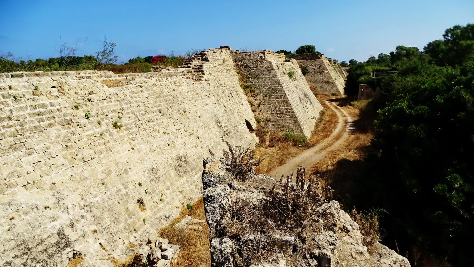
Saladin retook the city in 1187, the Crusaders again in 1191. Then, in 1251, Louis IX of France refortified it. His walls and dry moat are what you walk in through: a circuit enclosing about 120 dunams, a fraction of the Roman city, defended by fifteen towers with arrow slits, pierced by three gates, and fronted by a slope down into the ditch. The Caesarea Development Corporation puts the wall promenade at about 1,500 metres. The eastern gate, restored in the 1960s with its own fallen stones, has cross-vaults that catch the moment Romanesque turns Gothic.
It did not save the town. In 1265 the Mamluk sultan Baibars had his troops scale the walls in several places at once and then demolished the place deliberately, as he did the other Crusader ports, so it could not be used again. The decline had begun earlier: Benjamin of Tudela, in the twelfth century, counted only 200 Jews and 200 Samaritans here.
The last inhabited chapter is recent, and short. In 1880 the village of Qisarya was allocated to Bosniak refugees who had left Bosnia after the Austro-Hungarian occupation of 1878; fifty families, mostly from Mostar, built a town out of ancient masonry, with two mosques, a caravanserai and a market. It did not survive the 1948 war: the standard account, following the historian Benny Morris, is that part of the population left in February 1948 after a bus attack by the Lehi militia and the rest were expelled by the Palmach, which then demolished the houses. One mosque still stands beside the harbour.

Now
A national park, a harbour front and a dive site
Two organisations share the site. The Israel Nature and Parks Authority runs Caesarea National Park; the Caesarea Development Corporation (the executive arm of the Edmond de Rothschild Caesarea Foundation, which also runs the modern town inland, the only Israeli locality managed by a private body) operates the harbour front, with its restaurants, galleries and artists' court. The corporation says over 1.5 million people visit each year, and dates the current excavation and conservation programme, run with the Israel Antiquities Authority and the parks authority, to 2015.
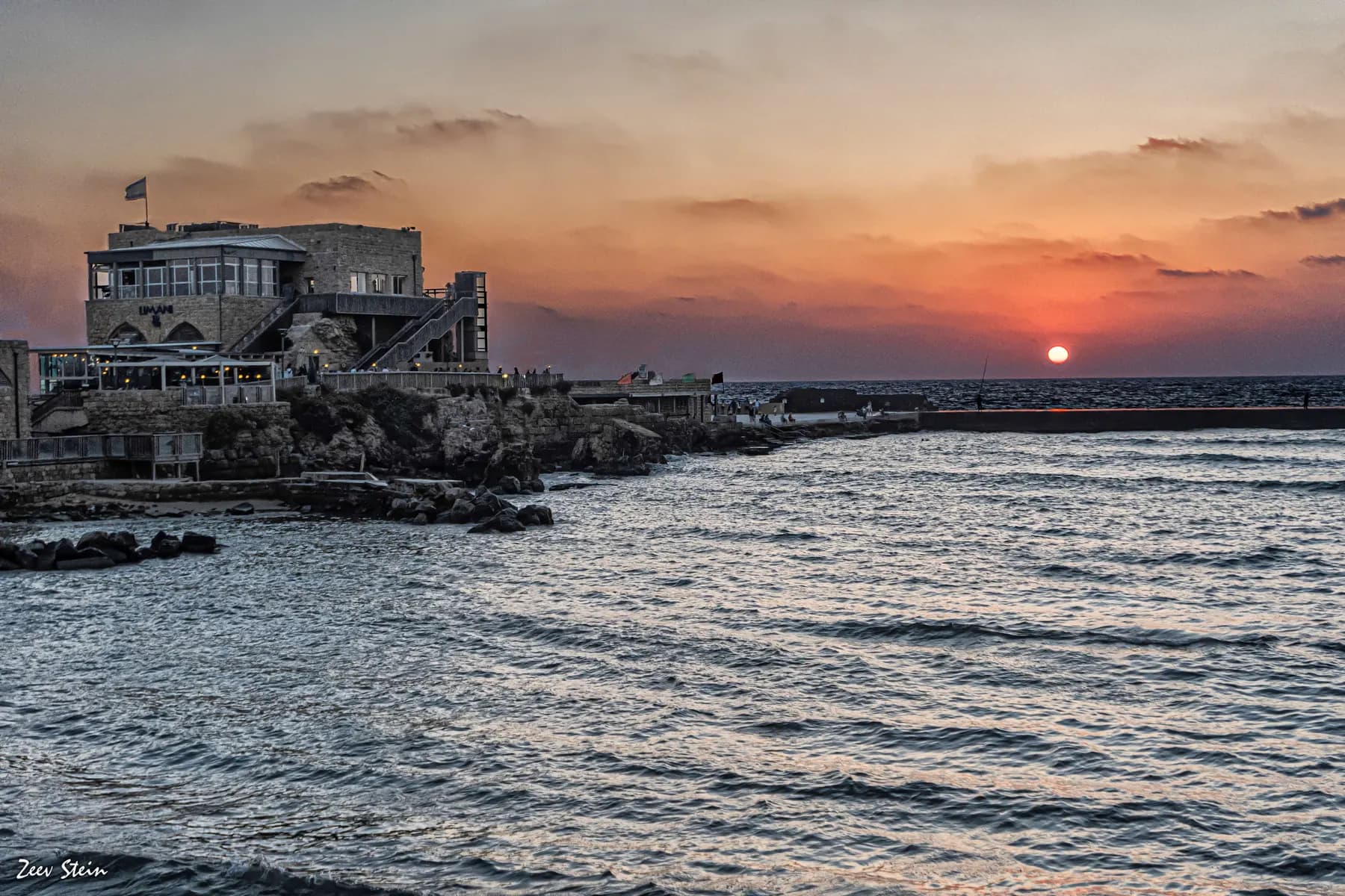
The most conspicuous result is the harbour visitor centre, opened in June 2019 after about five years of work inside Herod's own storage vaults. The vaults are substantial: 7.4 metres high and 21 metres deep, and they carried the platform of the temple to Augustus above. Four of the fourteen have been restored and fitted out; the parks authority puts a visit at roughly 25 minutes, with the exhibition in Hebrew, English and Arabic and the film about Herod in Hebrew and English.
The other half of the site is under water. The Old Caesarea Diving Club runs the underwater archaeological park over the drowned harbour: four marked routes with 28 numbered points, taking in the breakwaters, the three inner basins, a round tower that may sit on an earlier Hellenistic structure, and six anchors running from the Bronze Age to the modern era. It is a rare thing, an archaeological trail you swim rather than walk.
Above water, the theatre is a concert hall for part of the year, and the harbour front stays busy after the ruins close, one of the few sites in Israel where the ancient city and the evening meal share a few hundred metres of shore.
On the ground
What to see at Caesarea
The things worth building a visit around, in the order most people reach them.
The Roman theatre
Herodian, semicircular, about 4,000 seats, with the Mediterranean directly behind the stage. A cast of the Pilate inscription stands nearby; the original is in Jerusalem.
The promontory palace
Herod's palace on a spit of rock running into the sea, with a large pool cut into the promontory. Later Roman governors used the same building as their headquarters.
The seaside arena
The long racing course Josephus describes as an amphitheatre 'conveniently situated for a prospect to the sea'. One side of it is simply the Mediterranean.
The harbour vaults
Fourteen Herodian storage vaults, 7.4 m high and 21 m deep, that once carried the temple platform. Four are restored and hold the visitor centre, opened in 2019.
The Crusader walls and moat
Louis IX's circuit of 1251: about 120 dunams enclosed by fifteen towers and three gates, with a promenade of roughly 1,500 m along the top.
The aqueduct on the beach
Arches running north along the sand, carrying water that came from the Carmel foothills. Outside the ticketed park, and best in the last hour of light.
Go deeper
Every site in Caesarea, in full
11 places here have a page of their own: what survives, what it costs, when it opens and how long to give it.
Beach
Caesarea Aqueduct and Aqueduct Beach
The arcade behind the sand north of the harbour is two Roman aqueducts built hard against each other, and in February 2026 three bodies signed a ₪39 million agreement to stabilise all 85 of its arches.
Dr. Avishai Teicher / CC BY 2.5 · Wikimedia Commons
Museum
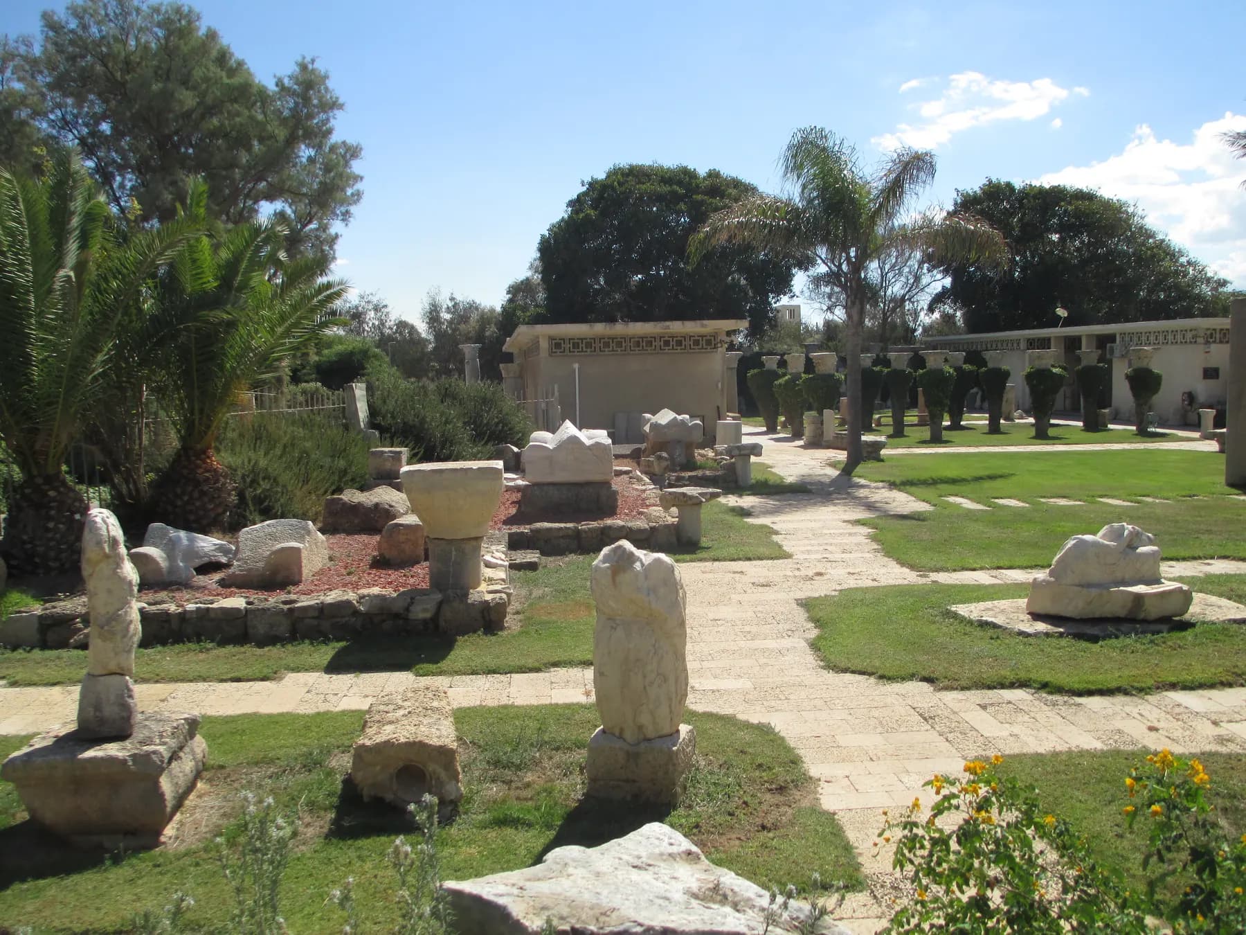
Caesarea Maritima Museum, Sdot Yam
A kibbutz collection with a single author: Aharon Wegman began picking up Caesarea's antiquities when he settled here on 2 May 1940, and the museum and the collection were named for him after his death in 1993.
israel zeller ישראל זלר / CC BY 2.5 · Wikimedia Commons
Archaeological site
Crusader City and Ramparts
Louis IX of France walled a town of about 120 dunams here in 1251, a fraction of the Roman city, and cut a dry moat round it that the park's operator still measures at 8 to 10 metres deep.
Museum
Caesarea Harbour Visitors' Centre
Four of the fourteen Herodian vaults that carried the temple platform above the harbour were dug out, stabilised and opened to the public in June 2019, after about five years of work.
זאב שטיין / CC BY 2.5 · Wikimedia Commons
Archaeological site
Herod's Harbour (Sebastos)
The breakwaters that made Caesarea possible are still there, five to seven metres down, and the harbour began settling into the seabed almost as soon as it was finished.
Carole Raddato from FRANKFURT, Germany / CC BY-SA 2.0 · Wikimedia Commons
Archaeological site
Herod's Hippodrome and Amphitheatre
A racing floor 301 metres long by 50.3 metres wide, laid on sand between Herod's palace and the sea, with eight starting gates at its northern end.
שי קנדלר / CC0 · Wikimedia Commons
Neighbourhood
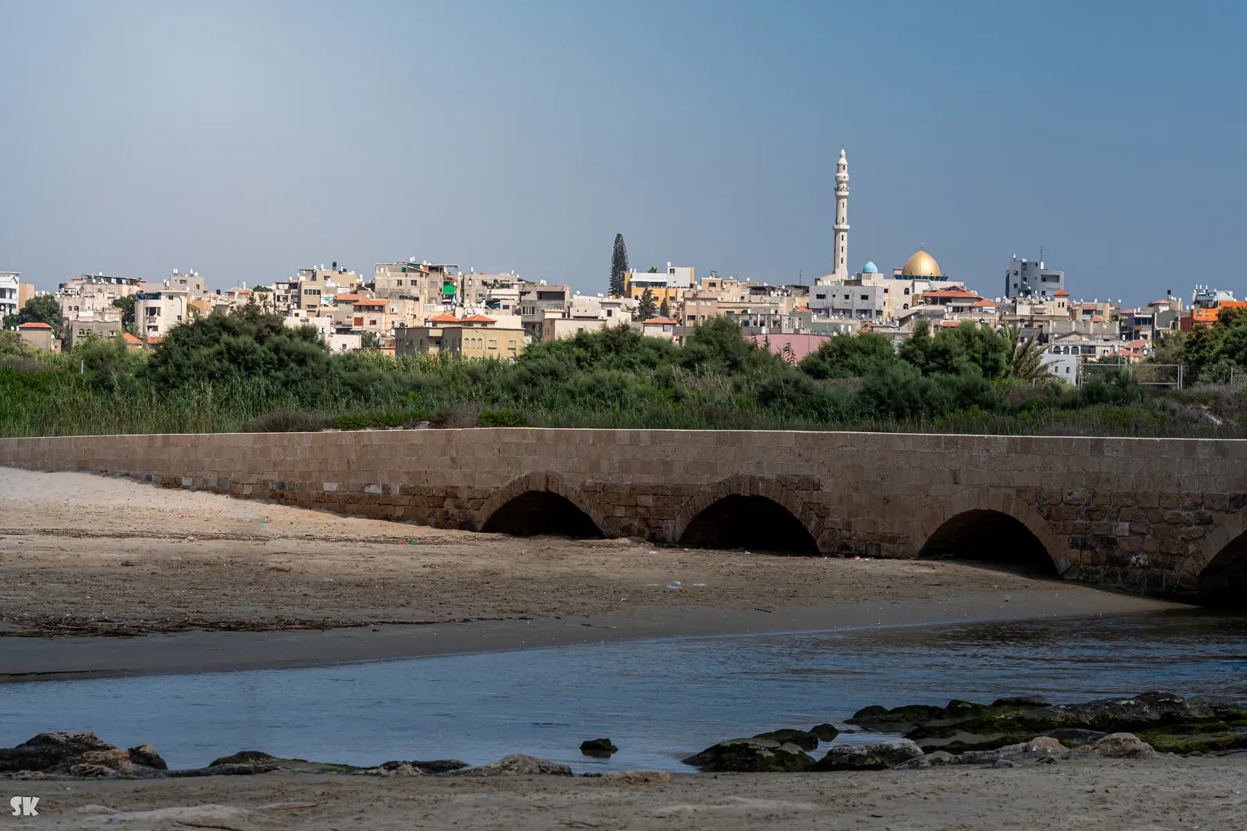
Jisr az-Zarqa
The town on the ridge north of Caesarea was laid out in 1926 for marsh dwellers displaced when the Kabara swamp was drained, and its local council calls the fishermen's village below it the only one still working on the Israeli coast.
israel zeller ישראל זלר / CC BY 2.5 · Wikimedia Commons
Museum
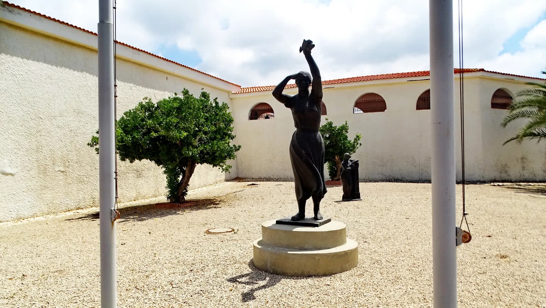
Ralli Museum
Two museums a retired banker built and endowed in the modern town above the ruins, both free to enter, one hung with Latin American surrealism and the other with European biblical painting of the sixteenth to eighteenth centuries.
זאב שטיין / CC BY 2.5 · Wikimedia Commons
Archaeological site
Roman Theatre of Caesarea
Herod's builders had no hillside to work with, so they stood the seating on a semicircle of vaults, and the building has been a working concert hall again since Pablo Casals played it in September 1961.
מיכל פריימן / CC BY 2.5 · Wikimedia Commons
Nature reserve
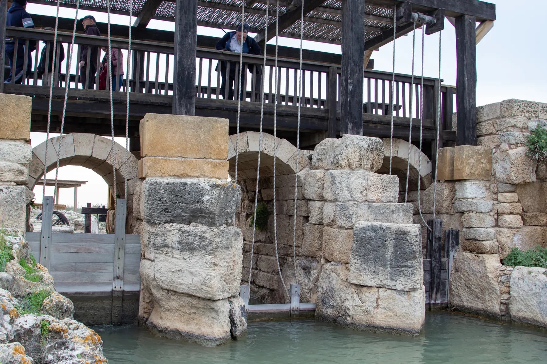
Taninim Stream Nature Reserve
A stone wall 194 metres long, thrown across the gap the stream cut through the kurkar ridge, raised the water by three metres and turned the Kebara valley into a lake of about 6,000 dunams, which is the only reason Caesarea's low aqueduct could run downhill.
Activity
Caesarea Underwater Archaeological Park
Four marked trails and 28 numbered signs run over the drowned moles of Herod's harbour, the shallowest at four metres and the deepest at nine.
The long view
Caesarea, in order
c. 4th century BCE
A Phoenician anchorage, Straton's Tower, is founded on the site.
30 BCE
Augustus awards the site, with the rest of Judaea, to Herod the Great.
22 BCE
Work begins on the harbour of Sebastos, laid into open water with imported pozzolana concrete.
10/9 BCE
Herod dedicates city and harbour to Augustus. Josephus says the whole programme took twelve years.
6 CE
Judaea becomes a Roman province and Caesarea, not Jerusalem, becomes its civil and military capital.
c. 26–36 CE
Pontius Pilate governs as prefect and dedicates a 'Tiberieum' here: the building recorded on the inscription found in 1961.
117–138 CE
The circus east of the city is built in Hadrian's reign, on the model of the Circus Maximus, and Channel B is added to the high-level aqueduct.
390
Caesarea becomes the capital of the Byzantine province of Palaestina Prima.
640/1
The city falls to the Muslim armies. The high-level aqueduct, in use for some six centuries, goes out of service.
1101
Baldwin I takes the city after a fifteen-day siege; the Genoese carry off the green bowl later venerated in Genoa as the Sacro Catino.
1251
Louis IX of France rebuilds the walls, towers and moat of a town a fraction of the Roman city's size.
1265
Baibars storms and deliberately destroys the town; the site is left uninhabited.
1880
Qisarya is allocated to Bosniak refugees, who build a town among the ruins out of ancient masonry.
1961
An Italian expedition finds the Pilate block reused as a step in the theatre stairs.
Getting there
- The park sits just off the Coastal Road, beside Caesarea and Kibbutz Sedot Yam and west of Or Akiva. The parks authority gives the approach either from the Coastal Road at the junction near the Orot Rabin power station, or from the old road, or through Or Akiva.
- If you are navigating, the parks authority's own instruction is to type 'Caesarea National Park' into Waze.
- The site is long and thin. The Roman theatre is at the southern end, the harbour, the Crusader walls and the visitor centre at the northern; walking between them along the shore is the whole point, so do not plan to park once and see it in twenty minutes.
- The aqueduct beach lies north of the park, on a separate road, and is not reached from inside the ticketed site.
Access
Unusually good for a Roman site. The parks authority lists step-free access to the Roman theatre area with an accessible lavatory, the archaeological garden, the site model, the promontory palace, the hippodrome and the beach promenade running to the port, the ancient city with its monuments, and the visitors' centre, which is described as accessible. There is an accessible-visit coordination form for visitors with disabilities on the park's page. Surfaces across the wider site are still ancient stone, sand and slope, so plan the route rather than the whole circuit.
When to go
Spring and autumn are best: the site is almost entirely unshaded, the sea breeze makes the summer bearable but not more than that, and the winter closing time is early. Late afternoon is the hour to aim for: the light comes off the sea into the theatre and along the aqueduct arcade. But note that the last entry is an hour before closing, which in winter means well before sunset. Concert nights at the theatre change the character of the place entirely; check the schedule if you want either to be there or to avoid it.
Hours and cost
The Israel Nature and Parks Authority lists summer hours of 08:00–17:00 Sunday to Thursday and Saturday, and 08:00–16:00 on Fridays and holiday eves; winter hours are an hour earlier, 08:00–16:00 and 08:00–15:00. Entry to the park closes one hour before the stated closing time. The harbour visitor centre keeps shorter hours than the park itself (in a notice published in 2021 the parks authority gave 09:30–16:00 in winter and 09:30–17:00 in summer, closing an hour earlier on Fridays, with last entry half an hour before) and a visit there takes about 25 minutes. On Saturdays and holidays the authority recommends arriving early, as entry is subject to available space. Hours drift; read the operator's page before you travel.
The parks authority's price list for Caesarea National Park, checked in August 2026, gives ₪46 for an adult and ₪27 for a child, with ₪39 for students and adults in groups and ₪23 for children in groups and Israeli senior citizens. Entry to the harbour visitor centre is included in the full park ticket; if you paid only for the harbour area, the difference can be settled at the visitor centre desk. The Israel Pass covers parks authority sites. Diving in the underwater park is arranged and charged separately by the diving club.
Opening times and prices change. Both are given as published by the operator and should be checked against its own page before you travel.

Practical
What people wish they had known about Caesarea
- Take the theatre first and walk north; the harbour front has the shade, the water and the food at the end of it.
- The Pilate inscription at the theatre is a cast. The original is in the Israel Museum in Jerusalem, if you want to see the stone itself.
- Bring a hat and water. There is very little shade between the theatre and the harbour, and the sea breeze disguises how much sun you are taking.
- Dogs are allowed in the park on a lead and muzzled, but not in the visitors' centre.
- For the aqueduct, drive north separately and go late; it faces west, and the arches only work in low light.
- Divers need to book with the Old Caesarea Diving Club in advance, and the underwater routes depend entirely on sea conditions and visibility.
The figures
Caesarea by the numbers
Each figure carries the year it belongs to and links the source it came from.
| Measure | Figure | As of | Source |
|---|---|---|---|
| Water enclosed by the harbour | about 100,000 m² | 2025 | romanports.org |
| Concrete used in Sebastos | about 35,000 m³, including over 24,000 m³ of imported pozzolana | 2005 | web.uvic.ca |
| Shiploads of volcanic ash | roughly 100 to 150 large cargoes from the Bay of Naples | 2005 | web.uvic.ca |
| Circus east of the city | about 31,500 m², in use to the 6th century | 2026 | caesarea.com |
| Crusader walled town | about 120 dunams, 15 towers, 3 gates, wall walk about 1,500 m | 2026 | caesarea.com |
| Harbour vaults | 7.4 m high and 21 m deep; 4 of 14 restored, opened June 2019 | 2021 | en.parks.org.il |
| Underwater park | 4 marked routes, 28 numbered points, 6 ancient anchors | 2026 | caesarea-diving.com |
| Adult entrance fee | ₪46 (child ₪27; Israeli senior ₪23) | 2026 | en.parks.org.il |
Where this is
Caesarea in the length of the country
Israel runs about 420 km from its northern tip to Eilat. Here is where this one sits on that line.
Nearby
Where to go next

Mount Carmel and Haifa Bay
Haifa
Israel's third city climbs a mountain: a World Heritage garden staircase on Mount Carmel, a working port at its foot, and a mixed Jewish and Arab downtown in between.

The southern quarter of Tel Aviv-…
Jaffa
A harbour worked for three and a half thousand years, now the southern quarter of Tel Aviv-Yafo: a tell of stacked ruins, an Ottoman old town, and a flea market still going.

Sources and further reading
Every link below was opened and checked when this page was written. Official statements are marked as such: they are the subject's own account, not an independent one.
- OfficialIsrael Nature and Parks Authorityen.parks.org.ilCaesarea National Park
Opening hours, entrance fees (₪46/₪27/₪39/₪23), accessibility list, dogs, directions and the Waze instruction
- OfficialIsrael Nature and Parks Authorityen.parks.org.ilSpectacular vaults and treasures: Caesarea Harbor Visitors' Center
Vault dimensions (7.40 m by 21 m), 4 of 14 restored, the June 2019 opening after five years' work, visit length, languages and the centre's 2021 hours
- OfficialCaesarea Development Corporation (Edmond de Rothschild Caesarea Foundation)caesarea.comAbout the Harbor
Over 1.5 million visitors a year, and the programme begun in 2015 with the Israel Antiquities Authority and the parks authority
- OfficialCaesarea Development Corporationcaesarea.comThe Roman Period
The circus east of the city: Hadrianic date, 31,500 m², use into the 6th century, the spina pools and the Aswan granite obelisk; Vespasian's grant of colonia rank
- OfficialCaesarea Development Corporationcaesarea.comThe Crusader Period
Louis IX's fortifications of 1251, about 120 dunams, fifteen towers, three gates, the great slope, the 1,500 m wall promenade and the 1960s restoration of the eastern gate
- OfficialCaesarea Development Corporationcaesarea.comMusic and Performances
The theatre's capacity of about 4,000, the Byzantine conversion of the orchestra to a pool, and its standing as a career milestone for performers
- OfficialCaesarea Development Corporationcaesarea.comBeaches and Water Activities
The aqueduct and the diving club listed among the town's water-activity sites
- OfficialOld Caesarea Diving Clubcaesarea-diving.comUnderwater archaeological park
Four marked routes, 28 numbered points, an anchorage given as about 200 dunams, the three inner basins, the round tower and the six ancient anchors
- ReportingBiblical Archaeology Societybiblicalarchaeology.orgCaesarea Maritima
Herod's harbour of 22–10 BCE, the Crusader church and city walls, and the continuing excavation seasons
- ReferenceRoman Maritime Concrete Study, University of Victoria (J. P. Oleson and colleagues)web.uvic.caConstructing the harbour of Caesarea Palaestinae: new evidence from the ROMACONS field campaign of October 2005
Concrete volumes, pozzolana imports, 100–150 shiploads, the three formwork systems, the c. 11 x 15 x 4 m double-walled form, and the core tests against Santa Liberata
- ReferenceUniversity of Victoriaweb.uvic.caThe Roman Maritime Concrete Study (ROMACONS)
Who ran the project, the Bay of Naples origin of the tuff and pozzolana, and the 1,200-mile bulk shipment to Herod's port
- ReferenceRomanPorts (Roman Ports and Maritime Archaeology)romanports.orgA Jewish port for the emperor
Harbour area of around 100,000 m², the Procumatia, the Drusus tower, the tide-flushed drains, the tsunami and the breakwaters now more than five metres down
- ReferenceFlavius Josephus, Whiston translation, University of Chicago (Penelope)penelope.uchicago.eduThe Wars of the Jews, Book I, chapter 21
Primary description: a haven larger than the Piraeus, twenty fathoms, the fifty-foot blocks, the 200-foot mole and Procumatia, the Drusion, the north entrance, and the games at the 192nd Olympiad
- ReferenceFlavius Josephus, Whiston translation, University of Chicago (Penelope)penelope.uchicago.eduAntiquities of the Jews, Book XV, chapter 9
The twelve-year building programme, the white stone, the temple with statues of Rome and Caesar, the tide-flushed vaults, the stone theatre and the seaside arena
- ReferenceWikipediaen.wikipedia.orgCaesarea Maritima
Breakwater lengths (500 m and 275 m, after Hohlfelder 2007), aqueduct channels and their dating, the 1101 siege, the Sacro Catino, Benjamin of Tudela, Palaestina Prima in 390, the 1880 Bosniak village and the February 1948 depopulation (citing Morris)
- ReferenceWikipediaen.wikipedia.orgPilate stone
Discovery in June 1961 under Antonio Frova, dimensions of 82 x 65 cm, the inscription and its restoration, the original in the Israel Museum and the cast in Milan
- ReferenceWikipediaen.wikipedia.orgPontius Pilate
The stone as the only surviving inscription naming a governor of Judaea before the Jewish–Roman wars, and the disputed 2018 reading of the Herodium sealing ring
- ReferenceEncyclopaedia Britannicabritannica.comCaesarea
Straton's Tower, Herod's rebuilding of 22–10 BCE, an aqueduct from springs almost 10 miles (16 km) to the north-east, and Baybars in 1265
- ReferenceWikipediaen.wikipedia.orgCaesarea (modern town)
The modern town, the Rothschild Caesarea Foundation lease arrangement, and the Caesarea Development Corporation as the only private manager of an Israeli locality
Caesarea: common questions
How long do I need at Caesarea?+
Two to three hours covers the theatre, the arena, the promontory palace, the harbour and the Crusader walls at a walking pace, plus about 25 minutes for the visitor centre inside the vaults. Add an hour if you want to eat on the harbour front, and a separate trip for the aqueduct.
Is the Pontius Pilate stone still at Caesarea?+
No. The block found in 1961 is in the Israel Museum in Jerusalem; what stands at the theatre is a cast. A plaster cast is also held at the Archaeological Museum in Milan.
Can you actually see Herod's harbour?+
Not from dry land, beyond the line of stone that breaks the water. The breakwaters lie more than five metres down. The Old Caesarea Diving Club runs an underwater archaeological park over them, with four marked routes and 28 numbered points.
Do I need to be a qualified diver?+
The underwater park is run by a diving club and is oriented towards certified divers, with guided dives, courses and equipment hire available. Arrange it with the club in advance rather than turning up, and expect sea conditions to decide the day.
Is the aqueduct inside the national park?+
No. The stretch of high-level aqueduct on the sand lies north of the ticketed park, on its own beach, which the Caesarea Development Corporation lists among the town's bathing and water-activity sites. You reach it separately by road.
What does 'Sebastos' mean?+
It is the Greek for 'Augustus'. Herod named the city Caesarea for Caesar and the harbour Sebastos for the same emperor in the other imperial language: a double dedication to his patron.
Why did such a famous harbour fail?+
Two reasons, in combination. All five cores ROMACONS took at Caesarea tested weaker than the project's Italian samples, two of them at less than half the compressive strength of its benchmark block, with poorly mixed lime throughout; and the harbour sat beside a fault, so seismic movement tilted and settled the moles. A tsunami struck at some point in the first or second century. By the sixth century the harbour was unusable.
Are there concerts in the Roman theatre?+
Yes. The theatre holds about 4,000 seats and is a working music venue; the Caesarea Development Corporation publishes the schedule. Concert dates change access to that end of the park, so check before planning an evening visit to the ruins.
How accessible is the site?+
More accessible than most classical sites in Israel. The parks authority lists step-free access to the theatre area, the archaeological garden, the site model, the promontory palace, the hippodrome, the promenade to the port, the ancient city and the visitors' centre, and offers a coordination form for visitors with disabilities.
Is Caesarea a World Heritage Site?+
Not an inscribed one. It is a national park run by the Israel Nature and Parks Authority, and excavation there continues under the Israel Antiquities Authority with the Caesarea Development Corporation; the corporation reports over 1.5 million visitors a year.
Hotels & Stays
See all hotels & stays →Ecce Homo Pilgrim House
Jerusalem
A guesthouse on the Via Dolorosa, over Roman pavement
Jerusalem Hotel
Jerusalem
A stone-vaulted hotel in East Jerusalem, by the Old City
Jungle Jaffa Hostel
Tel Aviv
A social hostel in old Jaffa, ten minutes' walk from the beach
Matmon Barava
Ein Yahav
Desert cabins and a visitor centre in Ein Yahav, deep in the Arava