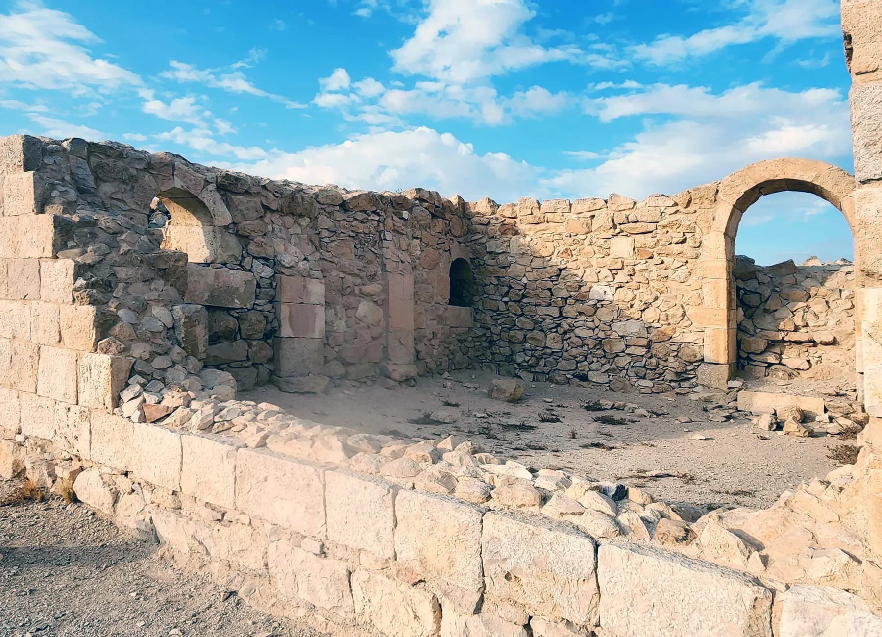
Archaeological site · The Negev
Avdat National Park
Avdat was station number 62 on the Incense Route, and the caravan road that brought frankincense from Arabia towards the port of Gaza can still be picked out climbing to it from the southeast.
ישראל פרקר / CC BY 2.5 · Wikimedia Commons
Station on the Incense Route
number 62
on a road the parks authority traces 2,400 km from Oman and Yemen to Gaza
Adult ticket
₪31
child ₪16, as published by the Israel Nature and Parks Authority in 2026
World Heritage Site
7 July 2005
inscribed at Durban with Halutza, Shivta and Mamshit, per the parks authority
Occupied
3rd century BCE onwards
with radiocarbon dates on site running to AD 890 (Antiquity, 2022)
In short
- How long to give it
- about 90 minutes for the short route from the upper car park, two hours for the medium route ending at the bathhouse, and about three hours for the long route from the lower car park
- Summer, Sunday to Thursday and Saturday
- 08:00 to 17:00
- Adult
- ₪31
עבדת
Avdat National Park is the ruin of a Nabataean, Roman and Byzantine town standing on the end of a limestone ridge above the Zin basin, off Route 40 between Sde Boker and Mitzpe Ramon. The Israel Nature and Parks Authority runs it, and describes it as a small trading post on the caravan route that grew into a prosperous settlement: Nabataeans put temples on the hilltop, Rome added an army camp, and the Byzantines turned it into an urban and agricultural centre with churches, a citadel, a bathhouse, winepresses and elaborate water systems.
It is the one site on the Israeli stretch of the Incense Route where all of those layers are legible in a single hour on foot. The acropolis carries a Nabataean temple precinct, a Byzantine citadel and two churches, one of them with a cruciform baptismal basin. Below the hill are a bathhouse fed by a well sunk through bedrock, a Roman burial cave with more than twenty niches, a hillside of rock-cut caves and, on the plain south of the town, the terraced valley where its wine grapes grew.
It is also the site where the difference between what is ancient and what has been put back matters most. Avdat was excavated from 1958, reconstructed through the 1960s, and then attacked by vandals in October 2009, after which the parks authority spent three years rebuilding what could be rebuilt. Some of the arches a visitor walks under are Byzantine masonry re-erected twice: once by archaeologists and once after the damage.
The road
A camping ground that became the second city of the incense trade
The Nabataeans reached this ridge as caravanners rather than settlers. English Wikipedia, drawing on the excavation literature, describes Avdat in the 3rd to late 2nd century BCE as a seasonal camping ground on the early Petra to Gaza road, and the parks authority's own brochure numbers it station 62 on a route it traces some 2,400 kilometres from Oman and Yemen through Saudi Arabia and Jordan to the Mediterranean.
The town takes its name from a deified king. Avraham Negev, who excavated here, quotes the 6th-century grammarian Stephanus of Byzantium: 'Oboda, a place of Nabateans. Uranios, in his fourth book on the Arabs, writes where king Obodas, who is deified, is buried.' Negev argued that Obodas I, who ruled around 96 to 85 BCE, built the new city, named it after himself and was worshipped there after his death. The Encyclopaedia Judaica entry is more cautious and says only that the site was probably named after the deified king Obodas.
Its wealth peaked with the kingdom's. Under Aretas IV, from 9 BCE to 40 CE, the incense trade enriched the Nabataeans and their main centres developed: Petra in Transjordan, Avdat and Halutza in the Negev. The parks authority sets out what a caravan of that road actually was, which is more prosaic than the word suggests: ten to twenty camels carrying 150 to 200 kilos each, every animal led by a handler on foot, moving at a pace set by the spacing between them.
Then the trade left. Rome annexed the kingdom in 106 CE, and by the early to mid 3rd century international traffic through the region had ceased. Avdat did what the other Negev highland towns did and turned to farming, and above all to wine. The Nabataeans, whose earliest agricultural inscriptions at this site date to 88 to 98 CE, were still here: recent excavation of a residential quarter outside the town wall found Nabataean pottery in production into the middle of the 3rd century.
- Seasonal Nabataean camping ground, 3rd to late 2nd century BCE
- Station 62 on a route of about 2,400 km, Oman and Yemen to Gaza
- Height of the trade under Aretas IV, 9 BCE to 40 CE
- Roman annexation in 106 CE; international trade through the Negev ends in the 3rd century
- The town survives by farming and winemaking rather than by transit
On the hill
Two temples, a citadel and two churches on one platform
Everything that made Avdat important sits on a platform along the western edge of the ridge, laid out before the end of the 1st century BCE. The Nabataean temple precinct is at its western end; the Temple of Oboda, dedicated to the deified king, is a tripartite building of porch, hall and adytum measuring about 14 by 11 metres. An inscription found nearby names Aphrodite, the Greek equivalent of the Nabataean goddess Uzza, and excavation of the temple walls turned up the moulded stucco and frescos that Nabataean temples usually carried.
The dated stones are the most specific thing here. The temple gate lintel bears a Nabataean dedication of 268 CE to Zeus-Oboda, naming its dedicators and 'all friends of Oboda'. The lookout tower above the upper car park carries a Greek inscription asking Zeus Oboda to help Irenius, who built it with the architect Wailos of Petra, in a year counted from the founding of Provincia Arabia in 106 CE: the parks authority reads that as 294 CE, and Wikipedia as 293/294.
The Christian town reused the same ground. In the 5th and 6th centuries a citadel and a monastery with two churches were built on the acropolis. The southern church, part of the monastery, is named for Saint Theodoros after the earliest of the inscribed marble slabs set into its floor, which run from 541 to 618 CE. The northern church is the earlier of the two and held the town's cathedral, and behind it stands a cruciform baptismal basin built into the remains of a Nabataean temple.
Two details in the baptistery are worth stopping for. The account published through the Jewish Virtual Library describes two fonts: a large cross-shaped basin for adults and a smaller round one, which it reads as being for babies. Standing at the temple gate immediately outside, a visitor is looking at a Nabataean lintel of 268 CE, a Christian font a few metres behind it, and the valley the town's vineyards stood in, all within one turn of the head.
- Temple platform laid out before the end of the 1st century BCE
- Temple of Oboda, about 14 by 11 m, on the acropolis
- Temple gate lintel dedicated to Zeus-Oboda, 268 CE
- Roman lookout tower inscription read as 294 CE
- Two churches and a citadel added in the 5th and 6th centuries
- Floor inscriptions in the southern church dated 541 to 618 CE
Reconstruction
What is original, what was rebuilt, and what was rebuilt twice
The excavation history is short and well documented, and the parks authority prints it on the site brochure. Michael Avi-Yonah uncovered Avdat in 1958 and Avraham Negev worked here from 1959 to 1961, both for the Hebrew University of Jerusalem. Conservation and reconstruction were carried out in the 1960s. Negev returned with Rudolph Cohen from 1975 to 1977 and alone in 1989; Ofer Katz, Gil Tahal, Tali Erickson-Gini and Peter Fabian dug for the Israel Antiquities Authority from 1990 to 1994, and Erickson-Gini and Fabian again in 1999 and 2000.
So a good deal of what stands has been stood back up. The marble baptistery behind the northern church is described by the parks authority as reconstructed. The winepress on the short route is a reconstruction. The Roman villa on the drive up the hill has been rebuilt around its courtyard cistern. None of this is concealed: the brochure labels the reconstructed elements, and the visitor centre holds a scale model of the Byzantine city precisely so that the ruin does not have to be read as if it were complete.
Then there is the damage nobody planned for. On the parks authority's account, vandals destroyed remnants of the Byzantine settlement on 5 October 2009, toppling, smashing and spray-painting buildings, vaults and columns. Ynet reported that hundreds of artefacts were smashed, that walls, a staircase and an ancient winepress were painted over, and quoted the authority's chairman, Eli Amitay, saying that a World Heritage Site had received a grave blow. Two cousins from the Azazma were later charged, with the indictment reported as putting the damage at 8.7 million shekels.
The repair took three years. The parks authority ran the project with the Israel Antiquities Authority and government funding: ruins restored, archaeological remains conserved, new signage and interpretation along the visitor route, and a security system installed against a repeat. The arches of the vaulted room in the Byzantine quarter, which once bore stone roof slabs, were re-erected during that project after the vandals pulled them down. Much of the loss was not recoverable, and the site does not pretend otherwise.
- Uncovered by Michael Avi-Yonah, 1958; excavated by Avraham Negev, 1959 to 1961
- Conservation and reconstruction carried out in the 1960s
- Israel Antiquities Authority seasons in 1990 to 1994 and 1999 to 2000
- 5 October 2009: vandals wreck Byzantine remains, columns and a winepress
- Three-year restoration follows, with new signage and a security system
The end
Three accounts of how Avdat ended, and they do not agree
The version on the signs is the simplest. In the early 7th century a huge earthquake struck the area, destroyed Avdat and led to its abandonment. The evidence is visible on the walk: the arches in the Byzantine quarter lean, and the brochure points at them as the physical record of that shock. Korjenkov and Mazor's archaeoseismic surveys, published in 1999, separated 7th-century seismic effects at Avdat from those of an earlier earthquake.
The Encyclopaedia Judaica tells it differently. In that account the two churches were razed during the Persian invasion of 614 CE, and the city was completely deserted after the middle of the 7th century. The seismic sequence itself has also been rewritten more than once. Erickson-Gini set out four events, in the early 2nd century, in 363, in the early 5th century and in the early 7th; the 'Atiqot report on the residential quarter argues that 363 did only minor damage here and that the serious destruction came a few decades later, in the early 5th century, on a date nobody can fix.
The most recent work removes the ending altogether. The Avdat in Late Antiquity Project, reported in Antiquity in 2022 by Scott Bucking, Daniel Fuks, Zachary Dunseth, Lior Schwimer and Tali Erickson-Gini, investigated a two-hectare residential sector of rock-hewn dwellings on the southern slope. Nine radiocarbon samples from dung-enriched deposits came back Umayyad to Abbasid, 650 to 890 CE, corroborated by pottery from the Khirbet al-Mafjar kilns. The Dead Sea earthquake catalogue's page on the site now allows abandonment as late as the 9th or 10th century.
This is not a quibble about a century. It changes what the caves on the slope were: not the wreckage a departing population left, but stabling and storage still being used two hundred years after the town is supposed to have died. Researchers still differ over how much weight to give the earthquake, and the site's own interpretation has not caught up with the radiocarbon.
- Parks authority: destroyed by an early 7th-century earthquake and abandoned
- Encyclopaedia Judaica: churches razed in the Persian invasion of 614 CE, deserted after the mid-7th century
- Erickson-Gini: four earthquakes, with the serious damage in the early 5th century rather than in 363
- Antiquity, 2022: radiocarbon dates of 650 to 890 CE from the cave quarter
- Leaning arches in the Byzantine quarter are the visible evidence
Wine
Five winepresses, a well sunk through bedrock, and a vineyard replanted in 2003
The reason Avdat survived the collapse of the caravan trade is in the valley below it. At least five Byzantine winepresses have been found at the site, and the parks authority's Hebrew page now routes visitors along a winepress trail past them, including a sophisticated industrial press on the south side with three collecting vats holding some 6,000 litres. The earliest press at or near Avdat belonged to a farmhouse of the late Roman or early Byzantine period, and the grapes were treaded where they grew, at the foot of the town.
Water was engineered rather than found. Rainwater ran off the hill through channels into large cisterns, one of them fed by a channel at the foot of the citadel's southeastern tower, and surface runoff was caught in more cisterns across the surrounding ground. The Byzantine bathhouse below the site, built in the 4th century by Roman soldiers, drew on a well tunnelled through bedrock beside it. Its depth is given as 70 metres in the parks authority's brochure and as about 64 metres on the authority's own web pages, which is a discrepancy the operator has not resolved.
The farming system was put back into service in living memory. In the late 1950s the Desert Runoff Farms Unit, now shared between the Hebrew University of Jerusalem and Ben-Gurion University of the Negev, reconstructed two Nabataean farms, one at Shivta and one at Avdat, under the ecologist Michael Evenari. The Avdat farm ran to about 20 acres and was planted with 3,000 orchard trees along with cereals, vegetables, legumes and pasture plants, watered by nothing but runoff steered off the slopes.
The vines came back too. In 2003 the parks authority planted a heritage vineyard beside the southern winepress, among the ancient terraces, reconstructing old grape varieties and Byzantine desert farming methods from the period when the Negev was known for its wine. It sits within a much larger picture: a survey of more than 500 sites across some 150 square kilometres around Avdat, published in 2024, treats the town and its agricultural hinterland as a single system rather than as a ruin with fields near it.
- At least five Byzantine winepresses, linked by a marked winepress trail
- Southern industrial press: three collecting vats of about 6,000 litres
- Bathhouse well given as 70 m in the brochure and about 64 m on the park's web pages
- Evenari's reconstructed runoff farm: about 20 acres, 3,000 orchard trees, from the late 1950s
- Heritage vineyard planted in 2003 between ancient terraces
What to look for
Things not to walk past at Avdat National Park
The details that repay knowing about before you are standing in front of them.
The Nabataean temple gate
The lintel carries a Nabataean dedication of 268 CE to Zeus-Oboda, naming the dedicators and 'all friends of Oboda'. It is the most precisely dated thing a visitor walks under here.
The cruciform baptistery
A reconstructed marble baptismal basin behind the northern church, set into the remains of a Nabataean temple. A large cross-shaped font stands beside a smaller round one.
The floor of St Theodoros
Marble slabs set into the southern church floor cover burials and carry Greek inscriptions dated between 541 and 618 CE. The earliest of them gave the church its name.
The Roman burial cave
Reached by a short path off the road between the lower and upper car parks, with reliefs of the sun, the moon and an altar on the façade and more than twenty burial niches inside. Names of women on the epitaphs have led some scholars to read it as a women's tomb.
The leaning arches
In the street of the Byzantine quarter, arches stand visibly out of true. The parks authority reads them as the record of the earthquake after which the town was abandoned, which is the point on the walk where the argument about Avdat's ending becomes physical.
The bathhouse and its well
A well-preserved Byzantine bathhouse by the lower entrance, with a changing room, cold, tepid and hot rooms and its stoves. Water came from a well tunnelled through bedrock alongside it.
The long view
Avdat National Park, in order
3rd to late 2nd century BCE
Nabataean caravans use the ridge as a seasonal camping ground on the early Petra to Gaza road.
c. 96 to 85 BCE
The reign of Obodas I, who on Avraham Negev's reading built the town, gave it his name and was worshipped here as a god after his death.
Before the end of the 1st century BCE
A temple platform, the acropolis, is created along the western edge of the plateau.
9 BCE to 40 CE
Under Aretas IV the incense trade reaches its height, and Avdat and Halutza develop as the kingdom's Negev centres alongside Petra.
88 to 98 CE
The earliest Nabataean inscriptions connected with agriculture appear at and around the site, on stone libation altars.
106 CE
Rabbel II dies and the Nabataean kingdom is annexed as Provincia Arabia. Dating at Avdat switches to the new era.
268 CE
The dedication inscription on the temple gate lintel, to Zeus-Oboda, is carved.
294 CE
The Roman lookout tower is built by Irenius with the architect Wailos of Petra, on the parks authority's reading of its Greek inscription.
Late 3rd or early 4th century CE
The Roman army lays out a camp of about 100 by 100 metres on the northern side of the plateau, and a bathhouse is built on the plain below the town.
Early 5th century CE
A massive earthquake wrecks the residential quarter. Excavators now put the serious damage here at this date rather than in 363 CE.
5th and 6th centuries CE
A citadel and a monastery with two churches are built on the acropolis. Marble tomb slabs in the southern church run from 541 to 618 CE.
Early 7th century CE
A large earthquake strikes. On the parks authority's account this destroys Avdat and leads to its abandonment.
650 to 890 CE
Radiocarbon dates from the rock-cut dwelling quarter show Umayyad and Abbasid activity, corroborated by pottery from the Khirbet al-Mafjar kilns.
1958 to 1961
Michael Avi-Yonah uncovers the site, and Avraham Negev excavates it for the Hebrew University of Jerusalem.
Late 1950s
Michael Evenari's team reconstructs a Nabataean runoff farm below Avdat, about 20 acres planted with 3,000 orchard trees and watered from engineered runoff.
2003
A heritage vineyard is planted beside the southern winepress, among the ancient terraces, in old grape varieties.
7 July 2005
UNESCO inscribes the Incense Route and the desert cities of the Negev at its session in Durban, with Avdat, Halutza, Shivta and Mamshit.
5 October 2009
Vandals wreck Byzantine remains at the site, toppling, smashing and spray-painting buildings, vaults and columns. A three-year restoration follows.
2022
The Avdat in Late Antiquity Project publishes its Early Islamic evidence in Antiquity, unsettling the account of a town abandoned after the earthquake.
Practical
Visiting Avdat National Park
Where
Off Route 40 between Sde Boker and Mitzpe Ramon, about 15 minutes from Sde Boker. Lower entrance with the visitor service centre, then a road up to the upper car park
What ticket you need
Avdat and Ein Avdat are two separate national parks about 15 minutes apart on Route 40, each with its own ticket, and the names cause constant confusion. The parks authority's own English page for Avdat currently prints Ein Avdat's directions under 'How to get here', which is a good reason to navigate by the park name in Waze rather than by that paragraph. Avdat is one of the four desert cities, with Halutza, Shivta and Mamshit, inside the UNESCO Incense Route inscription of 2005; that listing is not a ticket and each park is paid for separately.
Opening hours
- Summer, Sunday to Thursday and Saturday
- 08:00 to 17:00source
- Summer, Friday and holiday eves
- 08:00 to 16:00source
- Winter, Sunday to Thursday and Saturday
- 08:00 to 16:00source
- Winter, Friday and holiday eves
- 08:00 to 15:00source
- Rosh Hashanah eve and Passover eve
- 08:00 to 13:00source
- Yom Kippur eve
- 08:00 to 13:00source
- Late summer extension
- Thursdays and Fridays, 26 July to 31 August, until 18:00source
- Entry closes
- half an hour before the posted closing timesource
Admission
- Adult
- ₪31source
- Child
- ₪16source
- Student
- ₪26source
- Israeli senior citizen
- ₪16source
- Adult in a group of more than 30
- ₪26source
- Child in a group of more than 30
- ₪14source
- Reservist, on the Hebrew price list
- ₪23source
- Soldier in compulsory, national or civilian service, on the Hebrew price list
- ₪16source
- Pupil, on the Hebrew price list
- ₪8source
Access
Not a level site, and the two published versions of its accessibility do not match. The English page says flatly that the trails are not accessible for people with mobility impairments. The Hebrew page is more detailed and more positive: the entrance area (parking, service centre, ticket office, toilets, group assembly plaza, picnic tables, drinking fountains and signage) is accessible, and every visitor may drive up to the antiquities on the hill, with a card issued at the ticket office to open the vehicle gate. If getting out of the car to open the gate is difficult, the ticket office will open it remotely. On the hill there is accessible parking, a shaded viewing plaza and further viewpoints, concrete or timber paths, and handrails on the steps; the remaining paths are compacted gravel. The Hebrew page states that people with limited mobility can reach the Roman villa, the inner street at the entrance to the Nabataean settlement, the service road, the winepress and the acropolis. The service centre also holds a scale model of the site as an alternative for anyone who cannot walk the ruins. The steps, thresholds and uneven paving inside the churches and the citadel are not accessible.
On site
- Visitor service centre and shop
- Introductory film in 15 languages
- Scale model of the Byzantine city
- Archaeological display of pottery and glass from the excavations
- Toilets
- Picnic area by the lower car park
- Kiosk, cold drinks, hats and sunscreen
- Parking at the lower and the upper car park
- Dog-sitting facility at the entrance
Booking
The parks authority asks visitors to register through its visit-coordination system, and states that anyone who has booked and arrives to find the site full will be asked to show the confirmation at the gate. Telephone 08-6551511 for the park, or *3639 for the authority's information line. The two language versions of the park page also disagree about dogs: the English page says dogs may not be brought in and that service animals are not allowed, while the Hebrew page says dogs are admitted on a lead and muzzled, but not into buildings. Telephone before travelling with an animal.
Hours and prices are given as the operator publishes them and change without much notice, particularly around Shabbat and the festivals. Check the operator's own page before you travel for this.
Official page at en.parks.org.il →What people wish they had known
- Drive up the hill. Every visitor may take a vehicle from the lower entrance to the upper car park, and the ticket office issues a card that opens the gate. People who set off on foot from the lower gate in August are doing an unnecessary climb in full sun.
- Start in the service centre, not on the ruins. The film runs in 15 languages and the scale model shows the town as it stood in the Byzantine period, which is the difference between reading the acropolis and looking at a heap of walls.
- Choose the route before paying. The short circuit from the upper car park takes an hour to an hour and a half and skips the Nabataean settlement, the Roman camp and the caravan road; the three-hour route from the lower car park is the one that includes them.
- Eat only at the picnic area by the lower car park. The parks authority restricts eating to that spot, so a packed lunch carried up to the churches has to come back down again unopened.
- Do not confuse this with Ein Avdat. They are separate national parks with separate tickets about 15 minutes apart, and the English page for Avdat currently prints Ein Avdat's directions.
- Leave time at the end rather than at the start. Entry closes half an hour before the posted closing time, and the parks authority's Hebrew page says visitors may and should stay for the sunset over the Zin basin.
The figures
Avdat National Park by the numbers
Each figure carries the year it belongs to and links the source it came from.
| Measure | Figure | As of | Source |
|---|---|---|---|
| Adult admission | ₪31 | 2026 | en.parks.org.il |
| Station on the Incense Route | number 62 | 2015 | static-en.parks.org.il |
| Length of the inscribed route in Israel | about 65 km, from Orhan Mor in the Arava to Avdat | 2015 | static-en.parks.org.il |
| Temple of Oboda | about 14 by 11 m | 2026 | en.wikipedia.org |
| Roman army camp | about 100 by 100 m | 2026 | en.wikipedia.org |
| Well serving the bathhouse | 70 m in the park brochure, about 64 m on the park's web pages | 2026 | static-en.parks.org.il |
| Southern industrial winepress | three collecting vats of about 6,000 litres | 2026 | parks.org.il |
| Radiocarbon dates from the cave quarter | 650 to 890 CE, from nine samples | 2022 | cambridge.org |
While you are here
The rest of The Negev
Everything else in this destination with a page of its own.
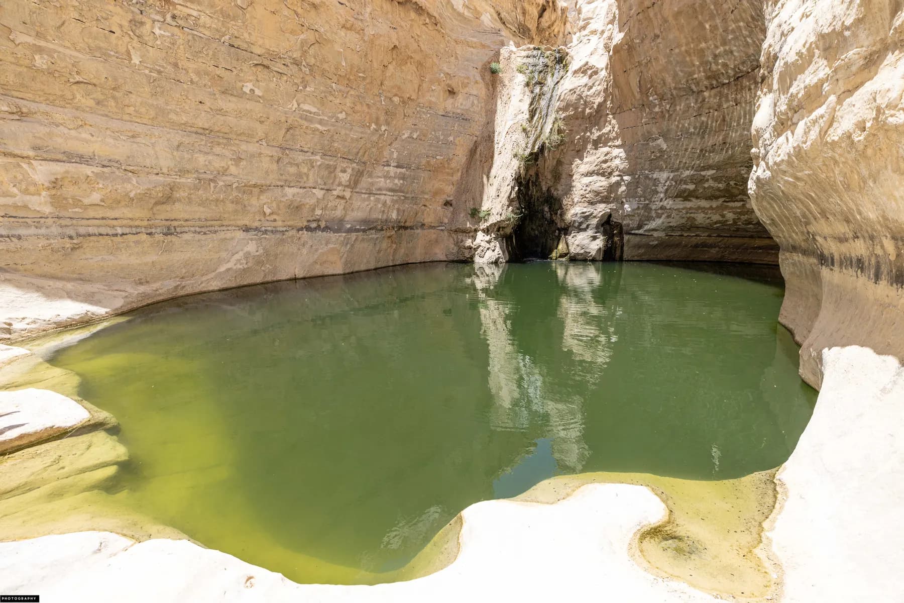
רחל וייסלר / CC BY 2.5 · Wikimedia Commons
Nature reserve
Ein Avdat National Park
Three springs keep water running all year at the bottom of a white chalk canyon that was cleared, laid out and opened to the public in 1961 as a seventy-fifth birthday present for David Ben-Gurion.
Museum
Ben-Gurion's Desert Home and Tomb
David and Paula Ben-Gurion moved into a Swedish prefabricated hut at Kibbutz Sde Boker on 14 December 1953, and his will asked that it be left exactly as he died in it twenty years later.
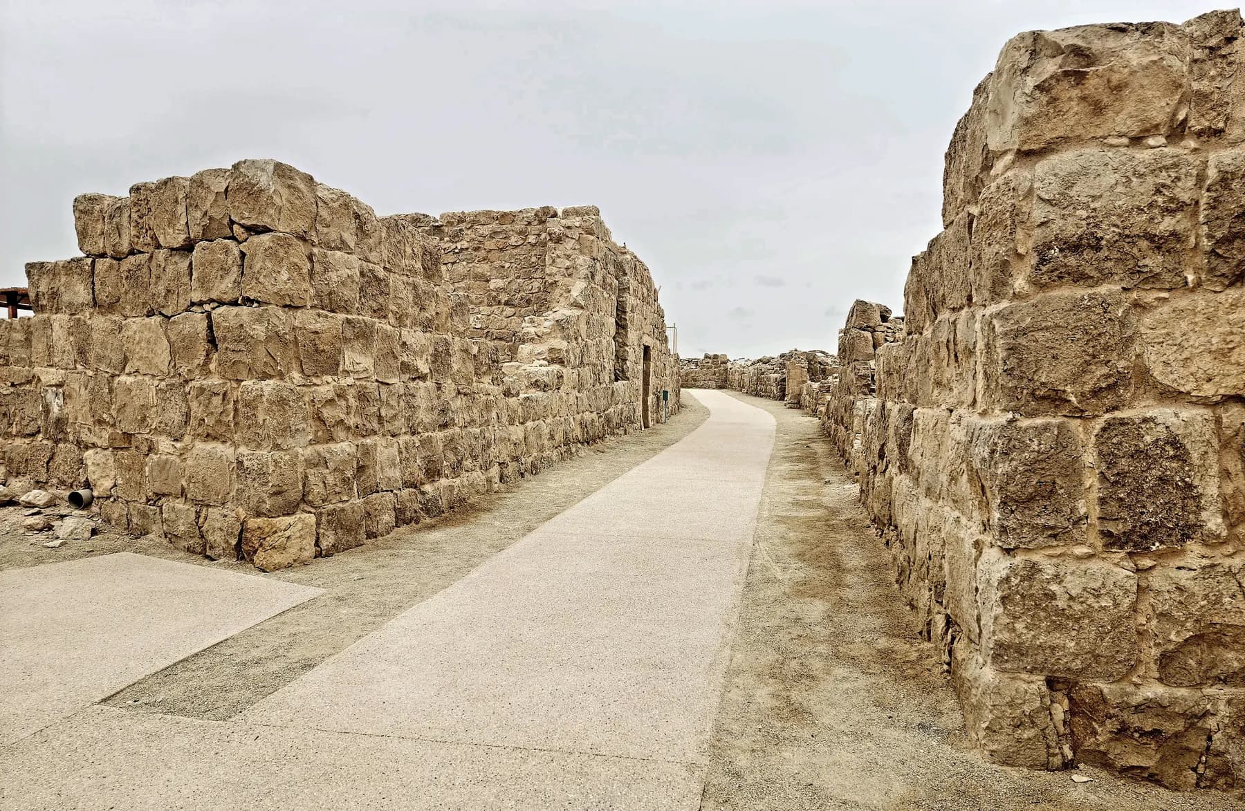
ישראל פרקר / CC BY 2.5 · Wikimedia Commons
Archaeological site
Shivta National Park
Nobody sacked Shivta: a University of Haifa survey recorded 21 doorways deliberately blocked with stone in 16 of its houses, which is why the streets and churches are still standing.
Sources and further reading
Every link below was opened and checked when this page was written. Official statements are marked as such: they are the subject's own account, not an independent one.
- OfficialIsrael Nature and Parks Authorityen.parks.org.ilAvdat National Park
Opening hours, the late-summer extension, the published entrance fees, points of interest, the dog and service-animal rules and the English accessibility statement
- OfficialIsrael Nature and Parks Authorityparks.org.ilגן לאומי עבדת
The fuller price list, the winepress trail and the 6,000-litre southern press, the heritage vineyard of 2003, the detailed accessibility account and the directions from Sde Boker
- OfficialIsrael Nature and Parks Authoritystatic-en.parks.org.ilWelcome to Avdat National Park: Station 62 on the Incense Route (PDF)
The UNESCO inscription of 7 July 2005, the excavation history, the three touring routes, the temple gate and tower inscriptions, the 70 m well and the account of the 2009 vandalism
- ReportingYnetnewsynetnews.comAvdat National Park vandalized
Contemporary account of the October 2009 attack, the painted walls, staircase and winepress, and the parks authority chairman's response
- ReportingYnetnewsynetnews.comIndictment on Avdat vandalism cites Bedouin revenge
The charging of two cousins from the Azazma and the 8.7 million shekel damage figure in the indictment
- ReferenceAntiquity 96(387), Bucking, Fuks, Dunseth, Schwimer and Erickson-Gini, 2022cambridge.orgThe Avdat in Late Antiquity Project: uncovering the Early Islamic phases of a Byzantine town in the Negev Highlands
The two-hectare rock-hewn dwelling sector, the nine radiocarbon samples dated 650 to 890 CE and the Khirbet al-Mafjar pottery
- Reference'Atiqot 121, Erickson-Gini, Paran and Shilovpublications.iaa.org.ilA Roman and Early Byzantine Residential Quarter at Oboda ('Avedat)
The three occupation phases outside the town wall, the rebuilding after the early 2nd-century earthquake and Nabataean pottery production into the mid-3rd century
- ReferenceEarthquake Catalog of the Dead Seadeadseaquake.infoAvdat: archaeoseismic evidence
Compiles the excavation reports: Erickson-Gini's four earthquakes, the argument that 363 CE did only minor damage here, Korjenkov and Mazor's 1999 surveys and the late abandonment date
- ReferenceWikipediaen.wikipedia.orgAvdat
The temple dimensions, the 100 by 100 m Roman camp, the wine presses, the ink-on-plaster Nabataean inscription and the UNESCO criteria
- ReferenceEncyclopaedia Judaica, via the Jewish Virtual Libraryjewishvirtuallibrary.orgAvedat (Ovdat; Ar. 'Abde')
The alternative ending: churches razed in the Persian invasion of 614 CE and the city deserted after the middle of the 7th century, with the full list of 19th and 20th-century explorers
- ReferenceJewish Virtual Library, from The Israeli Mosaicjewishvirtuallibrary.orgNational Parks in Israel: Avdat National Park
The two baptismal fonts, the rebuilt Roman villa and courtyard cistern, the terraced cave quarter and the Roman lookout tower
- ReferenceAvraham Negev, Hebrew University, Hecht Museummushecht2.haifa.ac.ilObodas the God in a Nabatean-Arabic Inscription from the Vicinity of Oboda, and a Review of Other Nabatean Inscriptions (PDF)
Obodas I as founder and deified king, the Stephanus of Byzantium quotation, the temple treasury inscriptions of Aretas IV and the agricultural inscriptions of 88 to 98 CE
- ReferenceBiblical Archaeology Society Librarylibrary.biblicalarchaeology.orgNabatean Farms Reconstructed in the Desert
Michael Evenari's Desert Runoff Farms Unit, the reconstructed farms at Avdat and Shivta and the 20-acre planting of 3,000 orchard trees
Avdat National Park: common questions
How long do you need at Avdat?+
About 90 minutes covers the short route from the upper car park: the Roman tower, the winepress and lookout, the citadel and the churches, and back. The medium route adds the storage caves and the Roman bathhouse and ends at the lower car park, around two hours. The long route from the lower car park takes in the burial cave, the Roman villa, the Nabataean settlement, the Roman army camp and the farmhouse as well, and the parks authority allows three hours for it.
How much does it cost?+
The Israel Nature and Parks Authority publishes ₪31 for an adult and ₪16 for a child, with ₪26 for a student, ₪16 for an Israeli senior citizen, and ₪26 and ₪14 for adults and children in groups of more than thirty. The Hebrew price list adds ₪23 for a reservist, ₪16 for a soldier in compulsory, national or civilian service and ₪8 for a pupil.
Can you drive up to the ruins?+
Yes, and most visitors should. The parks authority states on its Hebrew page that all visitors may drive up to the antiquities site on the hill, and that the ticket office issues a card to open the vehicle gate. There is parking at the top, including accessible bays. Anyone who finds it hard to get out of the car at the gate can ask at the ticket office to have it opened remotely.
Is it wheelchair accessible?+
Partly, and the parks authority's own two pages disagree about how much. The English page says the trails are not accessible for people with mobility impairments. The Hebrew page describes an accessible entrance area, vehicle access to the top of the hill, accessible parking, a shaded viewing plaza, concrete or timber paths and handrails on steps, and states that people with limited mobility can reach the Roman villa, the inner street of the Nabataean settlement, the service road, the winepress and the acropolis. The service centre keeps a scale model of the site as an alternative. Treat the Hebrew page as the fuller account and telephone 08-6551511 to confirm before a long drive.
What is actually original and what has been rebuilt?+
A significant amount has been re-erected, and the site says so. Conservation and reconstruction were carried out in the 1960s after the first excavations; the marble baptistery behind the northern church and the winepress on the short route are described by the parks authority as reconstructions, and the Roman villa on the drive up has been rebuilt. The arches of the vaulted room in the Byzantine quarter were put back a second time during the restoration that followed the vandalism of 2009. The temple gate lintel, the inscribed floor slabs in the southern church and the leaning arches are original.
What happened here in 2009?+
Vandals wrecked a large part of the Byzantine remains on 5 October 2009, toppling, smashing and spray-painting buildings, vaults and columns. Ynet reported that hundreds of artefacts were destroyed and that walls, a staircase and an ancient winepress were painted; two cousins from the Azazma were later charged, and the indictment was reported as putting the damage at 8.7 million shekels. The parks authority and the Israel Antiquities Authority then ran a three-year restoration with government funding, and installed a security system. Some of the loss was irreversible.
Is there shade, and how bad is it in summer?+
There is a shaded viewing plaza at the top of the hill and shade at the service centre and the picnic area, and very little on the walk itself. This is an exposed limestone ridge with no water on it. The practical answers in July and August are to arrive at opening time, to drive up rather than walk, and to use the late-summer extension: the parks authority publishes 18:00 closing on Thursdays and Fridays from 26 July to 31 August.
How is Avdat different from Shivta and Mamshit?+
All three are Nabataean towns in the same UNESCO inscription, but Avdat is the one with the acropolis. Its hilltop carries the Nabataean temple precinct, the Byzantine citadel and both churches on a single platform above a wide view, and it holds the dated inscriptions: the temple gate lintel of 268 CE and the tower inscription read as 294 CE. Shivta is flatter, larger in plan and has no hill; Mamshit sits further north, on a different branch of the road.
Is it worth combining with Ein Avdat?+
Yes, and it is the standard pairing, but they are separate parks with separate tickets about 15 minutes apart on Route 40. Ein Avdat is a walk in a canyon with permanent water and a fixed one-way exit; Avdat is a ruined town on a dry ridge. Together with Ben-Gurion's hut at Sde Boker they make a full day without any of the three feeling rushed.
Was Avdat really abandoned after an earthquake?+
That is the account on the site's own signs, and it is now contested. The parks authority says a huge earthquake in the early 7th century destroyed Avdat and led to its abandonment, and the leaning arches in the Byzantine quarter are shown as the evidence. The Avdat in Late Antiquity Project, published in Antiquity in 2022, radiocarbon-dated nine samples from the rock-cut dwelling quarter to 650 to 890 CE and found Umayyad and Abbasid pottery with them, which points to people using the site for two centuries after the town is supposed to have ended.