Landmark · The Dead Sea
Mount Sodom and Lot's Wife
A wall of rock salt that radar measurements show is still rising by up to 8.3 millimetres a year, with the longest salt cave in the world running through the inside of it.
Hoshvilim / CC BY-SA 4.0 · Wikimedia Commons
Length of the ridge
about 10 km
the parks authority's figure for the salt plug; the Baltimore Sun reported seven miles in 1991
Rock salt
about 80 per cent
of the mountain, per the Baltimore Sun's 1991 report from the site
Malham Cave
over 10 km
mapped over two years and announced in March 2019 as the world's longest salt cave
Uplift
8.3 mm a year
maximum for the northern block; 5.5 mm for the southern, from radar measurements published in 2006
In short
- How long to give it
- about 2 to 3 hours on the mountain for the parks authority's 3 km Fish Trail, plus the drive in on dirt roads
- Summer, Sunday to Thursday and Saturday
- 08:00 to 17:00
- Entry to Mount Sodom and the Judean Desert Nature Reserve
- The parks authority publishes no admission charge for this reserve, and there is no ticket office at Mount Sodom
הר סדום
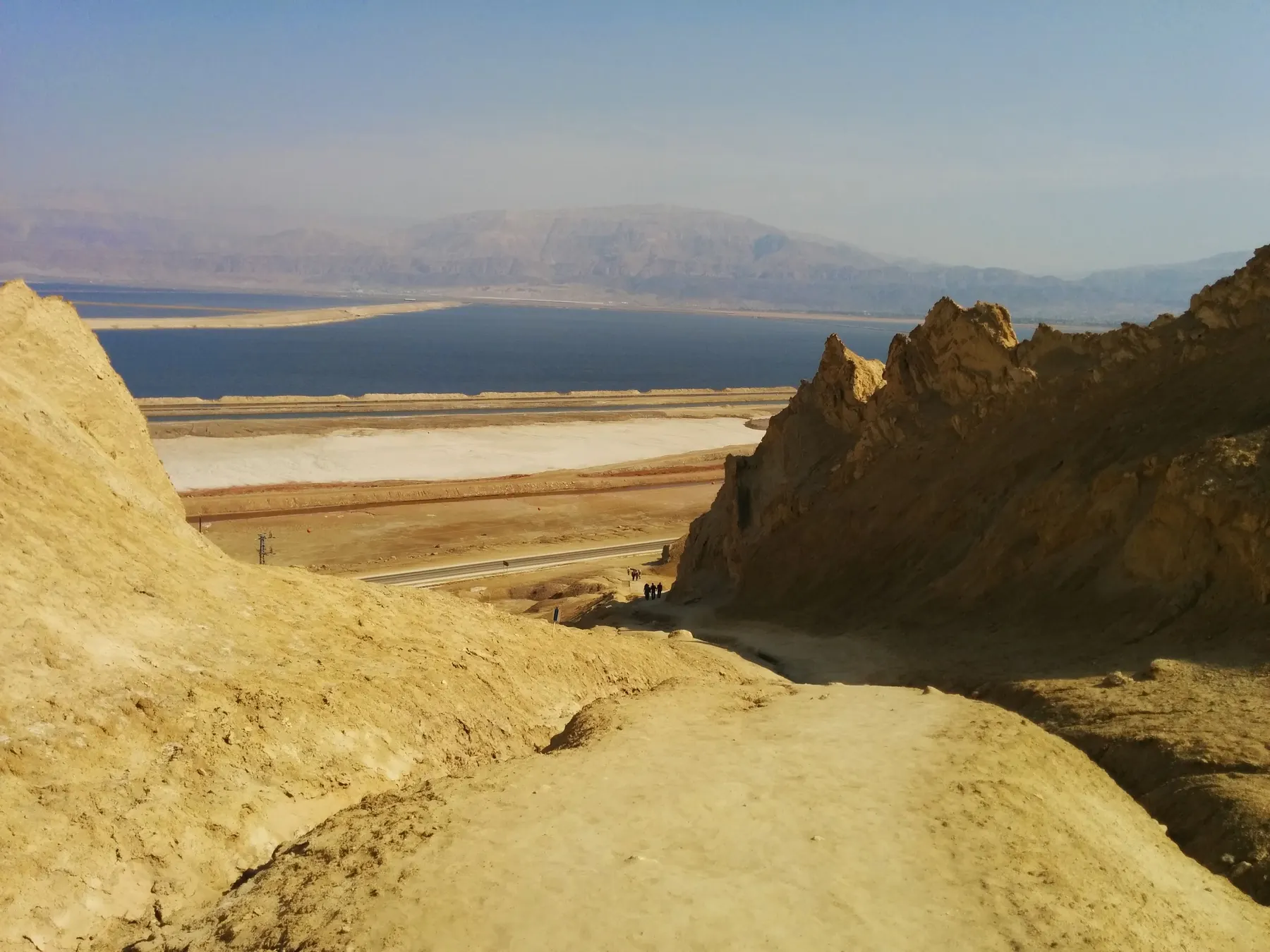
Mount Sodom is a ridge of rock salt on the south-western shore of the Dead Sea, and it is a landform rather than a monument: nothing here was built and nothing has been reconstructed. The Israel Nature and Parks Authority, which holds it inside the Judean Desert Nature Reserve, describes it as a giant salt plug about 10 kilometres long that burst up from deep underground. The Baltimore Sun, reporting from the mountain in 1991, called it seven miles long, about 80 per cent salt, and capped with limestone, clay and conglomerate dragged up with the salt from the valley floor.
The salt is what makes the place unusual twice over. Rock salt dissolves roughly a thousand times faster than limestone, so rain that would take a hundred thousand years to open a cave in chalk opens one here in a few thousand. The result is the densest concentration of salt caves anywhere, including Malham Cave, whose passages were mapped at over 10 kilometres in March 2019 and declared the longest salt cave in the world. Rock salt also flows under load, which is why the mountain is not finished: radar interferometry puts the maximum rise of its northern block at 8.3 millimetres a year.
The pillar visitors come to photograph, the one everybody calls Lot's wife, is a by-product of both processes. Genesis 19:26 says Lot's wife looked back and turned into a pillar of salt, and Josephus wrote in the first century CE that he had seen the pillar himself. The geology is stranger and better dated: the salt pillar Amos Frumkin analysed here stands about 20 metres high and is what was left when the roof of a salt cave fell in, probably in an earthquake.
Geology
Salt that flows, and a hill that has not stopped rising
Mount Sodom is a diapir: a body of salt buried under kilometres of younger sediment that was squeezed sideways and then upwards through the rocks above it, because salt is both lighter than its surroundings and able to deform rather than break. The Baltimore Sun's 1991 report described the mechanism as salt pushed out sideways like toothpaste from a leaking tube, and noted that drilling crews had gone down more than 3,000 feet and found salt all the way.
The rate of rise has been measured more than once, and the answers cluster without quite agreeing. Ram Weinberger's group, combining a mechanical model with interferometric radar in 2006, reported maximum uplift rates of 8.3 millimetres a year for the northern part of the mountain and 5.5 for the southern part. Amos Frumkin, measuring at the salt pillar in work published in 2009, got 9.3 plus or minus 3.5 millimetres a year. The two halves of the ridge do not rise at the same rate, and no published figure claims better than about a millimetre of precision.
Weinberger's model fits an effective viscosity for the rock salt of 2 to 3 times ten to the eighteenth pascal seconds, and finds that the radar uplift profiles track the shape of the mountain itself, which implies the rise has been steady for roughly the last 14,000 years. The ridge a visitor sees is close to a direct readout of a process still under way.
One consequence catches people out. Height above the Dead Sea is not a fixed number here, because the lake keeps dropping away from the mountain while the mountain rises. The parks authority's own pages carry two different figures: about 150 metres above the lake on the reserve page, about 270 metres on its Mount Sodom walking route. Both are the operator's, published years apart.
- Maximum uplift 8.3 mm a year in the north and 5.5 mm in the south (2006)
- 9.3 plus or minus 3.5 mm a year measured at the salt pillar (2009)
- Uplift history stable over roughly the last 14,000 years (2006)
Underground
The longest salt cave in the world is inside this hill
On 28 March 2019 the BBC reported that Israeli researchers had mapped 10 kilometres of passages and chambers inside Malham Cave, which runs through Mount Sodom, over two years of survey work. The claim was a recapture rather than a discovery: part of Malham had already been mapped in the 1980s, and Yoav Negev of the Israel Cave Explorers Club had assembled a team two years earlier to finish the job. The record it took had been held since 2006 by the Cave of the Three Nudes, a 6.85 kilometre salt cave on Qeshm Island in Iran.
The Israeli outlet Mako, reporting the day before, filled in why the number moved so far. The old Israeli figure was 5.5 kilometres. Amos Frumkin, who runs the Cave Research Center at the Hebrew University and has worked on these caves for about four decades, told Mako that thirty years ago the teams used measuring tape, a compass and a clinometer, and that the resurvey used laser rangefinders feeding straight into a tablet. Roughly fifty cavers took part, about half of them from abroad, and the project began as a collaboration with the caving club of Sofia. Frumkin dates the cave at around 7,000 years old by radiocarbon.
The speed is the point. Amos Frumkin and Derek Ford, publishing on these caves in 1995, noted that rock salt is roughly a thousand times more soluble than limestone, and that despite mean annual rainfall of about 50 millimetres the cave streams here cut down fast: an average of 8.8 millimetres a year in one passage between 1986 and 1991, and 6.2 millimetres a year over the long term from radiocarbon ages of driftwood in twelve passages. That is at least three orders of magnitude quicker than anything recorded in limestone caves. The same wood makes the caves a climate archive: Frumkin and colleagues built a Holocene sequence from fragments dated between about 7,100 and 200 years before present.
None of this is walkable on a visit. Mako's report states flatly that the cave is not set up for public visits and that any entry requires a caver who knows it, and the parks authority's warning for the mountain is that walkers must not leave the marked paths because of the risk of falling into very deep shafts. Those shafts are the tops of exactly this cave system.
- Over 10 km of passages, mapped over two years, announced March 2019
- Previous record: the Cave of the Three Nudes, Qeshm Island, Iran, 6.85 km, held since 2006
- Cave age about 7,000 years, by radiocarbon
- Not open to the public; entry requires an experienced caver
The pillar
What the pillar called Lot's wife actually is
The text is one verse long. Genesis 19:26, in the Jewish Publication Society translation Sefaria prints, reads that Lot's wife looked back and she thereupon turned into a pillar of salt. Josephus went further: in the Antiquities of the Jews, book 1, chapter 11, he writes that she was changed into a pillar of salt, and adds that he has seen it and that it remains to this day. No source consulted here connects what Josephus saw with any particular pillar standing now, and salt pillars here are neither rare nor permanent.
The geological account is more specific and better dated. Amos Frumkin analysed and dated a 20 metre salt pillar on the mountain in the Geological Society of America Bulletin in 2009. Against the earlier assumption that direct rainfall had sculpted it, he found that the solution notches on the pillar and the shape of the chasm beside it point to a karst cave that collapsed, leaving the pillar isolated. Six radiocarbon dates on wood washed into the highest level of that cave show a seasonal underground stream still running there about 4,000 years ago, and Frumkin concludes the collapse was probably triggered by a catastrophic earthquake.
The pillar tourists are shown has also been treated, for at least thirty years, as something that may not last. In December 1991 the Baltimore Sun reported that rangers had noticed it leaning further out from the mountain and that measurements found it had shifted by 15 degrees. The paper put its bulk at the size of a three or four storey townhouse and noted that if it fell it would probably land on the road below. Yossi Harash, then chief geologist at the potash works, told the paper the whole area was unstable and that the mountain was moving.
The same article has the neatest summary of why any of it survives. David Meneger, then district ranger, pointed out that water dissolves a salt mountain exactly as it dissolves table salt, and that normal rainfall would have removed the place long ago.
On foot
The Fish Trail, the chimneys and the rule about the path
The parks authority's recommended walk here is the Fish Trail, which it grades medium to hard, calls suitable for fit walkers, gives as 3 kilometres, and describes as linear rather than circular. It requires trail map sheet 11, South Judean Desert North, which the reserve page lists as compulsory equipment for the whole reserve rather than as a suggestion.
The directions matter because there is no signposted entrance. From Route 90, between kilometre markers 193 and 194, turn west onto the red-marked road; after about 2 kilometres carry straight on along the blue trail for a further 2.5 kilometres, and park at the sign announcing Mount Sodom. The walk ends beside kilometre marker 199 on Route 90, which means a second vehicle or a long walk back along the road.
What the route strings together, in the parks authority's own order: a climb on the blue trail to a viewpoint over the southern basin and the mountains of Moab in Jordan, then an easy descent along the ridges to Mitzpe HaKaftor, the Button Lookout, named for its domed shape and giving a view over the evaporation ponds; then a gentle drop towards the sea past salt formations thrown up as the mountain rose; then the Fish Channel and its fossil fish. The authority recommends autumn, winter and spring.
The safety instructions are unusually blunt for a page written to sell a walk. The reserve page says walkers must not deviate from the marked trails on Mount Sodom because of the danger of falling into very deep chimneys; the trail page warns of giant holes in the ground and tells parents to keep children close. Walking after dark is forbidden outright, in winter the wadis carry flash floods, and there is no drinking water anywhere on the mountain.
- Fish Trail: 3 km, linear, graded medium to hard
- Trail map sheet 11, South Judean Desert North, is compulsory
- Start: Route 90 between km markers 193 and 194, west on the red road
- Finish: beside km marker 199 on Route 90
Reality check
No gate, no ticket, nothing rebuilt
Mount Sodom has no visitor centre, no ticket office, no toilets and no drinking water, and the parks authority publishes no admission price for the Judean Desert Nature Reserve. The reserve does have published hours, and entry closes an hour before they end, but there is nobody here to enforce them: the hours state when the authority considers the reserve safe to be in, not when a gate shuts.
Nothing on the mountain is a reconstruction, which is worth saying on a page in this series, because on most of them half the interest lies in telling the original from the rebuilt. Here the only human additions are the dirt roads, the trail blazes and a sign.
It is not remote from industry, though. The landmark the parks authority uses for directions in this stretch is the entrance to the Dead Sea Works, and the evaporation ponds that feed the potash plants are part of the view from the ridge. The Baltimore Sun filed its 1991 story from a working mining district, and the chief geologist quoted in it worked for the potash company.
For an overnight, the reserve has free unmanned camping at Mishor Amiaz: from Route 90 opposite the entrance gate to the Dead Sea Works, between kilometre markers 193 and 194, west onto the red-marked road, which the authority says any vehicle can manage, north about 2 kilometres, then round for another 2 kilometres to the camping ground. The surface can be too slippery for a private car straight after rain. Dogs are not allowed in the reserve.
What to look for
Things not to walk past at Mount Sodom and Lot's Wife
The details that repay knowing about before you are standing in front of them.
The Lot's wife pillar
A salt pillar on the eastern face that from some angles reads as a human figure, and which the Baltimore Sun reported in 1991 had tilted 15 degrees away from the mountain. Geologically it is what is left when a salt cave collapses around a column.
Mitzpe HaKaftor, the Button Lookout
Named by the parks authority for its domed shape, and the point on the Fish Trail with the view over the Dead Sea evaporation ponds. The southern basin below is an industrial pond rather than open lake.
The Fish Channel
The stretch of the blue trail where fossil fish are found in the rock, and the reason the route is called the Fish Trail. The parks authority suggests setting children to look for them.
The view to Moab
From the high point the escarpment of Moab, in Jordan, stands clear across the water. The parks authority rates the panorama from the top of Mount Sodom among the finest in the region, and recommends early morning or late afternoon light.
Vertical salt bedding
The salt layers here stand on end rather than lying flat, tipped from horizontal as the diapir forced its way up, and they are exposed along the ridge. Above them sits the cap of insoluble limestone, clay and conglomerate that the salt carried up with it.
Mishor Amiaz camping ground
A free, unmanned overnight camping area a few kilometres off Route 90 at the foot of the mountain, listed by the parks authority. No facilities, no charge, and the access track turns slippery after rain.
The long view
Mount Sodom and Lot's Wife, in order
About 3 million years ago
Ocean water fills the basin, retreats about a million years later and leaves the thick salt deposits that Mount Sodom was later squeezed out of, as the Baltimore Sun's 1991 account of the geology sets it out.
Last 14,000 years
Radar uplift profiles match the mountain's present topography, implying the rise has been steady across this whole period (Weinberger and colleagues, 2006).
About 7,100 to 200 years ago
Wood washed into the salt cave passages and dated by radiocarbon, the material from which Frumkin, Magaritz, Carmi and Zak built a Holocene climate sequence for the Dead Sea basin in 1991.
About 4,000 years ago
A seasonal stream still runs in the highest level of the cave whose collapse later left a 20 metre salt pillar standing on its own, on six radiocarbon dates (Frumkin, 2009).
First century CE
Josephus writes in the Antiquities of the Jews that Lot's wife was changed into a pillar of salt, and that he has seen it and it remains to this day.
1980s
Part of Malham Cave is mapped for the first time, at a length later given as 5.5 kilometres.
December 1991
Rangers report that the Lot's wife pillar is leaning further out from the mountain, and measurements find it has shifted by 15 degrees.
2006
The Cave of the Three Nudes on Qeshm Island in Iran, at 6.85 kilometres, takes the title of the world's longest salt cave.
March 2019
A resurvey led from the Hebrew University and the Israel Cave Explorers Club, with cavers from Bulgaria and elsewhere, puts Malham Cave at over 10 kilometres and takes the record back.
Practical
Visiting Mount Sodom and Lot's Wife
Where
Mount Sodom, west of Route 90 between the Dead Sea Works and Neve Zohar, inside the Judean Desert Nature Reserve
What ticket you need
Mount Sodom lies inside the Judean Desert Nature Reserve, so the reserve's published hours, its ban on walking after dark and its requirement to carry trail map sheet 11 all apply here, even though there is no gate and no charge.
Opening hours
- Summer, Sunday to Thursday and Saturday
- 08:00 to 17:00source
- Summer, Friday and holiday eves
- 08:00 to 16:00source
- Winter, Sunday to Thursday and Saturday
- 08:00 to 16:00source
- Winter, Friday and holiday eves
- 08:00 to 15:00source
- Rosh Hashanah eve, Passover eve and Yom Kippur eve
- 08:00 to 13:00source
- Last entry to the reserve
- one hour before the closing time listedsource
- After dark
- Walking in the reserve during the hours of darkness is forbiddensource
Admission
- Entry to Mount Sodom and the Judean Desert Nature Reserve
- The parks authority publishes no admission charge for this reserve, and there is no ticket office at Mount Sodomsource
- Mishor Amiaz night camping
- Free, and unmannedsource
- Guided parks authority walk at the foot of the mountain
- ₪20 adult and ₪10 child for the Nahal Peratzim full-moon walk of 27 August 2026, open to Matmon members onlysource
Access
Not accessible. There is no paved path, no handrail and no wheelchair route on the mountain: the parks authority grades its Fish Trail medium to hard and for fit walkers, the ground is loose salt and rubble, there is no shade and no water, and the surface is pitted with open vertical shafts that make straying off the marked line genuinely dangerous. The approach is by dirt road off Route 90, which the authority says can be too slippery for a private car soon after rain.
On site
- No ticket office
- No toilets
- No drinking water
- No shade
- Free night camping at Mishor Amiaz
- Dogs not permitted
Booking
Nothing on the mountain needs booking, but the caves do more than that: Malham Cave is not arranged for public visits and entry requires a caver who knows the system. Guided parks authority activities in the area are ticketed separately and some are restricted to Matmon members.
Hours and prices are given as the operator publishes them and change without much notice, particularly around Shabbat and the festivals. Check the operator's own page before you travel for this.
Official page at parks.org.il →What people wish they had known
- The pillar you can see from Route 90 is not a trailhead. The parks authority's walking route starts on a dirt road heading west between kilometre markers 193 and 194, and there is no signposted gate anywhere on the highway.
- Do not step off the marked line to look into a hole. The reserve page's specific warning for Mount Sodom is that walkers must not leave the marked trails because of the risk of falling into very deep chimneys, and those chimneys are the entrances to a live cave system.
- Do not come expecting to go inside a salt cave. Malham is not set up for public visits and any entry requires a caver who knows it, so the caves are something to read about here and see photographs of, not to enter.
- Take trail map sheet 11, South Judean Desert North. The parks authority lists it as compulsory equipment for the reserve, and phone navigation is a poor substitute on a hill where every white ridge looks like the last one.
- The Fish Trail is linear, not circular: it starts at the Mount Sodom sign up the dirt road and finishes beside kilometre marker 199 on Route 90, so plan a second car or a long walk back along the highway.
- Treat summer as off season. The parks authority recommends autumn, winter and spring, says the reserve's harder routes are not intended for summer days at all, and there is no shade and no water anywhere on the mountain.
The figures
Mount Sodom and Lot's Wife by the numbers
Each figure carries the year it belongs to and links the source it came from.
| Measure | Figure | As of | Source |
|---|---|---|---|
| Length of the salt plug | about 10 km | 2026 | parks.org.il |
| Height above the Dead Sea, reserve page | about 150 m | 2026 | parks.org.il |
| Height above the Dead Sea, walking route page | about 270 m | 2022 | parks.org.il |
| Share of the mountain that is salt | about 80 per cent | 1991 | baltimoresun.com |
| Malham Cave, surveyed length | over 10 km | 2019 | bbc.com |
| Previous record salt cave, Qeshm Island, Iran | 6.85 km | 2006 | bbc.com |
| Maximum uplift, northern and southern parts | 8.3 and 5.5 mm a year | 2006 | doi.org |
| Cave stream downcutting, one passage | 8.8 mm a year | 1995 | doi.org |
While you are here
The rest of The Dead Sea
Everything else in this destination with a page of its own.
ליזי שאנן / CC BY 2.5 · Wikimedia Commons
Beach
Ein Bokek Beach
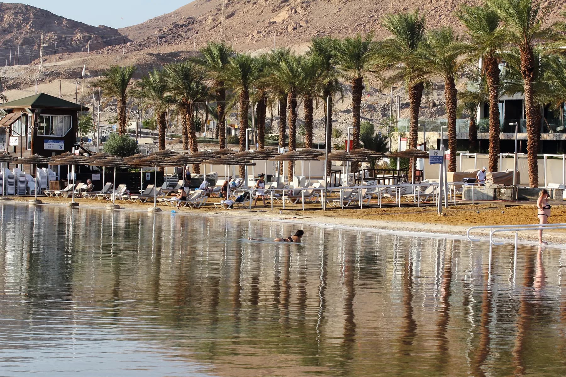
The free, lifeguarded public beach in front of the southern hotel strip, where the water is not the open Dead Sea but Pond 5, an evaporation pond of the mineral works, and the beach itself was raised two metres and rebuilt between 2012 and 2016.
israel zeller ישראל זלר / CC BY 2.5 · Wikimedia Commons
Museum
Moshe Novomeisky Visitor Center
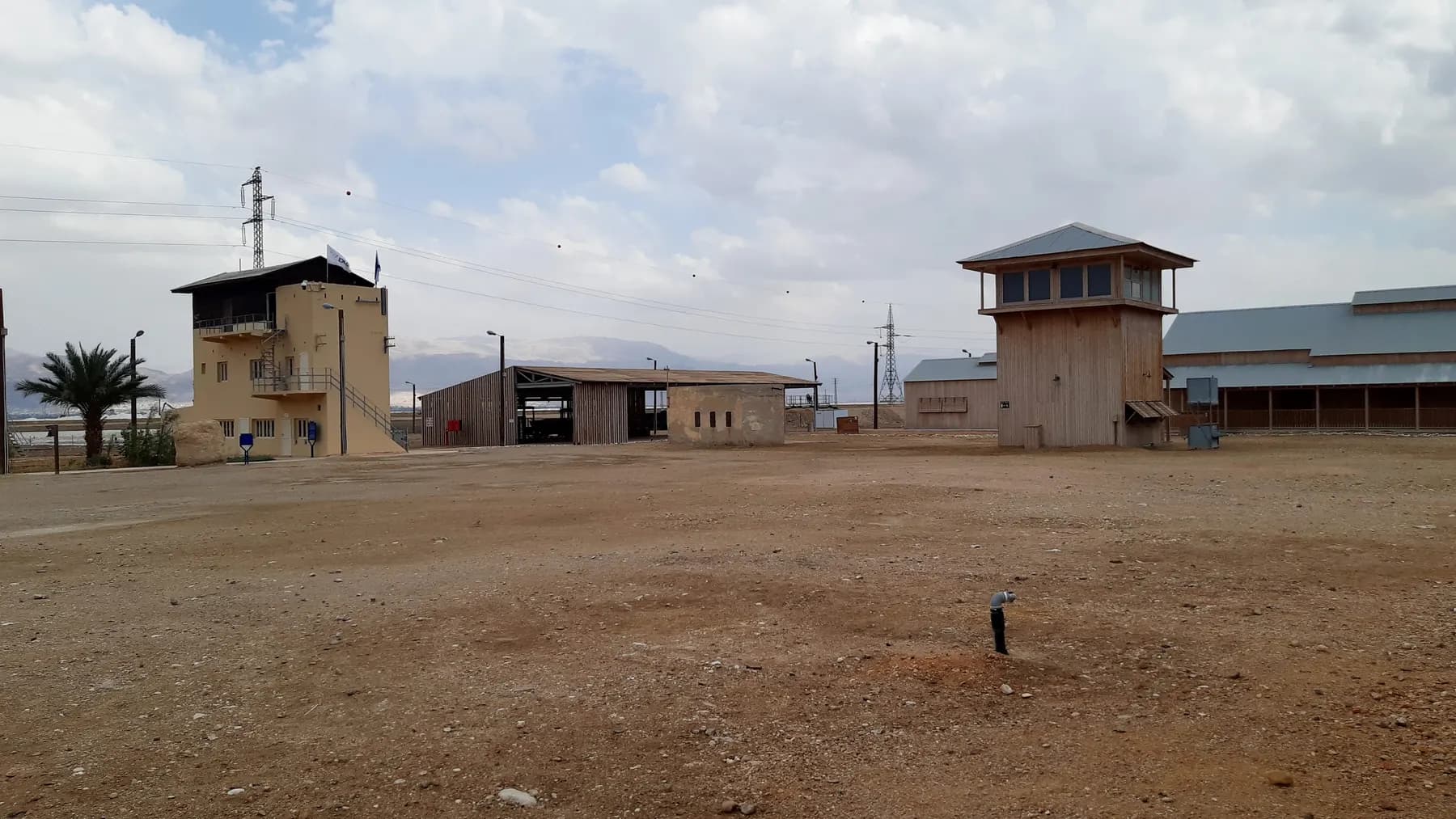
The restored workers' camp of Palestine Potash at Sdom, lived in from 1934 until the early 1950s, open only on a guided tour of about ninety minutes.
In-bar / CC BY-SA 4.0 · Wikimedia Commons
Nature reserve
Ein Gedi Nature Reserve
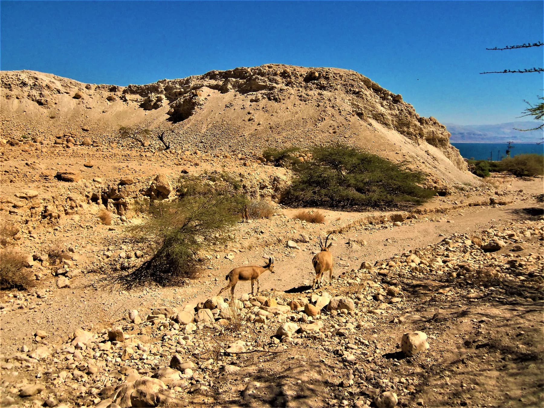
Four springs push about three million cubic metres of fresh water a year through two desert canyons here, and the parks authority has been rebuilding the trails between them since a flood tore through the reserve in May 2025.
Sources and further reading
Every link below was opened and checked when this page was written. Official statements are marked as such: they are the subject's own account, not an independent one.
- OfficialIsrael Nature and Parks Authorityparks.org.ilJudean Desert Nature Reserve
opening hours, the ban on walking after dark, the salt plug's dimensions, the warning about deep chimneys and the Mishor Amiaz camping directions
- OfficialIsrael Nature and Parks Authorityparks.org.ilThe Fish Trail on Mount Sodom
route length and grade, map sheet 11, the start and finish points, the Button Lookout, the fossil fish and the height above the lake
- OfficialIsrael Nature and Parks Authorityparks.org.ilJudean Desert: Nahal Peratzim full-moon walk
the guided activity at the foot of Mount Sodom, its price and its members-only condition
- ReportingBBC Newsbbc.comWorld's longest salt cave discovered in Israel
Malham Cave at 10 km, the two-year survey, Yoav Negev and Boaz Langford, and the Iranian record it displaced
- ReportingMakomako.co.ilThe world's longest salt cave has been found in Israel
the earlier 5.5 km figure, the survey method, the Bulgarian collaboration, the cave's radiocarbon age and the fact that it is closed to the public
- ReportingThe Baltimore Sunbaltimoresun.comPunished for looking back, Lot's wife may fall forward
the 80 per cent salt figure, the cap rock, the 15 degree tilt of the pillar and the interviews with the ranger and the potash company geologist
- ReferenceGeological Society of America Bulletindoi.orgFormation and dating of a salt pillar in Mount Sedom diapir, Israel
Amos Frumkin's dating of a 20 m salt pillar to a collapsed karst cave, the radiocarbon ages and the 9.3 mm a year uplift measurement
- ReferenceGeochemistry, Geophysics, Geosystemsdoi.orgMechanical modeling and InSAR measurements of Mount Sedom uplift
the effective viscosity of the rock salt, the radar uplift maxima for the two halves of the mountain and the finding that uplift has been stable for about 14,000 years
- ReferenceEarth Surface Processes and Landformsdoi.orgRapid entrenchment of stream profiles in the salt caves of Mount Sedom, Israel
salt as roughly a thousand times more soluble than limestone, the rainfall figure and the cave downcutting rates
- ReferenceThe Holocenedoi.orgThe Holocene climatic record of the salt caves of Mount Sedom, Israel
the radiocarbon range of wood in the cave passages and the climate sequence built from it
- ReferenceSefariasefaria.orgGenesis 19:26
the verse the pillar is named for, in the Jewish Publication Society translation
- ReferenceUniversity of Chicago, Penelopepenelope.uchicago.eduAntiquities of the Jews, Book 1, Chapter 11
Josephus's statement that he had seen the pillar of salt and that it remained in his day
Mount Sodom and Lot's Wife: common questions
Where exactly is Mount Sodom?+
It runs along the south-western shore of the Dead Sea, west of Route 90, between the Dead Sea Works and the southern end of the lake, and it sits inside the Judean Desert Nature Reserve. The parks authority's directions use the kilometre markers on Route 90 rather than a named entrance, because there is not one.
Is there an entrance fee?+
No. The parks authority publishes no admission charge for the Judean Desert Nature Reserve and there is no ticket office at Mount Sodom. Its guided activities in the area are separately ticketed, and the full-moon walk in Nahal Peratzim advertised for 27 August 2026 was priced at ₪20 for an adult and ₪10 for a child, for Matmon members only.
Can you go inside the salt caves?+
Not on your own, and not on a normal visit. Malham Cave, the longest salt cave in the world, is not arranged for public visits and any entry needs a caver who knows the system. The parks authority's line for everyone else is to stay on the marked trails, because the shafts that lead into those caves are open in the ground.
Which pillar is Lot's wife, and can you get to it?+
The pillar shown as Lot's wife stands on the eastern face of the mountain above the road, and it is best seen from the ridge above rather than from beside it. It is one of several salt pillars: the Baltimore Sun reported in 1991 that it had tilted 15 degrees away from the mountain and might eventually fall, and none of the sources here identify it with the pillar Josephus said he saw in the first century.
How long is the walk and how hard is it?+
The parks authority's recommended route, the Fish Trail, is 3 kilometres, linear rather than circular, and graded medium to hard for fit walkers. Allow two to three hours on the mountain plus the drive in on dirt roads, and note that the finish is several kilometres up Route 90 from where you park.
Is there shade or drinking water?+
Neither. There is no shade on the ridge and no water point anywhere in the reserve, and the parks authority's standing instruction is that visitors must carry enough water with them and must not rely on natural water sources. Mean rainfall here is around 50 millimetres a year.
Is it suitable for children?+
For sure-footed children on the marked trail, with adults watching closely. The parks authority's own trail page warns of giant holes in the ground and tells parents to keep an eye on children, and the reserve page warns against leaving the marked path because of deep shafts. It is not a route for pushchairs or for small children who wander.
Is it worth going, or is the view from Route 90 enough?+
The view from the road shows a white ridge and, if you know where to look, the pillar. What the road cannot show is the vertical salt bedding, the fossil fish, the chimneys and the panorama south over the evaporation ponds to Moab, which is the part the parks authority rates among the best in the region. If you would not walk 3 kilometres over broken ground in the heat, the roadside look is a fair trade.
When is the best time of year and time of day?+
Autumn, winter and spring, and early morning or late afternoon. Those are the parks authority's own recommendations: the seasons because the harder desert routes are not meant for summer, and the hours because the light across the ridge and the mountains of Moab is at its best when the sun is low. Winter carries the opposite risk, of flash floods in the wadis.
Is Mount Sodom the biblical Sodom?+
No, and nothing on the mountain claims it is. The ridge takes its name from the biblical city and the story is what draws people to the pillar, but the mountain is a salt diapir squeezed up out of the valley floor, not a ruin. Nothing on it has been excavated or rebuilt.