Nature reserve · Caesarea
Taninim Stream Nature Reserve
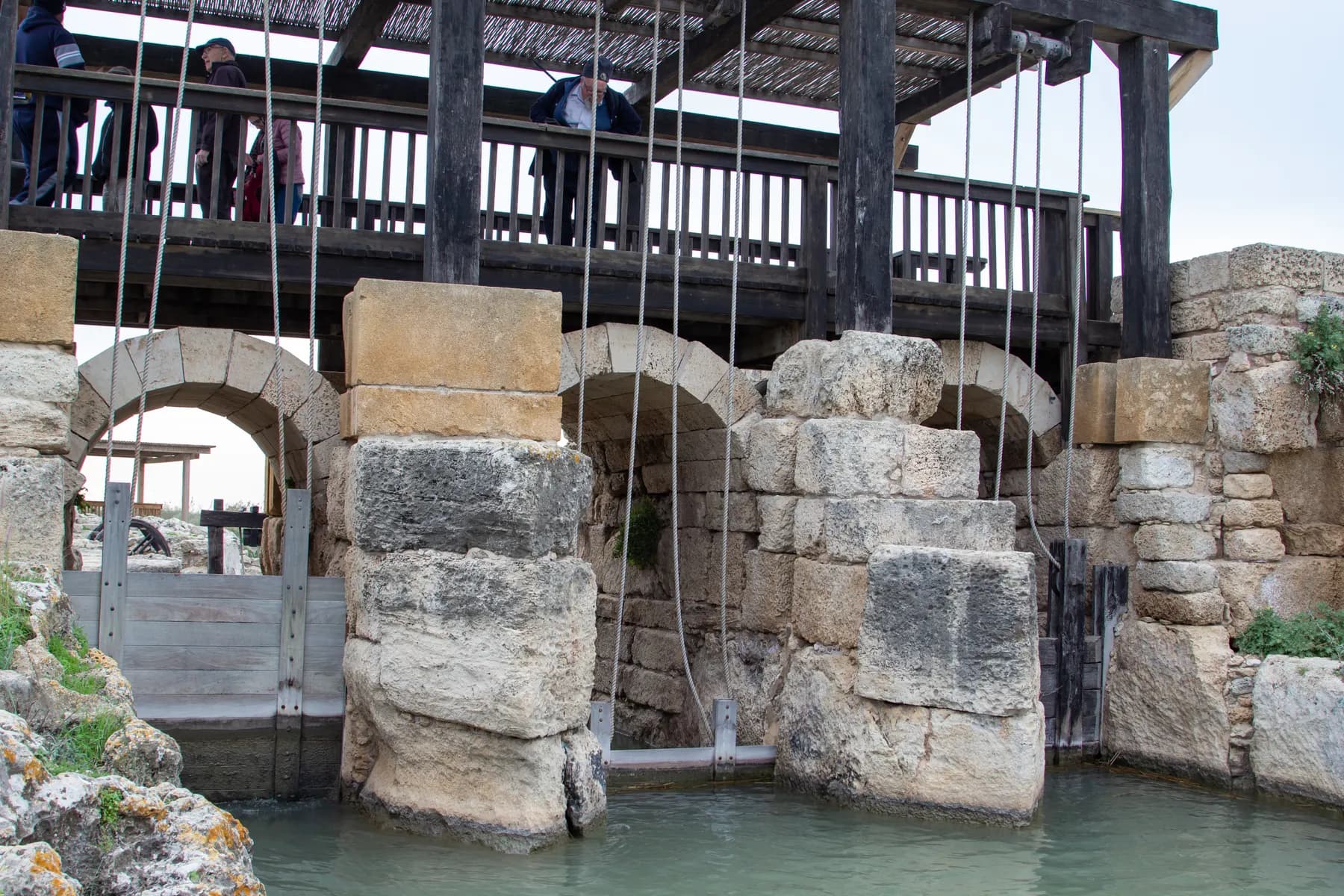
A stone wall 194 metres long, thrown across the gap the stream cut through the kurkar ridge, raised the water by three metres and turned the Kebara valley into a lake of about 6,000 dunams, which is the only reason Caesarea's low aqueduct could run downhill.
מיכל פריימן / CC BY 2.5 · Wikimedia Commons
The dam
194 m long
4 m wide at the crest and 10 m at the base, as the parks authority gives it
Lake it raised
about 6,000 dunams
held between this dam and a second one about 2 km to the north
Flour mills excavated
six Byzantine, seven Ottoman
the Ottoman group alone worked 13 milling stations
Adult admission
₪24
Israel Nature and Parks Authority list price, 2026
In short
- How long to give it
- about 90 minutes, and up to three hours if the whole trail network and the wet route are walked
- Summer, Sunday to Thursday and Saturday
- 08:00 to 17:00
- Adult
- ₪24
שמורת נחל תנינים
Taninim Stream Nature Reserve is a narrow strip of perennial coastal stream and kurkar ridge north of Jisr az-Zarqa, built around the dam that made Caesarea's second water supply possible. It lies about 5.7 km north of Caesarea harbour, and nearly everything in it is one engineering problem and its answer: the springs feeding the stream rise too low to reach the city, so the water had to be pooled behind a wall until it stood high enough to run there by gravity.
What a visitor walks is a made path along the southern bank, roughly 1.5 km of it running down to the stream mouth, with shorter loops that fill one to three hours. The set pieces are the dam, the regulating installation at its heart with its lifting wooden gates, the quarried hillside below it full of flour mills, and a rock-cut aqueduct abandoned half-finished and now walked through in about 45 cm of water.
The name is literal and no longer accurate. Taninim means crocodiles, and Nile crocodiles lived in the Kebara marshes beside the stream until the early twentieth century: the last one recorded here was hunted in 1912. What survives of that world is water quality rather than wildlife. The stream is fed by the Timsah springs, never pumped because they run brackish, and it was never used as a sewer, so it stayed wet and comparatively clean while most coastal streams did neither.
Engineering
Springs that sat too low for the city they had to supply
By the late Roman period Caesarea had outgrown the high-level aqueduct, which had taken every spring within reach that stood at a usable height. The nearest large untapped source was the cluster of springs in the Kebara basin, near what is now Kibbutz Ma'agan Michael. The catch was elevation. Those springs rise between three and a half and four metres above sea level, and the water had to reach roughly six metres to run into Caesarea at all.
The answer was to stop treating the marsh as a marsh and turn the whole of it into a header pool. Two dams of large ashlar went in. One, the wall standing in this reserve, blocked the breach that Nahal Taninim and its tributary Nahal 'Ada had cut westward through the kurkar ridge to the sea. The second, about 2 km north and far longer, closed the basin at its northern end. Between them, the Carmel and the ridge, the springs filled a sheet of standing water the parks authority puts at about 6,000 dunams.
What came out of it is easy to underrate. Published calculations give the low-level aqueduct, the one starting at this dam, a capacity of some 2,560 cubic metres an hour: more than the high aqueduct's first channel and its Hadrianic second channel together. The two supplies differed in kind as well. The high aqueduct carried spring water of drinking quality from the upper valley at Shuni; this one carried lake water, brackish and full of whatever the basin held.
The figures are not quoted identically everywhere. The parks authority gives the dam as 194 metres long and the lake as about 6,000 dunams; the Hebrew accounts of the Caesarea aqueducts and the iNature reserve entry round the dam to 200 metres and put the reservoir nearer 5,000 dunams, six metres deep.
- Springs rise at about 3.5 to 4 m above sea level; the water had to reach about 6 m to flow to Caesarea
- Two dams: this one across the ridge, and a second of about 900 m to the north
- Low-level aqueduct capacity: about 2,560 m³ an hour
- High-level aqueduct, for comparison: about 930 m³ an hour in Channel A and 1,630 in Channel B
Fabric
What is original, what is Ottoman, and what was put back
The dam was excavated by the Israel Antiquities Authority between June 2001 and August 2002, under 'Abed a-Salam Sa'id and Uzi 'Ad, with the parks authority and funding from the Ministry of Environmental Affairs and the Carmel Drainage Authority. The dig was a preliminary to conservation and public opening. The excavators dated the wall to the end of the Roman period and the beginning of the Byzantine; the parks authority puts it at the start of the fourth century CE at the latest.
Very little of what you stand on is ancient. Across the crest, everything down to between 0.7 and 1.5 metres below the present walkway proved to be Ottoman fill, with almost nothing of the original top beneath it. The core is rubble and reused ashlar bonded with grey mortar, most of it washed out where water got in. The eastern face was cast against wooden formwork that left its impressions, and patches of pink Byzantine hydraulic plaster survive there. One trench went to over two metres below sea level without reaching the bottom of the foundation.
The wall is not a uniform thickness either, and the parks authority explains why: supports were added over the centuries to stop it collapsing. One find dates it from underneath. A rock-cut burial cave at the northern end of the foundation was sealed when the dam went up, and held three limestone sarcophagi of a Samaritan type common in the second and third centuries CE.
The most conspicuous features are reconstructions and are worth recognising as such. The wooden gates in the regulating installation were rebuilt, and raising them releases water from the pool behind. The parks authority calls the full reconstruction of an ancient dam to recreate its lake one of the wonders of the site, and says it may be unique in the world. That is the operator's assessment of its own work, but it describes an unusual decision: most excavated waterworks here are conserved dry.
Milling
Six wheels turning the wrong way round for this country
Below the western foot of the dam the kurkar is cut away into a hillside of quarried chambers, and those chambers are flour mills. Six were hewn in the Byzantine period; seven more were built in the late Ottoman period, running 13 milling stations between them, two of them with four stations each.
The Byzantine six are the reason archaeologists come. Their feeder channels carry circular scour marks, and from those marks the excavators reconstructed the wheel that made them: between 1.9 and 2.3 metres across, and vertical, mounted so the water strikes its blades on the way past. The parks authority states that a Byzantine vertical wheel of this kind is not known anywhere else in Israel, and that the type is otherwise recorded here only from the Crusader period. The Ottoman mills use the commoner arrangement: a built and plastered vertical shaft about 1.3 metres across, dropping water onto a horizontal wheel at the bottom.
The two systems were never in use together. The Byzantine feeder channels were deliberately blocked in the Ottoman period, apparently to clear access to a newer mill, and the fill sealing them dates the closure.
Several wheels have been reconstructed, and the small lake retained beside the dam holds enough water to turn two of them. The parks authority is explicit that only reserve staff operate them, so a turning wheel is something a visitor may see and cannot arrange.
Abandoned works
The aqueduct that was cut, then given up on
The strangest thing in the reserve is a channel that never carried water. Running south from the dam, the excavators traced a rock-cut aqueduct for 390 metres: a narrow slot 45 to 50 cm wide at the bottom and up to 2.5 metres deep, with ledges along the top for covering slabs. Where it met the low-level aqueduct to Caesarea, that later channel rode piggyback on it for 145 metres, and at the point of divergence a wall was built inside the older cutting to push its water across into the Caesarea line.
Then the excavation followed the abandoned channel past the junction and found the quarrying had never been completed. Sa'id and 'Ad concluded that this aqueduct never functioned. The parks authority offers the reason: its builders worked out that the fall between the head of the channel and the city was not enough to move water to Caesarea, and stopped.
The low-level aqueduct that replaced it carries a puzzle nobody has resolved. Excavated for 320 metres from its outlet in the distribution pool, its floor sits about half a metre lower at the northern end than at the southern, which is the wrong way round for water heading south to Caesarea. The excavators wrote that the reason for this reverse gradient is still unclear. The standard account of the Caesarea aqueducts says something equally odd: the low channel has no gradient at all, and moved its water on the strength of its cross-section.
The unfinished cutting has ended up as the reserve's best half hour: a wet route 260 metres long in about 45 cm of water, and the only place the parks authority permits anyone into the water at all.
Afterwards
A thousand years of lake, then malaria, then pipes from France
The reservoir long outlived the empire that built it. It held for roughly a thousand years before silt and neglect turned the standing water into the Kebara marshes, a breeding ground for anopheles mosquitoes and a focus of malaria on the coastal plain. The people who lived off it were the Arab al-Ghawarina, who fished the marsh, grazed water buffalo on it and wove mats from its papyrus and reeds.
Draining it was a Rothschild project. The Jewish Colonisation Association bought the marshland in 1922 with the baron's money, put around a quarter of a million pounds into the works and brought in a French engineer, Léon Cron, who had drained swamps in Algeria. PICA, which took the association's place in 1924, bought replacement land for the Bedouin and in 1926 built them Jisr az-Zarqa on the kurkar ridge, the town whose roundabout you now turn at to reach the reserve car park.
The engineering was rescued by a labourer. Dov Kovlanov arrived as an ordinary worker, turned out to be a Russian agricultural engineer specialising in drainage, judged that Cron's plans would not solve the problem and submitted his own. They went to Paris, were approved, and he took over. His method was to find the thousands of underground seepages feeding the marsh and pipe them: brackish water to the sea, fresh water to the fields. That took some 50 km of clay pipe, imported from France because local clay would not make it.
The crocodiles went out with the marsh. Henry Baker Tristram recorded the capture of one over three and a half metres long in the Zarqa in 1864 and thought it the only crocodile ever taken in Asia; a female of about three metres with 48 eggs in her was caught in 1877. The last was hunted in 1912 and still exists, preserved in Father Ernst Schmitz's zoological collection, now held by the Steinhardt Museum of Natural History at Tel Aviv University.
On the ground
Where the reserve starts, where it ends and what is next to it
The reserve is small and long, running along both banks from the coastal highway to the sea. iNature gives its declared area as 348.55 dunams, accumulated in stages: two blocks totalling 55.3 dunams in the summer of 1972, an extension of 211 dunams in December 1992 that carried it down to the shore, and a redesignation in December 2015 turning about 11.5 dunams into national park so the entrance buildings could stand there legally.
The approach matters, because the obvious one is shut. The old access from Kibbutz Ma'agan Michael to the north is now closed by a gate; the working entrance is reached from the old Haifa to Tel Aviv road, over the bridge above the coastal highway towards Beit Hananya, then round to the roundabout at Jisr az-Zarqa. Without a car, bus 68 from Hadera stops about 350 metres south of the ticket office.
Two things worth walking to sit outside the main circuit. The stream mouth carries the remains of a stone bridge built at the end of the Ottoman period for Kaiser Wilhelm II's visit in 1898, and immediately south of it stands Tel Tanninim, the Krokodeilon polis of Strabo and Pliny, dug between 1996 and 1999 by Robert R. Stieglitz of Rutgers University. Its Byzantine and Crusader names both mean saltworks tower.
The stream repays a slow walk. Yellow water lily and hornwort grow in the channel, both uncommon, and the salt-tolerant plants on the banks are there because the water is brackish. Soft-shelled and marsh turtles, catfish and tilapia live in it, herons nest in the eucalyptus stand between Taninim and 'Ada, and the hillside north of the old dam flowers heavily with autumn narcissus in mid-November.
What to look for
Things not to walk past at Taninim Stream Nature Reserve
The details that repay knowing about before you are standing in front of them.
The regulating installation
The working heart of the dam: three sluices whose wooden shutters controlled how much water left the lake. The boards later did second duty as formwork when the lower parts of the sluices were cast shut to raise the flow level.
The wet route through the unfinished aqueduct
A 260 metre walk in about 45 cm of water along a Roman channel that was cut and then abandoned before it ever ran. It is the only place in the reserve where entering the water is allowed.
The Byzantine rock-cut mills
Six mill chambers quarried into the kurkar below the dam, driven by vertical paddle wheels of between 1.9 and 2.3 metres, a type the parks authority says is not known elsewhere in Israel from this period.
The distribution pool
A pool of about 5 by 7 metres beside the sluices, walled on the south with reused ashlars and marble columns. From here water went to Caesarea, to the mills, or straight back into the stream.
Autumn narcissus on the north hill
The kurkar rise north of the ancient dam flowers heavily around mid-November. It is the one date on which the reserve's plant list, rather than its masonry, is the reason to come.
The Kaiser's bridge at the stream mouth
A stone bridge at the mouth, built at the end of the Ottoman period for Wilhelm II's visit to the country in 1898, and the reason the town on the ridge is called Jisr az-Zarqa, the blue bridge.
The long view
Taninim Stream Nature Reserve, in order
4th century BCE
Tel Tanninim at the stream mouth is settled. Greek writers know the place as Krokodeilon polis, the crocodiles' city.
2nd-3rd century CE
Burial caves are cut in the kurkar ridge north of the future dam line, one of them holding Samaritan-type limestone sarcophagi.
Late 3rd to early 4th century CE
The dam is built. Sa'id and 'Ad date it to the end of the Roman and start of the Byzantine period; the parks authority says the start of the fourth century at the latest.
4th century CE
The aqueduct and fish ponds at Tel Tanninim go in, and stay in use until the end of the seventh century.
5th or 6th century CE
The distribution pool beside the sluices is refloored in stone, over a fill of collapse, soil and discarded millstones.
640/1 CE
Caesarea falls to the Muslim armies. The lake outlasts the system it served by centuries before silting into the Kebara marshes.
Ottoman period
The dam crest is rebuilt and seven built mills with 13 milling stations replace the Byzantine wheels, whose feeder channels are blocked.
1898
A stone bridge is put across the stream mouth for the visit of Kaiser Wilhelm II.
1912
The last crocodile recorded in the stream is hunted. Its remains survive in Ernst Schmitz's collection, now at Tel Aviv University.
1922-1926
The Jewish Colonisation Association buys the marsh with Rothschild money and begins draining it; PICA builds Jisr az-Zarqa for the displaced Ghawarina in 1926.
1972
The reserve is first declared, as two blocks totalling 55.3 dunams. An extension of 211 dunams in December 1992 carries it to the sea.
2001-2002
The Israel Antiquities Authority excavates the dam ahead of conservation and public opening. Charging for entry begins on 14 October 2004.
Practical
Visiting Taninim Stream Nature Reserve
Where
Taninim Stream Nature Reserve, north of Jisr az-Zarqa, reached from the old Haifa to Tel Aviv road via Beit Hananya
What ticket you need
This is not part of Caesarea National Park and a Caesarea ticket is neither needed nor valid here. It is a separate Israel Nature and Parks Authority site about 5.7 km north of the harbour with its own gate and its own price list, so an adult pays ₪24 here against ₪46 at Caesarea. A small piece of the reserve around the entrance buildings was redesignated as national park at the end of 2015, which changes the paperwork and nothing a visitor sees.
Opening hours
- Summer, Sunday to Thursday and Saturday
- 08:00 to 17:00source
- Summer, Friday and holiday eves
- 08:00 to 16:00source
- Winter, Sunday to Thursday and Saturday
- 08:00 to 16:00source
- Winter, Friday and holiday eves
- 08:00 to 15:00source
- Holiday eves and the eve of Yom Kippur
- 08:00 to 13:00source
- Last entry
- One hour before the closing time listedsource
Admission
Access
The first half of the visit is genuinely accessible and the second half is not. The parks authority lists the car park outside the gate with entry on foot, the entrance plaza, the shop, a shaded picnic area and drinking fountain, and toilets, then a concrete path running from the plaza to the bank of the stream and on to the ancient bridge over it, with benches on the bank, a viewpoint over the dam and the aqueducts, handrails on the steps and explanatory signage throughout. Past the bridge the trail changes to compacted base, which a wheelchair may or may not manage depending on the chair and on recent weather. The wet route through the unfinished aqueduct is a rock-cut channel in about 45 cm of water with an uneven floor, and is not accessible. There is no steep climb anywhere in the reserve.
On site
- Ticket office
- Toilets
- Drinking fountain
- Shaded picnic area
- Service shop (cold drinks, ice cream, hats, sunscreen)
- Benches on the stream bank
- Viewpoint over the dam
- Car park outside the gate
- No dogs
- No fires or barbecues
Booking
The parks authority runs an online reservation system for this reserve. Booking is not compulsory, but it holds a place for the date and time chosen, and if the site is at capacity when you arrive the confirmation is what gets you through the gate. Ask at the ticket office whether staff plan to run a mill wheel that day: only they can operate them.
Hours and prices are given as the operator publishes them and change without much notice, particularly around Shabbat and the festivals. Check the operator's own page before you travel for this.
Official page at en.parks.org.il →What people wish they had known
- Do not confuse this with the arcade on the beach at Caesarea. That is the high-level aqueduct, it is free, and it is about 5 km south. This is a ticketed nature reserve at the far end of a different channel, and the two need separate stops.
- Bring footwear you are willing to soak. The 260 metre route through the unfinished aqueduct is the only stretch of water anyone is allowed into, the floor is cut rock rather than sand, and dry shoes will make you skip the best part of the visit.
- Do not plan the trip around seeing a mill wheel turn. Two reconstructed wheels can be driven by the retained lake, but the parks authority states that reserve staff alone operate them, so it happens when they decide it does.
- Do not aim for the Ma'agan Michael side. That northern approach is closed by a gate, and the working entrance is off the roundabout at Jisr az-Zarqa, reached over the bridge above the coastal highway near Beit Hananya.
- Watch the closing time rather than the opening one. Last entry is a full hour before the posted close, Fridays and holiday eves shut an hour earlier again, and in winter that can mean the gate stops admitting at 15:00.
- Go in the middle of November if the walk matters more than the masonry. The rise north of the old dam carries a dense flowering of autumn narcissus then, and it is the reserve's one reliably seasonal sight.
The figures
Taninim Stream Nature Reserve by the numbers
Each figure carries the year it belongs to and links the source it came from.
| Measure | Figure | As of | Source |
|---|---|---|---|
| Length of the dam | 194 m | 2026 | parks.org.il |
| Area of the lake it created | about 6,000 dunams | 2026 | en.parks.org.il |
| Height the dam added to the stream | 3 m | 2026 | en.parks.org.il |
| Capacity of the low-level aqueduct to Caesarea | about 2,560 m³ an hour | 2026 | he.wikipedia.org |
| Diameter of the Byzantine vertical paddle wheels | 1.9 to 2.3 m | 2004 | hadashot-esi.org.il |
| Length of the unfinished rock-cut aqueduct exposed | 390 m | 2004 | hadashot-esi.org.il |
| Wet route through it, and its depth | 260 m, in 45 cm of water | 2026 | parks.org.il |
| Declared area of the reserve | 348.55 dunams | 2026 | inature.info |
While you are here
The rest of Caesarea
Everything else in this destination with a page of its own.
שי קנדלר / CC0 · Wikimedia Commons
Neighbourhood
Jisr az-Zarqa
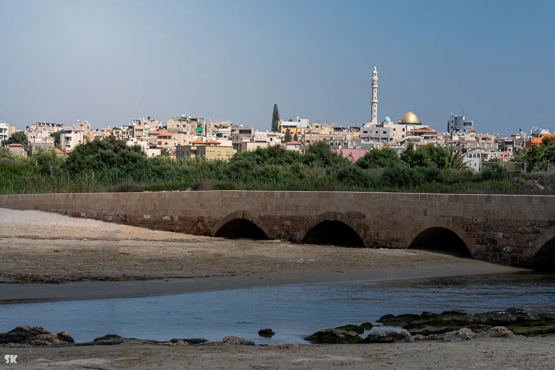
The town on the ridge north of Caesarea was laid out in 1926 for marsh dwellers displaced when the Kabara swamp was drained, and its local council calls the fishermen's village below it the only one still working on the Israeli coast.
Beach
Caesarea Aqueduct and Aqueduct Beach
The arcade behind the sand north of the harbour is two Roman aqueducts built hard against each other, and in February 2026 three bodies signed a ₪39 million agreement to stabilise all 85 of its arches.
זאב שטיין / CC BY 2.5 · Wikimedia Commons
Archaeological site
Herod's Harbour (Sebastos)
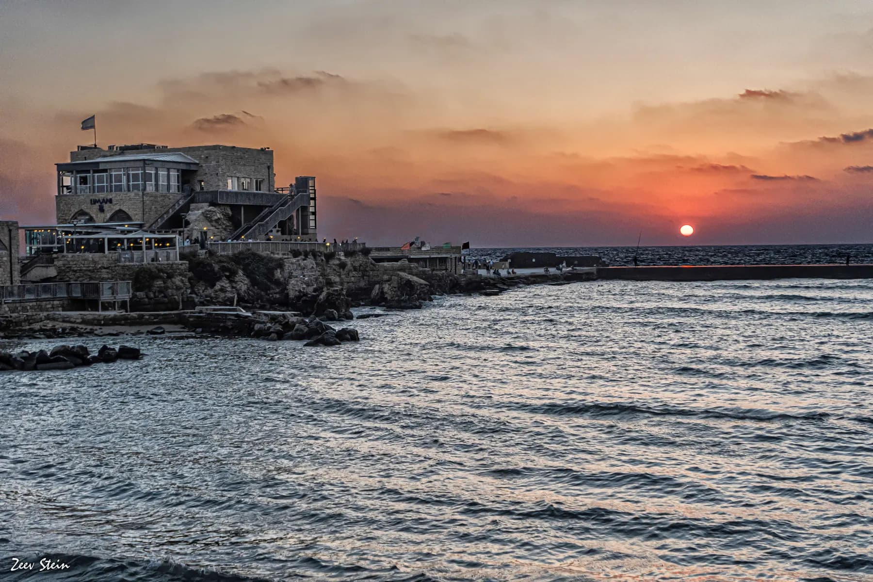
The breakwaters that made Caesarea possible are still there, five to seven metres down, and the harbour began settling into the seabed almost as soon as it was finished.
Sources and further reading
Every link below was opened and checked when this page was written. Official statements are marked as such: they are the subject's own account, not an independent one.
- OfficialIsrael Nature and Parks Authorityen.parks.org.ilTaninim Stream Nature Reserve
the operator's English page: summer and winter hours, last entry an hour before closing, the price list, the 6,000 dunam lake, the second dam 2 km north, and the Byzantine vertical paddle wheel
- OfficialIsrael Nature and Parks Authorityparks.org.ilשמורת טבע נחל תנינים
the fuller Hebrew page: the dam at 194 m long, 4 m at the crest and 10 m at the base, the 260 m wet route in 45 cm of water, the accessibility inventory, the full price list including reservists and pupils, and the clay pipe works
- OfficialIsrael Nature and Parks Authorityen.parks.org.ilCaesarea National Park
the separate ticket at the other end of the aqueduct, ₪46 for an adult and ₪27 for a child, confirming that the two sites are not one admission
- ReferenceIsrael Antiquities Authorityhadashot-esi.org.ilNahal Tanninim Dam, Hadashot Arkheologiyot 116
the excavation report by 'Abed a-Salam Sa'id and Uzi 'Ad: the late Roman to early Byzantine date, the wooden formwork and hydraulic plaster, the Ottoman fill over the crest, the sluices and distribution pool, the mills, and the unfinished aqueduct
- ReferenceIsrael Antiquities Authorityhadashot-esi.org.ilסכר נחל תנינים, חדשות ארכיאולוגיות 116
the Hebrew original of the same report, carrying the excavation permit numbers and the list of participating specialists
- ReferenceWikipediaen.wikipedia.orgNahal Taninim
the naming after the Nile crocodiles of the Kebara marshes, the last one hunted in 1912, and the description of the stream as the cleanest of Israel's coastal rivers
- ReferenceWikipediahe.wikipedia.orgנחל תנינים
the crocodile records: Tristram's capture of 1864, the female with 48 eggs in 1877, the 1912 hunt and the Schmitz collection, and the 1148 pilgrim's account
- ReferenceWikipediahe.wikipedia.orgאמות המים של קיסריה
why a second supply was needed: springs at 3.5 to 4 m above sea level against the 6 m the city required, the two dams of 200 m and 900 m, and the computed flows of 2,560 m³ an hour in the low aqueduct against 930 and 1,630 in the high one
- ReferenceWikipediahe.wikipedia.orgביצות כבארה
the lake surviving about a thousand years before silting, the Ghawarina, the 1922 purchase and the quarter of a million pounds spent, Léon Cron, Dov Kovlanov, and PICA founding Jisr az-Zarqa in 1926
- ReferenceiNatureinature.infoשמורת נחל תנינים
the declared area of 348.55 dunams and its 1972, 1992 and 2015 stages, charging beginning on 14 October 2004, the Timsah springs and why the stream stayed clean, bus 68 from Hadera, and the autumn narcissus north of the dam
- ReferenceWikipediaen.wikipedia.orgTel Tanninim
Krokodeilon polis in Strabo and Pliny, the saltworks names Migdal Malha and Turris Salinarum, and Robert R. Stieglitz's excavations of 1996 to 1999
Taninim Stream Nature Reserve: common questions
How much does Taninim Stream Nature Reserve cost?+
The Israel Nature and Parks Authority lists ₪24 for an adult and ₪10 for a child. A student pays ₪20 and an Israeli senior citizen ₪12. In groups of over 30 the rates drop to ₪20 and ₪9, a pupil pays ₪8, a reservist ₪18, and a soldier in compulsory, national or civilian service enters free on production of a valid card.
What are the opening hours?+
In summer the reserve opens 08:00 to 17:00 from Sunday to Thursday and on Saturday, and 08:00 to 16:00 on Fridays and holiday eves. In winter those become 08:00 to 16:00 and 08:00 to 15:00. Holiday eves and the eve of Yom Kippur close at 13:00. Entry stops one hour before the listed closing time in every case.
Is Taninim Stream inside Caesarea National Park?+
No. It is a separate nature reserve about 5.7 km north of Caesarea harbour, with its own gate, its own ticket and its own hours, and a Caesarea National Park ticket is not accepted here. The connection is historical rather than administrative: the dam in this reserve was the head of Caesarea's low-level aqueduct.
Can you swim or paddle in the stream?+
Only in one place. The parks authority permits entering the water in the aqueduct alone, which means the 260 metre wet route through the unfinished rock-cut channel, where the water runs about 45 cm deep. The stream itself is not a bathing site, and the reserve is not a swimming destination.
Is the dam Roman or Byzantine?+
It sits on the join, and the two published answers are compatible. The excavators, 'Abed a-Salam Sa'id and Uzi 'Ad, dated construction to the end of the Roman period and the beginning of the Byzantine. The parks authority puts it at the start of the fourth century CE at the latest. What you actually walk on top of is Ottoman, because the crest was rebuilt and the original upper core has gone.
Are there still crocodiles in Taninim Stream?+
No, and there have not been for over a century. The Nile crocodiles that gave the stream its name lived in the neighbouring Kebara marshes; the last one recorded here was hunted in 1912, and the animal itself is preserved in Ernst Schmitz's collection, now held by the Steinhardt Museum of Natural History at Tel Aviv University. Draining the marshes in the 1920s and 1930s removed the habitat as well as the animal.
Is it accessible for a wheelchair or a pushchair?+
Partly, and honestly so. The parks authority has surfaced a concrete path from the entrance plaza to the stream bank and on to the ancient bridge, with benches, a viewpoint over the dam and aqueducts, handrails on the steps and accessible toilets and picnic area. Beyond the bridge the trail becomes compacted base rather than concrete, and the wet route through the aqueduct is cut rock under water and cannot be done in a chair.
How long does a visit take?+
About 90 minutes covers the dam, the regulating installation, the mills and the wet route at an unhurried pace. The trail network can be stretched to three hours if you walk the roughly 1.5 km down the southern bank to the stream mouth and back. Nothing in the reserve is a climb, so the time is a function of distance rather than effort.
Is it worth it if I have already seen Caesarea?+
Yes, if the water system was the part of Caesarea that interested you, because this is the other half of it and the half that is explained on the ground. The national park shows you the city the water reached; this shows the wall that made the water reach it, plus the largest ancient milling complex on the stream. If you went to Caesarea for the theatre and the harbour, this will feel like a different sort of day out.
Can you get there without a car?+
Yes, with a walk. Bus 68 runs from Hadera to Jisr az-Zarqa and stops at Nahal Taninim Reserve, about 350 metres south of the ticket office. The old approach from Kibbutz Ma'agan Michael to the north is closed by a gate, so there is no useful alternative on that side.