
Activity · Caesarea
Caesarea Underwater Archaeological Park
Four marked trails and 28 numbered signs run over the drowned moles of Herod's harbour, the shallowest at four metres and the deepest at nine.
Marked trails
Four
leading to 28 numbered underwater signs
Depth range
4 m to 9 m
Track A, the snorkelling loop, to Track D at the harbour mouth
How far it has sunk
5 m to 7 m
subsidence of the Herodian structures, per the park's own guide
Snorkel hire
50 NIS
mask, snorkel and fins for the whole day, Old Caesarea Diving Center
In short
- How long to give it
- About 90 minutes for one snorkel or one guided dive, counting the briefing and the kit; about half a day for two dives
- April to November, Sunday to Thursday
- 09:00-17:00
- Independent snorkelling, including mask, snorkel and fins for the whole day
- 50 NIS
הפארק הארכיאולוגי התת-ימי
The Caesarea Underwater Archaeological Park is a set of four marked routes laid over the sunken harbour works of Sebastos, swum rather than walked. The trails lead to 28 numbered signs fixed to the seabed, and the operator, the Old Caesarea Diving Center, hands out a waterproof map keyed to those numbers before anyone gets in the water. Entry is from steps at the end of the quay, inside the harbour compound.
Only one of the four is a snorkelling route. Track A crosses the inner and middle basins in sheltered water no deeper than four metres, and the diving centre times it at 40 minutes. The other three want a tank: Track B along the base of the main mole and the subsidiary breakwater at six metres, Track C over the great breakwater at eight, and Track D across the harbour entrance and the northern mole at nine. What links them is that everything on the map was once above water, or meant to be.
The park is not a museum installation dropped on the seabed. Most of what the signs point at is Herodian concrete and ashlar sitting where it settled, but not all of it: the six anchors on Track B were gathered by excavators and set out as a teaching sequence, and the newest wreck on the site was deliberately sunk in 1950. The page below separates the two.
The trails
Four routes, and only one of them is a snorkel
The Old Caesarea Diving Center publishes a maximum depth and a time for each track. Track A, the sunken harbour's inner and middle basins, runs to four metres over 40 minutes and is the route it calls ideal for snorkelling: Herodian harbour ruins, granite and marble column shafts, the wreck of a steamer, and whatever Mediterranean fish are working the quay that morning. Track B follows the base of the main mole and the subsidiary breakwater to six metres over 45 minutes and takes in the ancient anchors. Track C crosses the great breakwater itself, at eight metres over 50 minutes, past basalt slabs, ancient concrete blocks, piers and a large pile of collapsed blocks. Track D is the deepest and the shortest, 30 minutes at nine metres over the harbour entrance and the northern breakwater, where the ruins of the two entrance towers and ashlar blocks lie.
The layout underwater follows the layout of the port, so the trails read as a plan rather than as a scatter of interesting objects. The enclosed anchorage was about 20 hectares in three basins. The inner one was dug inland and is now completely silted up, marked in the water by a round tower of ashlar blocks 13 metres across, laid with their narrow sides facing out, which may belong to the Hellenistic fortifications of Straton's Tower rather than to Herod's works at all. The middle basin sits in a natural bay and is still the working anchorage. The external basin, the largest, is the one the two breakwaters made.
The main breakwater arcs from south-east to north-west for about 500 metres and is 60 to 70 metres wide at the base. Estimates of the original width of the entrance channel between it and the northern mole range from 30 to 80 metres, which is a useful reminder of how much of this is still being argued from fragments. At the southern end of the mole stood the largest tower, the Drusion, which may have doubled as a lighthouse, and outside the entrance stood twin towers linked at the top by a platform built to carry sculpture that has not survived.
A guided dive with a Dive Master or instructor lasts about 45 minutes to a maximum of eight metres and opens with a talk on the harbour before anyone gets wet. Independent divers can rent gear and take the map out themselves.
- Track A: inner and middle basins, 4 m, 40 minutes, snorkellers
- Track B: base of the main mole and the subsidiary breakwater, 6 m, 45 minutes
- Track C: over the great breakwater, 8 m, 50 minutes
- Track D: harbour entrance and northern breakwater, 9 m, 30 minutes
Rediscovery
From a 1960 dive to a park that took thirteen years to open
The city was never lost. The harbour was. Its site slipped out of knowledge entirely, and the first underwater excavations here were headed by A. D. Link in 1960, at the point where recreational diving equipment was new enough to make the work possible at all. Galili, Salamon, Gambash and Zviely, writing in Geosciences in 2021, date the modern research programme from there.
Sustained work began in 1975, when the Center of Maritime Studies at the University of Haifa started on the harbour under Avner Raban and kept at it until his death in 2004. The same 2021 paper puts the Haifa programme at 1975 to 2005, headed by Raban throughout. It is his survey work, more than anything else, that the numbered signs are built on.
Raban proposed the underwater park in 1992. Nothing happened for thirteen years, and the project was only revived after his death; the guide text the diving centre publishes, written by Sarah Arenson, is drawn from his publications and dedicated to his memory. That gap is worth knowing about, because it explains the character of the place: this is a research trail turned into a visitor route, not a visitor attraction that acquired some archaeology.
What survives
Poured concrete in place, and an anchor collection that is not
The breakwater foundations are the real thing and are where they fell. They were made of concrete poured into wooden caissons prefabricated on shore, in sizes on the order of 14 by 7 metres and 15 by 11 metres; in places the timber survives, and in others the impression of the cross beams is still visible in the set concrete. The quays and superstructures above them used ashlar blocks reaching seven metres long and over ten tonnes, some joined with iron clamps fixed by lead poured in situ. The subsidiary breakwater Josephus calls the Prokumatia is also down there, about six metres wide and built deliberately never to rise above the water, so that it broke the winter waves before they reached the main mole.
The six anchors on Track B are a different case, and the guide says so plainly. They were collected by the excavators and placed together on the seafloor to show the anchor developing from the Bronze Age to the modern era, each set as it was designed to sit. One of the six, the composite wooden anchor of about 2,000 years ago, has a reconstructed shaft and arms; only its lead stock and assembling piece are original. This is an exhibit, arranged, in the middle of a site that is otherwise not arranged at all.
The most recent thing on the map is also the most obviously modern. In 1950 the State of Israel built a new quay for the fishermen of neighbouring Kibbutz Sdot Yam, and sank the metal hull of an old steamer, once used to carry illegal Jewish immigrants to Palestine after the Second World War, filled with cement, at the northern edge of the new breakwater. The guide notes without much sympathy that this modern concrete quay, at the time of writing only fifty years old, was already disintegrating.
In between sits the medieval reuse. Muslim and then Crusader builders took marble and granite columns out of the Roman ruins and laid them into a sea wall, a square tower and a jetty. The construction is poor: cemented rubble reinforced with column shafts. Some of the column drums a snorkeller sees on Track A are Roman stone in a medieval wall, not Roman architecture standing where it was put up.
Subsidence
Five to seven metres down, and the reason is still contested
The harbour began sinking almost as soon as it was finished. By the first century CE the head of the breakwater was already under water, which is known from the ships that wrecked on it, and subsidence today is put at five to seven metres. Quays and a pierced mooring stone that were built at water level now sit under five to seven metres of sea.
Why is the open question, and this site is a good place to watch a scholarly disagreement in progress. The park's own guide lists the candidates: a geological fault line running some 150 metres west of the present shoreline, earthquakes, possible tsunami waves, an unstable sandy bottom and the sheer weight of the structures. Galili and colleagues, in Geosciences in 2021, rejected most of that list, finding no conclusive evidence of active faults across the harbour, no reliable historical earthquake account and no unequivocal tsunami signal, and argued instead for geotechnical failure: winter storm waves and currents scouring, washing away or liquefying the sand under the foundations.
A 2025 remote sensing survey of the harbour entrance by Gambash, Arkin-Shalev, Wood, Nantet and Gambin, published in the Journal of Marine Science and Engineering, records that the debate now favours high-energy winter storms over tectonics, tsunami or sea level rise. That survey also puts numbers on the entrance a diver crosses on Track D: the northern breakwater's extremity at roughly 7.6 metres, the northern end of the southern breakwater averaging 7.3 metres, and structures outside the entrance at 7.4 to 8 metres. It reads the two sides of the entrance as architecturally different, with large ashlars up to three metres on the north and a rubble scatter on the south that may be a later attempt at repair.
The repair attempts are visible in the archaeology too. A trench dug across the entrance channel found that in the sixth century a rampart of rubble fill was laid right across it, in an effort to bring the decaying port back into use. It did not work.
Protection
The sea above the site is now a national park in its own right
In March 2021 the Haifa district planning and building committee approved for deposit a plan for a marine national park at Caesarea, the first in Israel. The plan covers roughly 1,096 dunams of sea west of the terrestrial national park, south of Aqueduct Beach and north of Kibbutz Sdot Yam, and was drawn up with the Israel Nature and Parks Authority and the Israel Antiquities Authority.
The parks authority sets out what it changes. Fishing stops in the core of the park and the movement of motorised craft inside it is reduced, both for the ecology and for the safety of the divers, snorkellers and swimmers who are already there. The plan also allows a floating jetty and operational areas for the diving club already working inside the terrestrial park. Before this, on the planning authority's own account, most Israeli coastal antiquity sites had only their land halves anchored as national parks, leaving the submerged part unprotected.
The scale is worth holding next to the figures on the destination page. The harbour itself covered about 200 dunams; the marine park drawn over and around it is more than five times that. What a visitor gets from the change is not a new exhibit but a quieter, better policed patch of water above a site that spent most of two millennia with nothing formal defending it.
What to look for
Things not to walk past at Caesarea Underwater Archaeological Park
The details that repay knowing about before you are standing in front of them.
The round tower on Track A
Ashlar blocks laid in a circle 13 metres across, narrow sides out, at the northern entrance to the now landlocked inner harbour. It may be part of the Hellenistic fortification of Straton's Tower, the town that preceded Caesarea.
The six anchors on Track B
A stone weight anchor of the Bronze Age, a three-holed composite stone, a composite wooden anchor about 2,000 years old, a wrought iron Roman anchor, a medieval grapnel and an admiralty anchor. Gathered here by the excavators and laid out as they were meant to work.
The Prokumatia
Josephus's name for the subsidiary breakwater, about six metres wide, built deliberately never to break the surface so that it absorbed the winter waves before they hit the main mole. Roman harbour engineering solving a problem modern engineers still have.
The caisson impressions
Concrete poured into wooden forms prefabricated on shore, in sizes on the order of 14 by 7 and 15 by 11 metres. In places the timber survives; in others the cross beams left their shape in the set concrete.
The cemented steamer
The hull of a ship that carried illegal Jewish immigrants after the Second World War, filled with cement and sunk in 1950 at the northern edge of the new quay built for the Sdot Yam fishermen. It is on the snorkelling route.
The twin entrance towers on Track D
The ruins of the two towers that marked the way in, at nine metres. They were joined at the top by a platform designed to carry sculpture, none of which survives.
The long view
Caesarea Underwater Archaeological Park, in order
22-10 BCE
Herod builds Sebastos and the city around it, in twelve years.
1st century CE
The head of the breakwater is already submerged, attested by ships wrecked over it.
6th century CE
A rampart of rubble fill is laid across the entrance channel in an attempt to revive the decaying port.
Middle Ages
Muslim and Crusader builders reuse Roman marble and granite columns in a sea wall, a square tower and a jetty.
1950
Israel builds a quay for the Sdot Yam fishermen and sinks a cement-filled steamer hull at the north edge of the new breakwater.
1960
The first underwater excavations in the harbour are headed by A. D. Link.
1975
The Center of Maritime Studies at the University of Haifa begins sustained work under Avner Raban.
1992
Raban proposes an underwater archaeological park over the drowned harbour.
2004
Raban dies; the Haifa programme he led runs to about 2005.
2005
The park project is revived, thirteen years after it was first proposed.
March 2021
The Haifa district committee deposits the plan for Israel's first marine national park, about 1,096 dunams of sea.
Practical
Visiting Caesarea Underwater Archaeological Park
Where
Old Caesarea Diving Center, Caesarea harbour, inside Caesarea National Park
What ticket you need
The diving centre sits inside the harbour compound of Caesarea National Park, so reaching it means paying the Caesarea Development Corporation's gate price before paying the diving centre's. Port-only admission is 18 NIS; the full single adult park ticket, which also covers the harbour visitors' centre, the theatre and the hippodrome, is 46 NIS.
Opening hours
- April to November, Sunday to Thursday
- 09:00-17:00source
- April to November, Friday, Saturday and holidays
- 07:00-17:00source
- December to March, Sunday to Thursday
- 10:00-16:00source
- December to March, Friday, Saturday and holidays
- 07:00-16:00source
- Holiday eves, all year
- 07:00-14:00source
- Sea conditions
- Dives and snorkels run only if the sea allows, and the centre asks for advance bookingsource
Admission
- Independent snorkelling, including mask, snorkel and fins for the whole day
- 50 NISsource
- Guided dive, group price with full gear
- 195 NISsource
- Guided dive, tank and weights only
- 100 NISsource
- Two guided dives with full gear
- 295 NISsource
- Private guided dive
- 380 NISsource
- Introductory dive, no certification needed, full gear included
- 310 NIS, or 400 NIS for the extended 45-minute versionsource
- Gear rental for certified divers, full gear for the whole day
- 180 NIS, tank refill 40 NISsource
- Port admission, Caesarea Development Corporation
- 18 NIS, not including the visitors' centre, theatre or hippodromesource
- Full national park ticket, single adult
- 46 NIS, children and soldiers 27 NISsource
Access
Entry is by steps at the end of the quay straight into open sea, with no ramp, no shallow beach shelving and no lifeguard on the trails. Wheelchair users cannot reach the water this way, and the whole site is unavailable to non-swimmers. The introductory dive is open from age eight with a signed medical declaration and a parent's signature under eighteen.
On site
- Gear hire
- Waterproof trail maps
- Air fills
- Guides and instructors
- Diving insurance sold on site
- Paid car park at the harbour
- Restaurants and cafes on the quay
Booking
Book ahead. Everything here is contingent on the sea: the centre states that execution of dives and snorkels depends on sea conditions. Israeli diving law requires certified divers to show their certification and valid diving insurance, and anyone below Dive Master level to show a log book with a dive stamped within the last six months. If six months have passed, a Refresh Dive comes first, at 240 NIS with full gear.
Hours and prices are given as the operator publishes them and change without much notice, particularly around Shabbat and the festivals. Check the operator's own page before you travel for this.
Official page at caesarea-diving.com →What people wish they had known
- Ring before driving out. Every activity here is conditional on the sea, and a swell that looks manageable from the quay is enough to close the trails for the day.
- Certified divers should bring the paperwork, not just the card. Israeli law wants the certification and valid insurance, and anyone below Dive Master also needs a log book with a dive stamped in the last six months, or the day turns into a paid Refresh Dive before anything else happens.
- Take the waterproof map into the water. The 28 signs are numbers, and without the key they stay numbers.
- Snorkellers should stay on Track A. The other three trails are tank routes, and the entrance channel in particular has waves and boat traffic across it.
- Budget for two gates. The quay is inside a paid compound, so the diving centre's price is on top of the harbour or park admission.
- In winter the centre opens an hour later on weekdays and shuts an hour earlier, which takes a serious bite out of a short day.
The figures
Caesarea Underwater Archaeological Park by the numbers
Each figure carries the year it belongs to and links the source it came from.
| Measure | Figure | As of | Source |
|---|---|---|---|
| Marked underwater trails | 4 | 2026 | caesarea-diving.com |
| Numbered signs on the seabed | 28 | 2026 | caesarea-diving.com |
| Deepest marked trail | 9 m, Track D | 2026 | caesarea-diving.com |
| Subsidence of the Herodian structures | 5-7 m | 2026 | caesarea-diving.com |
| Depth at the northern breakwater extremity | about 7.6 m | 2025 | mdpi.com |
| Enclosed anchorage, as the park guide gives it | about 20 hectares | 2026 | caesarea-diving.com |
| Main breakwater, length and width at base | about 500 m long, 60-70 m wide | 2026 | caesarea-diving.com |
| Marine national park plan area | about 1,096 dunams | 2021 | ynet.co.il |
While you are here
The rest of Caesarea
Everything else in this destination with a page of its own.
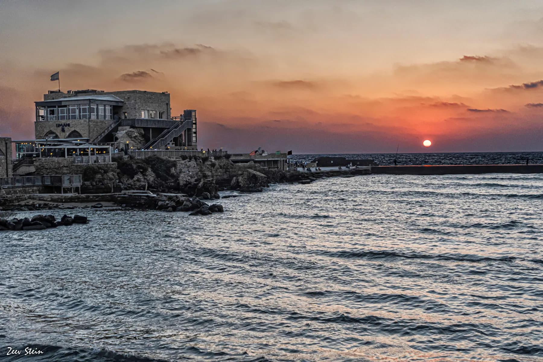
זאב שטיין / CC BY 2.5 · Wikimedia Commons
Archaeological site
Herod's Harbour (Sebastos)
The breakwaters that made Caesarea possible are still there, five to seven metres down, and the harbour began settling into the seabed almost as soon as it was finished.
Museum
Caesarea Harbour Visitors' Centre
Four of the fourteen Herodian vaults that carried the temple platform above the harbour were dug out, stabilised and opened to the public in June 2019, after about five years of work.
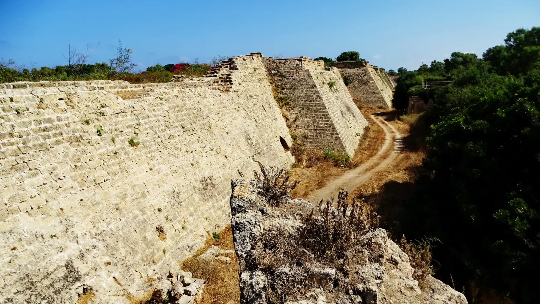
israel zeller ישראל זלר / CC BY 2.5 · Wikimedia Commons
Archaeological site
Crusader City and Ramparts
Louis IX of France walled a town of about 120 dunams here in 1251, a fraction of the Roman city, and cut a dry moat round it that the park's operator still measures at 8 to 10 metres deep.
Sources and further reading
Every link below was opened and checked when this page was written. Official statements are marked as such: they are the subject's own account, not an independent one.
- OfficialOld Caesarea Diving Centercaesarea-diving.comUnderwater Archeological Park
the operator's account of the four tracks, the 28 signs and the park's origin under Avner Raban
- OfficialOld Caesarea Diving Centercaesarea-diving.comOpening hours
summer and winter hours as published, including holiday eves
- OfficialOld Caesarea Diving Centercaesarea-diving.comIndependent snorkeling
the 50 NIS day price including mask, snorkel and fins
- OfficialOld Caesarea Diving Centercaesarea-diving.comGuided Dives
dive prices, the 45-minute duration, the 8 m ceiling and the Israeli diving law requirements
- OfficialOld Caesarea Diving Centercaesarea-diving.comIntroductory Dive
310 and 400 NIS, minimum age eight, 6 m maximum depth
- OfficialOld Caesarea Diving Centercaesarea-diving.comGear Rentals
180 NIS full gear for the day and 40 NIS tank refills for independent divers
- OfficialOld Caesarea Diving Centercaesarea-diving.comThe port and its components
the three basins, the round tower, the mole dimensions and the entrance channel estimates
- OfficialOld Caesarea Diving Centercaesarea-diving.comThe decay of the harbour and later developments
the 5 to 7 m subsidence, the sixth-century rubble rampart, medieval reuse and the 1950 steamer
- OfficialOld Caesarea Diving Centercaesarea-diving.comThe anchors
the six anchors on Track B, their types and which parts are reconstructed
- OfficialCaesarea Development Corporationcaesarea.comPrices, Caesarea Harbor and National Park
18 NIS port admission, 46 NIS single adult park ticket and the car park tariff
- OfficialIsrael Nature and Parks Authorityparks.org.ilYam Caesarea marine national park
Israel's first marine national park, the end of fishing in its core and the reduction of motorised craft
- ReportingYnetynet.co.ilFor the first time in Israel: a national park under water
the March 2021 deposit of the plan, its area of about 1,096 dunams and the 200 dunam figure for the ancient port
- ReferenceGeosciences (Galili, Salamon, Gambash and Zviely, 2021)mdpi.comArchaeological and Natural Indicators of Sea-Level and Coastal Changes: The Case Study of the Caesarea Roman Harbor
the 1960 Link excavation, the 1975 to 2005 Haifa programme under Raban, and the case against fault, earthquake and tsunami
- ReferenceJournal of Marine Science and Engineering (Gambash, Arkin-Shalev, Wood, Nantet and Gambin, 2025)mdpi.comCaesarea SubMaritima: Insights into the Entrance of the Roman Harbour of Sebastos
measured depths at the harbour entrance and the current standing of the winter-storm explanation
Caesarea Underwater Archaeological Park: common questions
Do you need to be a certified diver?+
No. The shallowest of the four trails, Track A across the inner and middle basins, tops out at four metres and is meant for snorkellers, and independent snorkelling with mask, snorkel and fins for the day costs 50 NIS. If you want a tank without a licence, the introductory dive puts an instructor beside you for 25 to 30 minutes at a maximum of six metres, for 310 NIS. Certification is only needed for the guided dives on Tracks B, C and D.
How deep is the underwater park?+
Between four and nine metres, depending on the trail. Track A is capped at four metres, Track B at six, Track C at eight and Track D, over the harbour entrance, at nine. A 2025 survey of the entrance measured the structures there at roughly 7.3 to 8 metres.
Can children do it?+
The introductory dive is open from the age of eight, provided the child is reasonably fit, and a parent must sign the medical declaration for anyone under eighteen. Snorkelling has no published age limit but requires the ability to swim, unassisted, in open water off a quay with no shelving beach. There is no lifeguard on the trails.
Is it worth it, or is it just rubble?+
It depends entirely on what you want from it. Nothing down there is a standing building: the trails cross concrete foundations, collapsed ashlar, column drums reused in a medieval wall and the outline of moles. What makes it worth an hour is that the numbered signs turn that into a plan you can read, and that Roman harbour engineering, the caisson impressions and the wave-absorbing Prokumatia in particular, is legible in a way it is nowhere on land.
Do you also need a Caesarea National Park ticket?+
You need to get into the harbour compound, which is ticketed by the Caesarea Development Corporation. Port-only admission is 18 NIS and does not include the visitors' centre, the theatre or the hippodrome; a single adult ticket to the whole national park, which does include them, is 46 NIS. The diving centre's own prices sit on top of whichever you buy.
What is the visibility like?+
Variable, and it is the thing most likely to disappoint. The harbour basin is one of the few sheltered stretches on the Israeli Mediterranean coast, which helps, but the site is sand and silt over a shallow seabed and any swell stirs it. The operator will not run the trails at all in poor sea conditions, which is a reasonable proxy: if they are running, the water is workable.
Is any of it reconstructed rather than original?+
Some of it, and the site's own guide is candid about which. The breakwater concrete and the ashlar are in place, where they settled. The six anchors on Track B were collected by excavators and arranged as a display of anchor development, and one of them has reconstructed wooden shaft and arms around original lead fittings. The steamer hull was sunk deliberately in 1950, and some of the column shafts are Roman stone reused by medieval builders.
Why is the harbour under water at all?+
It subsided by five to seven metres, and researchers still differ over why. The park's guide lists a fault line offshore, earthquakes, possible tsunami, unstable sand and the weight of the structures. A 2021 study in Geosciences found no conclusive evidence for the fault, the earthquakes or the tsunami and argued for foundation failure under winter storm waves instead, and a 2025 survey records that the storm explanation is currently the favoured one.
Is the site wheelchair accessible?+
No. Entry to the trails is down steps at the end of the quay directly into open water, with no ramp and no beach. The harbour front above it, with its restaurants and galleries, is another matter, and the harbour visitors' centre inside Herod's vaults is the alternative for anyone in the party who is not getting in the sea.
When is the best time of year to go?+
Late spring through autumn, which is also when the centre keeps its longer hours: 09:00 to 17:00 on weekdays from April to November, against 10:00 to 16:00 from December to March. Summer sea is calmer and warmer, so fewer days are lost to conditions. Winter diving happens, but the odds of arriving to a closed sea are much higher.