Archaeological site · Masada
The Roman Siege Camps and Circumvallation Wall
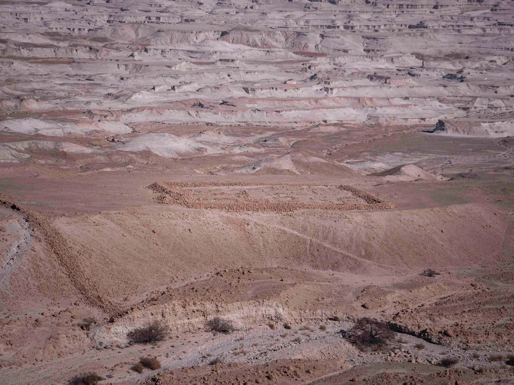
Eight Roman camps and a stone wall that a 2024 survey measured at 4,290 metres still ring the foot of Masada, and almost none of it has ever been excavated.
יוסי רון / CC BY 2.5 · Wikimedia Commons
Camps
8
lettered A to H; two of them legionary in size and plan
Circumvallation wall
4,290 m
measured by survey and 3D model, Journal of Roman Archaeology, 2024
Towers
15
all of them on the eastern and northern stretches of the wall
Stone moved
about 26,700 m³
wall, towers and camp walls together, on the 2024 calculation
In short
- How long to give it
- about 30 minutes at the summit lookouts to work out the plan of the siege works, and about 90 minutes if the walk up the Roman ramp path from the western side is part of it
- Summer, Sunday to Thursday and Saturday
- 08:00 to 17:00
- Adult
- ₪37
מחנות המצור הרומיים
The Roman siege works at Masada are the ring of military walls and enclosures on the ground below the mountain: eight camps known by the letters A to H, a fieldstone wall running the whole way round the rock between them, fifteen towers built into that wall, and the assault ramp on the western flank. They were thrown up by Legio X Fretensis under Lucius Flavius Silva during the last campaign of the First Jewish Revolt. The ICOMOS evaluation that recommended Masada for the World Heritage List called them the most complete Roman siege works in the world, and, in the same sentence, almost completely unexcavated.
That second half is the unusual part. Nearly everything a visitor looks at on the summit was dug, conserved and in places rebuilt during the twentieth century. What lies below was not. Apart from one camp, part of another and the ramp, the system has never been excavated at all, which is why its plan reads so cleanly from above: tent bases, gateways, towers and wall lines sitting where the army left them, undisturbed because the ground is dry, the site is remote and nobody afterwards had a use for the stones.
For a long time the siege works were described rather than measured. Between 2017 and 2020 a team from Tel Aviv University and the Israel Antiquities Authority surveyed the wall with satellite positioning equipment and built a photogrammetric 3D model of its eastern stretch, and in 2024 they published lengths, heights, stone volumes and a labour estimate in the Journal of Roman Archaeology. Several of the figures on this page come from that paper, and several of them displaced numbers repeated for decades.
The ring
Eight camps, fifteen towers and a wall that can be traced from the summit
The 2024 survey measured the circumvallation wall at 4,290 metres, and about 6,270 metres of built wall once the camp walls outside it are added. Where both faces still stand and are not buried, the wall is between 1.8 and 2 metres wide. Its original height was not measured but calculated: the 3D model gave the volume of stone in a segment and of the collapse lying beside it, and dividing by length and width produced a weighted mean of 2.2 metres, with a few stretches at 2.4 to 2.5.
Two of the camps are much larger than the rest. Camp B on the east and Camp F on the west are given in the World Heritage nomination file as 135 by 170 metres and 125 by 150 metres, described there as very similar in size and plan to the classic camp of the Roman legions, with Camp F named as Silva's headquarters. Both sit outside the siege wall, with the wall between them and the mountain. Inside all eight camps are hundreds of contubernia, the mess units of eight or nine men who shared a tent: low rubble walls about 1 to 1.5 metres high, built as a footing over which the tent was stretched.
The towers are the feature that has been counted most often and agreed on least. The 2024 team identified fifteen, every one of them on the eastern and northern sections of the wall, protruding about 0.9 to 1.5 metres from both faces, with gaps between towers 2 and 13 ranging from 61 to 110 metres and averaging 90. Earlier counts differ: Gichon and Yadin identified twelve, Arubas and Goldfus roughly thirteen, Richmond fourteen.
- Circumvallation wall: 4,290 m measured, 1.8 to 2 m wide, about 2 to 2.5 m high when built
- Camp walls not incorporated into it: about 1,980 m more
- 15 towers, all on the eastern and northern stretches
- Camp B (135 × 170 m) east and Camp F (125 × 150 m) west, both outside the wall
- Hundreds of tent bases inside the camps, each for eight or nine men
73 CE
What Silva built, and how long it actually took
Jerusalem fell in 70 CE. Masada was among the last places in Judaea still held against Rome, and in 73 or 74 CE the governor Lucius Flavius Silva brought the Tenth Legion Fretensis against it. The parks authority's own site brochure, written by Guy Stiebel, puts the force at 8,000 troops including auxiliary units, and records that captive Jews carried water to them, apparently from Ein Gedi, along with food. There is no spring anywhere near the mountain, a difficulty Josephus notes about the Roman camp himself.
Josephus describes the ring in one clause and gives no measurements at all: Silva "also built a wall quite round the entire fortress, that none of the besieged might easily escape; he also set his men to guard the several parts of it." The figures came much later. The nomination file the State of Israel submitted to UNESCO gives a siege wall about four kilometres long encircling the entire mountain; the 2024 survey put a number on it, 4,290 metres.
How long the work took has moved a great deal, and the old picture of a fortress holding out for years has gone. Joseph Roth argued in 1995 for a siege of four to nine weeks; he and Amnon Ben-Tor separately reckoned the wall could have been finished in under five days, a figure resting on a speech of Hadrian's claiming a soldier could build a cubic metre of wall a day, which the 2024 team considers exaggerated. Their own calculation gives about 26,700 cubic metres of stone, 50,000 to 80,000 workdays, and 11 to 16 days for 5,000 men. Cross-checked against the siege of Jerusalem, where a force five times larger built seven kilometres of wall and thirteen camps in three days, the same method gives about nine days.
Even the date of the fall is unsettled. The parks authority's brochure says 73 or 74 CE. The 2024 paper says the siege probably took place in 73/74 CE. The ICOMOS evaluation states 2 May 73, and Britannica gives 15 April 73 CE. Nobody has reconciled them, and the disagreement traces back to when Silva took the governorship, which the ancient evidence does not fix.
Fabric
Almost none of this has ever been dug
The nomination file states it plainly: "The Roman camps haven't been dug (except of probes)." ICOMOS, assessing the same property, called the siege works the most complete in the world and almost completely unexcavated. The preservation is a product of the climate, the remoteness, and the fact that nobody came afterwards to rob the stone. So the honest answer to what is original here is: nearly all of it. That is why the site was inscribed under criterion iv, whose wording calls the camps and fortifications encircling the monument the finest and most complete Roman siege works to have survived to the present day.
The exceptions are worth knowing. Camp A and Camp F have been excavated, along with the siege ramp: the nomination file records a season at Camp F and the ramp led by Gideon Foerster in 1995, and the 2024 paper credits that excavation to Benny Arubas, Haim Goldfus and Jodi Magness. Camp A was dug by Shmarya Gutman in the 1960s and its walls reconstructed in the process, which produces a small paradox: the tidiest-looking camp on the ground is the one whose walls are least original.
The modern intrusions have mostly been taken away rather than added. The nomination file records that the former entrance buildings, which had been scattered among the Roman camps and impaired their appearance, were demolished during the development project of the 1990s so the camps could be seen without modern construction in the way. ICOMOS noted at inscription that a service cable lift from the 1960s excavations passed directly above the ramp and through the breach, and that a project was under way to move it.
One thing has been lost to nature. The 2024 survey found long stretches of the eastern wall buried under sediment washed down from the mountain, which is why segments look missing on the ground. The authors use that finding against the argument, advanced from the Camp F and ramp excavations, that the siege ramp has barely eroded since the first century.
- Original and untouched: the circumvallation wall, the towers, the tent bases and six of the eight camps
- Excavated: Camp A, Camp F and the siege ramp
- Reconstructed: the walls of Camp A, rebuilt by Shmarya Gutman during his excavation
- Removed: the old entrance buildings that stood among the camps until the 1990s
- Buried: long stretches of the eastern wall, under sediment washed off the mountain
Function
A wall too thin to fight from, and partly built to be looked at
At about two metres wide and two to two and a half metres high, in fieldstone and without a parapet, the circumvallation could not have withstood a serious assault, and it is easily scaled. It is also taller than a person, so a soldier could not fight from behind it. The 2024 authors conclude that it worked as an obstacle to slow a sortie, and as a fighting platform only when soldiers stood on top of it, expected to counterattack rather than hold. Gutman found five staircases running up to the tops of the walls at Camp A, two of them on the rear wall.
Compare the works Rome built when it expected trouble. At Numantia in 133 BCE and Alesia in 52 BCE the siege lines had walls up to 4.7 metres wide, parapets, ditches, traps, and towers set within a bowshot of each other, about 31 metres. Masada's towers stand 61 to 110 metres apart, beyond mutual bowshot though still within catapult range, and there are no ditches or traps at all. The 2024 reading of that is straightforward: the Romans did not expect heavy fighting, from the rock or from anywhere else.
Where the towers do stand tells its own story. All fifteen are on the eastern and northern sections, every one beside a wadi or a deep gully, and several sit on stretches that bulge outwards rather than facing the mountain. That makes little sense for a wall watching Masada and a good deal of sense for a wall watching the desert behind it, against infiltration, deserters, or a relief force coming up the ravines from the east.
The strangest finding concerns the stretches that were never meant to stop anything. Above the western cliff and along the northern edge of Mount Elazar, where a 200-metre precipice already made the line impassable, the wall was built only in the lower dips, exactly where a viewer on the summit would need masonry to see an unbroken wall top. The 2024 authors take this as deliberate psychological warfare, and add that the audience may not have been only the besieged: a ring of works like this also had a job to do on the morale of the legionaries building it.
On the ground
Which side of the mountain to be on, and what is actually visible
The nomination file makes the practical point better than any guide: of the siege system, "there is an excellent view of it from the mountain." That is the whole trick. From the plain the camps are grey stone on grey ground and hard to pick out at all; from the summit lookouts the plan lies out flat below, wall, towers, gateways and tent rows together. Early and late light is what separates them, because everything here is a shadow line about half a metre high.
The two big camps are on opposite sides of the mountain. Camps A, B, C and D and the towered stretch of wall lie on the marl plain to the east, below the cable car and the Snake Path. Camp E, Camp F with its later garrison enclosure, Camp G and Camp H are west and southwest, Camp H on the top of Mount Elazar and Camp F at the top edge of the western cliff, close to where the ramp path begins. The park brochure warns that there is no road between the two entrances and that driving round takes about an hour and a quarter.
None of the camps is a museum. There are no signs, no rails, no interpretation and no reconstructed anything except the walls of Camp A. The parks authority's site rules are to stay on marked paths and not to climb walls or damage antiquities, and that applies here more than anywhere on the mountain, because these low rubble courses are the actual first-century surface. The western trail forecourt, on the Arad side, has the closest thing to a display: the parks authority lists parking, toilets, a visitor service centre, a picnic awning and models of Roman weapons there.
One piece of the story sits above the ramp rather than below it. The breach the battering ram made in the casemate wall is still identifiable at the top, and the nomination file says it is clearly seen today. Josephus describes the bank raised to 200 cubits on an outcrop he calls the White Promontory, a platform of great stones 50 cubits square on top of it, and an iron-plated tower of 60 cubits set on that.
- East side: Camps A, B, C and D, the fifteen towers and the best-preserved wall
- West side: Camps E, F, G and H, plus the ramp and the breach above it
- Best viewing: the summit lookouts, in low sun
- No road between the two sides; about an hour and a quarter by car
What to look for
Things not to walk past at The Roman Siege Camps and Circumvallation Wall
The details that repay knowing about before you are standing in front of them.
Camp F, Silva's headquarters
The larger of the two legionary camps, 125 by 150 metres, on the western cliff top outside the siege wall. The nomination file names it as the Roman commander's headquarters and one of only two camps at Masada built on the classic legionary plan.
Camp F2, the camp inside the camp
A smaller enclosure strengthened by towers, built into the northwestern corner of Camp F and destroying part of it, which is how archaeologists know it came later. A probe showed it housed the Roman garrison left behind after Masada fell.
The tent bases
The rows of low rubble walls inside every camp are not rooms. Each is a contubernium, the footing of a tent shared by eight or nine soldiers, standing about a metre to a metre and a half high.
The towers on the eastern plain
Fifteen of them, now mostly heaps of rock with corners and outer faces still traceable, each one sited beside a wadi or gully. Their spacing, 61 to 110 metres, is too wide for mutual bowshot and about right for catapults.
The funnel in the northwest
The wall northwest of the mountain does not run straight. The 2024 survey found it narrowing into a 40-metre funnel leading to the cliff edge, with the remains of a platform or tower at the end of it.
Camp H on Mount Elazar
The southernmost camp, on the summit of Mount Elazar above a sheer 200-metre cliff. Gutman argued it was too big for a mere observation post and was sited to meet an attack from the south.
The long view
The Roman Siege Camps and Circumvallation Wall, in order
73 or 74 CE
Lucius Flavius Silva brings Legio X Fretensis and auxiliary units against Masada, a force the parks authority puts at 8,000. Eight camps, the circumvallation wall and the western assault ramp go up around the mountain.
73 CE
The ramp carries a siege tower and battering ram to the casemate wall and a breach is made. Published dates for the fall differ: 15 April 73 in Britannica, 2 May 73 in the ICOMOS evaluation, 73 or 74 CE in the parks authority's own brochure.
after 73 CE
A Roman garrison stays on. Camp F2 is built into the corner of Camp F to house it, and the parks authority says an auxiliary unit remained at the site until the beginning of the second century CE.
1929
Hawkes publishes the first systematic study of the siege system, worked up from Royal Air Force aerial photographs.
1932
Adolf Schulten surveys the siege system on the ground and publishes the results the following year. Some of what he recorded, including a bauplatz south of Camp E, can no longer be found.
1962
Richmond publishes further analysis from aerial photography. Shmarya Gutman excavates and reconstructs Camp A in the same decade, finding five staircases up to the tops of its walls.
1995
Excavation at Camp F and the siege ramp. The nomination file credits a season to Gideon Foerster; the 2024 paper credits the work to Benny Arubas, Haim Goldfus and Jodi Magness.
2001
Masada is inscribed on the World Heritage List. Criterion iv turns on the siege works, calling the camps and fortifications encircling the mountain the finest and most complete Roman siege works to have survived to the present day.
2017 to 2020
A Tel Aviv University and Israel Antiquities Authority team surveys the wall with satellite positioning equipment and builds a photogrammetric 3D model of its eastern stretch.
2024
The results are published in the Journal of Roman Archaeology: 4,290 metres of circumvallation, fifteen towers, about 26,700 cubic metres of stone, and a construction estimate of 11 to 16 days for 5,000 men.
Practical
Visiting The Roman Siege Camps and Circumvallation Wall
Where
Masada National Park, eastern entrance off Route 90 and western entrance from Arad via Route 3199
What ticket you need
The siege works are inside Masada National Park and are not separately ticketed. One park ticket covers them along with the summit; the parks authority's fee table is headed as an entrance fee without the cable car, which is charged on top. The park covers about 3,400 dunams and includes both the eastern and western entrance areas, but there is no road between them: the brochure puts the drive from one side to the other at about an hour and a quarter, which is the single most useful thing to know before choosing which camps to look at.
Opening hours
- Summer, Sunday to Thursday and Saturday
- 08:00 to 17:00source
- Summer, Friday and holiday eves
- 08:00 to 16:00source
- Winter, Sunday to Thursday and Saturday
- 08:00 to 16:00source
- Winter, Friday and holiday eves
- 08:00 to 15:00source
- Holiday eves
- 08:00 to 13:00, and 08:00 to 12:00 on Yom Kippur evesource
- Last entry
- one hour before the closing time listed; the last cable car up also runs one hour before closingsource
- Snake Path, for the eastern camps at first light
- opens for ascent about one hour before sunrise; in extreme summer heat the last ascent is 07:00 and the last descent 08:00source
- Roman ramp path, for the western camps
- opens for ascent about 30 minutes before sunrise, from Arad on road 3199; in extreme heat the last ascent is 11:00 and the last descent noonsource
Admission
Access
Getting to the viewpoints is manageable; getting to the camps is not. The parks authority lists the cable car and the bridge at the top as wheelchair accessible, and on the plateau it lists concrete paths, railings on steps, benches, shaded gathering places, entry to most of the key sites and lookouts, and models and relief maps adapted for visually impaired visitors, so the summit views over the camps are reachable without a climb. The camps themselves are open, unsurfaced desert with no paths, no railings and no signage. The Snake Path is a steep earthen path largely built as stepped sections with handrails, graded high difficulty and about an hour up; the parks authority describes the climb to the plateau as steep, of local soil, with many steps.
On site
- Ticket office at both entrances
- Cable car from the eastern entrance
- Toilets
- Covered parking, eastern side
- Parking, toilets and a visitor service centre on the western side
- Picnic awning and models of Roman weapons, western side
- Masada Museum and film halls, eastern entrance
- Snack bars and shops, eastern entrance
- Summit lookouts, benches and shaded gathering places
- Masada West campsite, western side
Booking
The parks authority runs an online reservation system and says booking ahead guarantees entry at the chosen time. On busy days a visitor holding a reservation may be asked to show the confirmation at the gate. Nothing separate is booked or paid for the siege works.
Hours and prices are given as the operator publishes them and change without much notice, particularly around Shabbat and the festivals. Check the operator's own page before you travel for this.
Official page at en.parks.org.il →What people wish they had known
- Look for the camps from the top, not the bottom. From the car park and the roads they are grey stone on grey ground; from the summit lookouts the wall, the towers and the tent rows lie out flat and read as a plan.
- Pick a side before setting off. The two legionary camps are on opposite flanks, and the parks authority's brochure says there is no road between the eastern and western entrances and that the drive round takes about an hour and a quarter.
- The low rectangles inside the camps are not rooms or houses. Each is the footing of a tent for eight or nine soldiers, and they are the reason the camps look like street grids from above.
- Do not walk on the walls. These low rubble courses are the untouched first-century surface, and the park's own rules are to keep to marked paths and not to climb walls or damage antiquities.
- Come for the first or the last hour of light. Every feature down there is a shadow about half a metre high, and at midday the whole system flattens into the ground it is made of.
- The camps are not signposted or interpreted. The nearest thing to a display is on the western side, where the parks authority lists models of Roman weapons at the ramp trail forecourt.
The figures
The Roman Siege Camps and Circumvallation Wall by the numbers
Each figure carries the year it belongs to and links the source it came from.
| Measure | Figure | As of | Source |
|---|---|---|---|
| Length of the circumvallation wall | 4,290 m measured, about 4,300 m with reconstructed missing segments | 2024 | doi.org |
| Camp walls not incorporated into the circumvallation | 1,980 m, for about 6,270 m of built wall in total | 2024 | doi.org |
| Original height of the wall | 2 to 2.5 m, weighted mean 2.2 m, calculated from the 3D model | 2024 | doi.org |
| Towers | 15, spaced 61 to 110 m apart, average gap 90 m | 2024 | doi.org |
| Stone in the wall, towers and camps | about 26,700 m³, giving 50,000 to 80,000 workdays | 2024 | doi.org |
| Time to build the whole system | 11 to 16 days for 5,000 soldiers | 2024 | doi.org |
| Size of the two legionary camps | Camp B 135 × 170 m, Camp F 125 × 150 m | 2000 | whc.unesco.org |
| Adult admission to Masada National Park | ₪37 (child ₪21, student ₪31, Israeli senior ₪19) | 2026 | en.parks.org.il |
While you are here
The rest of Masada
Everything else in this destination with a page of its own.
Jan Helebrant / CC0 · Wikimedia Commons
Archaeological site
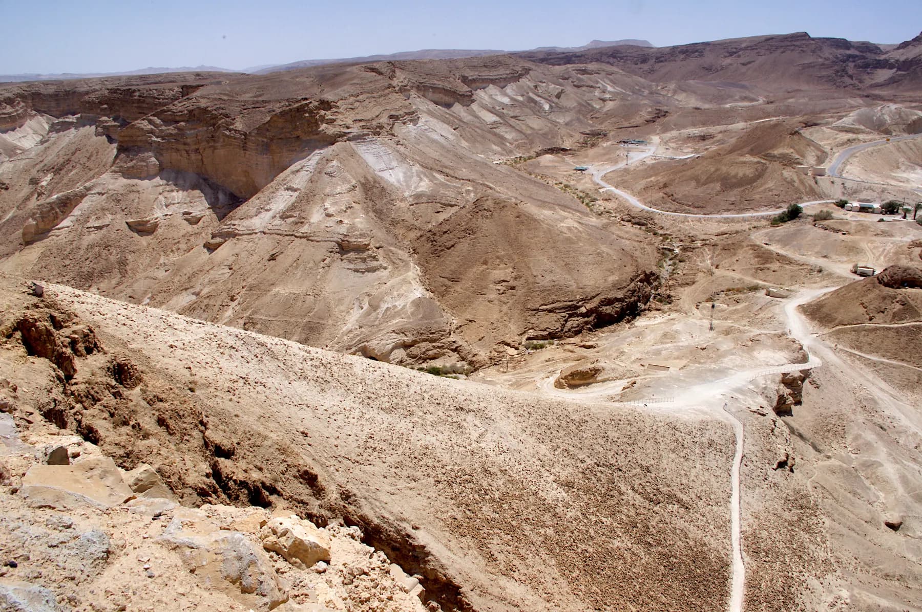
The Roman Assault Ramp
The bank the Tenth Legion raised against Masada's western cliff in the siege of 73 or 74 CE, whose foot the parks authority puts only about 60 metres below the summit, and which now carries the shortest footpath to the top.
Godot13 / CC BY-SA 4.0 · Wikimedia Commons
Archaeological site
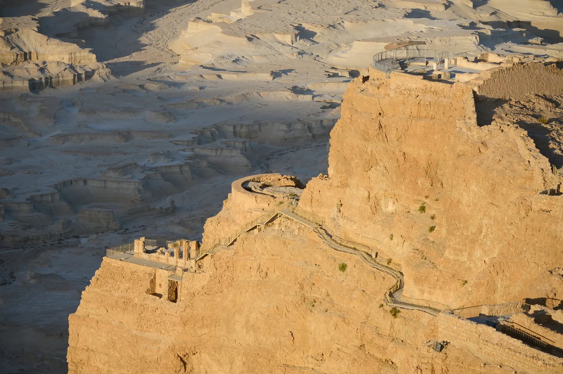
Herod's Northern Palace
Herod's architects hung a private house on three rock terraces at the northern tip of Masada, with about 30 metres of height between the top terrace and the bottom one and retaining walls holding the lower two onto the cliff.
Jan Helebrant / CC0 · Wikimedia Commons
Activity
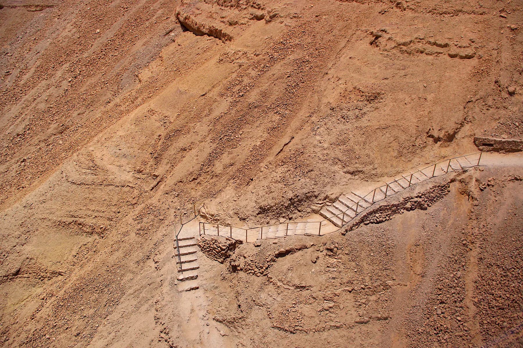
The Snake Path
The parks authority measures the climb at 350 metres over about two kilometres and roughly 900 steps, on a line up the east face that Josephus already knew as the serpent.
Sources and further reading
Every link below was opened and checked when this page was written. Official statements are marked as such: they are the subject's own account, not an independent one.
- OfficialIsrael Nature and Parks Authorityen.parks.org.ilMasada National Park
Current summer and winter opening hours, the one-hour entry cutoff and last cable car, the entrance fee table (adult ₪37, child ₪21, student and group adult ₪31, group child ₪18, Israeli senior ₪19, museum ₪20), the Snake Path and Roman ramp path opening times and heat closures, the accessibility provision on the plateau and at the western trail forecourt including models of Roman weapons, and the statement that the camps, fortifications and assault ramp at the foot of the mountain are the most complete Roman siege system found to date anywhere in the world
- OfficialIsrael Nature and Parks Authorityparks.org.ilגן לאומי מצדה (Masada National Park, Hebrew site)
The Hebrew original of the same statement about the siege system, the heat-based closing times for the Snake Path, the ramp path and the Elazar Ascent, and the accessibility list for the plateau and the western entrance
- OfficialIsrael Nature and Parks Authority, written by Guy Stiebelparks.org.ilMasada National Park visitor brochure (English)
The siege dated to 73 or 74 CE, the Tenth Legion Fretensis under Flavius Silva at 8,000 troops including auxiliaries, eight camps around the base plus a siege wall and a ramp of earth and wooden supports on a natural slope, captive Jews carrying water apparently from Ein Gedi, a Roman auxiliary unit remaining until the beginning of the second century CE, the park's 3,400-dunam area, the site rules on marked paths and climbing walls, and the note that there is no road between the eastern and western sides and the drive takes about an hour and a quarter
- OfficialState of Israel, submitted to UNESCO World Heritage Centrewhc.unesco.orgMasada: nomination file 1040 for inscription on the World Heritage List
Eight camps, two large and six small; Camp B (135 × 170 m) in the east and Camp F (125 × 150 m, Silva's headquarters) in the west, both outside the circumvallation; Camp F2 in the northwestern corner of Camp F, later and used by the garrison left after the fall; hundreds of contubernia of 8 to 9 men surviving as rubble walls 1 to 1.5 m high; a siege wall about four kilometres long; the statement that the camps have not been dug except for probes; the 1995 season at Camp F and the ramp under Gideon Foerster; the removal of the old entrance buildings that stood among the camps; the excellent view of the system from the mountain; and the site area of 276 ha with a 28,965 ha buffer
- DataIsrael Antiquities Authority and the Tel Aviv University Masada Expeditioniaapub.israntique.org.il3D model of the northern circumvallation at Masada, towers 7 to 13
The published photogrammetric model underlying the 2024 measurements, browsable in the open; the southern counterpart covering towers 2 to 8 is at the same address under South_Circ
- ReferenceICOMOS, for the UNESCO World Heritage Committeewhc.unesco.orgAdvisory body evaluation of nomination 1040, Masada
Criterion iii describing the Roman siege works around the mountain as the most complete in the world and almost completely unexcavated; criterion iv calling the camps and other fortifications that encircle the monument the finest and most complete Roman siege works to have survived to the present day; the fall dated to 2 May 73; the Roman garrison remaining some forty years and occupying the fortress Silva built for the besiegers; and the service cable lift from the 1960s excavations passing above the Roman ramp and through the breach, with a project to relocate it
- ReferenceHai Ashkenazi, Omer Ze'evi-Berger, Boaz Gross and Guy D. Stiebel, Journal of Roman Archaeology 37 (2024), 215-240doi.orgThe Roman siege system of Masada: a 3D computerized analysis of a conflict landscape
Open access. The 2017 to 2020 survey and photogrammetry: 4,290 m of circumvallation and 1,980 m of camp wall; wall 1.8 to 2 m wide and 2 to 2.5 m high with a weighted mean of 2.2 m; 15 towers on the eastern and northern sections spaced 61 to 110 m apart against earlier counts of 12, roughly 13 and 14; about 26,700 m³ of stone, 50,000 to 80,000 workdays and 11 to 16 days for 5,000 men; the 40 m funnel in the northwest; the five staircases Gutman found at Camp A and its reconstruction; the comparison with Numantia and Alesia; the psychological reading of sections 5 and 7; colluvial burial of the eastern wall; and the dispute with Goldfus and colleagues over erosion of the ramp
- ReferenceFlavius Josephus, via the Perseus Digital Library, Tufts Universityperseus.tufts.eduThe Wars of the Jews, Book VII, chapter 8, section 2 (Whiston translation)
The only ancient account of the ring: Silva 'also built a wall quite round the entire fortress, that none of the besieged might easily escape; he also set his men to guard the several parts of it', and the note that food had to be brought a long distance and water carried to the camp because there was no spring nearby
- ReferenceFlavius Josephus, via the Perseus Digital Library, Tufts Universityperseus.tufts.eduThe Wars of the Jews, Book VII, chapter 8, section 5 (Whiston translation)
The White Promontory, the bank raised solid to 200 cubits, the platform of great stones 50 cubits in breadth and height, the iron-plated tower of 60 cubits, the battering ram breaking down part of the wall, and the rebels' inner wall of beams and earth that the Romans burned
- ReferenceEncyclopaedia Britannicabritannica.comMasada
The summit area of about 18 acres (7 hectares), the besiegers' sloping ramp of earth and stones, the clearing of the Roman camps and siege works during the excavations, and the fall dated to 15 April 73 CE
The Roman Siege Camps and Circumvallation Wall: common questions
Can you walk into the Roman camps at Masada?+
There is no marked route into any of the camps published by the parks authority, and its site rules tell visitors not to leave marked paths and not to climb walls or damage antiquities. The normal way to see the siege works is from the summit lookouts and from the two approach paths, which pass close to them: the Snake Path on the east, above the eastern camps and the towered stretch of wall, and the Roman ramp path on the west, which starts near Camp F. Treat the camps as something to look at rather than something to enter.
Where is the best view of the siege camps?+
From the plateau, along the eastern and western edges. The World Heritage nomination file says of the siege system that there is an excellent view of it from the mountain, and that is accurate: the outlines that are nearly invisible from the plain resolve into a clear plan from 400 metres above. The parks authority lists lookouts, models and relief maps on the plateau, and those are reachable step-free from the cable car and the bridge.
How long was the Roman siege wall around Masada?+
4,290 metres, as measured by a survey published in the Journal of Roman Archaeology in 2024. Adding the camp walls that are not built into the circumvallation brings the total built wall to about 6,270 metres. Older sources round it to about four kilometres, including the nomination file Israel submitted to UNESCO. Josephus, the only ancient source, gives no figure at all and simply says Silva built a wall quite round the entire fortress.
Which camp was the Roman commander's headquarters?+
Camp F, on the western side, according to the World Heritage nomination file, which names it as Silva's headquarters. It measures 125 by 150 metres and is one of only two camps at Masada built to the size and plan of a classic legionary camp, the other being Camp B on the east. Both stand outside the circumvallation wall, with the wall running between them and the mountain.
Have the Roman camps been excavated?+
Almost not at all, which is the main reason they matter. The nomination file states that the camps have not been dug except for probes, and the ICOMOS evaluation that recommended the site for inscription described the siege works as the most complete in the world and almost completely unexcavated. The exceptions are Camp A, dug and partly rebuilt by Shmarya Gutman, and Camp F together with the siege ramp, excavated in the 1990s.
How long did the siege of Masada actually last?+
Weeks rather than years, on current scholarship, though nobody can put a firm number on it. Joseph Roth argued in 1995 for four to nine weeks. The 2024 survey calculated that 5,000 soldiers could have built the entire wall and camp system in 11 to 16 days, which supports a short siege, and a cross-check against the 70 CE siege of Jerusalem gives about nine days for the same works. The old picture of a fortress holding out for three years no longer has defenders among specialists.
Do I need a separate ticket for the siege works?+
No. They sit inside Masada National Park and are covered by the ordinary park ticket, which the parks authority lists at ₪37 for an adult, ₪21 for a child, ₪31 for a student or an adult in a group, ₪18 for a child in a group and ₪19 for an Israeli senior citizen. That table is published as an entrance fee without the cable car, so the cable car is an extra charge. The Masada Museum is a further ₪20.
Is any of the siege wall reconstructed?+
Very little. The walls of Camp A were reconstructed by Shmarya Gutman during his excavation in the 1960s, and that is essentially the only rebuilt masonry in the system. Everything else, including the 4,290 metres of circumvallation, the fifteen towers and the hundreds of tent bases, is untouched first-century construction, standing where it collapsed. Long stretches of the eastern wall are buried under sediment washed down from the mountain, which is why the line looks broken in places.
Why is part of the wall built above a cliff where nobody could climb?+
Because those stretches were never meant to stop anyone. Above the western cliff and along the northern edge of Mount Elazar the 2024 survey found the wall built only in the lower dips, precisely where masonry was needed for a viewer on the summit to see an unbroken wall top. The authors conclude that these sections were psychological warfare, and add that the intended audience may have included the Roman soldiers building them as much as the rebels watching.
Is it worth the time if I only have half a day at Masada?+
Yes, because it costs almost none of that time. The siege works need no extra ticket, no separate walk and no detour: half an hour at the eastern and western edges of the plateau, ideally in low sun, is enough to pick out the camps, the wall and the towers. What does cost time is trying to see both legionary camps in one visit, since Camp B and Camp F are on opposite sides and the drive round takes about an hour and a quarter.