Archaeological site · Masada
The Roman Assault Ramp
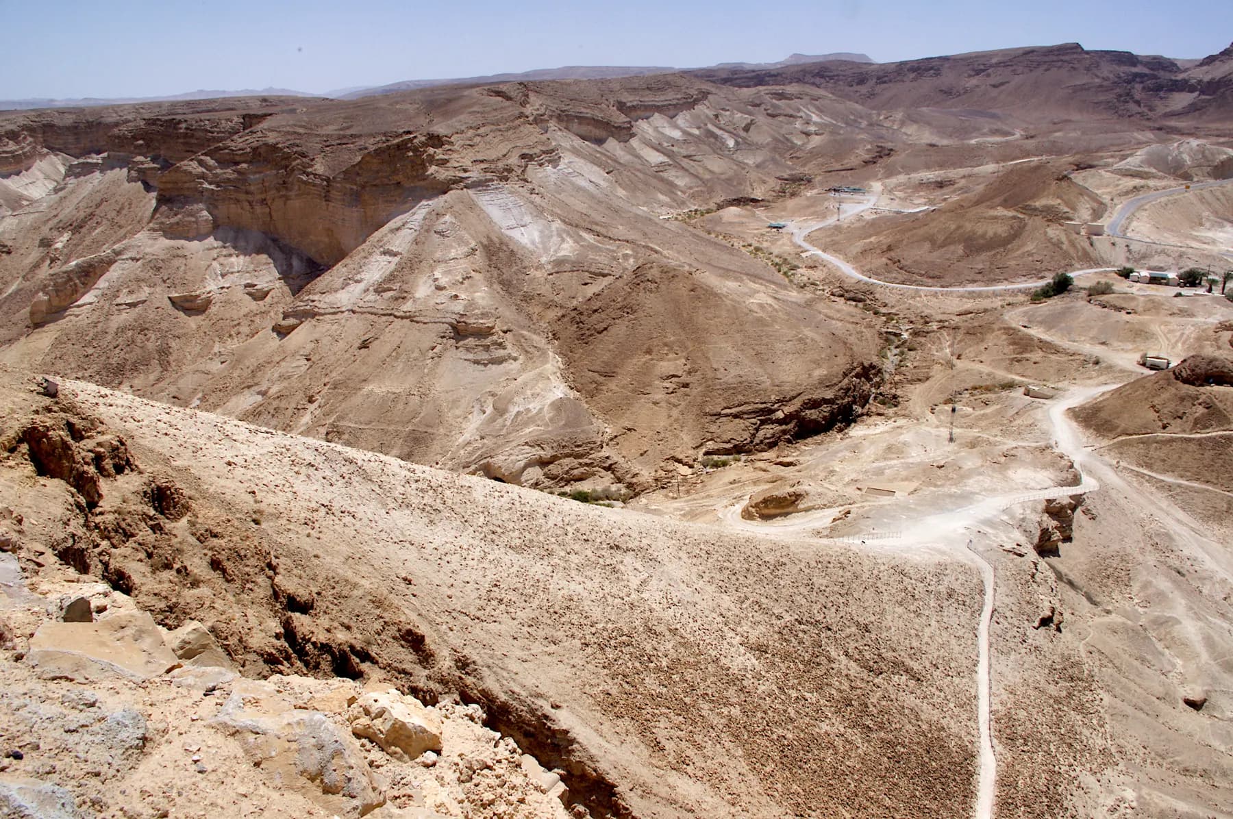
The bank the Tenth Legion raised against Masada's western cliff in the siege of 73 or 74 CE, whose foot the parks authority puts only about 60 metres below the summit, and which now carries the shortest footpath to the top.
Jan Helebrant / CC0 · Wikimedia Commons
Foot of the ramp
about 60 m
below the summit, the figure the parks authority publishes
Climb to the top
about 30 minutes
difficulty graded intermediate, against high for the Snake Path
Opens
30 minutes before sunrise
daily, reached from Arad on road 3199
Josephus's bank
200 cubits
his height for the embankment, raised in 73 or 74 CE
In short
- How long to give it
- about 30 minutes up and a little less down, per the parks authority, and about two to three hours for the climb, the plateau and the return
- Ramp trail opens for ascent
- about 30 minutes before sunrise, every day; sunrise times are not published by the operator
- Adult, park entry, cable car excluded
- ₪37
הסוללה הרומית
The Roman assault ramp is the bank of earth and stone that Flavius Silva's army piled against the western flank of Masada during the siege of 73 or 74 CE, and it is now also the shortest way on foot to the summit. The Israel Nature and Parks Authority runs a marked trail built over it, times the climb at about half an hour, grades the difficulty intermediate, and opens it about thirty minutes before sunrise. Access is from Arad on road 3199, at an entrance on the opposite side of the mountain from the cable car.
The thing under the path is not what Josephus describes, and it is not entirely Roman either. Geological work by Dan Gill of the Geological Survey of Israel, published in Nature in 1993, reported that contrary to the prevailing opinion that the ramp was entirely man-made, it 'consists mostly of natural bedrock'. The parks authority's own account says the same in plainer words: the Romans exploited a natural slope and built an earthen bank over it, supported by wooden beams.
How much they built, and whether they ever finished, is an open question. One group of researchers holds that the ramp was never completed and so could never have carried a battering ram at all, which would mean the Romans entered Masada somewhere else. Others read the gap in the casemate wall directly above the ramp as exactly what it looks like. The argument is live, it is about the ground a visitor is standing on, and this page sets out both sides of it.
73 CE
The one place on the mountain that would take an earthwork
Josephus says Silva walled the mountain in first and then looked for somewhere to attack from, and 'found but one single place that would admit of the banks he was to raise'. Behind the tower guarding the road that led up from the west there was a broad projection of rock, jutting out and standing three hundred cubits below the summit. He calls it the white promontory, Leuce in the Greek. Jodi Magness, who has excavated here, notes that a path to the top already ran up this side and now lies buried under the ramp: the Snake Path in the east and this western route were the two ways up the rock.
The problem the ramp solved was not access but exposure. Soldiers using either path would have had to climb in single file, carrying their equipment and the parts of a battering ram to be assembled at the top, under stones and missiles from the wall above. A ramp wide enough to walk up several abreast put the machines at the wall instead of the men.
The figures Josephus gives are the ones every account repeats. The bank was raised solid to two hundred cubits; on top of it went a platform of great stones fitted closely together, fifty cubits broad and fifty high; and on that a tower sixty cubits tall and plated all over with iron, from which the Romans shot to clear the defenders off the wall. A cubit is roughly half a metre. Silva's battering ram then broke down a part of the wall, and the defenders threw up a second wall inside it, built of parallel rows of timber packed with earth, which absorbed the blows rather than shattering. Silva had it burned. Josephus records that the wind first drove the flames back at the Romans and then turned and carried the fire into the wall.
The archaeology at the top of the ramp fits a fight rather than a formality. Yigael Yadin found iron arrowheads and ballista stones around the head of the ramp. Andrew Holley, who published the stones, read their relatively light weights as evidence of small-calibre engines aimed at people on the wall rather than at the wall itself, which is what covering fire looks like. The section of casemate wall directly above the ramp is missing.
Engineering
Tamarisk, date palm and a hill that was already there
The Encyclopaedia Judaica entry on Masada, written by Guy Stiebel, describes the work in one sentence: hewn from the nearby white spur, a mass of earth and stones stabilised by tamarisk and date palm branches was laid on the natural spur of the western slope. A stone platform paved the head of the ramp so the siege tower could be raised, and the engines themselves were most likely put together in a walled yard west of the ramp.
The best account of the fabric comes from the 1995 season, when Gideon Foerster, Benny Arubas, Haim Goldfus and Jodi Magness cut a section through the ramp a little over halfway up. Magness describes what the excavation found: the Romans took pieces of wood, mostly tamarisk and date palm, laid some flat and drove others in as vertical stakes to make a timber bracing, and filled it with packed stones, rubble and earth. The tips of those timbers still protrude near the bottom of the ramp. Her team did not reach the natural spur underneath, so the boundary between the hill and the work remains, in her account, something the geologists infer rather than something the diggers saw.
Above that stratum, what the ramp is made of is the mountain. Gill's 1993 note in Nature put the point sharply, and the geomorphological survey published by Haim Goldfus, Yoav Avni, Roy Albag and Benny Arubas in Catena in 2016 set out to separate the natural lower part from the man-made upper part. Gideon Hadas, writing in 2023, summarises the resulting picture: most of the ramp's volume is a natural spur, and the Roman contribution over it is a relatively thin layer of earth, about a metre thick, mixed with tamarisk trunks and palm branches for stability.
None of it was cheap to hold. The parks authority's own site brochure, written by Stiebel, gives the besieging force as the Tenth Legion Fretensis and auxiliaries, about 8,000 troops in all, and records that captive Jews carried water and food to them, apparently from Ein Gedi. Nothing on this shore supplies an army.
- Mostly a natural bedrock spur (Gill, Nature, 1993)
- Roman layer over it about a metre thick, with tamarisk and palm timbers
- Timber tips still visible near the foot of the ramp
- The excavators of 1995 never reached the spur itself
The argument
Whether the ramp was ever finished, and whether it was used
The Catena paper of 2016 is titled, without hedging, 'The significance of geomorphological and soil formation research for understanding the unfinished Roman ramp at Masada'. Roy Albag, one of its four authors, states the conclusion on his own project page: the assault ramp was never completed by the Romans and therefore could not have been operational.
Gideon Hadas took that further in the Journal of Jewish Archaeology in 2023. He measured the ramp at about three metres wide at the top, reaching fourteen metres below the base of the wall, and found no trace of the stone platform Josephus describes; a platform of the size Josephus gives could not stand on a base that narrow. Josephus's dimensions, he writes, are about twice what is there. Hadas concludes that a breach from the west is highly improbable, and argues instead that the ramp was a feint that drew the defenders to the western side while a Roman unit went up the Southern Ascent from Camp G and broke through the wooden door of the Southern Gate.
Not everyone reads it that way. The 1995 excavators and the Encyclopaedia Judaica entry both treat the missing section of casemate wall above the ramp as the breach itself, and Magness writes that the Romans erected a stone platform for the battering ram once the ramp was completed and that the large gap in the wall at the top of the ramp is still visible today. The 2024 study of the siege landscape in the Journal of Roman Archaeology, by Hai Ashkenazi, Omer Ze'evi-Berger, Boaz Gross and Guy Stiebel, likewise narrates the assault as following the ramp's completion, while cutting the whole siege down to weeks: it calculates that 5,000 soldiers could have thrown up the circumvallation wall and the camps in 11 to 16 days.
Researchers still differ, and the difference is not decorative: it decides whether the last act of the siege happened at the top of the path visitors walk up, or at the far end of the mountain. What is agreed is that the ramp has never been fully excavated, that its bulk is natural, and that the wall above it is broken.
On the ground
What is Roman, what is modern, and what is simply the hill
The Roman Ramp Trail is a made path. The parks authority describes it as built over the ramp the Romans constructed from the west side, and the steps and handrails on it are its own work, not antiquity: this is not a Roman staircase and it never was one. Walking up, the surface underfoot is fine pale chalky dust and small stones, which Magness describes as poofing up in clouds underfoot.
The Roman work that is actually visible is modest and worth looking for. The tips of the bracing timbers show near the bottom. The bank of packed earth and rubble is the material of the path itself. At the top, the gap in the casemate wall is the one dramatic survival. There is no stone platform and no tower: the platform is absent from the ground and the tower existed only in wood and iron.
The western entrance complex is a modern visitor site rather than a ruin. There are enclosures interpreting the mountain and its defenders, models of Roman weapons, a picnic awning and a visitor service centre selling drinks, snacks, sunscreen and hats. The parks authority's night show, running on Tuesdays and Thursdays after sunset from May to December, is projected onto the mountain's western slope between the ramp and the Northern Palace, which means the ramp is part of the screen.
The other thing to look at from here is water. Herod's engineers dammed the channels of Wadi Masada to divert flood water into channels that filled twelve enormous cisterns cut on two levels into the northern slope, with a total capacity the parks authority gives as 40,000 cubic metres. Pack animals carried the water up through the Water Gate to storage cisterns on the summit. The parks authority says the northern cisterns are seen very well from the western entrance complex, and they are: nothing on the eastern side shows the water system this clearly.
The walk
Half an hour up, and the heat decides when
The trail opens every day about thirty minutes before sunrise, and the parks authority expects visitors to look up sunrise times themselves. The climb takes about half an hour at intermediate difficulty, against about an hour at high difficulty for the Snake Path on the Dead Sea side. That difference is the whole argument for coming this way: the ramp path is the sunrise walk that does not require an hour of climbing in the dark.
Heat governs the closing times rather than the clock. On days of extreme summer heat the parks authority closes the ramp trail at 11:00 for ascent and 12:00 for descent. The same rule shuts the Snake Path at 07:00 and 08:00, and closes the Runner's Path and the Elazar Ascent at 07:00, so the ramp is the route that stays open longest on the worst days. The authority sets these times from the Israel Meteorological Service forecast, and warns that in extreme heat, wind or rain the published times can move.
There is no cable car on this side. Whatever you walk up you walk back down, or you cross the summit and descend the east face into a car park a long drive from your own. The two entrances are not connected by any road across the mountain. Everything at the eastern complex, including the Yigael Yadin museum, the film halls and the shops, is on the other side.
For a dawn start without an alarm at three in the morning, the Masada West campground sits at this entrance, is reached from Arad only, and takes arrivals from 15:00. Flash flooding in the wadis is a real hazard in winter, spring and autumn, and the parks authority asks visitors to check the forecast independently and to stay out of wadi beds when flooding looks likely.
- From Arad on road 3199; no access from the Dead Sea road
- Opens about 30 minutes before sunrise, every day
- About 30 minutes up, graded intermediate
- Extreme heat: last ascent 11:00, last descent 12:00
- No cable car and no museum on this side of the mountain
What to look for
Things not to walk past at The Roman Assault Ramp
The details that repay knowing about before you are standing in front of them.
The timber tips at the foot
Near the bottom of the ramp the ends of the tamarisk and date palm beams that braced the Roman fill still protrude from the ground. They are the most direct thing on the mountain that a Roman soldier put there.
The gap in the casemate wall
At the head of the trail the section of Herod's casemate wall directly above the ramp is simply missing. Excavators read it as the breach made by the battering ram; it is the reason this path ends where it does.
The northern cisterns
Twelve cisterns cut on two levels into the northern slope, holding 40,000 cubic metres between them, are visible from the western entrance complex. They are the clearest view anywhere of how a fortress in a rainless desert was supplied.
Camp F below and to the north
Silva put his own camp where he could watch the ramp being built, and the layout is legible from the path. Josephus says he chose the spot for the siege works rather than for supply, and it shows.
The models of Roman weapons
The parks authority has set replica Roman siege weapons at the western entrance, alongside enclosures on the mountain's story. They are reconstructions and are presented as such, which makes the empty ramp above them easier to read.
The long view
The Roman Assault Ramp, in order
66 CE
A band of Sicarii under Menahem son of Judah take Masada by stratagem. Eleazar ben Yair later commands the rebel community on the rock.
73 or 74 CE
Flavius Silva besieges Masada with the Tenth Legion Fretensis and auxiliaries, and raises a ramp on the western slope from the rock projection Josephus calls the white promontory.
73 or 74 CE
A battering ram breaks the wall above the ramp, according to Josephus, and the rebels' improvised inner wall of timber and earth is burned. The casemate section above the ramp is missing to this day.
1932-1933
Adolf Schulten and colleagues survey Masada and the siege system and publish detailed maps of the ramp and the camps, still used as the base for later analysis.
1993
Dan Gill of the Geological Survey of Israel publishes 'A natural spur at Masada' in Nature, reporting that the ramp consists mostly of natural bedrock.
1995
Gideon Foerster, Benny Arubas, Haim Goldfus and Jodi Magness cut a section through the ramp above its halfway point and record the timber bracing packed with stone, rubble and earth.
2016
Haim Goldfus, Yoav Avni, Roy Albag and Benny Arubas publish a geomorphological study in Catena arguing that the Roman ramp was never finished.
2023
Gideon Hadas argues in the Journal of Jewish Archaeology that no breach from the west was possible and that the Romans entered through the Southern Gate.
2024
A 3D survey of the siege landscape in the Journal of Roman Archaeology calculates that the wall and camps could have been built in 11 to 16 days, and reads the whole siege as a matter of weeks.
Practical
Visiting The Roman Assault Ramp
Where
Western entrance to Masada National Park, at the foot of the Roman ramp, reached from Arad on road 3199
What ticket you need
The ramp trail is inside Masada National Park and is covered by the park entrance fee rather than ticketed on its own. The fee is the same as at the eastern entrance, but what it buys is not: the cable car, the Yigael Yadin museum, the film halls and the shops are all on the Dead Sea side, and there is no road across the mountain between the two entrances.
Opening hours
- Ramp trail opens for ascent
- about 30 minutes before sunrise, every day; sunrise times are not published by the operatorsource
- Extreme summer heat
- last ascent 11:00, last descent 12:00source
- Park, summer, Sunday to Thursday and Saturday
- 08:00 to 17:00source
- Park, summer, Friday and holiday eves
- 08:00 to 16:00source
- Park, winter, Sunday to Thursday and Saturday
- 08:00 to 16:00source
- Park, winter, Friday and holiday eves
- 08:00 to 15:00source
- Holiday eves and Yom Kippur eve
- 08:00 to 13:00 on the ramp trail page; the main park page gives 08:00 to 12:00 for Yom Kippur evesource
- Last entry
- one hour before the closing time listedsource
- Night show, on the western slope
- Tuesdays and Thursdays after sunset, about 45 minutes; closed January to Aprilsource
Admission
- Adult, park entry, cable car excluded
- ₪37source
- Child
- ₪21source
- Student
- ₪31source
- Adult in a group
- ₪31source
- Child in a group
- ₪18source
- Israeli senior citizen
- ₪19source
- Yigael Yadin museum, on the eastern side
- ₪20, one price, by reservation onlysource
- Night show at the western entrance
- ₪45 adult, ₪45 child; Matmon members ₪35source
- Masada West campground, own tent
- ₪64 adult, ₪47 child, per nightsource
Access
The path itself is not accessible. The parks authority describes the ascent from the western entrance as steep, made of local soil and with many steps, and there is no cable car and no step-free route on this side of the mountain. Its accessibility note for the western side describes that path as ascending 'from the east', which appears to be text carried over from its description of the Snake Path; the substance, a steep unpaved climb with steps, is what the ground shows. What is accessible at the western entrance is everything at the bottom: parking, toilets, the visitor service centre, the picnic awning, railings on steps, identification and directional signage and the models of Roman weapons. The sound and light show has accessible parking, a cashier, toilets, paved paths, dedicated seating for wheelchair users, railings at steps and hearing assistance systems. Visitors who cannot manage a steep unpaved climb should use the eastern entrance and the cable car, which is wheelchair accessible and reaches the summit across a step-free suspension bridge. The parks authority runs a coordination form for accessible visits.
On site
- Parking at the western entrance
- Toilets
- Visitor service centre selling drinks, snacks, sunscreen and hats
- Picnic awning
- Interpretive enclosures and models of Roman weapons
- Railings on the steps
- Masada West campground alongside
- Sound and light show seating
- No dogs anywhere in the national park
Booking
The parks authority asks visitors to book a time slot through its online reservation system, and says a booking guarantees entry at the chosen time. If the slot is full on arrival, visitors are asked to show the reservation confirmation to get in. The night show and the campground are booked separately, and access to both is from Arad only.
Hours and prices are given as the operator publishes them and change without much notice, particularly around Shabbat and the festivals. Check the operator's own page before you travel for this.
Official page at en.parks.org.il →What people wish they had known
- Set the navigation to Arad, not to the Dead Sea. The ramp trail is reached only from road 3199 on the western side, and drivers who arrive at the cable car car park by mistake face a long detour round the mountain to correct it.
- Plan for a return on foot. There is no cable car at the western entrance, so unless you intend to walk down the far side into a car park nowhere near your car, the descent is back down the ramp.
- Check sunrise time before you leave. The trail opens about half an hour before sunrise rather than at a fixed hour, and the parks authority does not publish the times.
- Do not assume the museum and the visitor centre are waiting at the top. Both are at the eastern entrance, and the western side offers a visitor service centre, interpretive enclosures and shade at the bottom.
- Look down before you look up. The northern cisterns and the outline of Camp F read far better from the western entrance and the lower part of the path than from anywhere on the summit.
- Treat the steps as the parks authority's, not Rome's. The trail is a modern path built over the ramp; the Roman fabric to look for is the timber ends near the foot and the missing stretch of casemate wall at the head.
The figures
The Roman Assault Ramp by the numbers
Each figure carries the year it belongs to and links the source it came from.
| Measure | Figure | As of | Source |
|---|---|---|---|
| Foot of the ramp below the summit | about 60 m | 2026 | en.parks.org.il |
| Climb to the top | about 30 minutes, difficulty graded intermediate | 2026 | en.parks.org.il |
| Last ascent and descent in extreme summer heat | 11:00 and 12:00 | 2026 | en.parks.org.il |
| Height Josephus gives for the embankment | 200 cubits, raised on a rock projection he places 300 cubits below the summit | 1st c. CE account | penelope.uchicago.edu |
| Roman layer over the natural spur | about a metre thick, mixed with tamarisk trunks and palm branches | 2023 | jjar.huji.ac.il |
| Ramp as measured today | about 3 m wide at the top, reaching 14 m below the base of the wall | 2023 | jjar.huji.ac.il |
| Northern cisterns seen from the western entrance | 12 cisterns on two levels, about 40,000 cubic metres | 2026 | en.parks.org.il |
| Park entry, cable car excluded | ₪37 adult, ₪21 child | 2026 | en.parks.org.il |
While you are here
The rest of Masada
Everything else in this destination with a page of its own.
יוסי רון / CC BY 2.5 · Wikimedia Commons
Archaeological site
The Roman Siege Camps and Circumvallation Wall
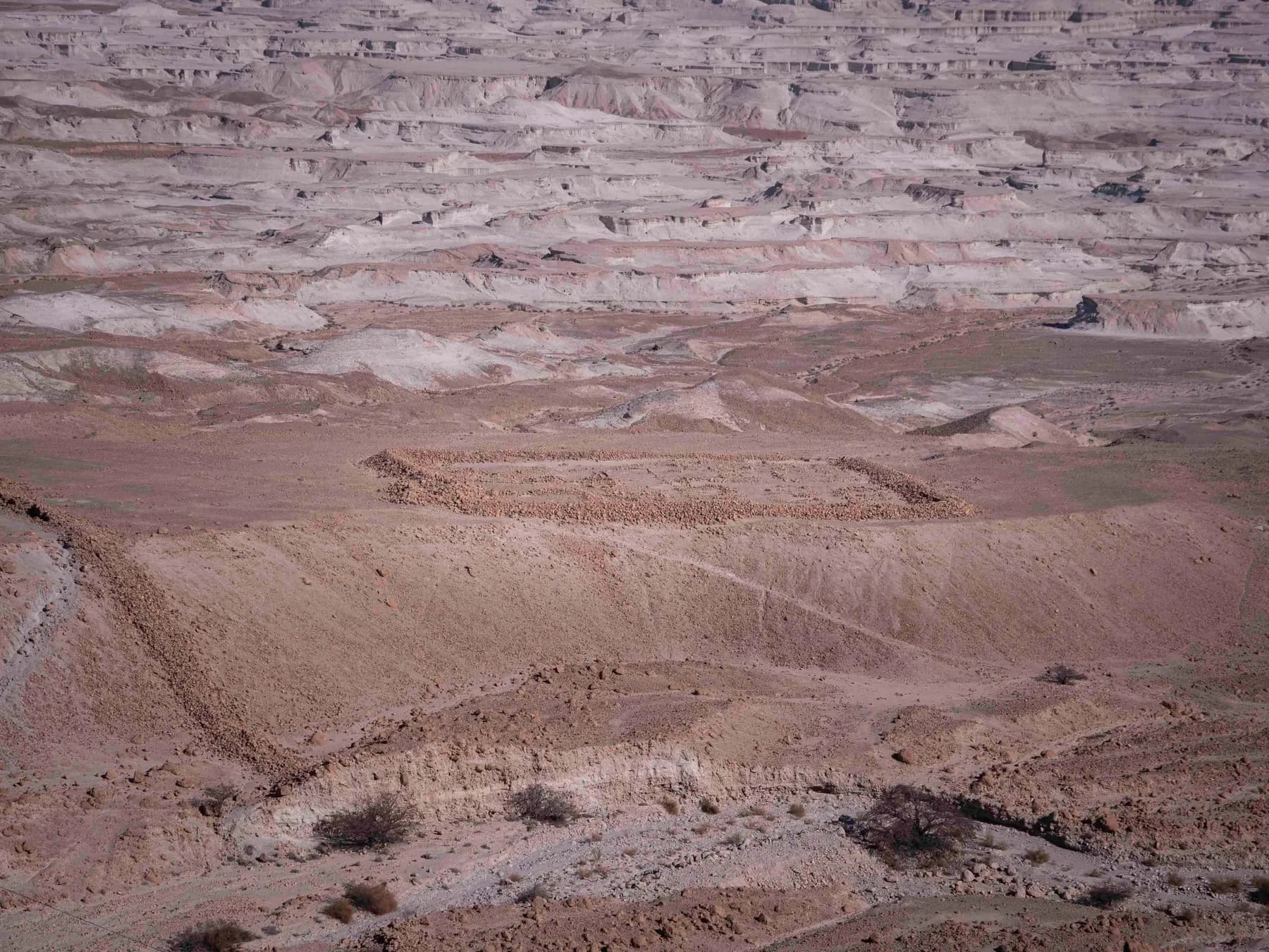
Eight Roman camps and a stone wall that a 2024 survey measured at 4,290 metres still ring the foot of Masada, and almost none of it has ever been excavated.
Jan Helebrant / CC0 · Wikimedia Commons
Activity
The Snake Path
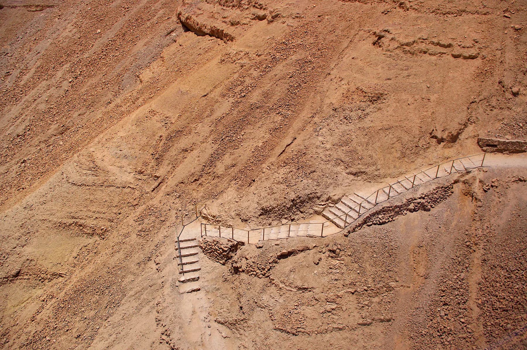
The parks authority measures the climb at 350 metres over about two kilometres and roughly 900 steps, on a line up the east face that Josephus already knew as the serpent.
Activity
Masada from Dusk to Dawn
A 45-minute video-mapping show projected straight onto the western cliff of Masada, between the Roman siege ramp and the Northern Palace, watched from an open-air theatre that can only be reached through Arad.
Sources and further reading
Every link below was opened and checked when this page was written. Official statements are marked as such: they are the subject's own account, not an independent one.
- OfficialIsrael Nature and Parks Authorityen.parks.org.ilThe Roman Ramp Trail at Masada National Park
The trail built over the ramp from the west side and Ha'Etekim Cliff; the foot of the ramp about 60 m below the summit; the Romans exploiting a natural slope in 73 CE and supporting an earthen ramp on wooden beams; the missing casemate section above the ramp; the twelve northern cisterns on two levels totalling 40,000 cubic metres and visible from the western entrance; the accessible features on the western side; the visitor service centre's stock; opening half an hour before sunrise via the road from Arad; about half an hour at intermediate difficulty; summer and winter opening hours; and the extreme-heat closure at 11:00 and 12:00
- OfficialIsrael Nature and Parks Authorityen.parks.org.ilMasada National Park
Entrance fees of ₪37 adult, ₪21 child, ₪31 student and adult in group, ₪18 child in group, ₪19 Israeli senior citizen and ₪20 museum; the night show fee of ₪45; entry closing one hour before the stated time; the ramp trail opening 30 minutes before sunrise with access from Arad via road 3199; the full heat schedule including the Snake Path at 07:00 and 08:00 and the Runner's Path and Elazar Ascent at 07:00; the flood warning; the reservation rule; and the accessibility notes for the eastern entrance, the plateau, the western side and the show
- OfficialIsrael Nature and Parks Authority (Hebrew)parks.org.ilשביל הסוללה בגן לאומי מצדה
The Hebrew original of the ramp trail page, giving the same 60 m below the summit, the natural slope with an earth bank on wooden beams, the twelve cisterns of 40,000 cubic metres and the water carried up on pack animals through the Water Gate, and adding the Rosh Hashanah and Passover eve closing at 13:00
- OfficialIsrael Nature and Parks Authorityen.parks.org.ilMasada from Dusk to Dawn
The night show projected on the mountain's western slope between the ramp and the Northern Palace; Tuesdays and Thursdays after sunset, about 45 minutes, closed January to April; the ₪45 adult and child fee and the ₪35 Matmon rate; and access from Arad via road 3199
- OfficialIsrael Nature and Parks Authorityen.parks.org.ilCampsite Masada West
The campground reached from Arad only, entry from 15:00, with toilets, showers, two field kitchens, barbecue and bonfire areas and power points, and the published overnight rates of ₪64 for an adult and ₪47 for a child in an own tent
- OfficialIsrael Nature and Parks Authority, written by Guy Stiebelstatic-en.parks.org.ilWelcome to Masada National Park (site brochure)
The siege placed in 73 or 74 CE under Flavius Silva with the Tenth Legion Fretensis and auxiliaries totalling about 8,000 troops; the ramp described as earth and wooden supports on a natural slope to the west; captive Jews bringing water and food apparently from Ein Gedi; and the siege works called the most complete surviving ancient Roman siege system in the world
- ReferencePenelope, University of Chicagopenelope.uchicago.eduThe Wars of the Jews, Book VII (Whiston translation)
Silva finding but one single place that would admit of the banks he was to raise; the broad projecting rock three hundred cubits beneath the highest part of Masada, called the white promontory; the bank raised solid to two hundred cubits; the platform of great stones fifty cubits in breadth and height; the iron-plated tower of sixty cubits; the battering ram breaking down part of the wall; the rebels' inner wall of beams and earth; and the fire and the change of wind
- ReferenceNature (Dan Gill, Geological Survey of Israel)nature.comA natural spur at Masada
Nature volume 364, pages 569 to 570, 12 August 1993: contrary to the prevailing opinion that the Roman assault ramp at Masada was entirely man-made, geological observations reveal that it consists mostly of natural bedrock
- ReferenceJournal of Jewish Archaeology (Gideon Hadas)jjar.huji.ac.ilFrom Where Did the Romans Breach into Masada?
Volume 4, 2023: most of the ramp's volume a natural spur after Gill 1993 and Goldfus et al. 2016; the Roman contribution a thin earth layer about a metre thick with tamarisk trunks and palm branches; the ramp reaching 14 m below the base of the wall and about 3 m wide at the top; no remains of Josephus's platform; Josephus's dimensions twice what is observed; the conclusion that the ramp was never completed and could support no artillery; and the argument that the Romans entered through the Southern Gate from Camp G
- ReferencePrinceton University Press (Jodi Magness)assets.press.princeton.eduMasada: From Jewish Revolt to Modern Myth, chapter 1 (PDF)
Two paths to the top, the Snake Path in the east and a western path now buried under the ramp; the Leuke as the low white hill with a cubit given as about half a metre; the 1995 section cut through the ramp; the timber bracing of tamarisk and date palm filled with packed stones, rubble and earth; the timber tips still protruding near the bottom; the excavators not reaching the natural spur; the large breach in the casemate wall at the top still visible; Camp F sited so Silva could oversee the ramp; Holley on the light ballista stones aimed at people rather than at the wall; and the siege lasting no longer than six months and perhaps as little as seven weeks
- ReferenceEncyclopaedia Judaica, entry by Guy Stiebel (via Encyclopedia.com)encyclopedia.comMasada
The assault ramp hewn from the nearby white spur, a mass of earth and stones stabilised by tamarisk and date palm branches laid on the natural spur of the western slope; the stone platform paving the head of the ramp for the siege tower; the siege engines built in a secured courtyard west of the ramp; the western casemate section directly above the ramp entirely missing and in all likelihood breached by the battering ram; the ballista balls, arrowheads and slingshots found around the breach; the 1995 season on Camp F and the ramp under Foerster, Arubas, Goldfus and Magness; and water brought from Ein Gedi by Jewish captives
- ReferenceJournal of Roman Archaeology (Cambridge University Press)cambridge.orgThe Roman siege system of Masada: a 3D computerized analysis of a conflict landscape
Ashkenazi, Ze'evi-Berger, Gross and Stiebel, volume 37 (2024), pages 215 to 240: a circumvallation wall of about 4,300 m standing 2 to 2.5 m high, 15 towers, about 26,700 cubic metres of stone, and the estimate that 5,000 soldiers needed 11 to 16 days to build the wall and camps
- ReferenceRoy Albag, co-author of the Catena studyroyalbagarch.comAssault Ramp at Masada
The project combining geomorphological investigation, soil survey, 3D landscape reconstruction and soil volume analysis to separate the man-made construction from the natural slope, and the conclusion that the assault ramp was never completed by the Romans and therefore could not have been operational
- ReferenceTel Aviv Universityenglish.tau.ac.ilCrushing the Longtime Myth of Masada
The Neustadter expedition of Guy Stiebel, Hai Ashkenazi, Boaz Gross and Omer Ze'evi-Berger; drone survey and 3D modelling putting the construction of the eight camps and the siege wall at about two weeks; and the reading that once the assault ramp was completed the Romans attacked and took the fortress within a few weeks at most
The Roman Assault Ramp: common questions
Is the Roman ramp the easiest way up Masada on foot?+
Yes, of the walking routes. The parks authority times the ramp trail at about half an hour and grades it intermediate, against about an hour at high difficulty for the Snake Path on the eastern side. It is still a steep unpaved climb with many steps, and the cable car on the eastern side remains the only route that involves no climbing at all.
Can I walk up the Roman ramp and take the cable car down?+
Not without a long walk or a long drive. The cable car runs on the eastern side of the mountain and the ramp trail starts on the western side, and there is no road linking the two entrances directly. Taking the cable car down leaves you at the Dead Sea complex, well away from a car left at the Arad entrance.
How much of the ramp did the Romans actually build?+
Less than it looks. Dan Gill reported in Nature in 1993 that the ramp consists mostly of natural bedrock, and a geomorphological survey published in Catena in 2016 set out to separate the natural lower part from the man-made upper part. Gideon Hadas summarises the Roman contribution as a layer of earth about a metre thick over the spur, mixed with tamarisk trunks and palm branches. The parks authority's own text agrees in outline: the Romans exploited a natural slope and built an earthen bank over it, supported by wooden beams.
Was the ramp ever finished?+
That is disputed. Haim Goldfus, Yoav Avni, Roy Albag and Benny Arubas argue it was not, and Albag states plainly that the ramp was never completed and therefore could not have been operational. Gideon Hadas builds on that to argue that the Romans entered through the Southern Gate instead. Against them, the 1995 excavators and the Encyclopaedia Judaica entry treat the missing casemate section above the ramp as the breach, and the 2024 study in the Journal of Roman Archaeology narrates the assault as following the ramp's completion.
What is actually left to see on the ramp?+
Three things, and none of them is monumental. The tips of the tamarisk and date palm timbers that braced the Roman fill still protrude near the bottom. The bank of packed earth and rubble is the material of the path underfoot. At the head, the stretch of Herod's casemate wall directly above the ramp is missing. The stone platform and the iron-plated tower that Josephus describes have left nothing on the ground.
What time does the ramp trail close?+
It depends on the heat rather than on a fixed hour. On days of extreme summer heat the parks authority closes the ramp trail at 11:00 for ascent and 12:00 for descent, when the Snake Path is already shut at 07:00 and 08:00. Otherwise the park's own closing time governs, at 17:00 in summer and 16:00 in winter from Sunday to Thursday and on Saturday, an hour earlier on Fridays and holiday eves, with entry closing an hour before.
Do I need a separate ticket for the western side?+
No. The ramp trail is inside Masada National Park and is covered by the ordinary park entrance fee, listed by the parks authority at ₪37 for an adult and ₪21 for a child, with ₪31 for students and adults in groups and ₪19 for Israeli senior citizens. The Yigael Yadin museum at ₪20 and the night show at ₪45 are ticketed separately, and the museum is on the other side of the mountain.
Is there shade on the way up?+
Not on the path. There is a picnic awning and a visitor service centre at the western entrance and shaded gathering places on the plateau, but the climb itself is open rock and earth with nothing overhead. That is why the trail opens before sunrise and why the parks authority shuts it by late morning in a heatwave.
Can wheelchair users use this entrance?+
Only at the bottom. The parks authority lists the parking, toilets, visitor service centre, picnic awning, railings on steps, signage and models of Roman weapons at the western entrance as accessible, but the path to the plateau from here is steep, unpaved and stepped, and there is no cable car on this side. The accessible route to the summit is the cable car from the eastern entrance, which is wheelchair accessible and reaches the top across a step-free suspension bridge.
Is it worth camping at Masada West the night before?+
It is the simplest way to be on the ramp before dawn. The campground sits at this entrance, is reached from Arad only, and takes arrivals from 15:00, with toilets, showers, field kitchens, barbecue and bonfire areas and power points. Its published rate for a night in your own tent is ₪64 for an adult and ₪47 for a child. The night show, projected on the western slope between the ramp and the Northern Palace, runs on Tuesdays and Thursdays after sunset for most of the year.