Landmark · Jaffa
Kedumim Square
The flagged main square of Old Jaffa is a space the British made by demolition in June 1936, and the Israel Antiquities Authority excavation under its fountain found the drains of one of the houses that came down.
Fallaner / CC BY-SA 4.0 · Wikimedia Commons
How the square was made
June 1936
Operation Anchor, the British demolition the Israel Antiquities Authority excavation report names as the reason this ground is open
The room under the visitor centre
3.4 m a side
the ashlar chamber Jacob Kaplan dated to the early Hellenistic period, measured when its west wall was finally exposed in 2008
Coins in one hoard
851
Alexander Jannaeus coins recovered on this ground in P.L.O. Guy's 1949 season, published by Kindler in 1954
The zodiac fountain
2011
carved by Varda Ghivoly and Ilan Gelber, a year after a salvage excavation dug the ground it stands on
In short
- How long to give it
- about 30 minutes for the square, the fountain and the church front, or about 90 minutes with the visitor centre and the walk down the zodiac alleys to the port
- The square itself
- Open at all hours. There is no gate and no closing time: the municipality treats it as station fourteen on its own Old Jaffa walking route rather than as an attraction with opening times. Restaurants and shops around the perimeter keep their own hours, and the square is busiest in the evening.
- The square, the fountain and the alleys
- No charge. There is no ticket desk, no perimeter and no gate anywhere in Old Jaffa's street network.
כיכר קדומים
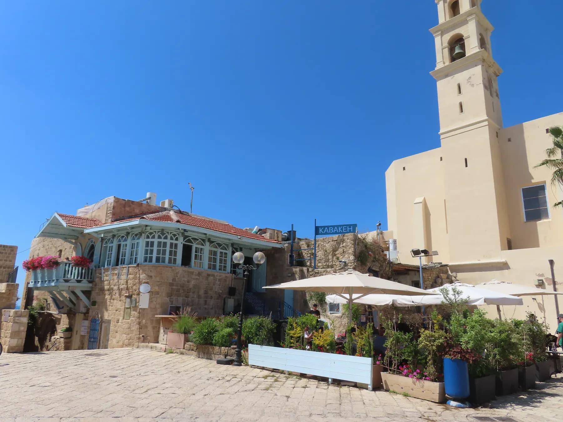
Kedumim Square is the paved main space at the top of the Old Jaffa hill. St Peter's Church closes its northern end, restaurants and shops fill the buildings around it, a stone fountain carved with the twelve signs of the zodiac stands in the middle, and a roofed archaeological excavation sits directly beneath, entered as the Old Jaffa visitor centre. It is free, unfenced and open at any hour.
It is not, however, an old square. The Israel Antiquities Authority's report on the ground under the fountain concludes that the remains there belonged to a residential building destroyed in Operation Anchor, the demolition the British Mandatory government carried out in Old Jaffa in June 1936, and that Kikar Qedumim now lies on the course of one of the roads driven through the wreckage afterwards. The Tel Aviv-Yafo municipality says the same on station fourteen of its own walking route.
So there are two things here a visitor is likely to run together. Above the paving is 1960s municipal landscaping in a quarter the city cleared and rebuilt for artists. Below it is a stratified tell, excavated in campaigns from 1948 onward and published as recently as 2026. This page keeps them apart and says who says what.
Orientation
A flagged rectangle with a church at one end and a hole underneath
The square sits on the summit of the kurkar hill, between the alleys of the artists' quarter to the west and Mifratz Shlomo Street and HaPisga garden to the east. From the port the approach is a climb up Shimon HaBursekai Street and then a wide flight of steps, with the public lavatories at the foot of them. From the clock tower it is level along Ruslan Street, then downhill through the Jerusalem Gate.
What occupies the square is short to list. St Peter's Church stands at the north end with a plaza of Ottoman cannons in front of it, the zodiac fountain stands in the open middle, and the entrance to the visitor centre is set into the paving. The perimeter buildings hold restaurants, cafés and souvenir shops. Beyond that, the square is the place the alleys drop away from toward the harbour.
The name is descriptive, not historical. Kedumim means antiquities, and the municipality states the square was named for the archaeological remains hidden under the modern paving.
1936
The square is the space the demolition left
In April 1936 a general strike began in Jaffa and armed men used the dense lanes of the old town to fire on the road to the port. The British answer was to remove the lanes. Under what became known as Operation Anchor, sappers blew a broad swath through the old city from east to west in June 1936 and a second from north to south at the end of the month, leaving a cleared shape that from the air resembled an anchor. The municipality's own route says residents were ordered out and more than two hundred houses went this way.
The archaeology confirms it from below. When the Israel Antiquities Authority dug a small area of the square in January 2010, the excavator concluded from historical sources and photographs that the late Ottoman walls, floors and drains he had found belonged to a residential building destroyed in Operation Anchor, and that the square now stands on the course of one of the new roads. The dig, the report says, clearly illustrates the extent of the damage done here.
What 1936 began, 1948 and the 1950s finished. The IAA's 2025 report records hundreds of houses destroyed here in 1936 and more during and after the 1948 war. In the 1960s the municipality cleared the remaining population of a quarter that had become poor and neglected and rebuilt Old Jaffa for artists and tourism, which is the plan the square belongs to; the city states this on its own pages, eviction included. So the most spacious part of Old Jaffa is the part where the town was destroyed, and the intact fabric is in the alleys around it.
- June 1936: Operation Anchor cuts two broad roads through the old town
- More than 200 houses demolished, per the Tel Aviv-Yafo municipality
- Hundreds destroyed in 1936 and more in and after 1948, per the Israel Antiquities Authority
- 1960s: the municipality clears the remaining residents and rebuilds the quarter for artists and tourism
- Kikar Qedumim occupies the line of one of the 1936 roads, per the 2010 salvage excavation
Area C
Kaplan's cellar, and the room you can stand inside
The excavation under the square is the one archaeologists call Area C. Jacob Kaplan opened it in 1961 for the Jaffa Museum of Antiquities, making it one of the larger areas dug on the summit of the tell, and returned for a second season in 1965. Work was later resumed by E. Brand for the Israel Antiquities Authority to prepare the ground for a roofed visitor centre, which is why the excavation is indoors today. The centre reopened in April 2011 with the remains built into it.
The centrepiece is a square room of ashlar headers and stretchers. Kaplan read it as the courtyard of a cellar or catacomb and dated the masonry to the early Hellenistic period, but left the western half undug, so its dimensions were unknown until the Jaffa Cultural Heritage Project, a UCLA and Israel Antiquities Authority partnership founded in 2007, sank four probes inside the visitor centre in July 2008. The missing west wall turned up standing nine courses against the north wall's twelve, and the room resolved as 3.4 m on a side and about 2.5 m tall, with ledges along two walls on which the beams of an upper floor had rested. Beneath the north wall lay an earlier wall of undressed stone, tentatively assigned to the Persian period.
That season also identified something long read as ancient and not. A stepped stone structure cutting across the middle of the room proved to be a modern mantle with modern debris beneath it, probably laid in the 1970s to stop an Early Roman wall eroding. Not everything stacked underground here was stacked in antiquity.
The 2009 follow-up produced the published headline. Aaron Burke, Martin Peilstöcker and George Pierce reported in Palestine Exploration Quarterly in 2014 that the work inside the visitor centre exposed one of the best preserved examples of Hellenistic architecture in the southern Levant, and confirmed a Hippodamian grid plan at Jaffa from as early as the late Persian period. A sounding out in the square met architecture immediately below the modern flagstones that the excavators thought probably Early Islamic, though too little pottery came up to date it.
- 1961 and 1965: Jacob Kaplan digs Area C for the Jaffa Museum of Antiquities
- Later: E. Brand digs for the IAA to prepare the ground for a roofed visitor centre
- July 2008: the Jaffa Cultural Heritage Project reopens the area, licence G-35/2008
- 2009: the season published in Palestine Exploration Quarterly in 2014
- April 2011: the visitor centre reopens with the remains incorporated
Finds
851 coins, a market supervisor's stamp and an Umayyad wall
The first research excavation ever carried out on the tell was dug on this ground, and its report waited seventy-five years. From November 1948 through 1949 and 1950, P.L.O. Guy dug for the new Department of Antiquities in the open space southeast of St Peter's Church that would become Kedumim Square; Yoav Arbel published the surviving records in 2025. Guy's Trench C, 15 by 20 m, held a slanting wall 15.5 m long standing up to fifteen courses, which Arbel reads as a glacis buttress and probably the Ottoman fortress that stood here before the church.
Two finds are worth carrying underground. In 1949 a hoard of 851 intact coins of the Hasmonean king Alexander Jannaeus came out of the ground; Arie Kindler, publishing it in 1954, argued they were struck at Jaffa itself between 90 and 85 BCE by hands less skilled than the Jerusalem mint's, with inscriptions surviving on 208. And among five Hellenistic stamped amphora handles photographed in 1948, one carries the title of market supervisor with no name and a year equivalent to 129/130 BCE, which Arbel takes as evidence that Jews in Hasmonean Jaffa drank wine sealed by Gentile cities on the coast. The visitor centre's presentation is narrated by a character described as superintendent of the local market; neither publisher connects the two.
The most recent work is the most substantial. In April 2026 the Israel Antiquities Authority journal 'Atiqot published Avraham Tendler on a Qedumim Square excavation reaching Iron II, Persian, Hellenistic and Early Roman, Byzantine, Early Islamic, Crusader and late Ottoman to Mandate remains, including two segments of a fortification wall probably belonging to an Umayyad fortress of the seventh century CE, and a late Ottoman paved street with a drainage and sewage channel beneath it. Itamar Taxel's companion pottery study in the same volume dates those features and reads part of the assemblage as hinting at foreign residents among the local population.
One gap deserves flagging because tour patter papers over it. Crusader Jaffa is richly documented in writing and has left almost nothing stratified on the tell, which is why the Crusader glazed bowls in Guy's material stand out at all. Part of the reason is the excavators: the 2010 report states plainly that earlier digs here concentrated on the ancient remains and removed the later ones without documentation, so a complete stratigraphic sequence for the site can no longer be assembled.
Zodiac
Twelve signs, one fountain, and an Ottoman cistern below it
The zodiac runs through the whole quarter, and it is 1960s planning rather than folklore. When the municipality restored the emptied houses and handed them to artists and craftspeople, the alleys were repaved in stone and each named after a sign of the zodiac, the main lane as Netiv HaMazalot, the path of the signs. Mazal Dagim, Mazal Aryeh and the rest are ordinary street names on the map. The wishing bridge over Mifratz Shlomo Street to HaPisga garden carries zodiac plaques, and the tradition is that a wish made while holding your own sign comes true.
The fountain completes the set. Its twelve signs were carved in limestone by the sculptors Varda Ghivoly and Ilan Gelber in 2011, to designs by Navot Gil, combining water, lighting and stonework. The tourism description circulated through the Israeli government data portal adds that archaeological finds beneath it support an old legend of a magical wishing well on this spot.
The excavation record says something more prosaic and more interesting. In January 2010, before the fountain went up, the Israel Antiquities Authority dug 62.5 square metres of the square to about 1.5 m, the depth the works would disturb, in a job underwritten by the Old Jaffa Development Company. What came up was a late Ottoman building: a plastered cistern with a square opening 0.46 by 0.48 m on a supporting arch and an interior 2.4 m deep, two stone-covered drains, a limestone pavement laid over the cistern later, corner pillars of the kind used to carry Ottoman vaults, clay pipes, a hookah top, European porcelain coffee cups and an 81 mm iron round shot. Almost all the pottery was nineteenth century.
So there is a plastered water installation under the fountain, and it is a domestic cistern in a house demolished in 1936. The excavation report does not name the fountain it was clearing the way for, and the artists' credit does not mention the excavation.
The edges
St Peter's, the cannons, and the way down to the harbour
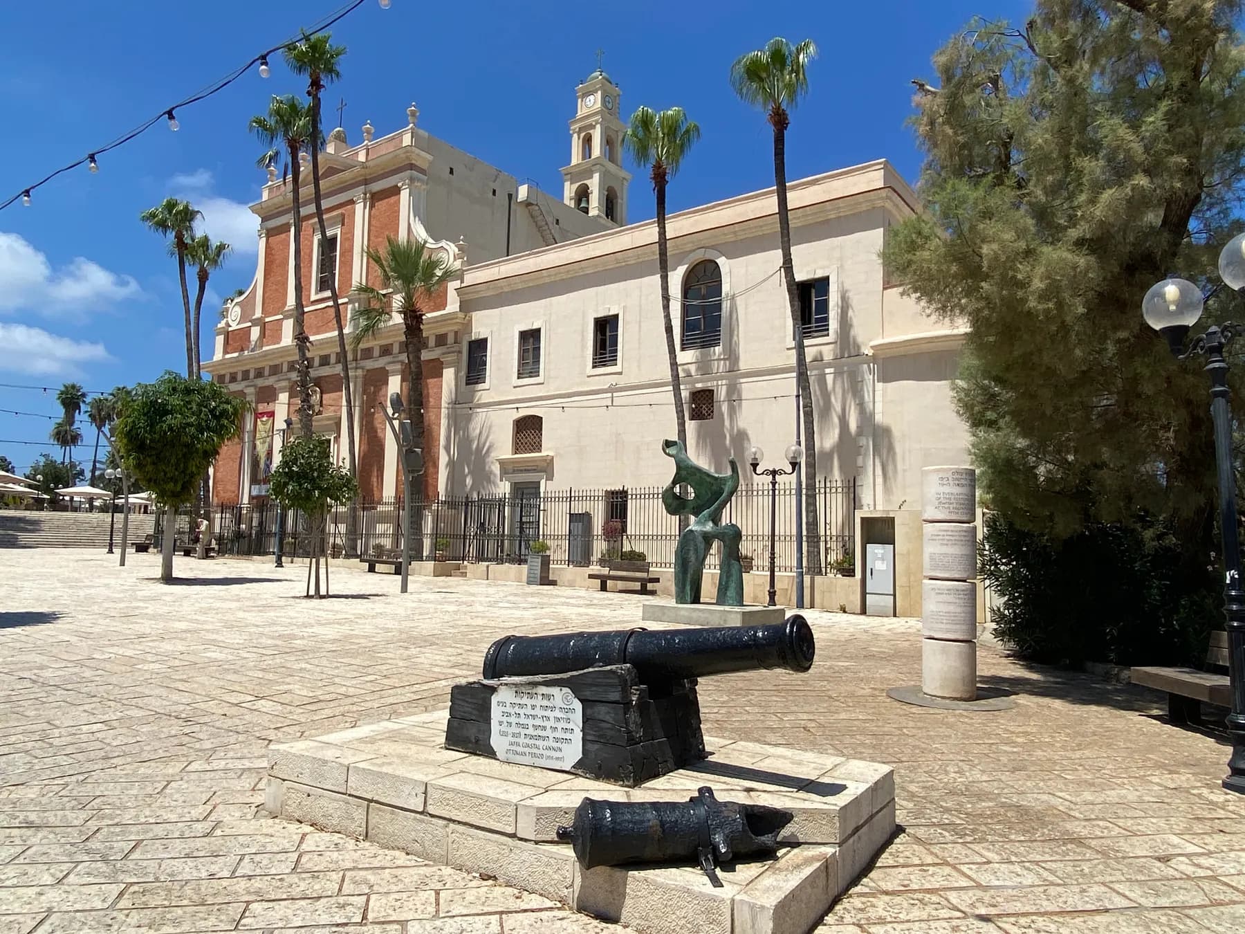
The Franciscan church of St Peter dominates the north end and has its own page, so only the part bearing on the square belongs here. The municipality dates the present building to 1888, notes that it faces west rather than east, and reads the choice as a gesture toward Rome. A rounded structure at its right-hand end encloses a small room surviving from the Crusader citadel the church was built on; by the friars' tradition Napoleon lodged in it in 1799.
The cannons ranged on the church plaza are explained by almost every guide as Napoleon's. The municipality's own route corrects it: his soldiers never fired a shot from them, and they were Ottoman guns used to defend the city against him.
West and downhill the zodiac alleys begin, narrow, stepped in places, lined with galleries and studios, and end at Jaffa Port. The projecting wooden balconies overhead are Ottoman and were functional as well as decorative: the municipality notes they were often used to store food, with the sea breeze doing the cooling. Going down is easy. Coming back up is the part people underestimate, and there is no lift or shuttle.
What to look for
Things not to walk past at Kedumim Square
The details that repay knowing about before you are standing in front of them.
The ashlar room under the visitor centre
A square chamber of dressed headers and stretchers, 3.4 m a side, that Kaplan dated to the early Hellenistic period and read as a cellar courtyard. Ledges along two walls once carried the beams of a floor above.
The stepped stones that are not ancient
The stone structure cutting across that room was identified in 2008 as a modern mantle laid over an Early Roman wall to stop it eroding, probably in the 1970s. It is the clearest example in Old Jaffa of consolidation being mistaken for antiquity.
The zodiac fountain
Twelve signs carved in limestone by Varda Ghivoly and Ilan Gelber in 2011, to designs by Navot Gil. A salvage excavation the year before found a late Ottoman cistern and drains in the ground beneath it.
St Peter's west-facing front
The Franciscan church closing the north end faces west rather than east, which the municipality reads as a gesture toward Rome. A rounded chamber at its right-hand end survives from the Crusader citadel underneath.
The Ottoman guns called Napoleon's
The cannons on the church plaza were used by the Ottomans against Napoleon in 1799, not by his army. The municipality states that his soldiers never fired one of them.
The head of the zodiac alleys
The lanes running downhill to the harbour were repaved and named after the signs of the zodiac when the quarter was rebuilt for artists in the 1960s, the main one as Netiv HaMazalot. The wooden balconies overhead are Ottoman food stores.
The long view
Kedumim Square, in order
7th century CE
Two segments of a fortification wall found under the square, published in 2026, are read as probably part of an Umayyad fortress.
1799
Napoleon takes Jaffa. By the friars' tradition he lodges in the round Crusader chamber at the end of the church at the head of the future square, and the guns now displayed in front of it were Ottoman.
June 1936
Operation Anchor: British sappers blow two broad swaths through Old Jaffa. The municipality puts the loss at more than two hundred houses, and the ground that becomes Kedumim Square lies on the line of one of the new roads.
1948-1950
P.L.O. Guy digs three trenches southeast of St Peter's Church for the new Department of Antiquities, the first research excavation on Tel Yafo. His report is never published in his lifetime.
1949
A hoard of 851 coins of Alexander Jannaeus is recovered in Guy's second season, published by Arie Kindler in 1954.
1952
The University of Leeds expedition digs southeast of the church, in what its report describes as the northern part of Guy's trial excavation.
1961
Jacob Kaplan opens Area C for the Jaffa Museum of Antiquities and reaches the ashlar room later built into the visitor centre.
1965
Kaplan digs a second season in Area C.
1960s
The municipality clears the remaining residents of the quarter and rebuilds Old Jaffa for artists and tourism. The alleys are repaved and named after the signs of the zodiac.
1970s
A mantle of stones is laid over an Early Roman wall inside the excavation to stop it eroding. It is later mistaken for ancient construction and identified as modern only in 2008.
July 2008
The Jaffa Cultural Heritage Project, a UCLA and Israel Antiquities Authority partnership, reopens Area C with four probes inside the visitor centre and a sounding out in the square.
2009
A second JCHP season in the visitor centre, published in Palestine Exploration Quarterly in 2014, exposes what its excavators call one of the best preserved examples of Hellenistic architecture in the southern Levant.
January 2010
A salvage excavation clears 62.5 square metres of the square before an ornamental fountain is installed, and finds a late Ottoman cistern, drains and floors from a house lost in 1936.
2011
The zodiac fountain is carved by Varda Ghivoly and Ilan Gelber, and the visitor centre reopens in April after refurbishment with the excavated remains built into it.
April 2026
'Atiqot publishes Avraham Tendler on the Qedumim Square excavation and Itamar Taxel on its pottery, covering Iron II to the British Mandate.
Practical
Visiting Kedumim Square
Where
Kikar Kedumim, Old Jaffa, Tel Aviv-Yafo
What ticket you need
The square is not inside a ticketed park. It sits in the Old Jaffa complex managed by the Old Jaffa Development Company, which is free to walk through in its entirety; the excavation beneath the square is the only part of it that sells a ticket. HaPisga garden, the Ramesses gate excavation and Jaffa Port are all free too, and all involve a climb or a descent from here.
Opening hours
- The square itself
- Open at all hours. There is no gate and no closing time: the municipality treats it as station fourteen on its own Old Jaffa walking route rather than as an attraction with opening times. Restaurants and shops around the perimeter keep their own hours, and the square is busiest in the evening.source
- The visitor centre beneath it
- Run by the Old Jaffa Development Company, which asks visitors to arrange entry in advance by telephone or email rather than publishing walk-in hours. The company's website returned a block to automated requests when this page was checked, so confirm on the day before planning around it.source
Admission
- The square, the fountain and the alleys
- No charge. There is no ticket desk, no perimeter and no gate anywhere in Old Jaffa's street network.source
- The visitor centre
- Ticketed separately by the Old Jaffa Development Company. No current shekel price could be read from the operator's own site, which blocks automated requests, so this page does not quote one. Ask when booking.source
Access
The square itself is flat, paved and easy: this is the one level piece of Old Jaffa. Reaching it is the problem. From the port the municipality's own route goes up Shimon HaBursekai Street and then a wide flight of steps, which a wheelchair cannot use; from Yefet Street and the clock tower the approach along Ruslan Street and through the Jerusalem Gate is gentler but still sloped and cobbled. The wishing bridge links the square to HaPisga garden over the road on the east side. The zodiac alleys running down to the harbour are narrow, uneven and stepped in places, and should not be attempted on wheels. The visitor centre is an underground excavation entered from the square; ask the operator about access when arranging entry rather than assuming it.
On site
- Public lavatories at the foot of the steps up to the square
- Restaurants and cafés around the perimeter
- Souvenir and gallery shops
- Tourist information point in the square
- Visitor centre and archaeological excavation beneath the square
- Zodiac fountain
- Step-free surface within the square
- Wishing bridge to HaPisga garden
Booking
Nothing about the square needs booking. The visitor centre underneath does: the operator asks for entry to be arranged in advance by telephone or email, and walk-in space is not guaranteed. Because the Old Jaffa Development Company's website blocks automated requests, the hours and prices on this page could not be read from the operator directly and should be confirmed with them.
Hours and prices are given as the operator publishes them and change without much notice, particularly around Shabbat and the festivals. Check the operator's own page before you travel for this.
Official page at oldjaffa.co.il →What people wish they had known
- The square is free and the thing under it is not. Visitors routinely arrive expecting to walk into the excavation and find the visitor centre wants entry arranged in advance; ring or email the Old Jaffa Development Company before making it the point of the trip.
- Do not read the paving as old. The flagstones and the layout are 1960s municipal work on ground cleared by demolition in 1936, and the antiquity is entirely beneath them.
- Underground, treat the stonework sceptically. The stepped structure across the middle of the excavated room is a modern mantle laid to stop an Early Roman wall eroding, identified as such only in 2008, and it is not labelled as modern in most descriptions.
- The cannons in front of the church are Ottoman. They were used against Napoleon in 1799, not by him, on the municipality's own account, and almost every guide in the square says the opposite.
- Walk the alleys downhill, not uphill. The zodiac lanes drop from the square to Jaffa Port on steps and slopes; doing that climb in reverse at the end of a hot afternoon is the commonest mistake made here.
- Come back after dark if you can. The square is a venue as much as a space, with restaurants filling the perimeter in the evening and free summer concerts run in it, and it is the one time the 1960s plan does what it was designed to do.
The figures
Kedumim Square by the numbers
Each figure carries the year it belongs to and links the source it came from.
| Measure | Figure | As of | Source |
|---|---|---|---|
| Ashlar room beneath the visitor centre | 3.4 m on each side and about 2.5 m high, with ledges for the beams of a second storey | 2008 | hadashot.iaa.org.il |
| Standing height of that room's walls | twelve courses on the north wall and nine on the west wall once fully exposed | 2008 | hadashot.iaa.org.il |
| Alexander Jannaeus coin hoard | 851 intact coins from the 1949 season, with inscriptions surviving on 208; Kindler read them as struck at Jaffa in 90-85 BCE | 2025 | hadashot.iaa.org.il |
| P.L.O. Guy's Trench C | 15 by 20 m, southeast of St Peter's Church | 2025 | hadashot.iaa.org.il |
| The slanting wall in Trench C | 15.5 m long and up to fifteen courses high, read as a buttress of a glacis and probably the Ottoman fortress before St Peter's | 2025 | hadashot.iaa.org.il |
| Salvage excavation before the fountain | 62.5 square metres in two squares, dug to about 1.5 m in January 2010 under permit A-5816 | 2010 | hadashot.iaa.org.il |
| Late Ottoman cistern under that ground | square opening 0.46 by 0.48 m on a supporting arch, plastered interior 2.4 m deep | 2010 | hadashot.iaa.org.il |
| Umayyad fortification wall under the square | two segments, probably part of a fortress of the seventh century CE | 2026 | publications.iaa.org.il |
While you are here
The rest of Jaffa
Everything else in this destination with a page of its own.
שלמה רודד / CC BY 2.5 · Wikimedia Commons
Religious site
St Peter's Church
The Custody of the Holy Land runs this as a shrine rather than a parish: a Spanish-funded church of 1888 to 1894 standing on the citadel Louis IX rebuilt, with an altar that faces west instead of east.
Anagoria / CC BY 3.0 · Wikimedia Commons
Viewpoint
HaPisga Garden (Abrasha Park)
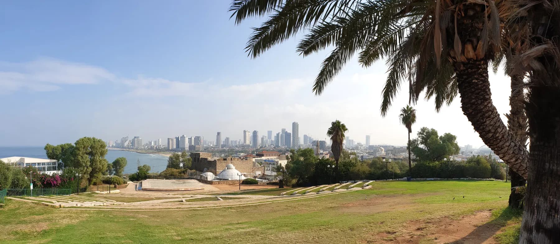
The lawns on top of Old Jaffa are not old: they are the ground left empty after the British blew a quarter of the town apart in June 1936, laid out as a public garden under a 1956 plan and planted by Tel Aviv's city gardener Avraham Karavan, whose nickname Abrasha the park still carries.
שלמה רודד / CC BY 2.5 · Wikimedia Commons
Landmark
Jaffa Port
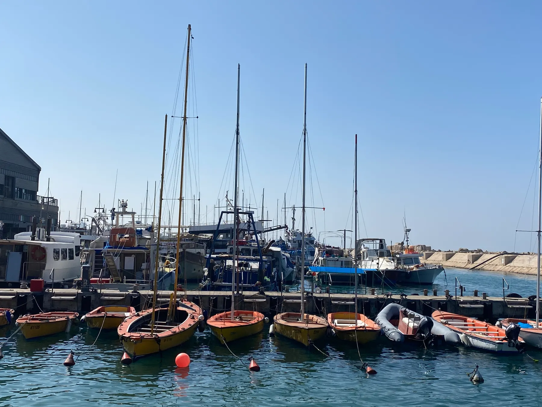
The quay, the breakwater and the three long sheds along it are British work of the mid-1930s, built for the orange trade on ground reclaimed from the sea, and two of those sheds were taken down and built again between 2019 and 2023.
Sources and further reading
Every link below was opened and checked when this page was written. Official statements are marked as such: they are the subject's own account, not an independent one.
- OfficialThe Old Jaffa Development Company Ltdoldjaffa.co.ilOld Jaffa Development Company
The operator of the Old Jaffa complex and of the visitor centre beneath Kedumim Square, and the body that underwrote the 2010 salvage excavation in the square. The site returned a block to automated requests when this page was checked, so its current hours and prices could not be read and are not quoted here
- OfficialTel Aviv-Yafo Municipalitytel-aviv.gov.ilOld Jaffa and Jaffa Port walking route, station 14: Kedumim Square
The city's own audio route: the square built in consequence of the 1936 events, residents ordered out and more than two hundred houses blown up, the visitor centre as the main structure beneath the square, the zodiac fountain, the name Kedumim given for the archaeological remains hidden under the modern paving, St Peter's of 1888 facing west toward Rome with the round Crusader chamber at its end, the cannons as Ottoman rather than Napoleon's, the alleys named after the signs of the zodiac with their Ottoman food-store balconies, the public lavatories at the foot of the steps, and the 1960s decision to clear the quarter's residents and rebuild it for artists and tourism
- OfficialVisit Tel Aviv (Tel Aviv Hotel Association)visit-tel-aviv.comOld Jaffa: Meet the Old City
Ruslan Street leading to Kedumim Square as the Old City centre, the Old Jaffa Development Corporation's investment in the square and in the tourist information centre with its Jaffa Tales presentation, the narrator described as a real resident who was superintendent of the local market at the beginning of the first century CE, Pisgah Park designed by the municipality in the 1960s as part of the plan to renovate the Old City, and the summer Jaffa Nights concerts
- DataOutdooractive, from the Israeli government open data portal (data.gov.il)outdooractive.comFountain 'Zodiac Signs', Jaffa
The fountain's twelve limestone zodiac sculptures by Varda Ghivoly and Ilan Gelber in 2011 with character design by Navot Gil, its combination of water, lighting and stonework, its place in the wider zodiac scheme of street names and the wishing bridge, and the tourism claim that finds beneath it support a legend of a magical wishing well
- ReferenceHadashot Arkheologiyot 137, Israel Antiquities Authority (Yoav Arbel, 20 July 2025)hadashot.iaa.org.ilYafo, Tel: final report on P.L.O. Guy's excavation of 1948-1950
The first research excavation at Tel Yafo, dug in the open space southeast of St Peter's that became Qedumim Square, prompted by the destruction of hundreds of houses in 1936 under the Anchor Plan and more in and after 1948; Trench C at 15 by 20 m; the slanting wall W7, 15.5 m long and up to fifteen courses, read as a glacis buttress and probably the Ottoman fortress preceding the church; the hoard of 851 Alexander Jannaeus coins from 1949 with inscriptions on 208 of them, published by Kindler in 1954 and read as struck at Jaffa in 90-85 BCE; the stamped amphora handle bearing the title of market supervisor with a year equivalent to 129/130 BCE; and the near-absence of Crusader strata on the tell
- ReferenceHadashot Arkheologiyot, Israel Antiquities Authority (D. Barkan)hadashot.iaa.org.ilYafo, Kikar Qedumim: final report on the January 2010 salvage excavation
The dig ahead of an ornamental fountain, permit A-5816, 62.5 square metres to about 1.5 m, underwritten by the Old Jaffa Development Company; the late Ottoman cistern with its 0.46 by 0.48 m opening on a supporting arch and 2.4 m plastered interior, the two covered drainage channels, the limestone pavement, the vault-carrying pillars, the clay pipes, hookah top, European porcelain and 81 mm round shot; the conclusion that the remains belonged to a residential building destroyed in Operation Anchor in June 1936 and that the square lies on the line of one of the new roads; and the statement that earlier digs here removed the later remains without documentation, so no complete stratigraphic sequence can now be formed
- ReferenceHadashot Arkheologiyot, Israel Antiquities Authority (A.A. Burke and M. Peilstöcker)hadashot.iaa.org.ilYafo, Qedumim Square: preliminary report on the 2008 Jaffa Cultural Heritage Project season
Licence G-35/2008; Kaplan's Area C opened in 1961 for the Jaffa Museum of Antiquities with a second season in 1965, and E. Brand's later work for the IAA to prepare the ground for a roofed visitor centre; the four probes inside the centre; the ashlar room measuring 3.4 m a side and about 2.5 m high with beam ledges, its north wall standing twelve courses and its newly found west wall nine; the undressed wall beneath tentatively assigned to the Persian period as the earliest feature in Area C; the stepped stone structure identified as a modern mantle of about the 1970s laid to stop an Early Roman wall eroding; and architecture directly below the modern paving of the square, probably Early Islamic
- Reference'Atiqot 120, Israel Antiquities Authority (Avraham S. Tendler, 22 April 2026)publications.iaa.org.ilPersian to British Mandate-Period Settlement at Qedumim Square, Yafo (Jaffa): An Umayyad Fortress and Ottoman Street
Settlement remains at Qedumim Square from Iron II, the Persian, Hellenistic to Early Roman, Byzantine, Early Islamic, Crusader and late Ottoman to British Mandate periods; two segments of a fortification wall probably belonging to an Umayyad fortress of the seventh century CE; a late Ottoman stone-paved street with a drainage and sewage channel beneath it; and coins and pottery including items inscribed in Hebrew, Greek and Latin
- Reference'Atiqot 120, Israel Antiquities Authority (Itamar Taxel, 22 April 2026)publications.iaa.org.ilIron Age to Ottoman-Period Pottery from the Excavation at Qedumim Square, Tel Yafo (Jaffa)
The companion pottery study covering Iron Age II through the Ottoman period, its rare and locally uncommon types, its hints at foreign individuals among the local population, and the dating it supplies for the Early Islamic fortification wall and the Ottoman street and buildings
- ReferencePalestine Exploration Quarterly 146.1 (2014), pp. 40-55 (Aaron A. Burke, Martin Peilstöcker and George A. Pierce)doi.orgHellenistic Architecture in Jaffa: the 2009 Excavations of the Jaffa Cultural Heritage Project in the Visitor's Centre
The 2009 pilot excavation inside the soon-to-be-renovated visitor's centre in Qedumim Square, intended to clarify stratigraphic questions in Kaplan's Area C of 1961 and 1965; the project's founding in 2007 as a UCLA and Israel Antiquities Authority partnership; and the finding that the excavation exposed one of the best preserved examples of Hellenistic architecture in the southern Levant and confirmed a Hippodamian town plan from as early as the late Persian period
- ReferenceMiddle Eastern Studies 55.6 (2019), pp. 1005-1019 (Tamir Goren), record at Bar-Ilan Universitycris.biu.ac.ilThe destruction of old Jaffa in 1936 and the question of the Arab refugees
The scholarly account of the 1936 demolition in Old Jaffa as the first large-scale displacement of Arab families under the Mandate, and of the mandatory government's response to the refugee problem it had itself created, including a residential quarter built to house the displaced
Kedumim Square: common questions
How old is Kedumim Square?+
The square dates from the 1960s and the ground under it is ancient. The open space was created by British demolition in June 1936 and enlarged by clearance after 1948, and the municipality then laid the square out as part of its rebuilding of Old Jaffa for artists and tourism. Everything genuinely old at this spot is below the flagstones, in the excavation that runs under them.
Is there anything to pay for?+
No, not for the square. It is open ground with no gate, no ticket desk and no closing time, and the same is true of the alleys, the fountain and the church forecourt. The only ticketed thing here is the visitor centre in the excavated chamber beneath the paving.
Can I go into the excavation under the square?+
Yes, but arrange it first. The Old Jaffa Development Company runs the underground visitor centre and asks for entry to be booked in advance by telephone or email rather than publishing walk-in hours, and space is not guaranteed on the day. Its website blocks automated requests, so this page cannot quote a current price or a current opening time and neither should anyone else without ringing.
What is actually in the excavation?+
The centrepiece is a square room built of dressed ashlar, 3.4 m on a side and about 2.5 m high, which Jacob Kaplan dated to the early Hellenistic period when he dug it in 1961. Ledges on two of its walls carried the wooden beams of a floor above, and an earlier wall of undressed stone below it is tentatively assigned to the Persian period. The 2009 excavation here was published as one of the best preserved examples of Hellenistic architecture in the southern Levant.
Why is the square so big when the rest of Old Jaffa is so tight?+
Because the buildings that stood here were blown up. In June 1936 British forces drove two broad roads through the old town to break armed resistance around the port, demolishing more than two hundred houses on the municipality's own account, and the square occupies the line of one of those roads. The tight lanes to the west are what the town looked like before.
Is the zodiac fountain old?+
No. Its twelve signs were carved in limestone by Varda Ghivoly and Ilan Gelber in 2011, to designs by Navot Gil. Tourism material circulated through the Israeli government data portal claims finds beneath it support an old legend of a wishing well on the spot; the excavation that cleared the ground in January 2010 found a plastered domestic cistern and drains from a late Ottoman house, which is not the same thing.
Why are the alleys named after star signs?+
Because the municipality named them that way in the 1960s. When Old Jaffa was rebuilt as an artists' quarter the lanes were repaved in stone and each was given the name of a sign of the zodiac, with the main one called Netiv HaMazalot. The wishing bridge on the eastern edge and the fountain in the square extend the same scheme.
Is it worth it if I only have an hour in Jaffa?+
Yes, because everything else converges here. Half an hour covers the square, the fountain, the front of St Peter's and the Ottoman cannons, and the head of the zodiac alleys is a few steps away. If the hour is the whole visit, skip the underground centre, which needs booking, and spend the time walking down to the port instead.
Is there shade?+
Not much. The square is a broad paved space at the top of an exposed hill and the sun sits on it for most of the day, though the perimeter buildings throw shade along the edges in the afternoon and the cafés have awnings. In July and August the sensible plan is early morning or after five.
How do I get up there without stairs?+
Come from the east rather than from the port. The route up from Jaffa Port uses a wide flight of steps that a wheelchair cannot manage, while the approach from the clock tower along Ruslan Street and through the Jerusalem Gate is sloped and cobbled but stepless, and the wishing bridge connects the square to HaPisga garden across the road. The square itself is flat once you are on it.